Mild Temperatures Remain, Rain Chances Move In For The 2nd Half Of The Week
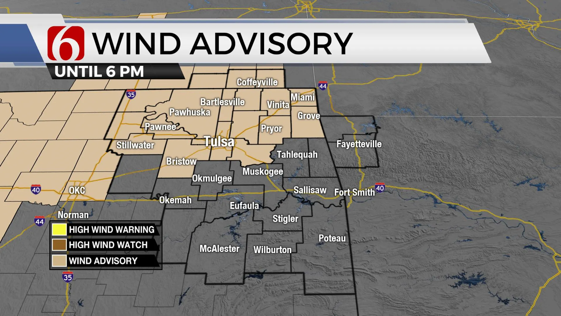
A wind advisory will be required later today with south winds from 20 to 40 mph. Mild temps will remain, but the pattern quickly brings increasing rain and thunder chances for the second half of the week into the weekend. Gusty strong south winds will remain likely both today and tomorrow as a strong upper-level system slowly gains strength and nears our region with increasing thunderstorm chances for the latter half of the week. Some of the storms will more than likely become strong to severe aTuesday, March 9th 2021, 6:40 am
A wind advisory will be required later today with south winds from 20 to 40 mph. Mild temps will remain, but the pattern quickly brings increasing rain and thunder chances for the second half of the week into the weekend.

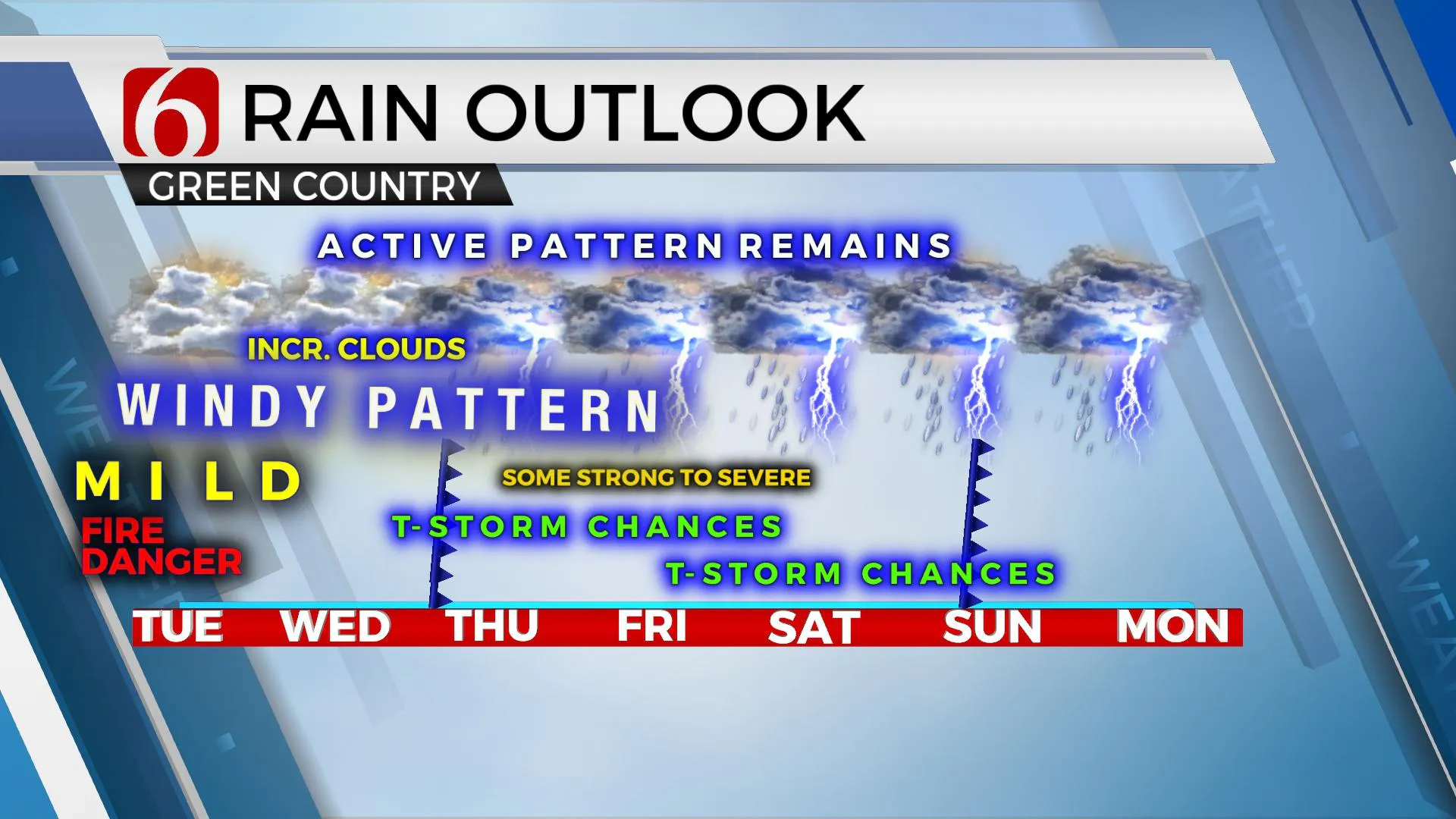
Gusty strong south winds will remain likely both today and tomorrow as a strong upper-level system slowly gains strength and nears our region with increasing thunderstorm chances for the latter half of the week. Some of the storms will more than likely become strong to severe and pockets of locally heavy rainfall will be possible. Before this active weather arrives, the fire spread rates will remain high due to south winds from 20 to near 40 mph both today and Wednesday. Increasing low-level moisture will gradually off-set the elevated fire danger issues, but fire issues will remain problematic today. Additional clouds are likely later this afternoon and tomorrow. Temps will remain mostly in the 50s for morning lows today and the lower 60s tomorrow morning with highs maxing out in the lower to mid-70s. The first chance for a few storms will arrive late Wednesday night into Thursday, but mostly for locations along and northwest of the I-44 corridor. A few of these storms could become severe, with large hail and damaging winds the main threat. A capping inversion may limit the number of storms to the northwest of the metro, but Tulsa will have a chance for a few storms during this period. A higher chance will remain along the I-35 corridor from north-central OK into southcentral Kansas. There will be enough shear in the atmosphere to produce a tornado warning or two, but this chance currently remains very low, and mostly across the state line into southcentral Kansas.

The main upper air pattern remains quite active for the rest of the week. A developing broad trough across the western U.S. has already developed, and a strong closed low will be likely by the end of the week into this weekend at the basal portion of this feature. A lead wave will eject across the central and northern plains Wednesday into Thursday while a surface cold front moves from Kansas into northern OK before stalling Thursday morning to midday. Scattered showers and storms will be likely near and north of this boundary during these periods, including the threat for a few strong to severe storms. This front will either remain near the highway 412 corridor or move slightly northward Friday as the main closed low to our west slowly moves east. This will increase thunderstorm chances across a larger area late Thursday evening into early Friday, mostly along and north of the I-40 region. By the weekend, the combination of increasing low-level moisture and the approach of the main upper-level system will bring even more thunderstorm chances into the state, including not only strong to severe threats, but the potential for heavy rainfall near the boundary position across the northern third of Oklahoma. This entire system finally exits our area sometimes Sunday midday to afternoon with most of the thunderstorm activity exiting the area. But the main upper-level system may not pass our immediate area until Sunday afternoon or evening.

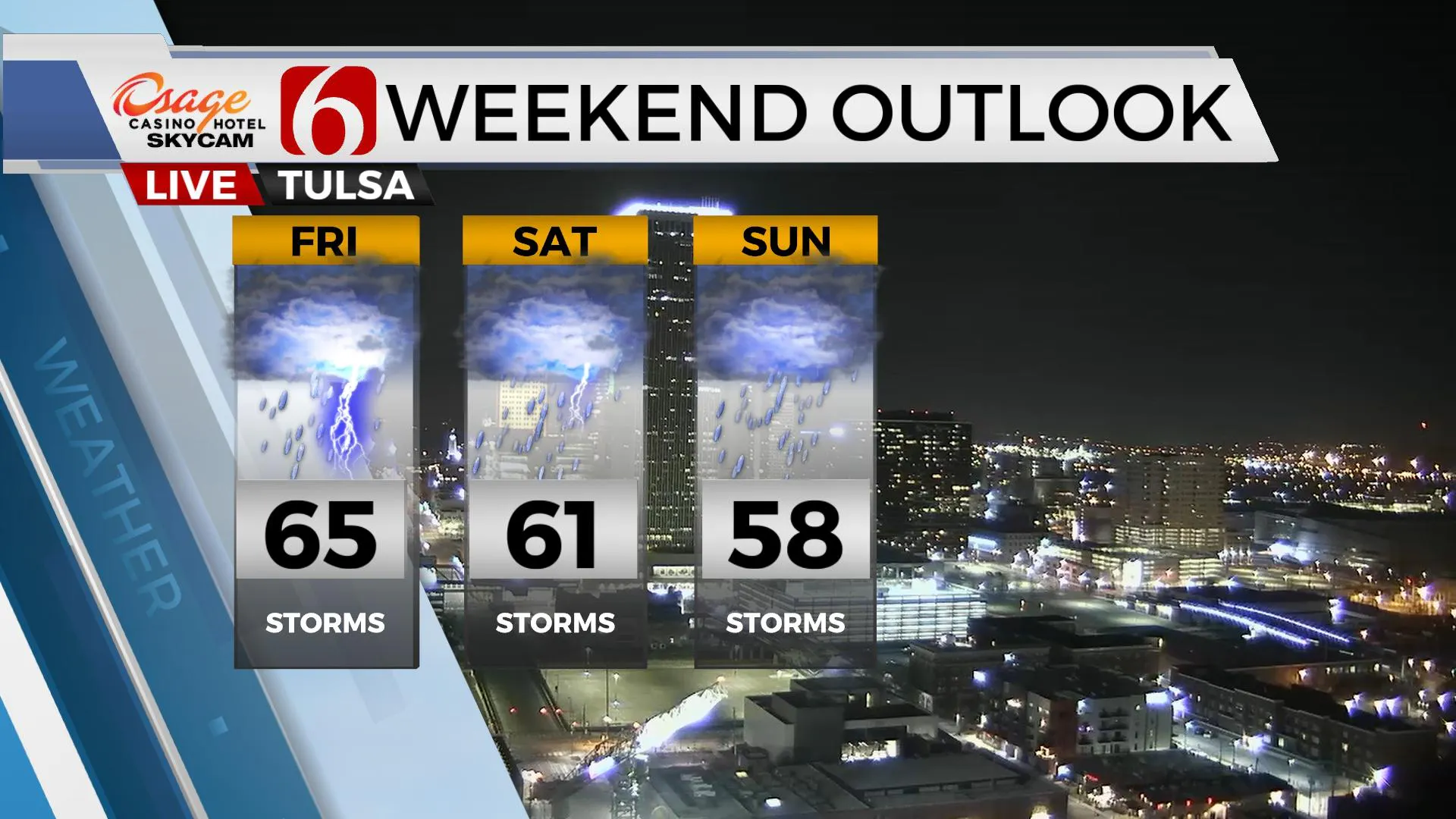
Temperatures will remain very spring-like through the end of the week, but a noticeable reduction is likely this weekend with Saturday highs near 60s and Sunday dropping into the upper-50s as the main system pulls away from the state. We’re seeing some signals for a notable cool-down for the middle to end of next week.
Thanks for reading the Tuesday morning weather discussion and blog.
Have a super great day!
Alan Crone
KOTV
If you’re into podcasts, check out my daily weather update below. Search for NewsOn6 and ‘Weather Out The Door’ on most podcast providers, including Apple, Stitcher, Tune-In and down below on Spotify.
More Like This
February 14th, 2022
January 26th, 2022
January 25th, 2022
Top Headlines
April 7th, 2025


