Broad Range Of Afternoon Temperatures, Thunderstorm Chances
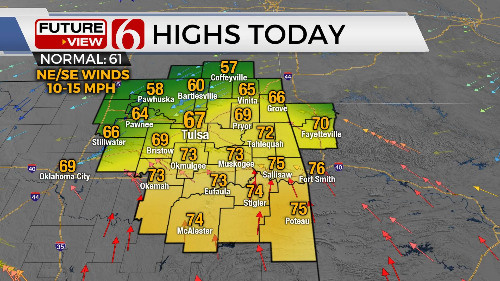
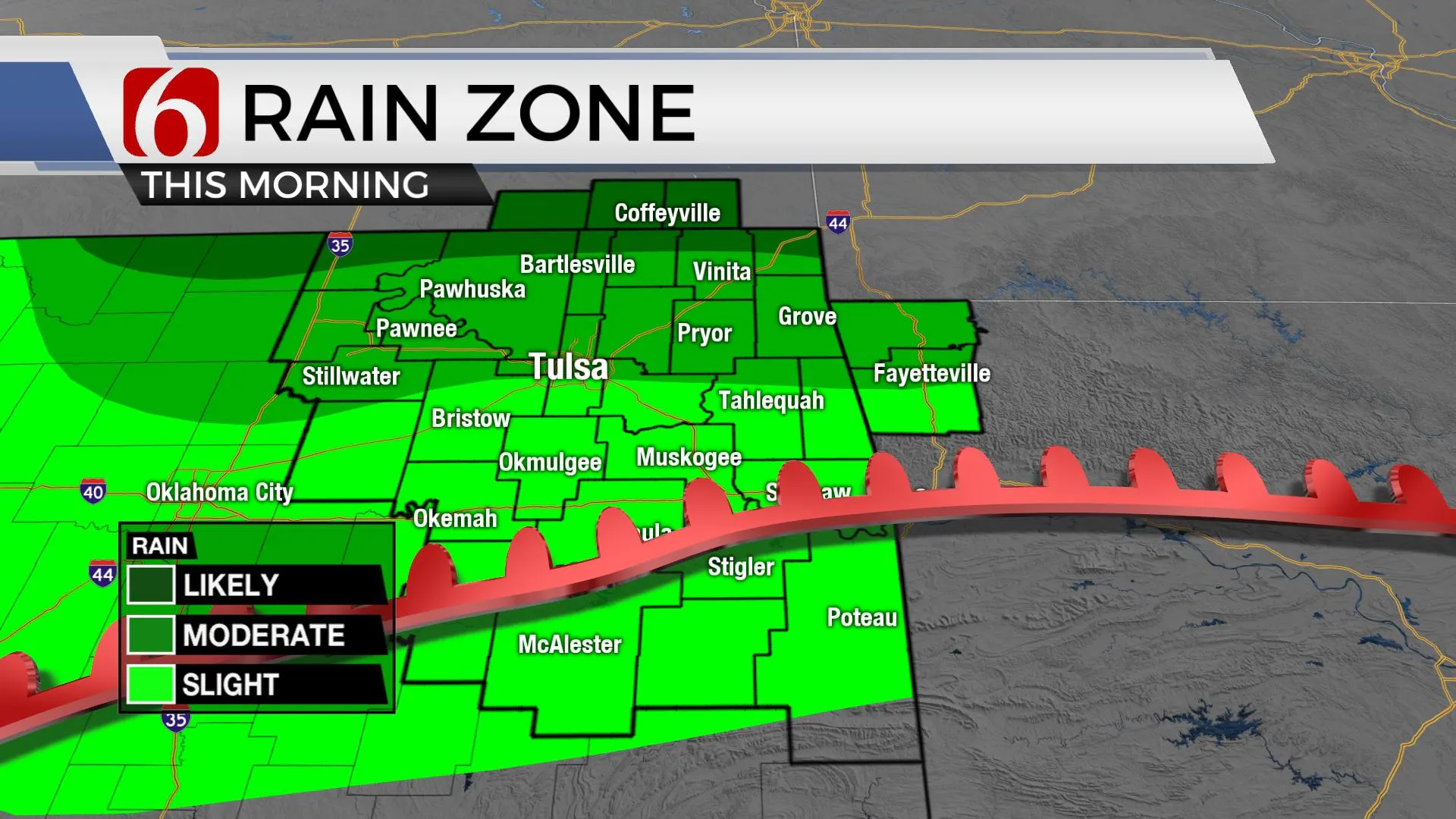
The front that moved across the area yesterday is still well south of the metro this morning. Scattered showers and thunderstorms will attempt to develop across the cool side of the boundary for the next few hours, but very little has done so at this point. Another broad range of afternoon temps will be likely, from the 50s along the northern OK-Kansas state line region, the mid to upper 60s near Tulsa and the lower 70s across southeastern OK.Friday, March 12th 2021, 5:53 am
TULSA, Okla. -
The front that moved across the area yesterday is still well south of the metro this morning. Scattered showers and thunderstorms will attempt to develop across the cool side of the boundary for the next few hours, but very little has done so at this point. Another broad range of afternoon temps will be likely, from the 50s along the northern OK-Kansas state line region, the mid to upper 60s near Tulsa and the lower 70s across southeastern OK.

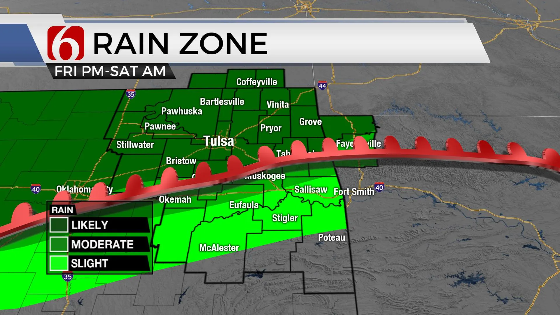
Regarding northern OK and southern Kansas, the front will begin slowly lifting northward as a warm front later this afternoon with additional storms developing near and north of this boundary late this afternoon and tonight. A few of these storms could become strong to severe along the retreating warm front, but we think most of the activity will remain mostly on the cool side of the boundary and elevated in nature. Regardless, this activity may produce nickel hail and periods of strong winds. Several rounds of showers and storms will move across the highway 412 corridor by this evening into southern Kansas and produce heavy rainfall. A flood watch will remain for these areas of southern Kansas, but currently, no counties in northern OK are included in this flood watch.

After pre-dawn Saturday, I still think most of the daytime period Saturday will be rain-free and mild with highs reaching the lower 70s with gusty southeast winds at 15 to 30 mph. Our main upper-level system, currently to our west will begin moving east Saturday night into Sunday morning with a surface dryline also advancing eastward during this period. A line of thunderstorms will develop Saturday evening ahead of these features across western OK and quickly become severe with all modes of severe weather. As this squall line nears our area by pre-dawn Sunday, instability will be limited across eastern OK during the overnight and pre-dawn Sunday period and the severe weather threats should be muted as the line enters our immediate area. Most of this activity will exit into western Arkansas by midday to afternoon Sunday. But the main upper-level cold core will be nearing northern OK Sunday evening into Monday and may still produce a few isolated cells across southeastern Kansas Monday, but the odds will remain low.

Next week remains active with another system nearing Tuesday night into Wednesday morning with a few storms followed by another cool-down for the remainder of Spring Break week in Oklahoma. This Tuesday evening storm system will be watched for some severe weather threats.
Thanks for reading the Friday morning weather discussion and blog.
Have a super great day!
Alan Crone
KOTV
If you’re into podcasts, check out my daily weather update below. Search for NewsOn6 and ‘Weather Out The Door’ on most podcast providers, including Apple, Stitcher, Tune-In and down below on Spotify.

More Like This
March 12th, 2021
June 21st, 2023
June 19th, 2023
June 13th, 2023
Top Headlines
December 14th, 2024
December 14th, 2024
December 14th, 2024
December 14th, 2024


