Cooler Weather Likely For The Remainder Of The Week
A pattern change is well underway with cooler weather likely for the remainder of the week, both morning lows and daytime highs. Periodic shower and storm chances will arrive for some, but not all locations for the next few days. The weekend outlook keeps the cool weather in place with mostly dry conditions.Tuesday, April 13th 2021, 5:48 am
TULSA, Okla. -
A pattern change is well underway with cooler weather likely for the remainder of the week, both morning lows and daytime highs. Periodic shower and storm chances will arrive for some, but not all locations for the next few days. The weekend outlook keeps the cool weather in place with mostly dry conditions.

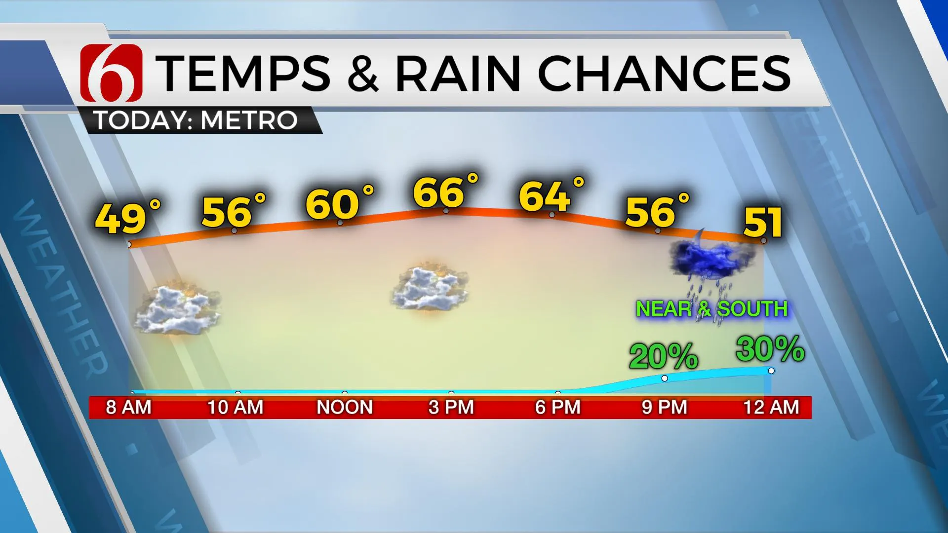
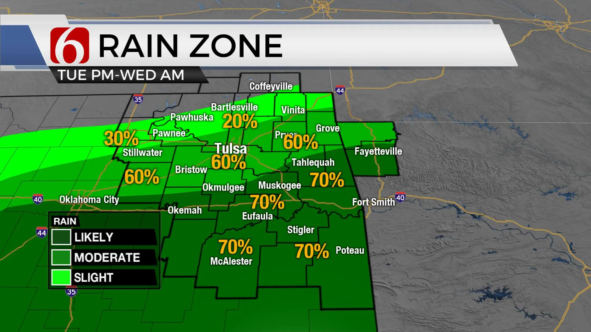
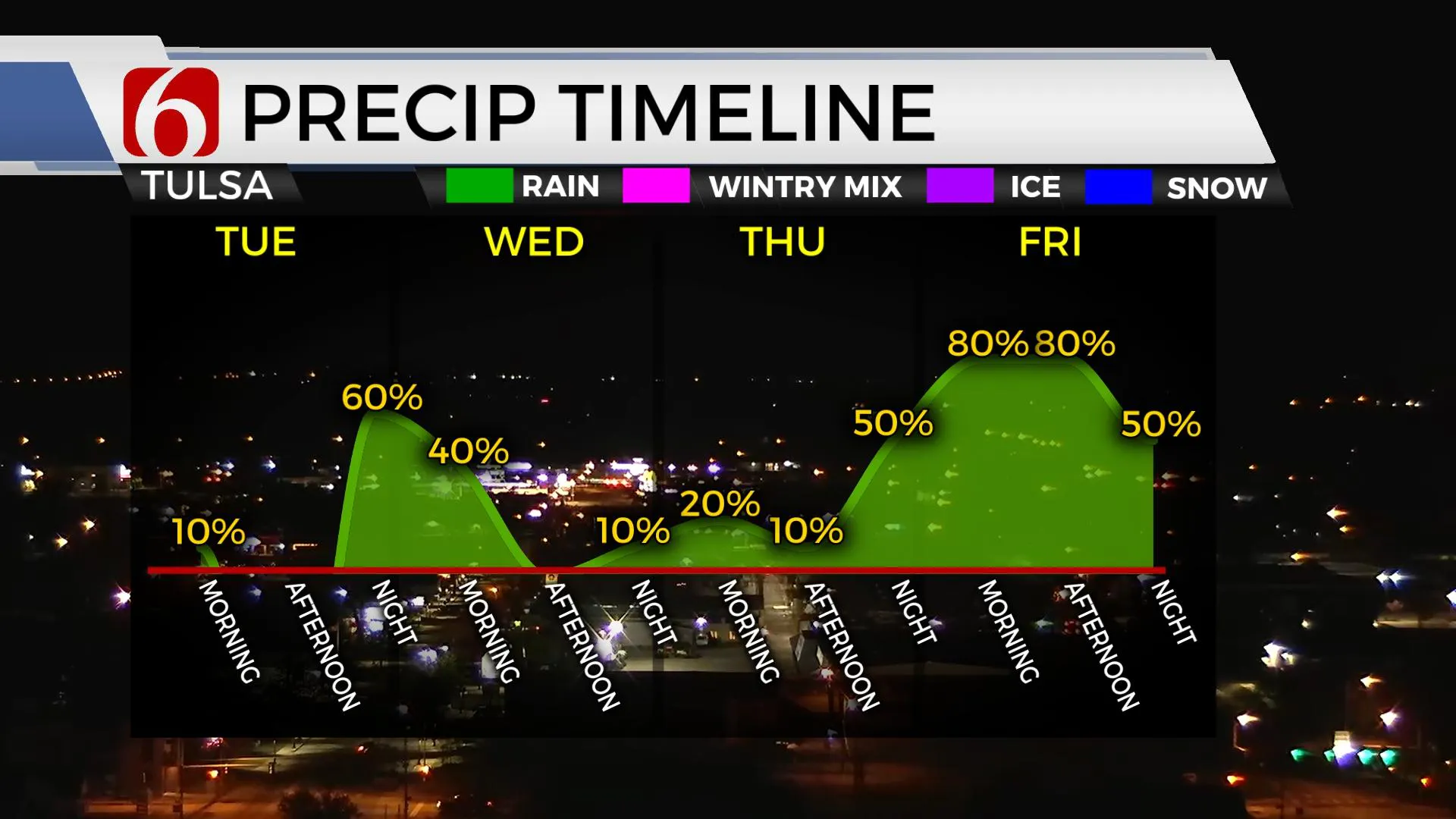
After a few scattered storms exit southeastern Oklahoma early this morning, we are in the running for another system nearing the area later tonight into early Wednesday morning. Most of this will take the southern route with higher chances across southeastern and eastern OK, but the metro is closer, and our probability remains near 50% to 60% tonight into early Wednesday morning with locations south of the metro in the likely category. Another wave nears the state later tonight into early Thursday morning that may produce a few showers for some, but the best window of all continues to be late Thursday night into Friday as some widespread rain with embedded thunder will be likely as another strong upper-level wave approaches from the west. The lack of deep low-level moisture across most of the state combined with cooler highs will keep our severe weather threats unusually low for the week.

The main upper-level pattern consists of a strong and cold upper-level trough centered upon the Great Lakes region with another western U.S. trough across part of the Sierra Nevada range. At the surface, cool, Canadian air continues to filter southward with some of this reaching the Oklahoma region. This will result in morning lows mostly in the mid-40s and afternoon highs in the lower to mid-60s. The role of local clouds and eventually the coverage of precipitation will give some locations highs in the mid to upper 50s Friday and possibly Saturday. It’s during the latter half of the week the western U.S. trough weakens as it ejects across the central and southern plains Friday evening into Saturday morning. As this system passes the region, the shower chances will subside. There remains some difference in some of the exact parameters with the strength of this system. The GFS is slightly stronger and more amplified with the EURO weaker. Any strong storms with the Friday system should remain across far southern OK, mostly along the Red River Valley into north Texas. A few spotty showers may remain early Saturday morning across far northeastern OK but will quickly end. Temps behind this system look cool and possibly colder than I’m currently advertising, but we’re continuing to keep highs mostly in the mid to upper 50s for this period. Some data will drop us into the upper 30s for Monday morning lows before warming into the lower 70s Monday afternoon before our next system rolls across the state.

I’ll post more about the expectations for early next week tomorrow.
Thanks for reading the Tuesday morning weather discussion and blog.
Have a super great day!
Alan Crone
KOTV
If you’re into podcasts, check out my daily weather update below. Search for NewsOn6 and ‘Weather Out The Door’ on most podcast providers, including Apple, Stitcher, Tune-In and down below on Spotify.

More Like This
April 13th, 2021
February 14th, 2022
January 26th, 2022
January 25th, 2022
Top Headlines
December 12th, 2024
December 12th, 2024
December 12th, 2024


