Friday Storm System On Its Way To Green Country
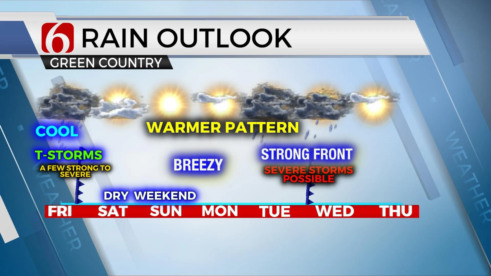
We’re tracking two storm systems over the next 7 days, both with some severe weather threats. The first arriving today, mostly tonight and the 2nd nearing Tuesday into Wednesday. Our weekend weather looks good with highs nearing 70 Saturday and the upper 70s Sunday. We’re moving into the lower 80s Monday before the 2nd system nears with increasing severe weather threats for part of the state. Much of our discussion today involves our current system arriving throughout the day and tonight.Friday, April 23rd 2021, 6:06 am
We’re tracking two storm systems over the next 7 days, both with some severe weather threats. The first arriving today, mostly tonight and the 2nd nearing Tuesday into Wednesday. Our weekend weather looks good with highs nearing 70 Saturday and the upper 70s Sunday. We’re moving into the lower 80s Monday before the 2nd system nears with increasing severe weather threats for part of the state. Much of our discussion today involves our current system arriving throughout the day and tonight.

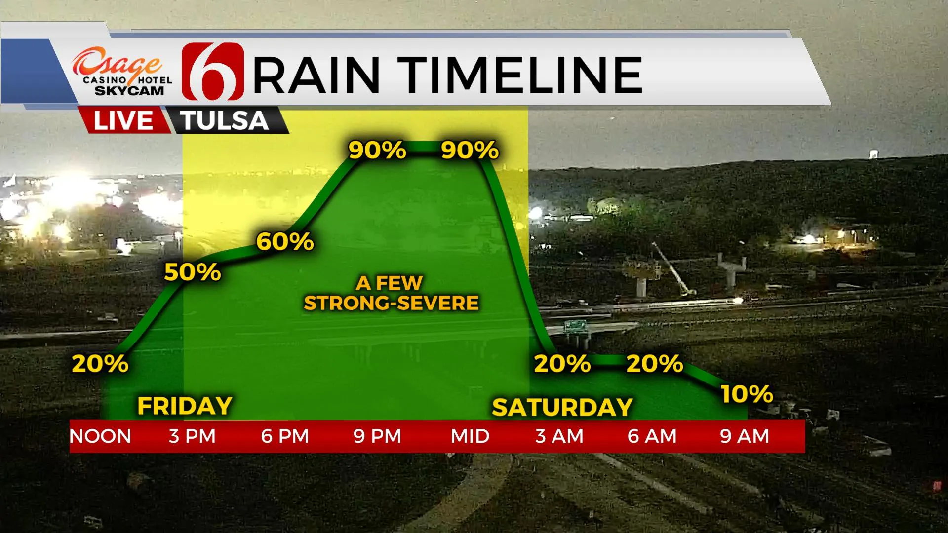
Steady southerly flow is continuing to bring low-level moisture into the state in the form of 50- and 60-degree dew points by later this afternoon. A warm front will develop and could go as far north as the metro region or may also remain mostly across south-central OK. This position of the warm front will determine a lot about our severe weather potential. The odds are favoring the southern position. A surface area of low pressure developing across the Texas high plains will move eastward and eventually be positioned across southcentral to central OK late tonight. A dryline will develop southward from the low across southcentral OK near and west of the I-35 corridor extending into central Texas. A strong upper-level system will approach the state later tonight with southwest winds aloft nearing 70 knots. Winds at the 5K ft level will also be from the southwest around 40 knots and surface winds from the southeast at 20 to 30 mph. Thunderstorms will develop around or shortly after noon across North Texas and spread into southeastern OK through the afternoon. A few of these storms may produce some hail and wind, but most of this activity is expected to remain elevated in nature. More southward, across the southeastern sections of North Texas, additional storms will form as energy rounding the base of the trough enters East TX and severe storms are likely. Well north, across northeastern OK, a few cells may also develop by early afternoon and move quickly northeast into southern Kansas and southwestern Missouri, a few of which could produce hail and wind.

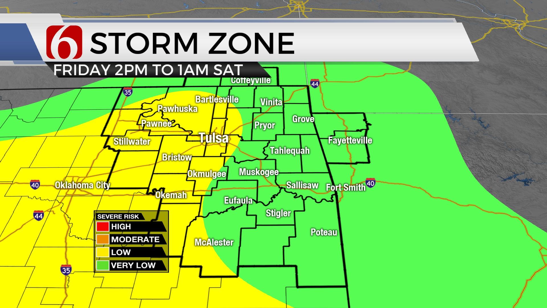
By early afternoon and evening, the parameters mentioned above will begin moving east-southeast and additional storms are likely to develop in at least two areas: the advancing cold front along the I-44 corridor, and along the intersection of the surface low and dry line. Storms advancing along the cold front may initially be discrete but would quickly become linear and move as at least one, possibly two-line segments southeast across eastern OK with a wind damage threat. Storms developing near the south-central OK would also be super-cells and capable of all modes initially before becoming linear and progressing across far southeastern OK and the Red River Valley as a damaging bow echo with a few embedded vortices. The entire system is expected to exit our area of concern, far southeastern OK, by 1 a.m. Saturday morning. Some data does produce a few wrap-around showers into early Saturday morning across NE OK, but this chance remains very low.

The Tuesday system continues to slow down in the EURO data which would bring not only severe threats Tuesday evening but also Wednesday morning through early afternoon for part of the state. GFS is slightly faster but has been trending slower with each run. Synoptically, this system has the potential to produce widespread severe weather threats, but the specific timing and other parameters could play mitigating roles, hopefully, as we draw closer to this period. We’ll post more specifics as confidence and data arrive.
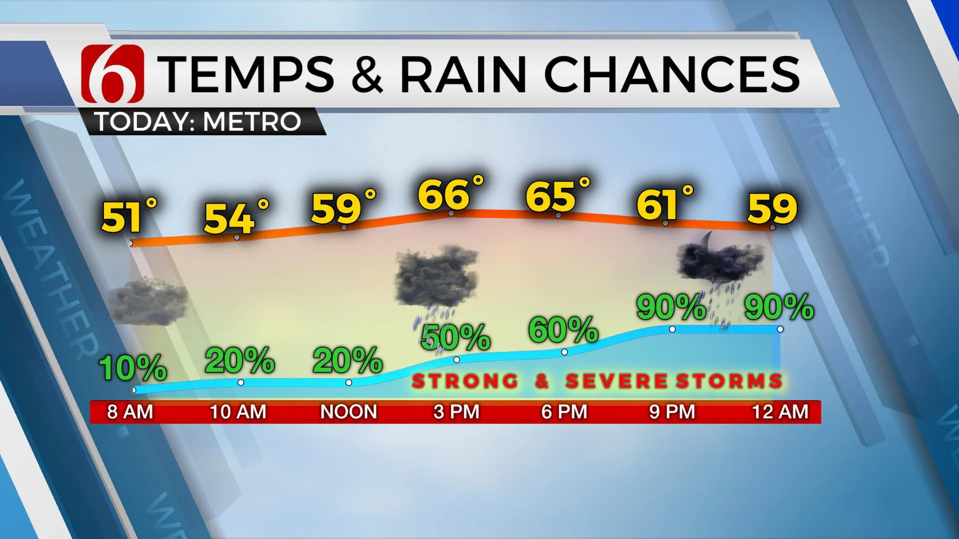
From a sensible weather standpoint, highs today in the mid-60s. Saturday lows in the 50s, with highs in the upper 60s along with north winds at 15 to 25 mph.
Sunday features highs in the upper 70s with sunshine and gusty south winds.
Strong south winds are likely Monday with highs reaching the lower 80s. A wind advisory may be required.
Thanks for reading the Friday morning weather discussion and blog.
Have a super great and safe day.
Alan Crone
KOTV
If you’re into podcasts, check out my daily weather update below. Search for NewsOn6 and ‘Weather Out The Door’ on most podcast providers, including Apple, Stitcher, Tune-In and down below on Spotify.

More Like This
April 23rd, 2021
December 12th, 2024
December 12th, 2024
December 12th, 2024
Top Headlines
December 12th, 2024
December 12th, 2024
December 12th, 2024


