Cool Morning Temperatures, Afternoon Highs In The Lower 70s
It is a cool morning in Green Country and afternoon temperatures could reach the low 70s.Wednesday, May 5th 2021, 6:50 am
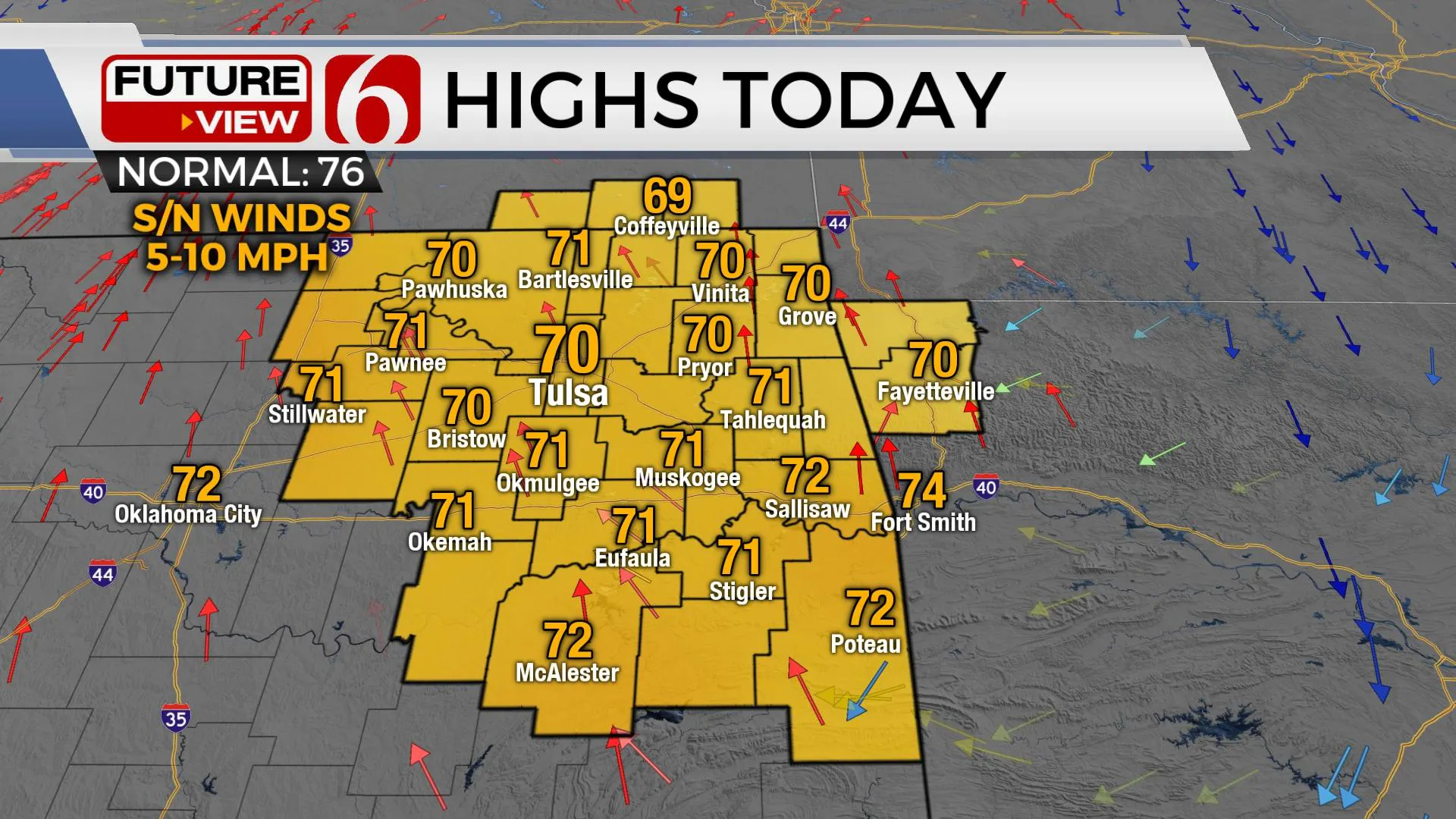
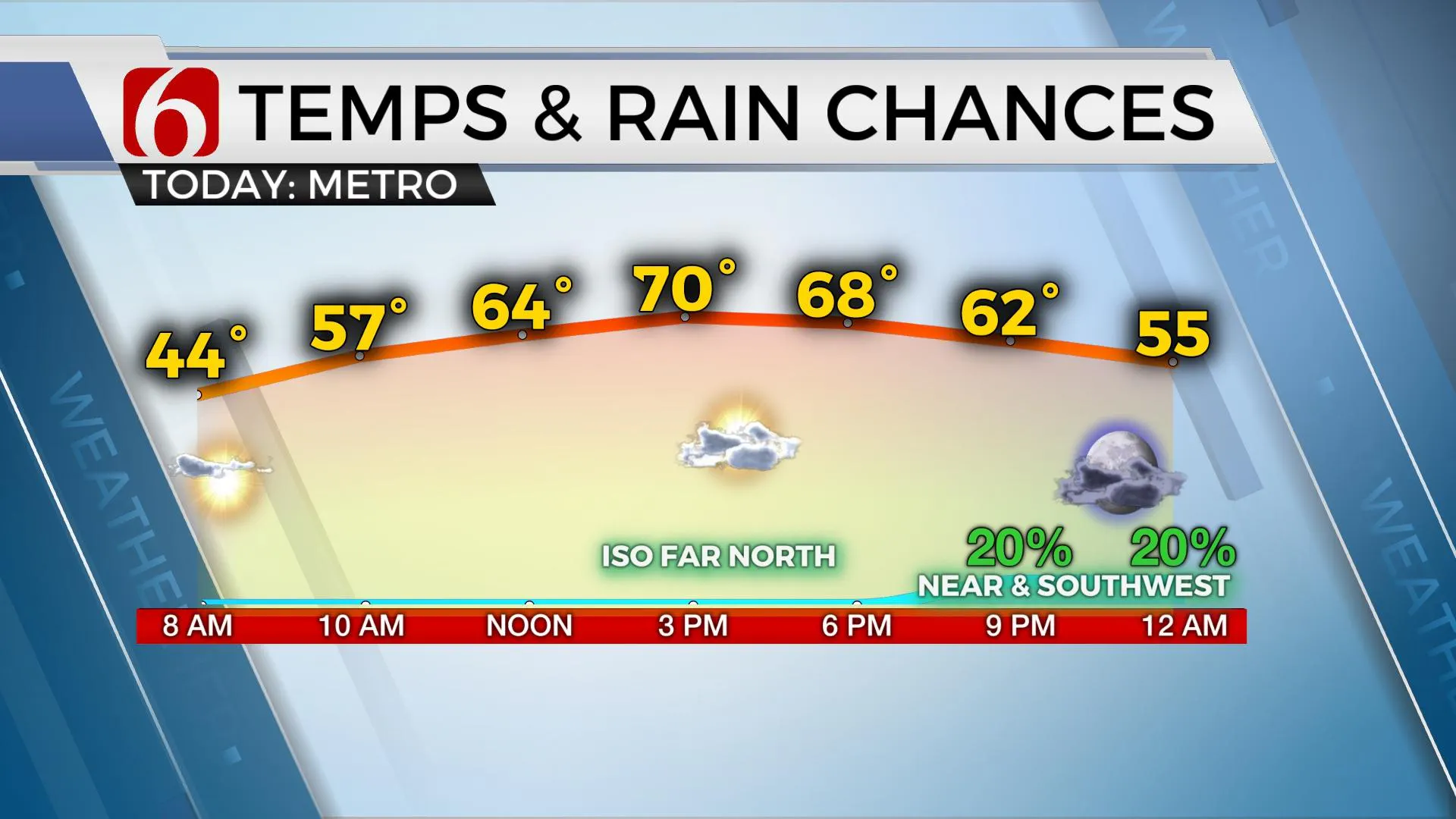
A cool morning is underway with temps mostly in the 40s along with clear sky and light winds. Some patchy fog has developed in a few of the valleys, but this will not be significant. Highs this afternoon will reach the upper 60s and lower 70s before the first of several short waves near the state bringing a few clouds and some low-impact, low probabilities of precip near the region.

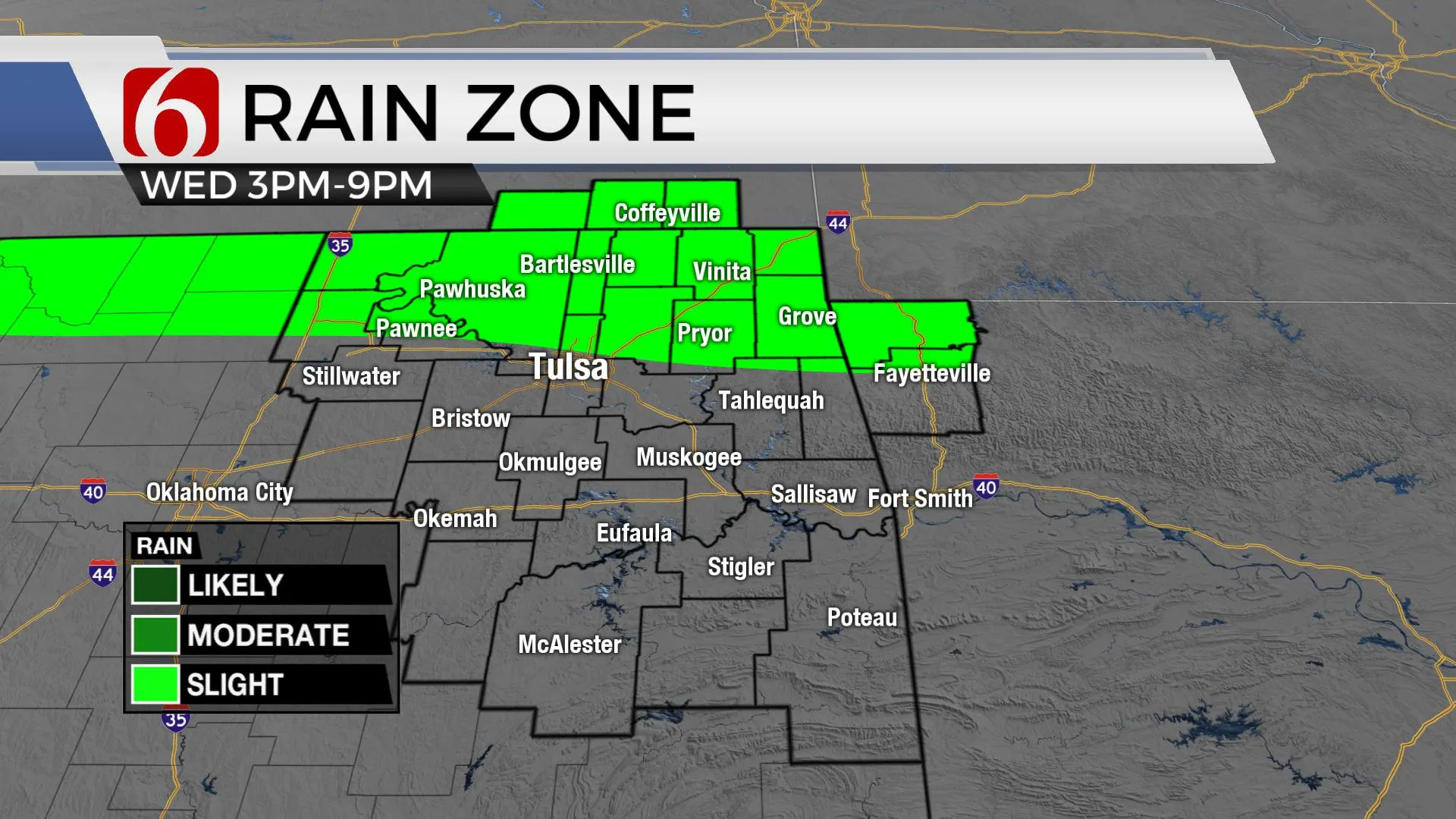
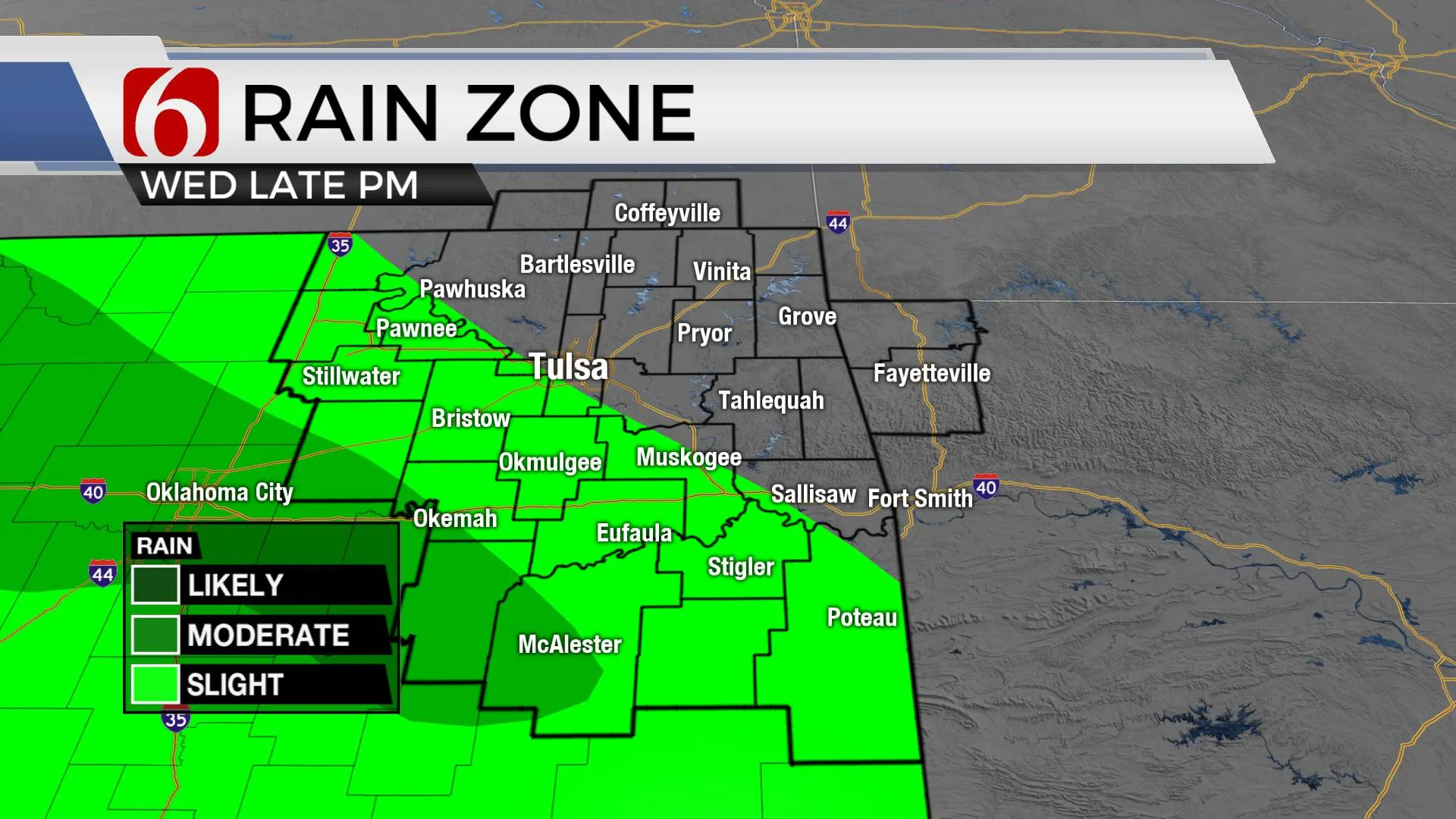
Our short-term issue revolves around a pair of disturbances that will travel down the northwest flow upper air pattern this afternoon and later tonight. Moisture may be limited, but at least a low chance for a shower or two will exist with both weak waves. The first chance arrives this afternoon and early evening across far northern OK and southern Kansas. This more than likely stays north of the metro. The second later tonight through pre-dawn Thursday, and mostly southwest of the Tulsa metro. I’ll continue keeping a low chance for a few showers or storms, but the lack of consistency in the model output combined with some drier air may limited precipitation with both disturbances. The 2nd one has a stronger signal for a few showers, but even if this occurs, instability and convective energy does not support any mentions for strong or severe storms. Removed of these two disturbances, most of the midweek weather looks good with mostly sunny sky and mild afternoon highs. Grab the jacket for the morning hours. Most of the afternoon looks fine. This chance currently remains low. Highs tomorrow will reach the lower 70s with south winds returning around 1o to 20 mph. A small wave also arrives Friday in some, but not all the data that could bring a few showers across part of northern OK or southern Kansas.

The upper air pattern changes some into the weekend and this may bring some thunderstorm chances back to the state, including mentions of strong or severe storms, as a cold front moves southward and low-level moisture surges northward.

The next stronger upper-level trough is developing across the pacific northwest and will soon drop southeast across the northernmost areas of the intermountain region. Most of the forcing for this system will focus across the central and northern high plains early this weekend but will bring some energy around the basal region of the trough Saturday night into Sunday morning. Gusty south winds return across the state Saturday, possibly nearing some advisory levels along the I-35 corridor region, with significant low-level moisture surging northward. A surface low is expected to develop across southwestern Kansas or northwestern OK with a decent dry line positioned across the extreme western OK region. A layer of warm air aloft ( the CAP) is expected to suppress most daytime thunderstorms across most of the state. Saturday evening into Sunday morning the CAP may weaken as colder air aloft arrives from the west. Storms will attempt to develop, and some severe threats would be possible Saturday evening into early Sunday morning.

As this occurs, another surface cold front moves from central Kansas southward into northern OK with a few storms through the day Sunday. This boundary may slowly inch southward Sunday midday before entering southern OK Sunday night and pre-dawn Monday with some additional storm chances, including the threat of severe weather along the Red River Sunday evening. This same boundary will be south of our immediate area early next week as the main upper trough remains north but a few short-waves near the state. This will bring additional storm chances near and north of the front, including Monday evening into Tuesday morning, possibly into Wednesday. This period may feature some flooding potential and cooler than normal temperatures, along with some marginal severe weather threats across southern OK.
Thanks for reading the Wednesday morning weather discussion and blog.
Have a super great day!
Alan Crone
KOTV
If you’re into podcasts, check out my daily weather update below. Search for NewsOn6 and ‘Weather Out The Door’ on most podcast providers, including Apple, Stitcher, Tune-In and below on Spotify.

More Like This
February 14th, 2022
January 26th, 2022
January 25th, 2022
Top Headlines
December 12th, 2024
December 12th, 2024
December 12th, 2024
December 12th, 2024


