Another Chilly Morning Underway, Warmer Afternoon Temperatures Arrive
A chilly morning is underway but warmer temps could soon arrive.Wednesday, May 12th 2021, 5:05 am
Another jacket morning is underway, but improving weather is likely for the next few days before more storm chances return to Northeastern OK as warmer weather arrives.

The upper air pattern, currently from the west to east will go through some changes soon, eventually becoming from the southwest Sunday into early next week. This brings seasonal weather back to the southern plains, including the mentions for more storm chances this weekend into early next week. Before this occurs, a quick northwest flow will allow mostly pleasant weather Thursday and Friday as temperatures begin climbing out from the cooler weather we have been experiencing the past few days. The upper flow from the northwest may also bring a few showers into far northeastern OK early Friday morning and Saturday morning.

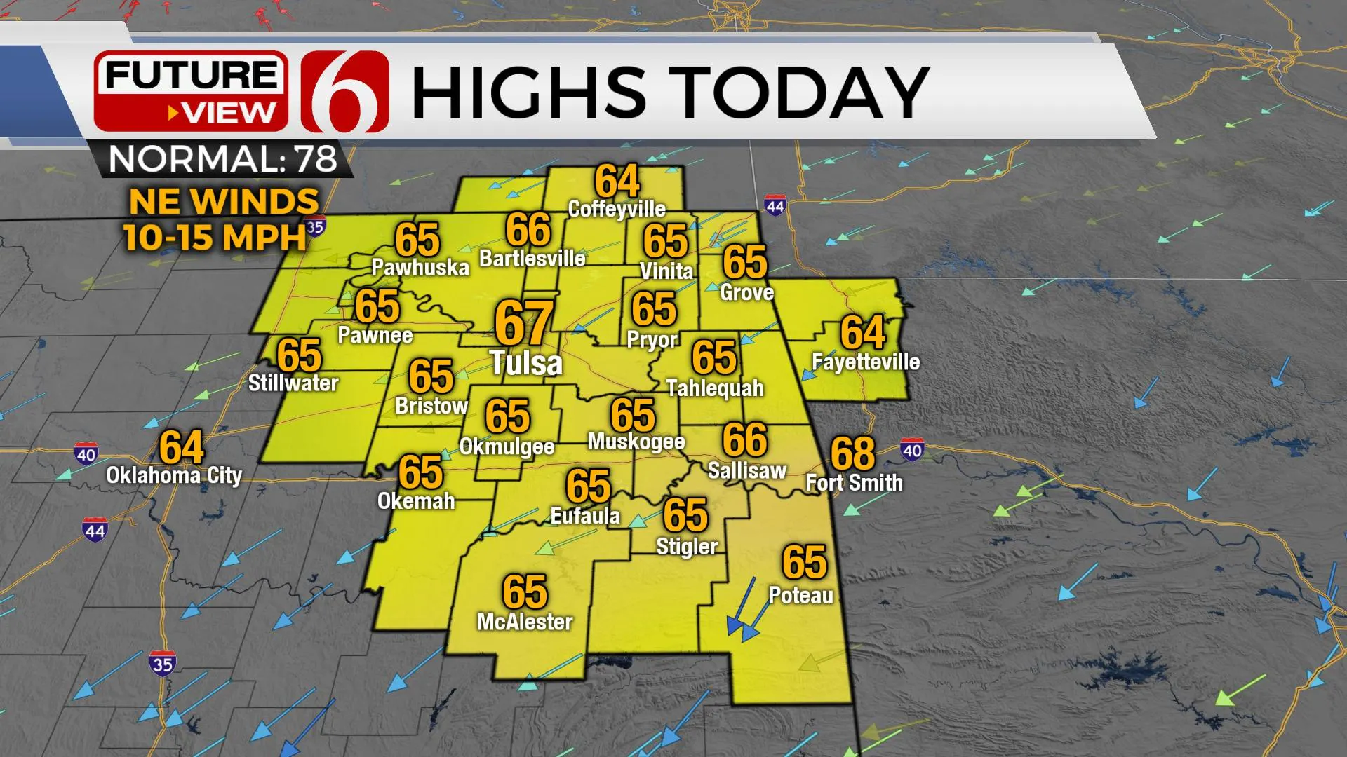
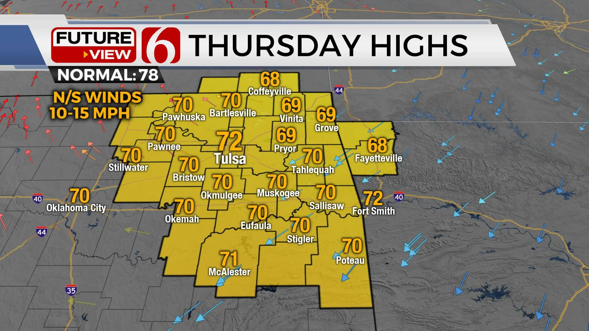
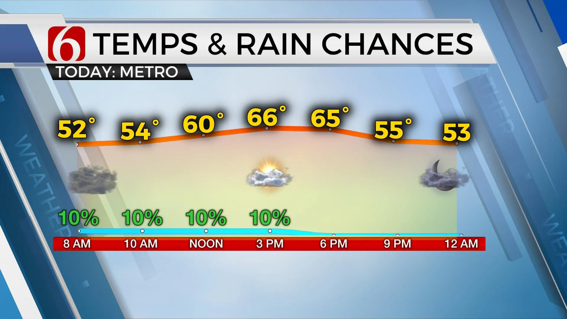
We’re starting this morning back into the 40s with clouds nearby but will see slowly decreasing clouds later with partly sunny sky and highs reaching the mid-60s across the northeastern sections of the state. Northeast winds will remain from 10 to 15 mph. Any shower activity this morning will be highly isolated and non-impactful. A few spotty showers may develop by midday to early afternoon with a weak zone of lift along or southeast of the I-40 corridor. This will also remain a very low chance this afternoon for our friends across southeastern OK. Even better conditions are expected tomorrow after chilly conditions in the 40s, Thursday afternoon highs will reach the lower 70s with sunshine and southeast winds returning at 10 to 15 mph.

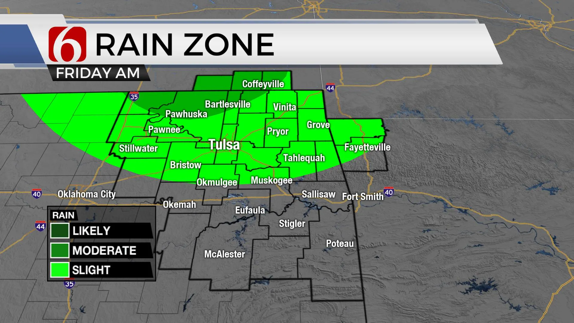
The upper air flow quickly turns out of the northwest Thursday into Friday and this can be tricky for our region. Storms are likely to develop Thursday night across central Kansas. These storms will have the tendency to drop southeast through the evening hours and a few of these could survive the trip into northeastern OK, even though most data support keeping this activity out of our immediate area. I’m leaning toward keeping a low mention for this Friday morning period. The upper flow will bring another disturbance across the northern part of the state late Friday night into Saturday morning with a small complex of storms for some spots. At this point, this will include the Tulsa metro. No severe storms are expected at this time, but as deeper low-level moisture returns, we’ll need to remain aware of any small changes that could bring a few stronger storms nearby.

The return of the upper flow from the southwest will help to bring low-level moisture streaming northward into the state this weekend with local dew points reaching the upper 60s along the Red River into northeastern OK early next week. This means Sunday into Monday additional storms are possible, even likely for some locations across Eastern OK. The data is not conclusive on some important features, but the pattern suggests we should mention the possibility of a few strong to severe storms during this period along with pockets of moderate to heavy downpours. This same pattern will more than likely persist for a few days into next week.
Temps this weekend will support lows in the 60s and highs in the upper 70s and lower 80s, along with gusty southeast winds from 20 to 30 mph.
Thanks for reading the Wednesday morning weather discussion and blog.
Have a super great day!
Alan Crone
KOTV
If you’re into podcasts, check out my daily weather update below. Search for NewsOn6 and ‘Weather Out The Door’ on most podcast providers, including Apple, Stitcher, Tune-In and below on Spotify.

More Like This
February 14th, 2022
January 26th, 2022
January 25th, 2022
Top Headlines
December 15th, 2024
December 15th, 2024
December 15th, 2024
December 15th, 2024


