Scattered Showers Remain, Severe Weather Potential Moves In Toward The End Of The Week
Scattered showers and storms stick around today and severe weather chances make their way into Green CountryTuesday, May 25th 2021, 7:36 am
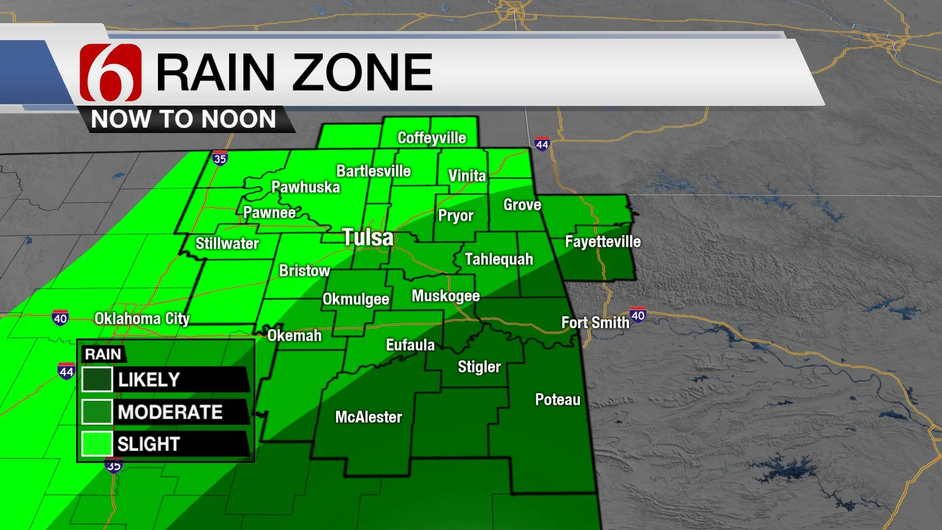
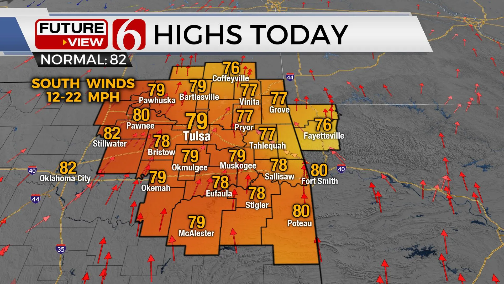
Scattered showers and storms will remain nearby this morning into the midday, with higher chances southeast of the metro. Highs this afternoon should reach the upper 70s to lower 80s across Eastern Oklahoma. . Additional storm chances remain, including the potential for severe weather Thursday evening.

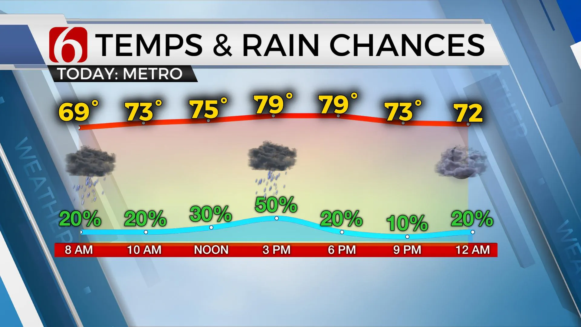
The overall trend in the forecast remains unchanged: rain and thunderstorm chances will continue, almost daily into part of the weekend. The potential for a few strong to severe storms will eventually arrive, including a low chance later this evening for a small complex to brush the northwest region, yet higher chances for organized severe storms should ramp up Thursday afternoon and evening with a strong storm system entering the central and southern plains. Consequently, daytime highs will also be climbing with afternoon temps nearing 80 today and mid-80s for the middle of the week. A cold front will enter northern OK Thursday evening into early Friday with severe storms, but the data is inconclusive on the exact positioning of this boundary this weekend. Data this morning is suggesting the Thursday night and Friday morning cold front could move southward and stall near the Red River into part of north TX this weekend. After severe storms Thursday evening, this could keep most of the showers and storms away from most of our area for the weekend. Currently, Monday, Memorial Day appears mild with highs in the lower 80s. More activity will arrive early next week with additional showers and storms Tuesday through the middle of next week.

The plume of tropical moisture is still positioned near the region this morning and additional showers and storms will attempt to develop this morning across southeastern OK into western Arkansas as at least one disturbance rotates near the region. We’ll be in the running for a few showers and storms near the metro midday. Any activity this afternoon should be isolated and mostly to our east. Later this afternoon and evening, a complex of storms will attempt to form across northwestern OK and move southeast. Part of this system could clip our region near or southwest of us later tonight into pre-dawn Wednesday. For this reason, I’ll make mention of a few strong to severe storms with this complex later tonight, yet the chance for severe will remain low and mostly away from our area. The southern extent of this complex could brush far northern OK early Wednesday morning, but this chance also remains low, but not zero. Wednesday’s expectations for highs will stay in the lower to mid-80s.
Thursday into Friday, the upper airflow will flatten some and bring stronger winds aloft across the central plains states. A surface cold front will also develop and slowly move southeast Thursday evening. These features, combined with deep tropical moisture will support mentions of severe weather, including the possibility of a mesoscale convective complex system that will roll from southern Kansas into northern OK Thursday evening. This system will bring some severe characteristics, including hail and damaging wind. Additionally, the presence of a slow-moving surface front may also enhance the potential for pockets of moderate to heavy rainfall along the boundary. As storms are developing Thursday afternoon and evening across southeastern Kansas and northeastern OK, supercells are possible, including the potential for large hail and possibly tornadoes before the threat transitions to damaging winds as the system drops southward.

Friday night into Saturday, another MCS may develop and impact locations to our west or southwest if the cold front indeed moves southward during Friday morning. I’m not exactly sure about the eventual outcome of the front and will keep some low probabilities for storms in the weekend forecast, but not enough to change any of your Memorial Day Holiday plans at this point.
Thanks for reading the Tuesday morning weather discussion and blog.
Have a super great day!
Alan Crone
KOTV
If you’re into podcasts, check out my daily weather update below. Search for NewsOn6 and ‘Weather Out The Door’ on most podcast providers, including Apple, Stitcher, Tune-In and down below on Spotify.

More Like This
May 25th, 2021
February 14th, 2022
January 26th, 2022
January 25th, 2022
Top Headlines
December 12th, 2024
December 12th, 2024
December 12th, 2024


