The Early Summer Heat Wave Continues
Summer-like temperatures persist on Wednesday. Possible storm chances move in early next week.Wednesday, June 16th 2021, 4:29 am
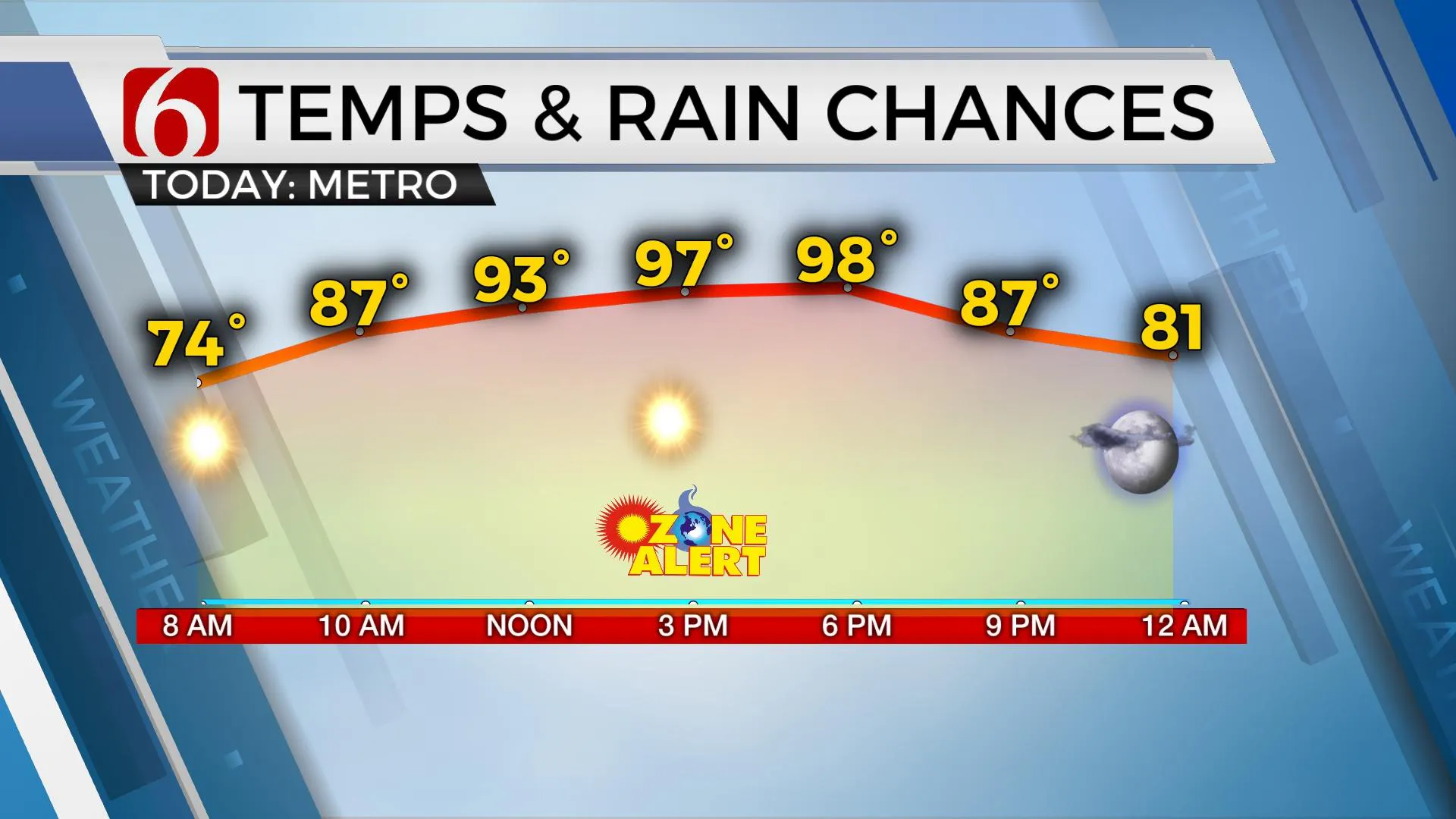
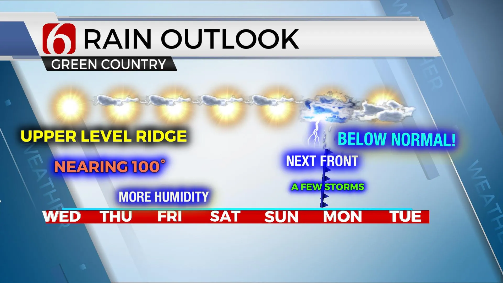
The strong mid-level ridge of high pressure will remain centered across the four corners of the intermountain region for the next 3 days before gradually weakening as a series of upper-level troughs will move across the northern U.S. The net impact will be more noticeable late this weekend as daytime highs drop a few degrees with a weak boundary nearing northern Ok Sunday night or early Monday morning with a chance for a few storms. A consensus of data suggests this front will have enough strength to clear the entire area Monday bringing a day or two of below normal temps early next week. Until then, unseasonably warm, nearing hot weather is likely, with some locations nearing 100 by Thursday. Low-level moisture is also slowly increasing with dew points moving into the upper 60s and lower 70s later today and continuing this week. The heat index values will be moving back into the 100 to 104 range but will still not trigger heat advisories based on most data. If temps are slightly higher than advertised or dew points don’t mix down some during the afternoon, some advisory level heat index numbers may be possible for the latter half of the week. A few small, isolated showers or storms will remain possible on the northern and eastern periphery of the ridge, mostly across extreme eastern OK and western Arkansas for the next two days. For example, a small shower with a lightning strike moved across Rose, OK around 2 a.m. this morning before quickly dissipating. This chance remains extremely low and less than 5% for the entire region.

The first wave in the mid to upper levels will quickly move across southern Canada into the upper Midwest Friday into Saturday with a surface front moving into at least the central plains before stalling. The upper flow, while increasing speeds aloft, will remain too far north to impact most of our area. The 2nd short wave scheduled to move across the northern plains Sunday into Monday is stronger and will act to bring the front southward, possibly entering northern OK Sunday night or Monday morning with a few storms, including the threat of a few strong to severe storms. Data this morning suggest the front enters our immediate area either Sunday night or sometime Monday morning. GFS is a little more robust with storm chances, while our European model counterpart is slightly slower and mostly wet south of the metro. We’ll continue with a conservative pop for this period with every intention of increasing these as data supports higher confidence. A few of these storms may end up strong to severe.

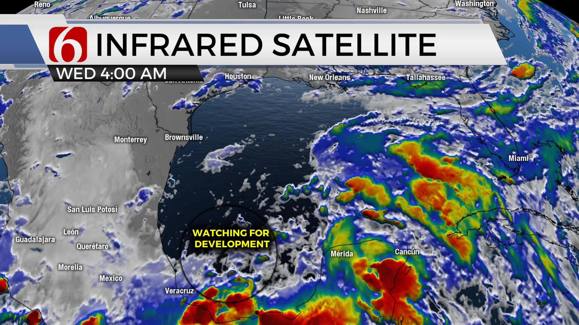
Additionally, we're tracking a developing tropical system in the southern Gulf of Mexico that will move northeast the next few days before making some impacts across southeast TX and southern Louisiana. This system will not directly impact our weather. The system has trended slightly more northward and could bring a circulation into the ArklaTex or slightly east this weekend.

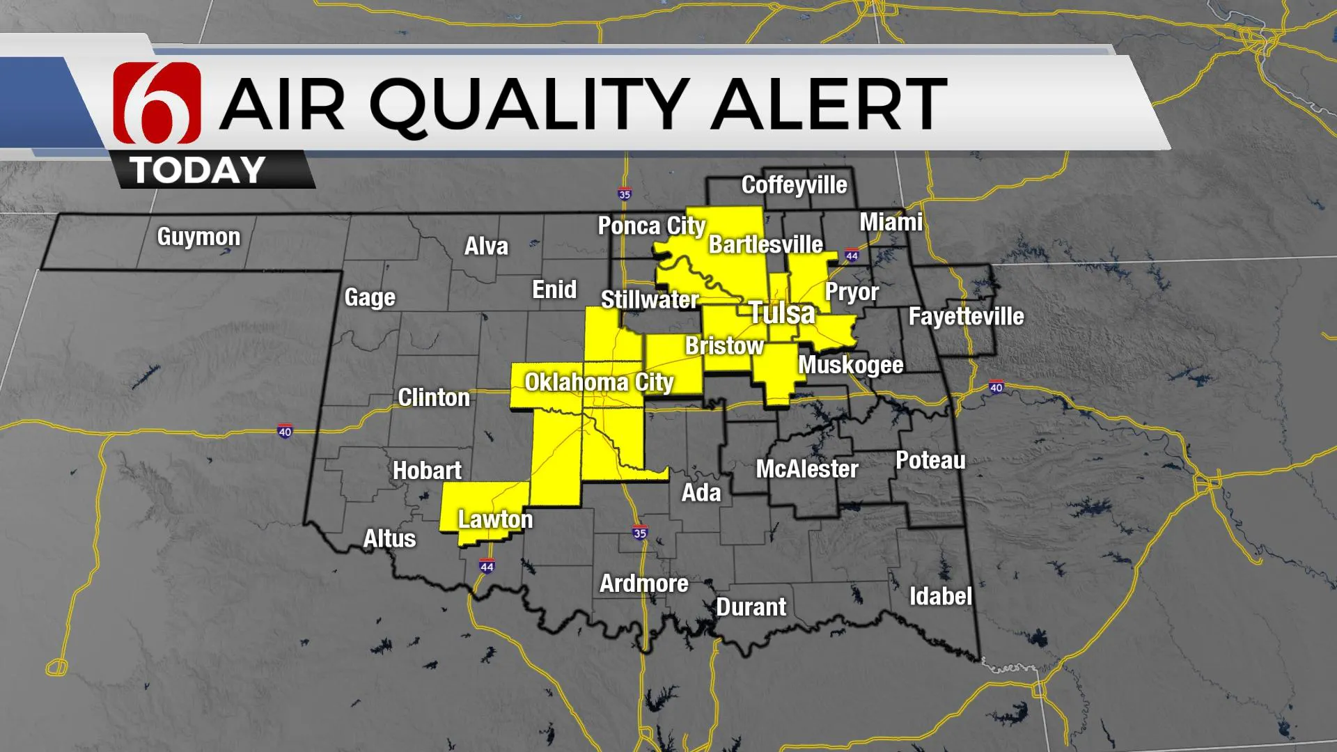
Another Ozone alert will be underway again today for the Tulsa metro regional area. To learn more about Ozone alerts and how you can help mitigate formation, please see the information posted by our friends at NWS Tulsa.

Thanks for reading the Wednesday morning weather discussion and blog.
Have a super great day!
Alan Crone
KOTV
If you’re into podcasts, check out my daily weather update below. Search for NewsOn6 and ‘Weather Out The Door’ on most podcast providers, including Apple, Stitcher, Tune-In and down below on Spotify.

More Like This
June 16th, 2021
February 14th, 2022
January 26th, 2022
January 25th, 2022
Top Headlines
December 14th, 2024
December 14th, 2024
December 14th, 2024
December 14th, 2024


