Mini Heat Wave Continues, Pattern Change Likely Next Week
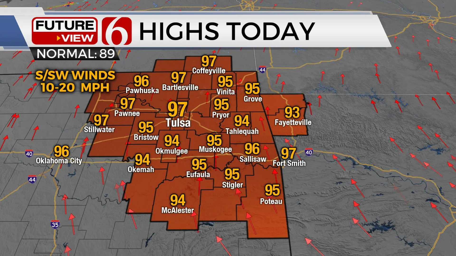
The mini-heatwave continues for the next few days, but some changes will occur soon as a pattern change next week offers below normal temperatures, both morning lows and afternoon highs. Local dew points may slowly mix down through the afternoon periods into the weekend and heat advisory level indices are not expected.Friday, June 18th 2021, 7:14 am
TULSA, Oklahoma -
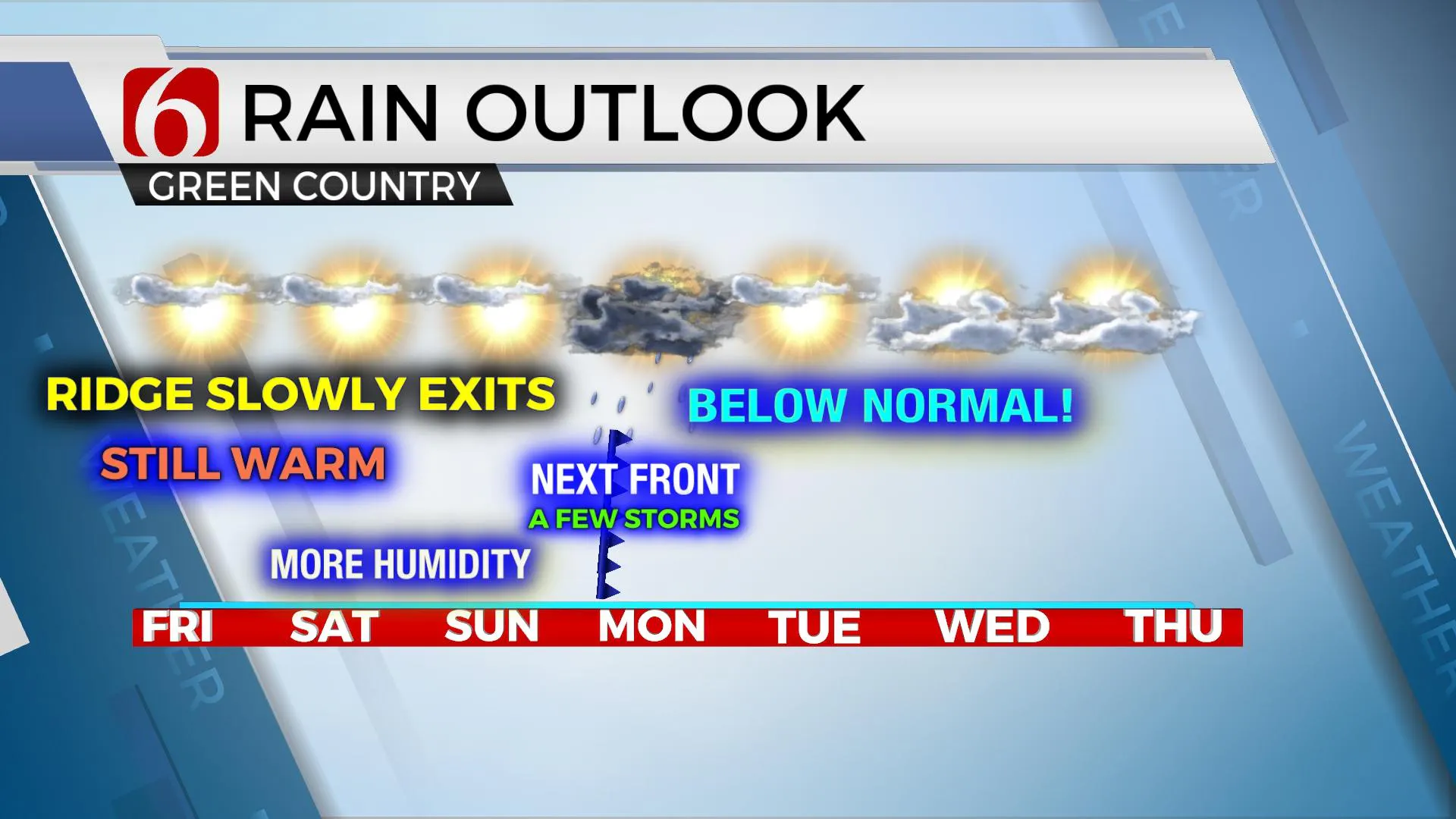
The mini-heat wave continues for the next few days, but some changes will occur soon as a pattern change next week offers below normal temperatures, both morning lows and afternoon highs. Local dew points may slowly mix down through the afternoon periods into the weekend and heat advisory level indices are not expected. The main item of interest will be a seasonally strong cold front nearing the state Sunday night into Monday bringing a few storms and some relief from the heat for several days next week.

The mean level ridge of high pressure currently positioned to our west will begin flattening and moving slowly southwest as a series of upper-level disturbances pivot across the northern and central plains. The first arriving today and Saturday will keep most of the energy well north but will bring the front southward into the central plains. The 2nd and stronger upper trough will dive through the Midwest Sunday into Monday while ushering the surface front southward from the period of Sunday evening through Monday. Cold fronts in mid-June usually don’t clear the entire state, but a consensus of data support this front ending up across the Red River Valley into north TX early next week. This will temporarily erode the hot and humid weather replacing it with highs in the lower 80s Tuesday and mid-80s Wednesday. Morning lows Tue and Wed should also start in the upper 50s and lower 60s. There remain some differences in the various data regarding the exact timing of the front and this could bring some changes to our Monday forecast. As of this morning, we're sticking with decent pops late Sunday night through part of Monday, including the mention of a few strong to severe storms. Temps Monday should only reach the mid-80s around the metro before slowly dropping down Monday afternoon and evening. By the second half of next week, the midlevel ridge slowly expands across Texas with the northern extent across far northern OK. This will bring warm muggy weather back near the region and could provide a corridor across far northern OK and southern Kansas in a favorable position for a few storms late next week.

The National Hurricane Center will be issuing forecast information on a developing tropical system in the southern Gulf of Mexico, with the anticipation of becoming a tropical depression or tropical storm Claudette later today.
Thanks for reading the Friday morning weather discussion and blog.
Have a super great day!
Alan Crone
KOTV
If you’re into podcasts, check out my daily weather update below. Search for NewsOn6 and ‘Weather Out The Door’ on most podcast providers, including Apple, Stitcher, Tune-In and down below on Spotify.

More Like This
June 18th, 2021
February 14th, 2022
January 26th, 2022
January 25th, 2022
Top Headlines
December 11th, 2024
December 11th, 2024
December 11th, 2024
December 11th, 2024


