Additional Showers Remain, Highs In The Mid 80s
Mostly cloudy, warm, and humid. Scattered showers and isolated storms possible.Wednesday, June 30th 2021, 9:32 am
TULSA, Oklahoma -
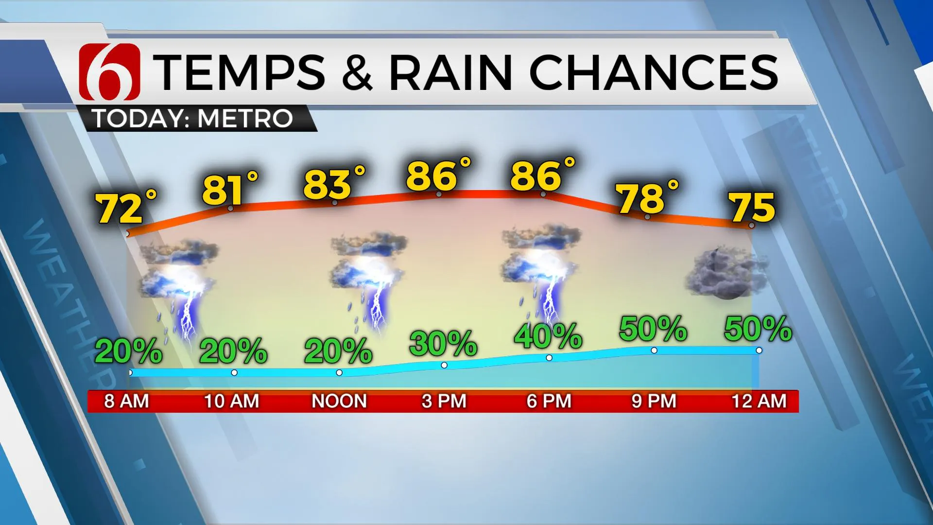
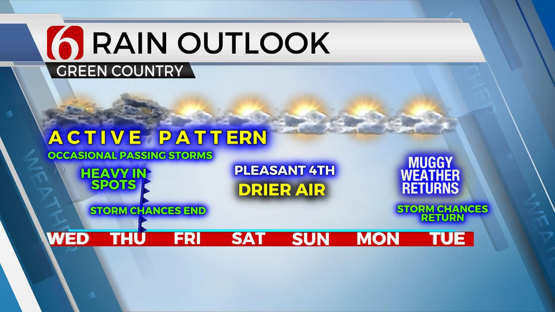
The overall trend in the forecast has not changed much from the previous few days. A rather moist and warm atmosphere will yield some scattered showers and storms today but not for all locations. A Thursday morning front brings additional storms for a larger area but as this boundary moves southward Thursday afternoon, most of the precipitation will slowly transition to the south leaving northern Oklahoma mostly dry Friday into the weekend. Low-level moisture will remain quite high behind this boundary for most of Friday before some noticeably drier air will temporarily arrive from the Missouri Valley this weekend across northeastern sections of the state proving for some pleasant weather for our extended holiday. This will be short-lived with tropical moisture streaming northward into the area by the middle of next week. Temps today will be very similar to yesterday with afternoon highs ranging from 83 to 87, with warmer readings near the metro.

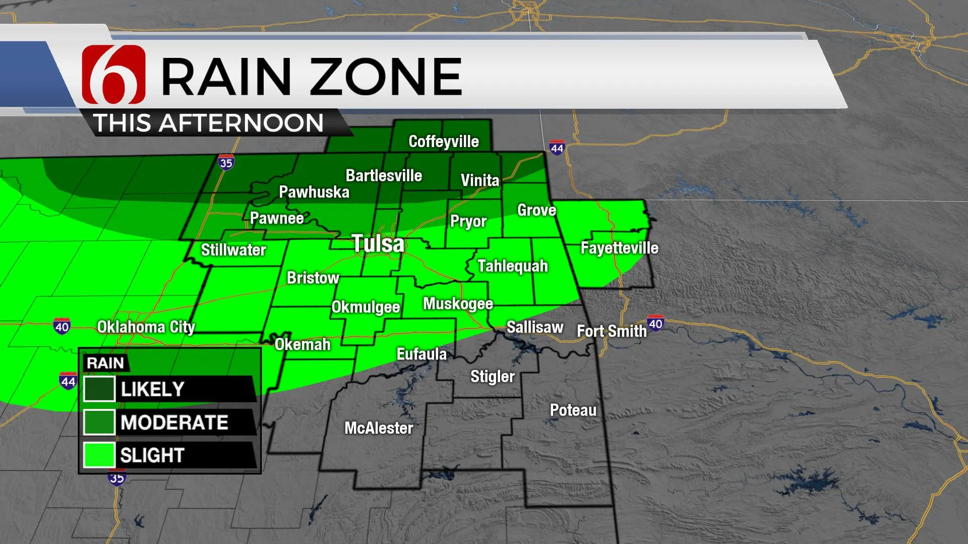
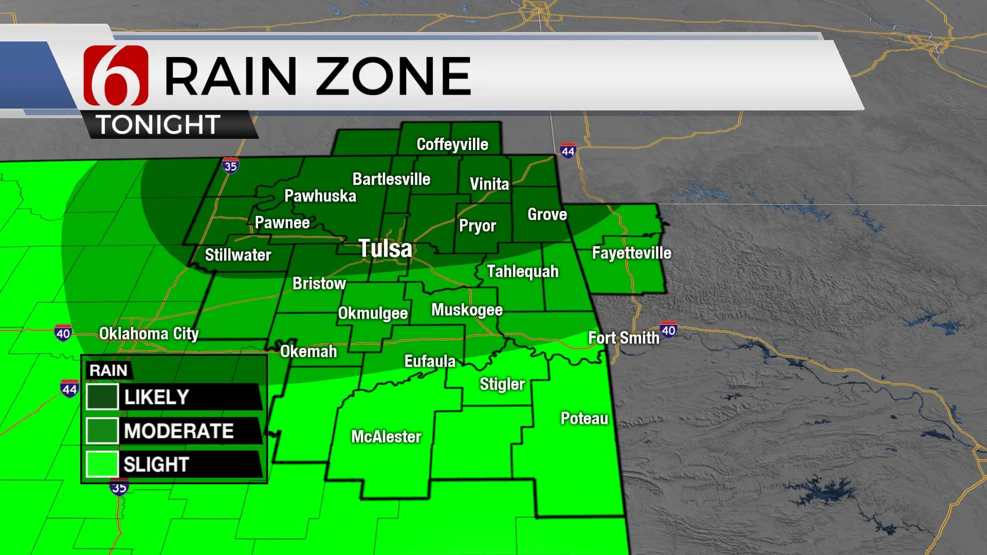
While the plume or axis of most of the shower activity has shifted westward, this region is expected to migrate more northward on the northern and western periphery of a mid-level ridge of high pressure located south of the area. Scattered shows near I-35 will gradually move northeast around the top of the ridge and may impact part of the area later today. Additionally, a few pop-up showers or storms will continue to be possible elsewhere. Our probabilities will remain in the general category of 30 to 50% for today but will be increasing to a likely category later tonight into early Thursday as the next boundary nears the state from the north. Flood watches are posted for most of southern Kansas today and some locations across northern OK may be added to a flood watch for later this evening. Most of the dynamic energy with this system will stay northeast of the state and severe weather threats will be limited. A few cells may still produce some hail and gusty winds Thursday, but the overall severe threat will be low.

The front passes the area Thursday midday to afternoon but the airmass will not change too much until late Friday night as slightly drier air arrives. This will knock the weekend lows down into the 60s, but afternoon highs will continue to reach at the mid to upper 80s with sunshine and mostly light wind. The 4th looks good with highs in the upper 80s, south winds and a few clouds. At this point, it appears any showers or storms Sunday will remain well west or south of the area.

Early next week, some controversy arrives in the data regarding the upper airflow. The GFS would support a midlevel trough developing Sunday and spinning slowly across north TX and southern OK for a few days next week with daily shower chances. The EURO counterpart is not as strong with this feature and more southward with limited or no chances until the latter half of next week. Muggy weather quickly returns by Tuesday and I’ll introduce a chance for a few showers or storms Tuesday through the middle of next week. Stay tuned.

Thanks for reading the Wednesday morning weather discussion and blog.
Have a super great day!
Alan Crone
KOTV
If you’re into podcasts, check out my daily weather update below. Search for NewsOn6 and ‘Weather Out The Door’ on most podcast providers, including Apple, Stitcher, Tune-In and down below on Spotify.

More Like This
June 30th, 2021
February 14th, 2022
January 26th, 2022
January 25th, 2022
Top Headlines
December 14th, 2024
December 14th, 2024
December 14th, 2024
December 14th, 2024


