Warm, Muggy Weather Sticks Around, A few Scattered Showers Possible
A weak front passes through with cooler temperatures and breezy winds.Wednesday, July 7th 2021, 10:01 am
TULSA, Oklahoma -
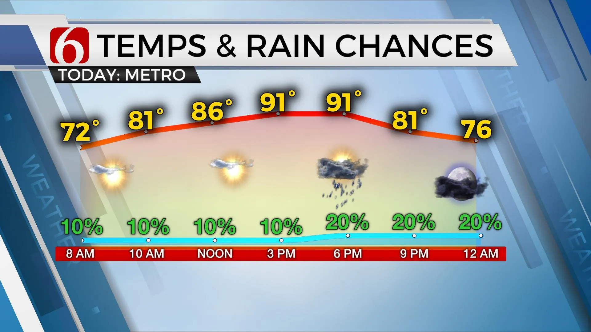
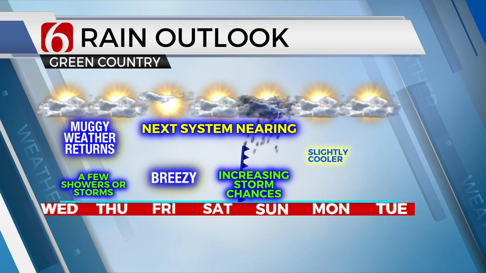
Warm and muggy weather remains today along with a few scattered showers and storms. A stronger system nears the state Saturday night with increasing rain and thunderstorm chances for northeastern Oklahoma.

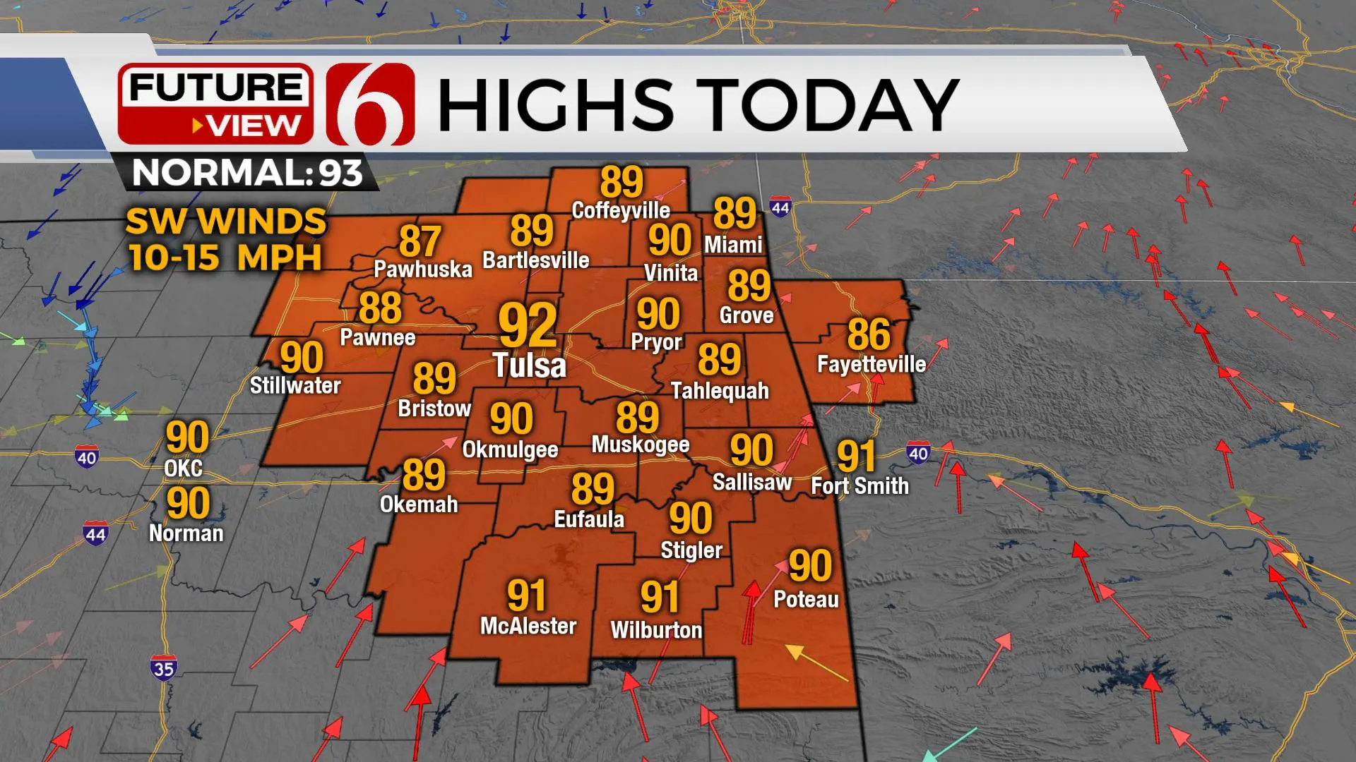
We’re now in the window for a few scattered showers and storms today and through early Thursday as low-level moisture streams northward and a weak system nears from the northwest. A second, stronger system nears the state this weekend with increasing rain and thunder probabilities, including the threats for a few strong storms and some activity producing locally heavy downpours. Highs this afternoon should reach the upper 80s and lower 90s with south to southwest winds at 10 to 15mph. Heat index values will reach the mid to upper 90s today and Thursday, and possibly nearing 100 to 103 Friday as daytime highs climb into the lower to mid-90s.

A mid-level ridge of high pressure remains anchored to the west with a weak short-wave trough entering the central plains this morning. A surface cold front will enter southeastern Kansas later this afternoon and possibly far northern OK later tonight with a few showers or storms in a small segment of storms. A few of these may persist into early Thursday morning before the boundary stalls and becomes diffuse by midmorning to afternoon. Thursday morning lows in the lower 70s will return with afternoon highs in the lower 90s. Friday will be the warmest day of this current stretch of weather with morning lows in the lower to mid-70s and afternoon highs reaching 92 to 95.

Saturday an unseasonably strong mid-level trough drops southward from Canada into the northern plains states and continues moving southeast nearing the Midwest by Saturday evening. A surface front will be positioned across the central plains moving southward by Saturday evening bringing a round of rain and storms near and behind this front southward into the state by the evening hours. While more significant shear and instability remains northeast of our immediate area during this period, a few strong to severe storms will be possible by Saturday evening as the system nears the region. Low-level moisture pooling along the front increases the possibility of locally heavy rainfall that may result in some drainage or flooding issues for some spots. The main forcing of the system remains slightly northeast of our region Sunday, but close enough to keep a few showers and storms nearby Sunday into Monday as this surface front also stalls and becomes diffuse early next week.
Thanks for reading the Wednesday morning weather discussion and blog.
Have a super great day!
Alan Crone
KOTV
If you’re into podcasts, check out my daily weather update below. Search for NewsOn6 and ‘Weather Out The Door’ on most podcast providers, including Apple, Stitcher, Tune-In and down below on Spotify.

More Like This
February 14th, 2022
January 26th, 2022
January 25th, 2022
Top Headlines
December 13th, 2024
December 13th, 2024
December 13th, 2024
December 13th, 2024


