Friday Temperatures Above Normal, Showers Possible For The Weekend
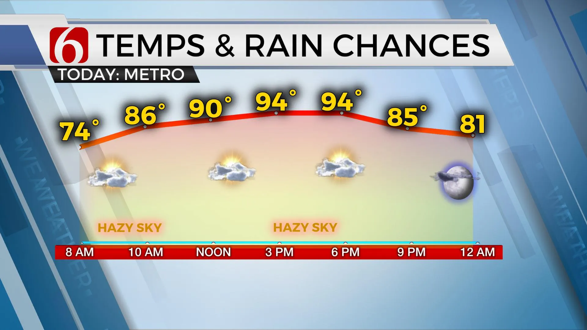
It is going to be a partly to mostly sunny, hot and humid Friday with a southerly breeze.Friday, July 23rd 2021, 8:44 am
TULSA, Oklahoma -
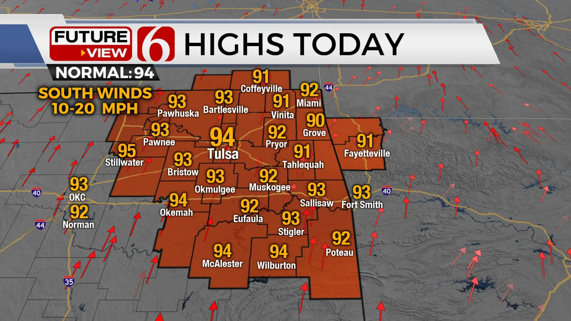
Temperatures will be moving near and above normal today and for the foreseeable future as a typical summerlike pattern begins across the state. This does not totally exempt us from a few shower or storm chances the next few days, but the heat and humidity will be the common denominator for several days to follow.

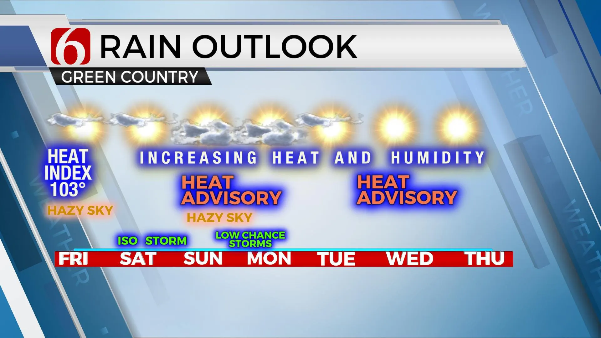
We still have some minor controversy on the exact positing and strength of the incoming mid-level ridge of high pressure. Until the ridge amplifies and expands across the entire area, we’ll need to account for a few low-end chances for a few showers or storms. The issue is that in this environment, even one or two mature storms could produce extremely heavy rainfall and gusty winds. But most of the area this weekend and into early next week will remain void of precipitation. All locations will experience increasing heat and humidity with heat index values nearing 105 to 110 this weekend, and for a few days next week before the lower atmosphere slowly dries and temps rise even more.

The northernmost and eastern periphery of the ridge will be susceptible for a few showers and storms, including pre-dawn Sunday morning and then again late Sunday night into Monday morning. Before this occurs, a few pop-up storms will be possible across extreme southeastern OK and northwest Arkansas in the slightly higher and varied terrain where some minor orographic lifting occurs in this type of pattern.

The recent rainfall and lush green vegetation will suppress the normal realization of temps one would expect under this type of ridge, at least initially, with afternoon highs in the mid to upper 90s this weekend through most of next week. As mentioned here yesterday, there will be a process that allows for some minor drying of the boundary layer that also allows surfaces temps to slowly come up a degree or two: the heat index slowly drops but the afternoon high slowly increases. This is more likely for the 2nd half of next week. The ridge may also flatten on the eastern edge later next week allowing a weak back-door boundary to take a run at northeastern OK next weekend. Before any of this occurs, our heat and humidity both will slowly increase into the weekend with heat advisories likely for portions of Eastern OK.
Thanks for reading the Friday morning weather discussion and blog.
Have a super great day!
Alan Crone
KOTV
If you’re into podcasts, check out my daily weather update below. Search for NewsOn6 and ‘Weather Out The Door’ on most podcast providers, including Apple, Stitcher, Tune-In and down below on Spotify.

More Like This
February 14th, 2022
January 26th, 2022
January 25th, 2022
Top Headlines
April 25th, 2024
April 25th, 2024
April 25th, 2024


