More Heat & Humidity Remain, Low Chance for Scattered Pop-Up Storms
Hot and muggy weather continues on Tuesday with a slight chance of an isolated shower or storm.Tuesday, July 27th 2021, 7:28 am
TULSA, Oklahoma -
More heat and humidity remain in the forecast for the rest of the forecast period, including a low chance for a few scattered, pop-up storms later today. A small convective area of vorticity is noted near and south of the metro this morning and should continue to drift southward through the day. This feature may flare up a few showers and storms early this morning before expanding in coverage later today across the far southern part of the state. Some of the storm activity early this morning produced wind gusts from 50 to 64 mph near the Lake Eufaula region along with 1 to near 2-inch rainfall.

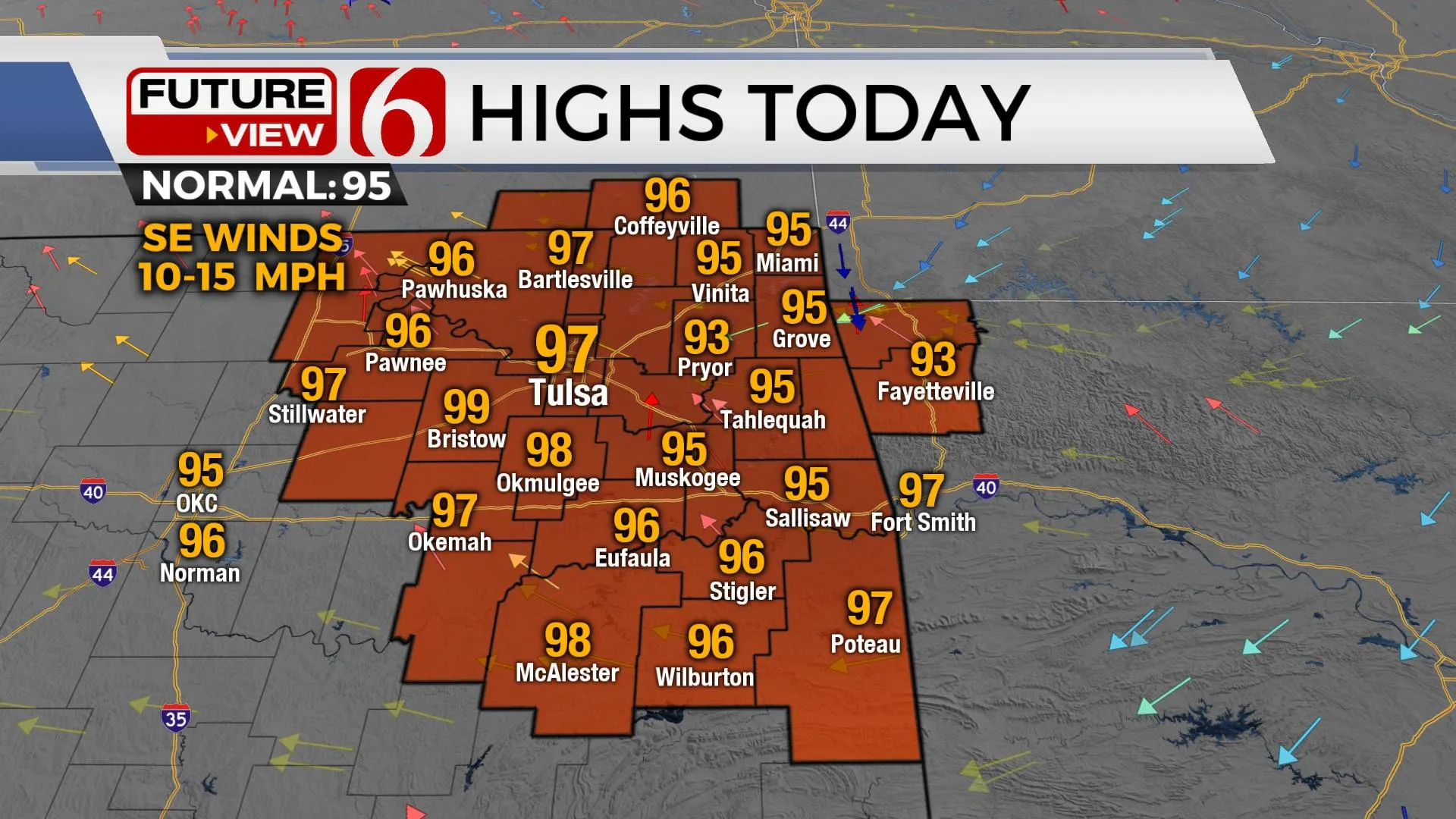
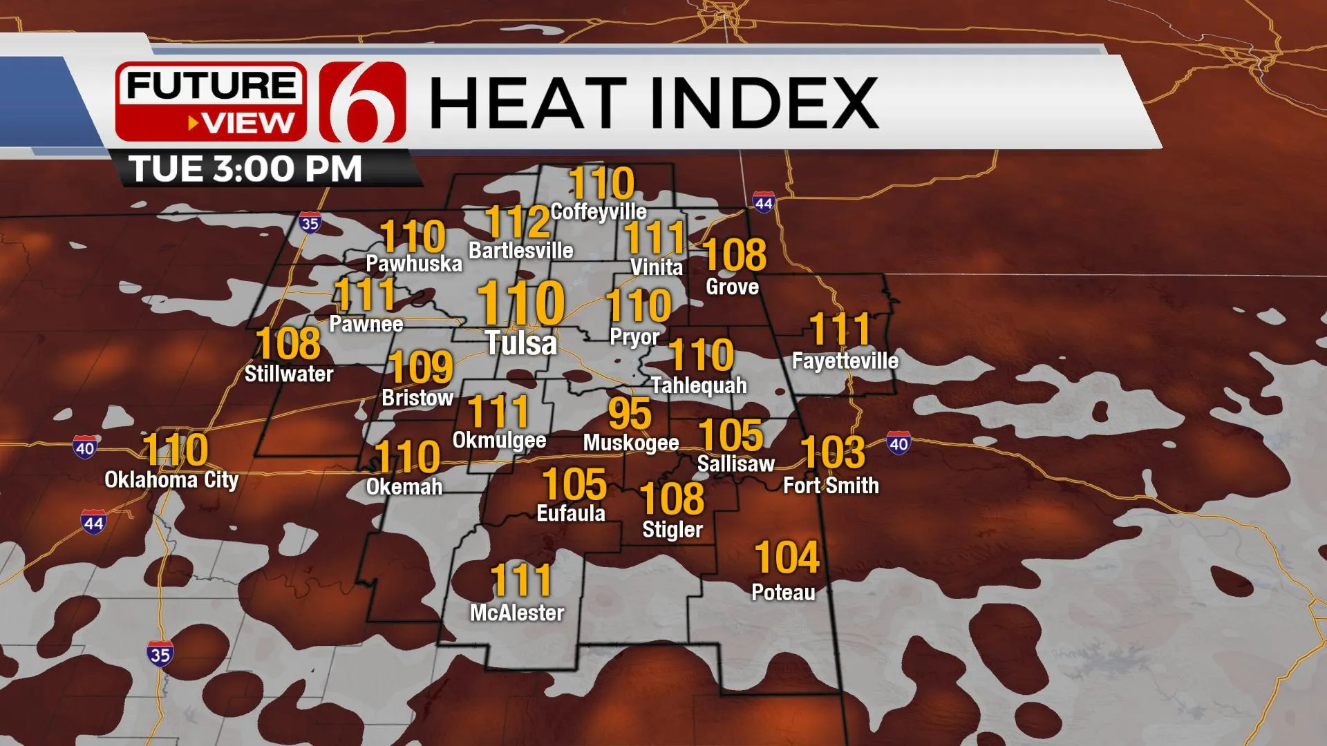
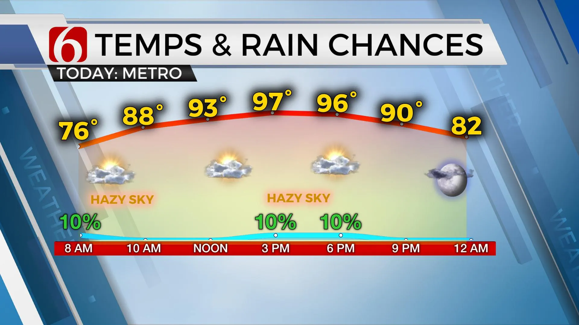
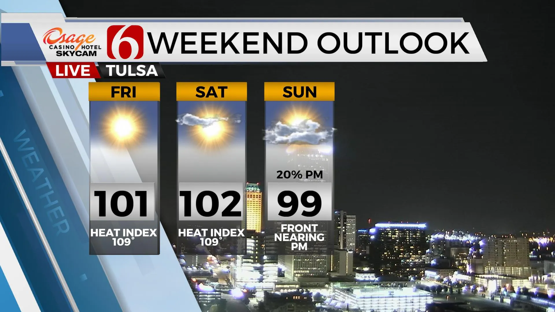
Daytime highs are expected to reach the mid to upper 90s Tuesday and Wednesday before nearing or slightly above 100 for the 2nd half of the week into the weekend. Low-level moisture may dry some slightly by the end of the week, but not enough to keep the heat advisories away from the area. Our heat index values will be nearing 105 to 112 again today and Wednesday before dropping into the 105 to 109 range for the weekend.

Just like the past few days, any mature storm, mostly in the afternoon, could produce highly localized heavy rainfall along with gusty to damaging downbursts of wind. We’ve already experienced this early this morning near the lake Eufaula region. Again, most locations will remain dry for the day, but a few storms will remain possible. This morning, the small disturbance mentioned above will produce some widely scattered storms. These will produce locally heavy rainfall, but the overall coverage is expected to remain limited.

The mid-level ridge high pressure continues to expand and should cover most of the area soon. This feature will eventually take the pop-up variety out of the forecast while bringing the hottest weather of the season, which is typically expected during late July and early August. The mean position of this ridge has been well west of our area for the entire summer. As mentioned here last week, its entirely possible that our ridge will change shape and retro slightly more west again early next week allowing another weak boundary to “back-door” the area from the Missouri Valley Sunday night into early next week. Typically, this ridge would stick around for a few weeks into August before moving west but could easily move westward next week based on the experience of the summer-so-far. This would knock our highs down a few degrees and bring us some slightly lower moisture content air for next week and keep us in the running for a few more showers or storms.

Thanks for reading the Tuesday morning weather discussion and blog.
Have a super great day!
Alan Crone
KOTV
If you’re into podcasts, check out my daily weather update below. Search for NewsOn6 and ‘Weather Out The Door’ on most podcast providers, including Apple, Stitcher, Tune-In and down below on Spotify.

More Like This
February 14th, 2022
January 26th, 2022
January 25th, 2022
Top Headlines
December 14th, 2024
December 14th, 2024
December 14th, 2024
December 14th, 2024


