Plenty Of Sunshine, Hot Temperatures
Heat and humidity will be the common denominators for the rest of the week across most of the southern and central plains statesTuesday, August 10th 2021, 4:22 am
TULSA, Oklahoma -
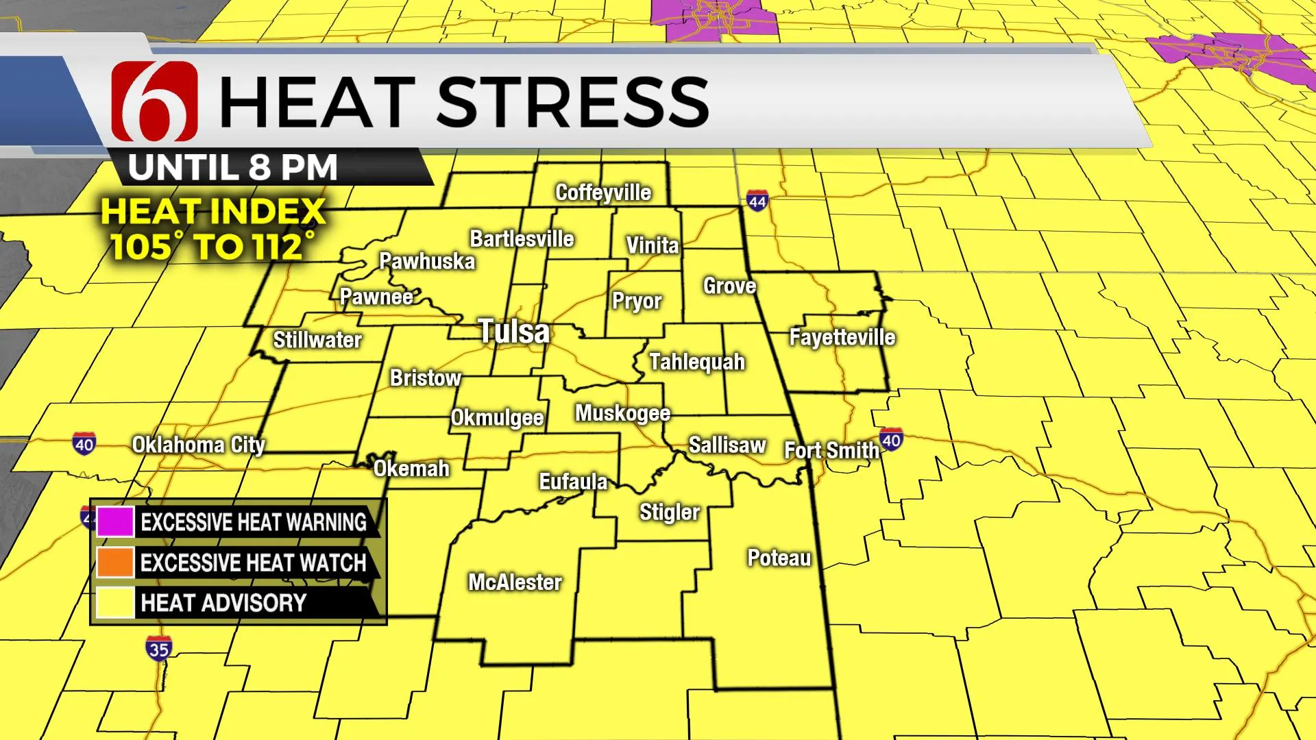
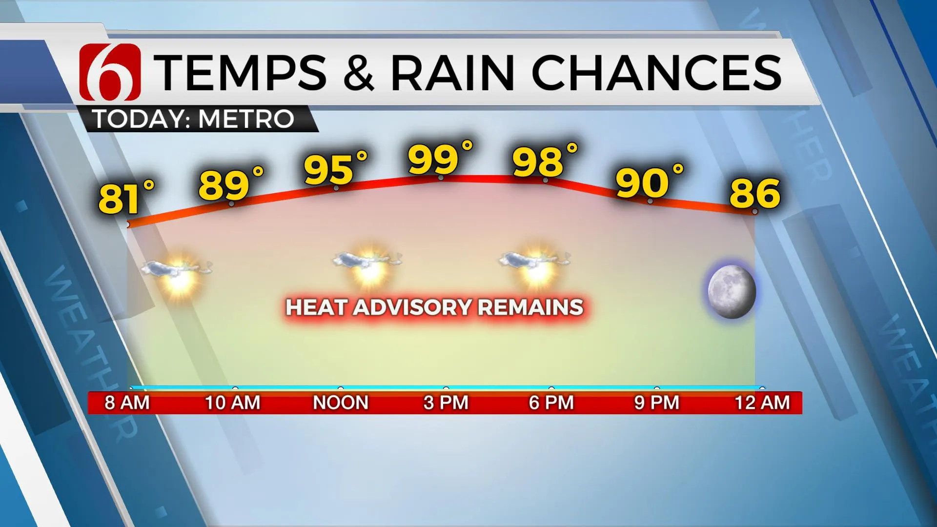
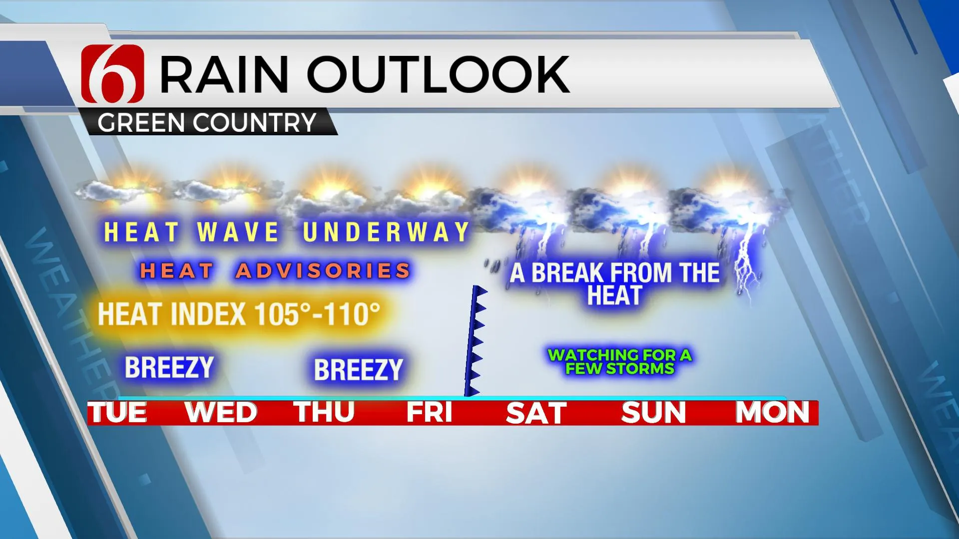
Heat and humidity will be the common denominators for the rest of the week across most of the southern and central plains states with heat index values reaching 105 to 110 through at least Thursday across northeastern OK before some changes are possible into the weekend. Heat advisories and possibly excessive heat warnings will be required for the region until these possible changes occur when a weak boundary enters northern OK with a few storms and some reductions in temperature this weekend. Very little relief is expected until then as morning lows will only drop into the upper 70s and lower 80s along with daytime highs in the upper 90s or at 100 for the entire region. South to southwest winds from 15 to 30 mph will provide some relief but not much. Heat stress is a serious issue. Please take precautions and prepare by consuming adequate water, scheduling significant breaks when working outside, and wearing heat-resistant clothing.

The data continues to offer a respite from the heat and humidity into the weekend.
The EURO brings a decent front for August standards into the area Friday and pushes into part of north TX before stalling later this weekend. This would bring scattered showers and storms Friday and especially this weekend across part of the area with highs dropping into the lower to mid-80s, yet no major reduction in low-level moisture would occur. The GFS has started to trend closer to this solution, but I still have some doubts based on our normal climo for this time of year. But I’ll make some minor changes and lower the weekend highs into the upper 80s while increasing some probabilities around 30% to account for scattered showers and storms. Basically, I’ve continued with a blended, compromise approach but will slowly begin to lower some temps closer to operational data.

The Tropical Atlantic continues to offer some potential with a few systems developing soon, including Tropical Potential Cyclone Six. This system should quickly become Tropical Storm Fred and may have some impacts on the U.S. by the weekend.

Thanks for reading the Tuesday morning weather discussion and blog.
Have a super great day!
Alan Crone
KOTV
If you’re into podcasts, check out my daily weather update below. Search for NewsOn6 and ‘Weather Out The Door’ on most podcast providers, including Apple, Stitcher, Tune-In and down below on Spotify.

More Like This
August 10th, 2021
February 14th, 2022
January 26th, 2022
January 25th, 2022
Top Headlines
December 11th, 2024
December 11th, 2024
December 11th, 2024
December 11th, 2024


