Hot and Humid Weather Remains
Highs nearing the century mark with heat index values above 105.Tuesday, August 24th 2021, 4:39 am
TULSA, Oklahoma -
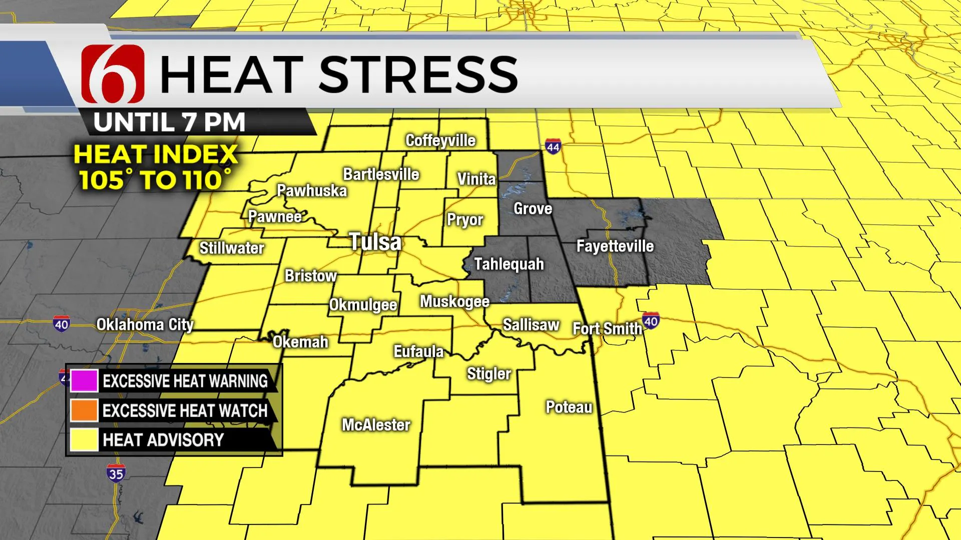
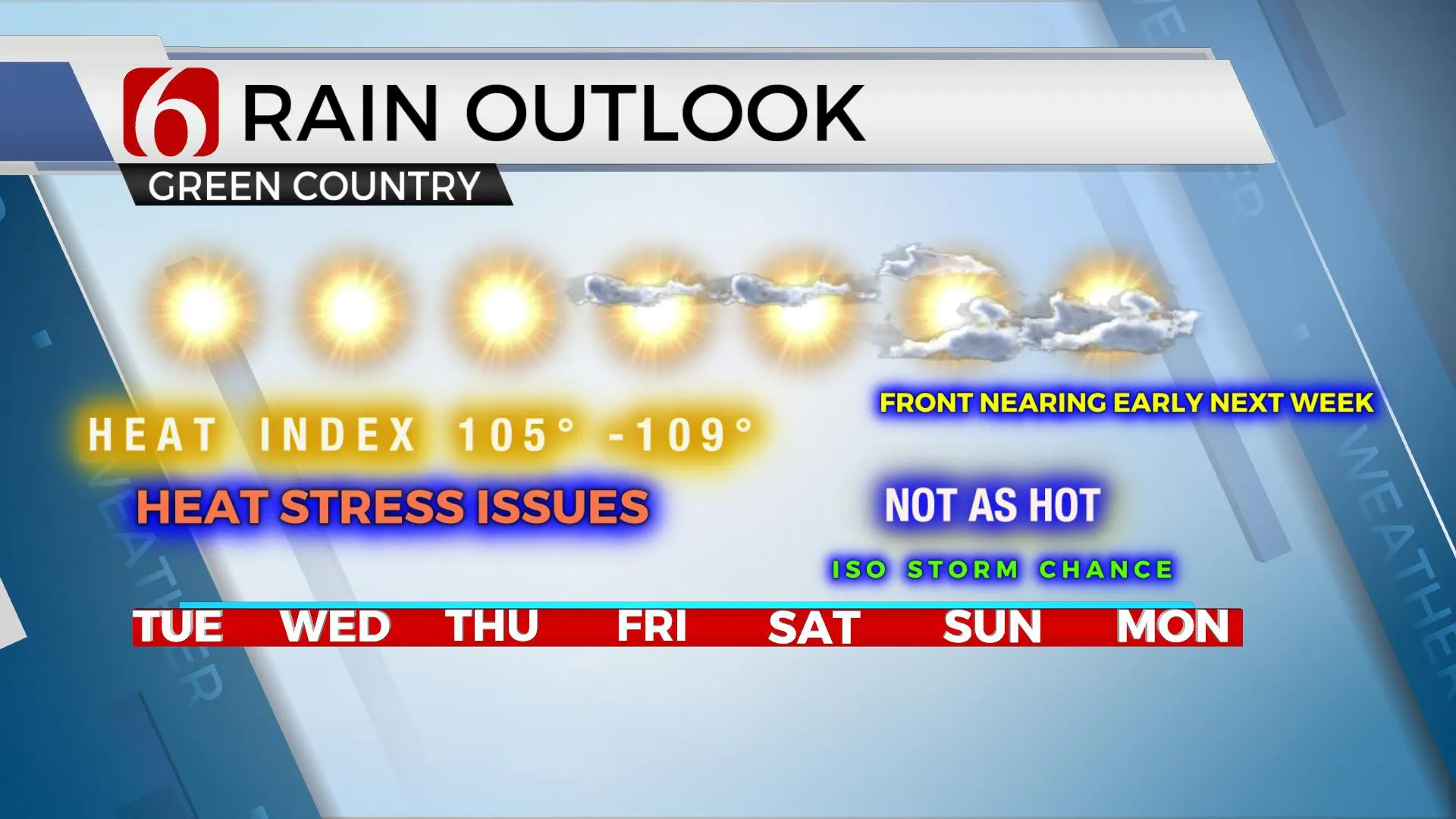
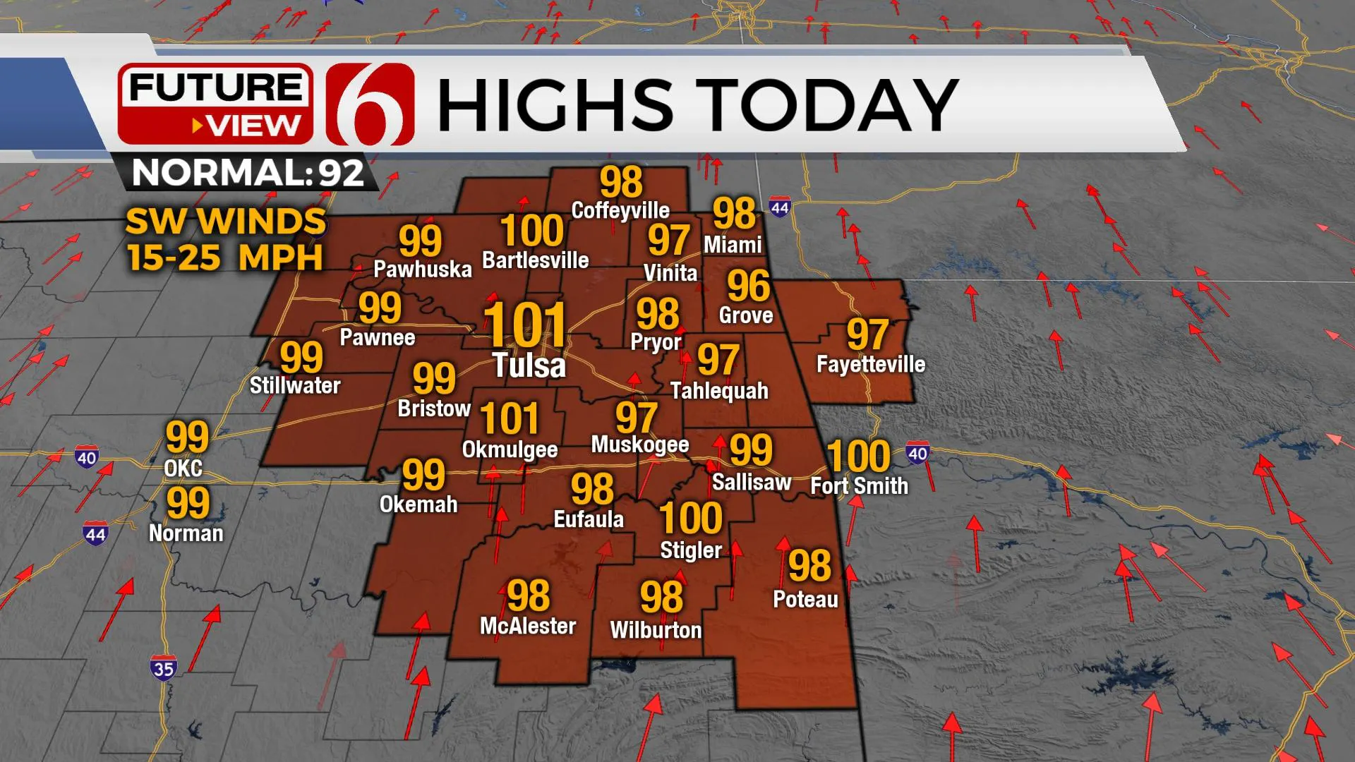
We're anticipating no major changes in the next few days with a broad, midlevel ridge of high pressure centered across most of north TX and Oklahoma. Compression and sinking air will bring the heat with afternoon highs near or slightly above 100 for the metro regions, with upper 90s likely in the surrounding areas. Heat index values will continue to reach over 105 to 109, but a gradual drying of the atmosphere is underway with a slight westerly component to the southerly breeze. Despite local dews mixing down from the lower 70s to the 60s by the afternoon, heat advisory criteria is likely to be met at least for the next few days, possibly getting a break Friday before falling by the weekend. This pattern also keeps any major system out of the region but could allow for a few isolated storms across extreme southeastern OK and western Arkansas by the end of the week.

Stronger westerlies remain well northward across the northern plains with the mid-level ridge positioned across the central plains. A weak easterly wave will develop across the southeastern U.S and move westward by the end of the week bringing enough lift for scattered storms across the Ark LaTeX into part of southcentral Texas. A few of these showers could sneak into far southeastern OK Friday or Saturday. Regarding northeastern OK, the ridge aloft is expected to flatten some and migrate eastward this weekend into early next week allowing the potential for a storm system to near or enter northern OK early next week. The data is inconsistent with a frontal boundary position. Due to this uncertainty, probabilities for showers and storms will remain very low for the weekend and early next week. For the short term, it's a 'heat and humidity' forecast.

Morning lows are expected in the mid to upper 70s with afternoon highs near 100 through Thursday. Friday into the weekend, daytime highs will drop from 97 Friday to 94 through the weekend. Morning lows will remain in the mid-70s. We'll keep low mentions for a few isolated storms this weekend and will include at least low probabilities Monday and Tuesday of next week for southeastern Kansas and northern OK as a front may potentially near the state.

Thanks for reading the Tuesday morning weather discussion and blog.
Have a super great day!
Alan Crone
KOTV
If you’re into podcasts, check out my daily weather update below. Search for NewsOn6 and ‘Weather Out The Door’ on most podcast providers, including Apple, Stitcher, Tune-In and down below on Spotify.

More Like This
August 24th, 2021
February 14th, 2022
January 26th, 2022
January 25th, 2022
Top Headlines
December 13th, 2024
December 13th, 2024
December 13th, 2024
December 13th, 2024


