Heat Advisories Return On Wednesday
Temperatures staying hot with sunshine and an easterly breeze.Wednesday, September 1st 2021, 4:35 am
TULSA, Oklahoma -
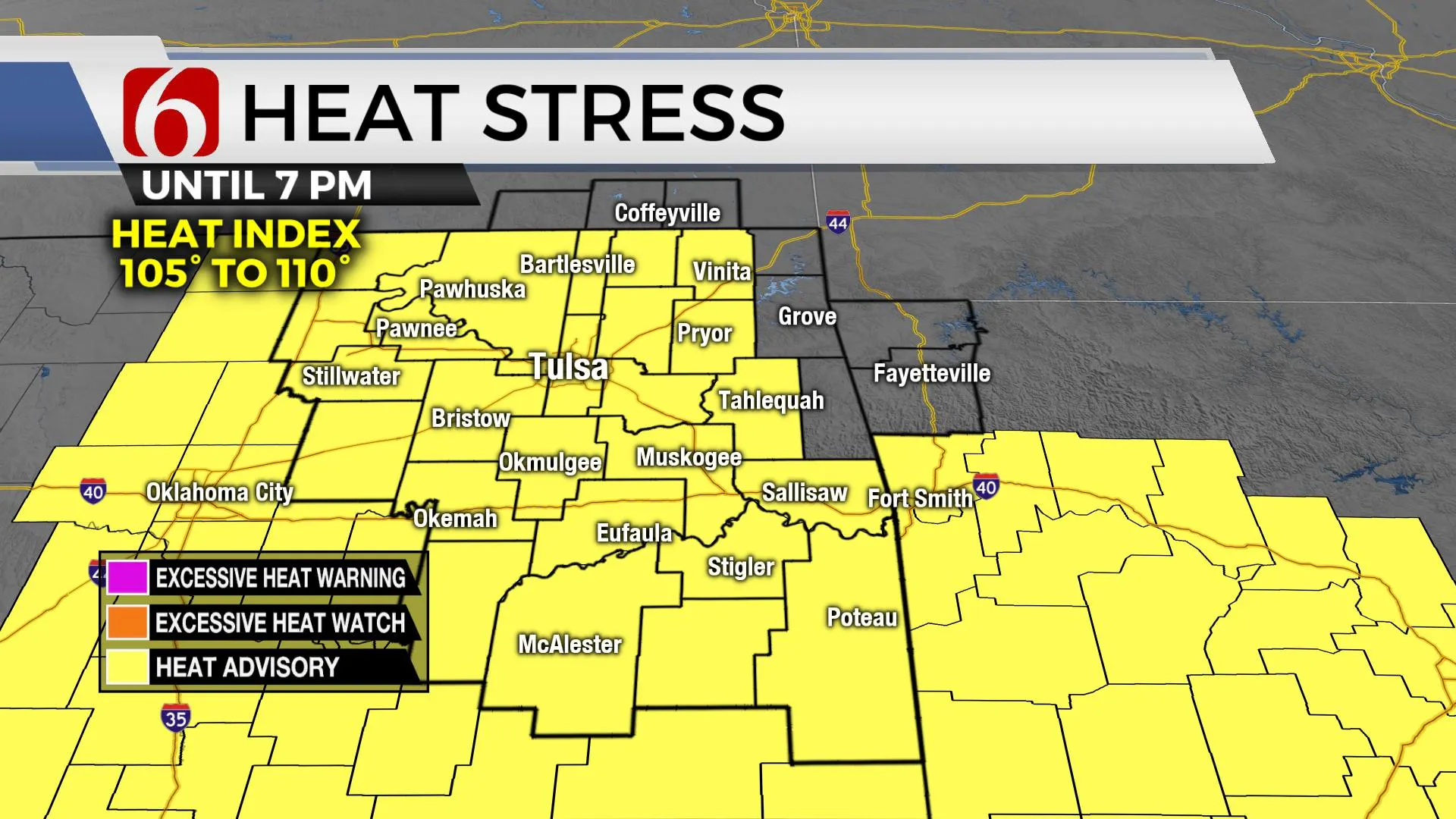
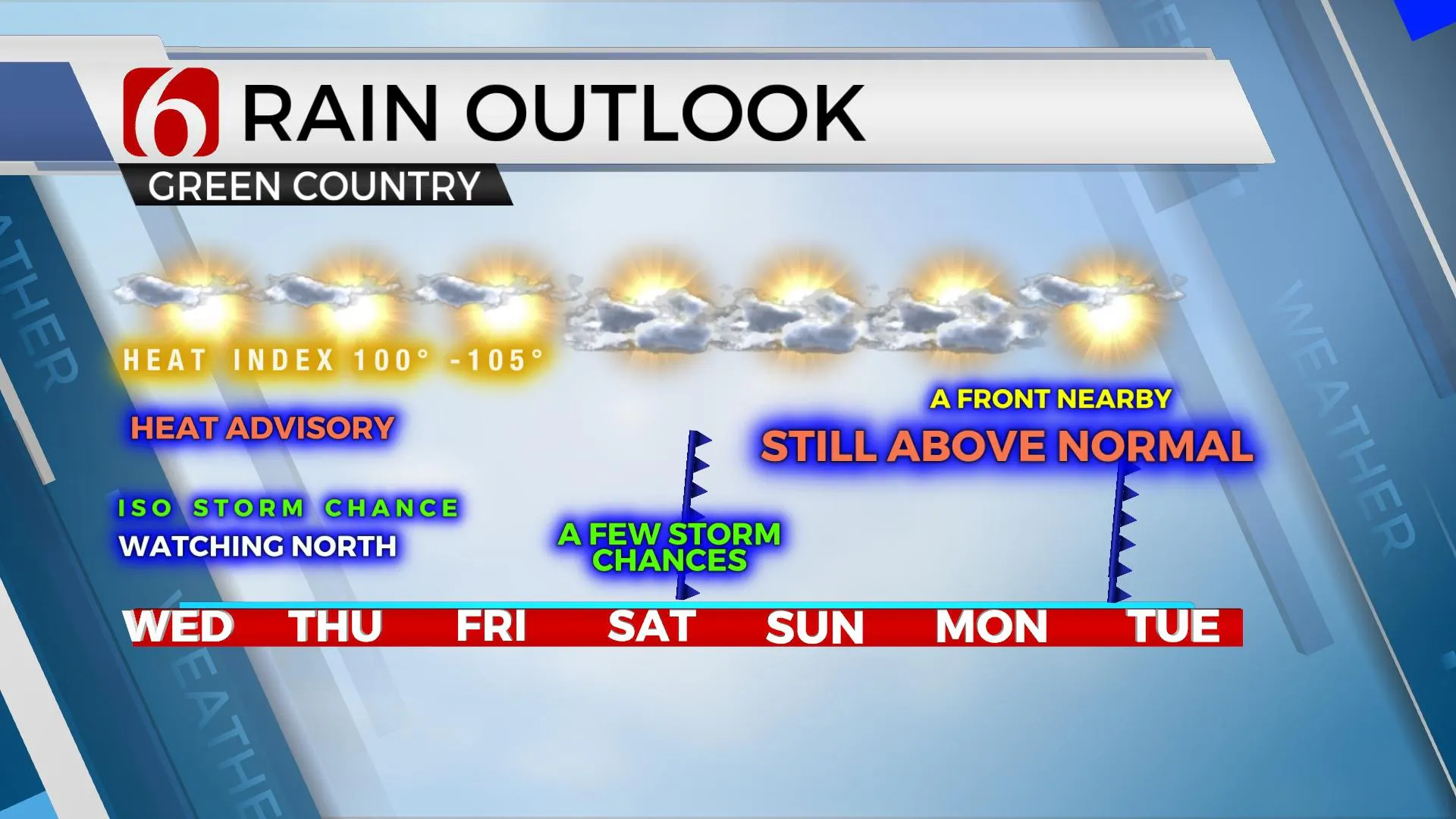
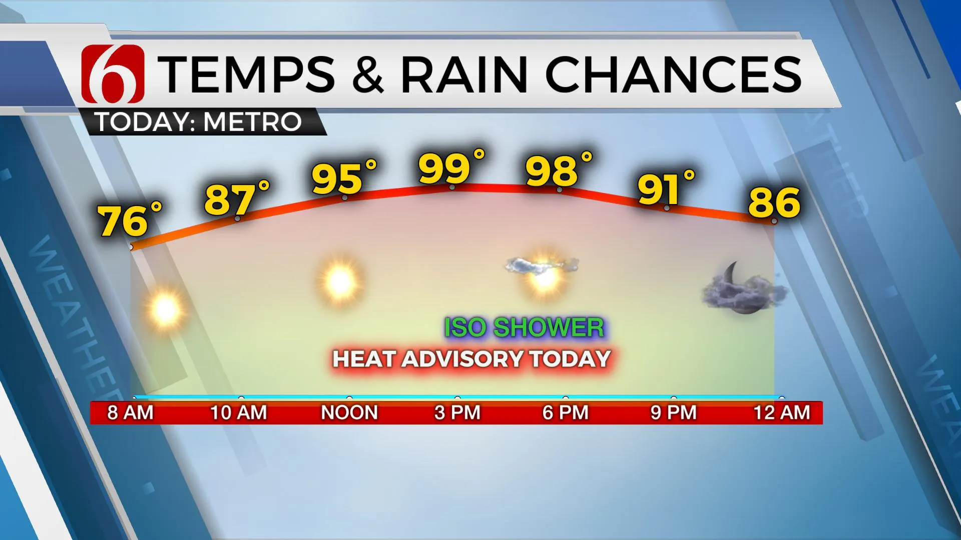
Mid-level ridging will be the story for most of Oklahoma for the next few days with heat and humidity our main concerns. A few spots will experience a few scattered showers or storms, but the limited expected coverage will keep the chances low. Heat index values will be near or slightly above 105 today and our friends at the National Weather Service will issue another heat advisory for part of the area. Remain aware of growing heat stress issues again today and tomorrow. A weak outflow boundary is positioned across northeastern OK this morning. Another outflow is nearing NE OK and NW Arkansas bringing the potential for a few showers and storms near Grand Lake eastward for the morning hours. Elsewhere, I can't totally rule out a stray shower or two, but it seems the chances will remain almost too low to keep a real pop on the 7-day planner for the day. These conditions will continue through Friday before the ridge flattens allowing a weak boundary to near the state bringing a few more scattered storms and some minor reduction in heat and humidity. A stronger front is possible for the middle of next week, but data is highly inconsistent with the eventual outcome of this front for next week.

Friday and Saturday max highs will reach the mid to upper 90s before a weak front nears the OK-KS state line region early Saturday morning. Higher chances for a few storms should initially be concentrated across southern Kansas during this pre-dawn Saturday morning period. The boundary will slowly sink southward Saturday and should be positioned near or south of the metro by the evening hours. Despite this front, we think Saturday will be a rather toasty day with highs reaching the upper 90s. Later Saturday evening, a few scattered showers or storms will remain possible near and south of the I-40 region as the boundary continues to slowly slink southward, nearing the Red River Valley by Sunday morning. I'll continue with a few low pops for these periods of Saturday evening into Sunday morning. This boundary appears rather weak and should either become diffused or lift northward Sunday night into Monday morning. I have a minor reduction in heat and humidity Sunday but will bring the temps back around Monday into the mid-90s.

Around Tuesday or Wednesday, a stronger front is a possibility for northern OK, but the data is highly inconsistent. Due to these issues, I’m also inclined to stay the course with above-normal temps for this period, at least for this forecast update. EURO and associated ensembles have a decent change in temps, but the GFS continues with the high heat. More to come later for the middle of next week.

Thanks for reading the Wednesday morning weather discussion and blog.
Have a super great day!
Alan Crone
KOTV
If you’re into podcasts, check out my daily weather update below. Search for NewsOn6 and ‘Weather Out The Door’ on most podcast providers, including Apple, Stitcher, Tune-In and down below on Spotify.

More Like This
September 1st, 2021
February 14th, 2022
January 26th, 2022
January 25th, 2022
Top Headlines
December 14th, 2024
December 14th, 2024
December 14th, 2024
December 14th, 2024


