Heat & Humidity Stick Around Thursday
Once again, hot and humid with plenty of sunshine. A slight chance of an isolated showers.Thursday, September 2nd 2021, 5:53 am
TULSA, Oklahoma -
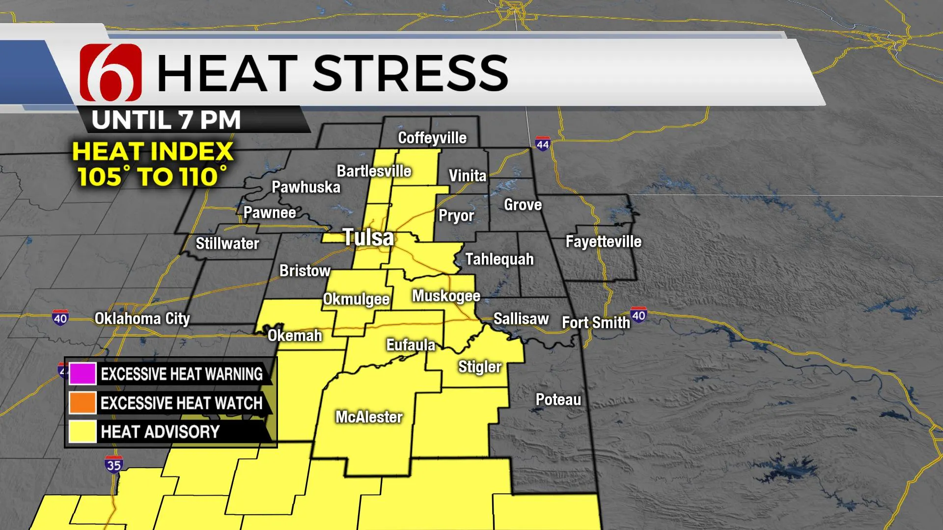
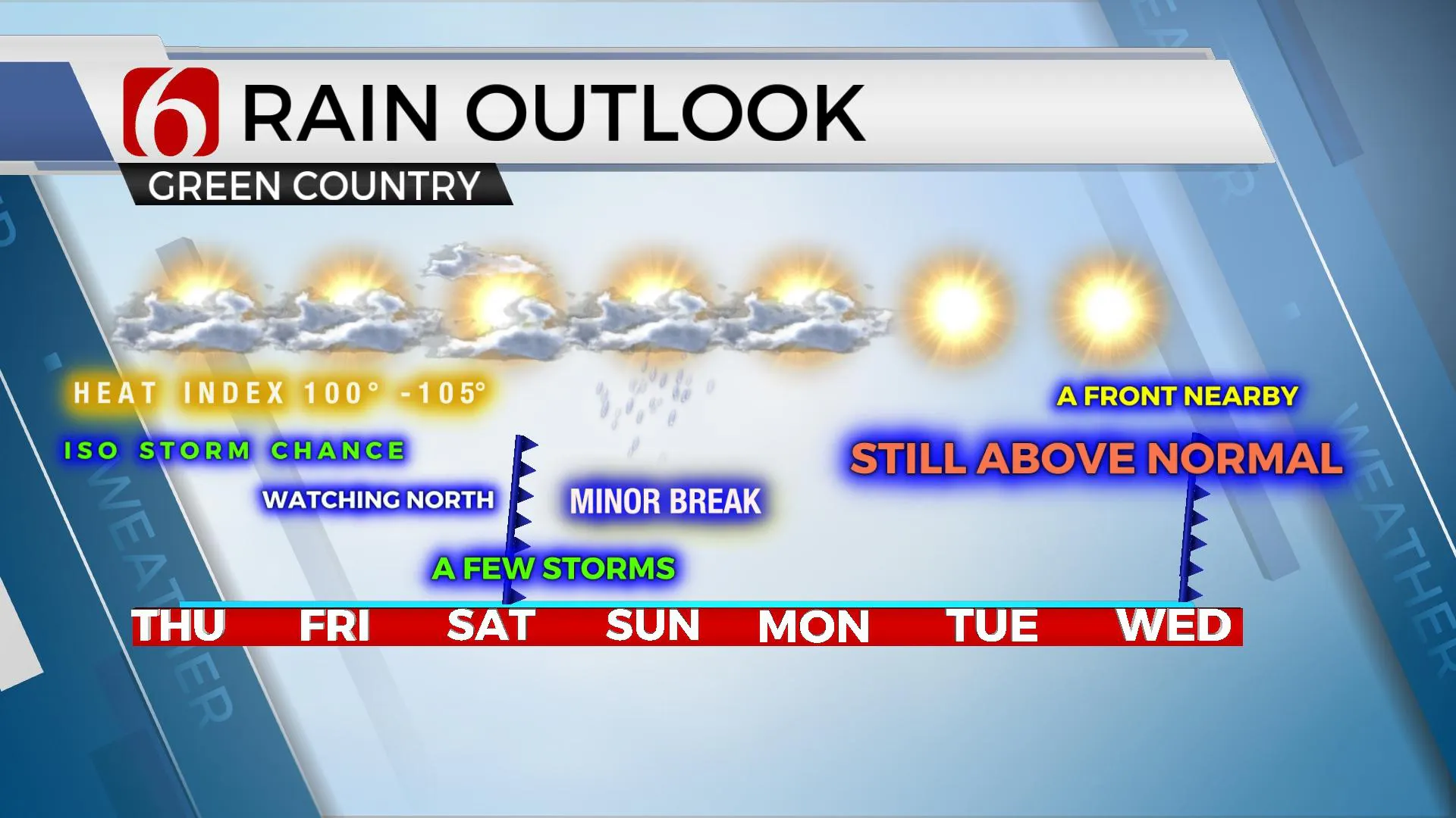
Mid-level ridging should be the common denominator today across most of the region with highs topping out in the upper 90s to mid-90s. Heat index values running from 100 to 107 could trigger a few heat advisories, but mostly across southeastern to southcentral OK into the Red River Valley. The metro heat index will be right on the bubble of 105 for the afternoon. We could go either way regarding a heat advisory by the National Weather Service. Regardless, stay aware of the heat and prepare for heat stress for the midday to afternoon across Eastern Ok. We had a few isolated storms yesterday evening, mostly across southeastern OK. A few isolated cells are possible again today, mostly this morning near or south, and then one or two for the late afternoon. The ridge should preclude a larger number of storms today. Winds will be up slightly from the south in the 10 to 18 mph range. The ridge will slowly flatten over the next two days allowing a weak boundary to approach the southern Kansas area Friday evening. This front eventually moves across northern OK bringing a few storms and a minor, not as hot period for Sunday.

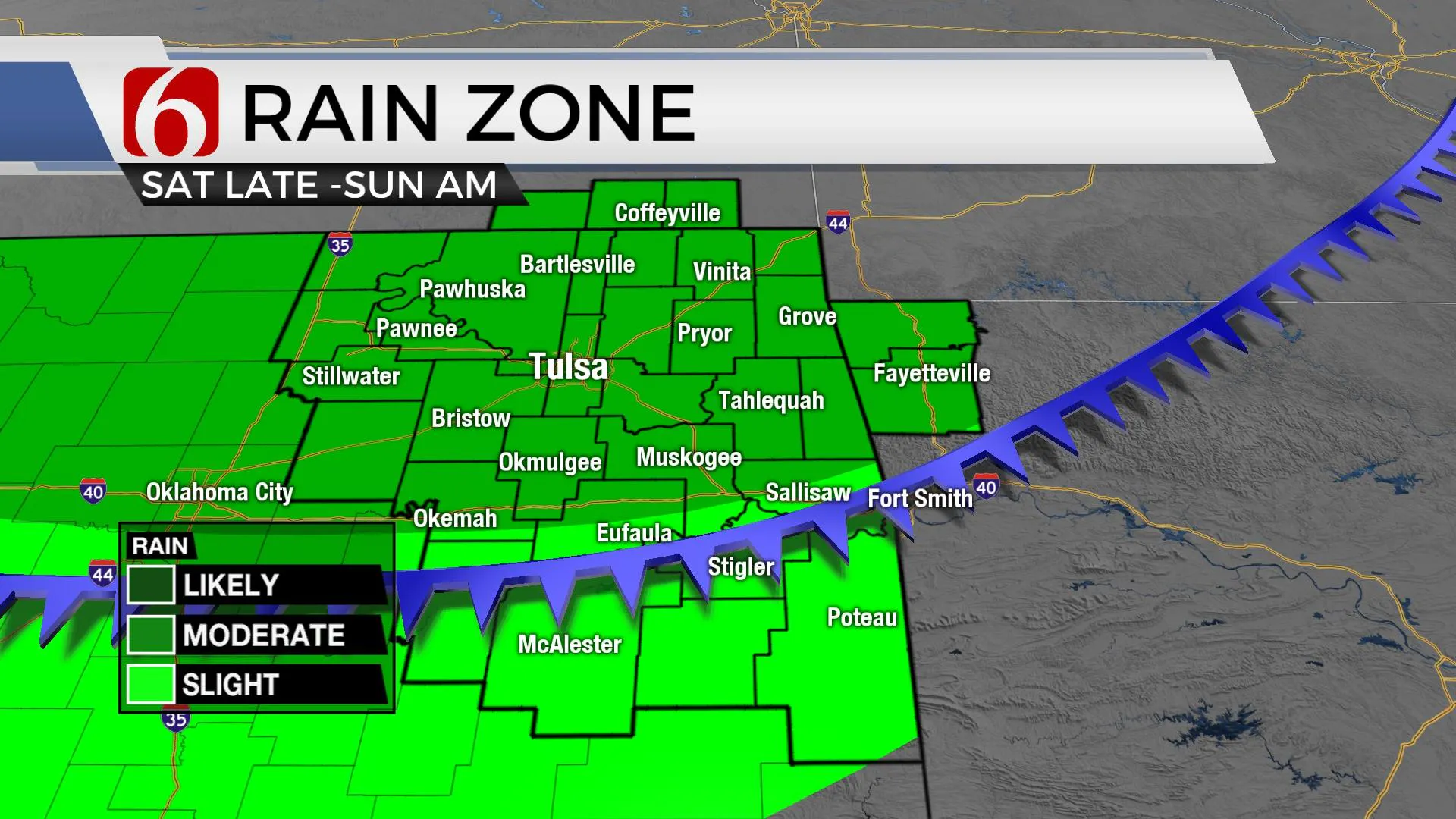
The ridge flattens and moves out of the state this weekend as a stronger mid-level trough ejects out of the Rockies Saturday and moves eastward into the Midwest Sunday. This helps to move the surface boundary slowly. Most data support the actual front nearing Saturday afternoon or early evening, but most storm activity may be post-frontal. We’ll have some higher precip chances late Saturday evening into early Sunday morning as some energy from the base of the trough moves across the state. A few strong storms may occur for a short period of time Saturday evening, but widespread severe weather threats are unlikely.

This front will end up south of the Red River Sunday morning to midday with northeast winds populating most of northeastern OK. This should bring the temps and humidity down for Sunday with highs in the mid-80s. We’ve made some adjustments to the temp forecast, but I’ll keep us in the upper 80s for now. The winds should quickly return from the south Monday in advance of our next system that arrives Wednesday. Unfortunately, it appears this boundary may enter the area dry. The data remains highly inconsistent regarding exact synoptic features, and this has a big influence of the temps for early next week. I’m leaning toward the warmer side of guidance. This will keep us into the mid and upper 90s for the middle of next week before dropping some by the end of the week.

Thanks for reading the Thursday morning weather discussion and blog.
Have a super great day!
Alan Crone
KOTV
If you’re into podcasts, check out my daily weather update below. Search for NewsOn6 and ‘Weather Out The Door’ on most podcast providers, including Apple, Stitcher, Tune-In and down below on Spotify.

More Like This
September 2nd, 2021
February 14th, 2022
January 26th, 2022
January 25th, 2022
Top Headlines
December 11th, 2024
December 11th, 2024
December 11th, 2024
December 11th, 2024


