A 6 Star Morning Underway
The next front or system will be approaching the southern plains by the middle of next week.Thursday, September 9th 2021, 4:16 am
TULSA, Oklahoma -
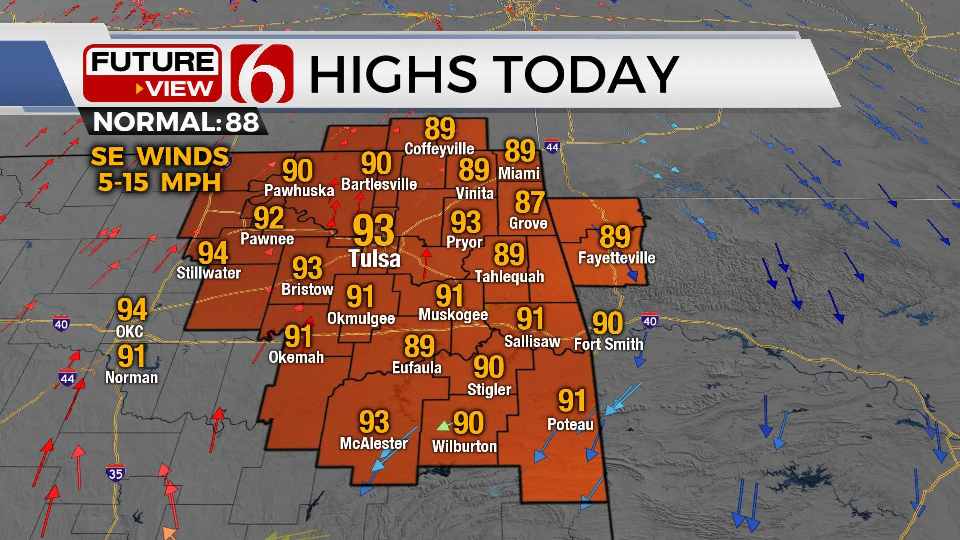
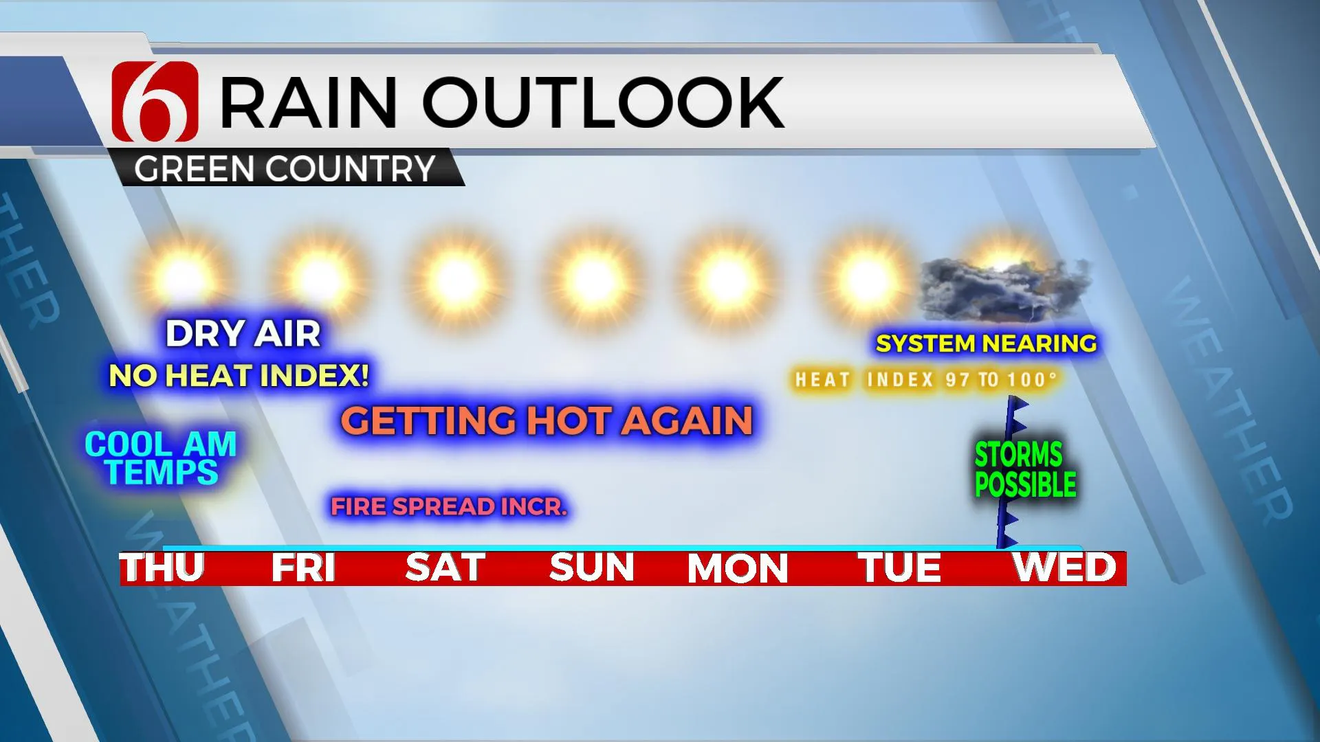
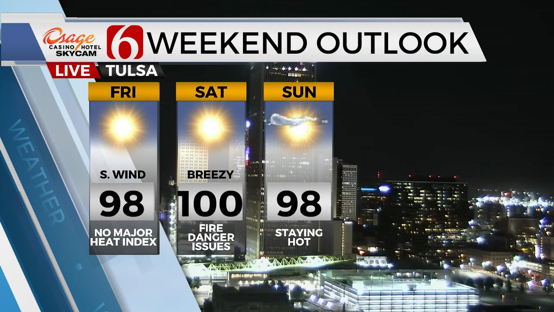
The next front or system will be approaching the southern plains by the middle of next week. But before this scenario has a chance, it's back to summer this weekend with afternoon highs reaching the upper 90s near 100. Gusty south to southwest winds Saturday combined with drying vegetation and humidity near or below 30% for the afternoon will support a rapid-fire spread rate across eastern and central Oklahoma Saturday. The prospects for any appreciable rainfall between now and the middle of next week will be extremely low if not zero. Highs today will stay in the lower 90s near Tulsa.

The good news for the short term remains the much drier lower level of the atmosphere due to Tuesday night's front. Northeast winds Wednesday ushered in dew points in the 40s and 50s and this dry lower level will support fantastic temperatures this morning. Some sheltered and valley locations will drop into the mid-50s, with most of the metro reaching the upper 50s and lower 60s for the morning low. Winds will return from the south later today and the mid-level ridge of high pressure anchored across the Rockies will expand slowly eastward. This will bring afternoon highs back into the upper 80s and lower 90s today with more sunshine. Friday morning starts in the mid-60s, but afternoon highs will reach the mid and upper 90s, yet the lack of moisture will keep any heat index values from being realized. This means our hot weather this weekend will be characterized as a mostly dry heat.

Early next week the mid-level ridge weakens and flattens while the progressive westerly flow aloft slowly drops southward, reaching the central plains states Tuesday and Wednesday as a surface front attempts to enter the state. Some data support a surface low developing across northwestern or western OK during this period which will enhance southeast winds and increase some low-level moisture during this period. To our south, a surface low may also develop across Southeast TX and move slowly northeast and bring some moisture into part of southeastern OK. The result should be increasing rain and thunder for part of the state. The overall data has suggested temperatures could drop into the 80s for daytime highs Wednesday with the initial probability of precip remaining conservative for now.

Thanks for reading the Thursday morning weather discussion and blog.
Have a super great day!
Alan Crone
KOTV
If you’re into podcasts, check out my daily weather update below. Search for NewsOn6 and ‘Weather Out The Door’ on most podcast providers, including Apple, Stitcher, Tune-In and down below on Spotify.

More Like This
September 9th, 2021
February 14th, 2022
January 26th, 2022
January 25th, 2022
Top Headlines
December 12th, 2024
December 12th, 2024
December 12th, 2024
December 12th, 2024


