A Taste Of Fall Next Week
A cool morning brings a warm afternoon with highs reaching the lower 90s across most of Eastern Oklahoma.Friday, September 17th 2021, 5:03 am
TULSA, Oklahoma -
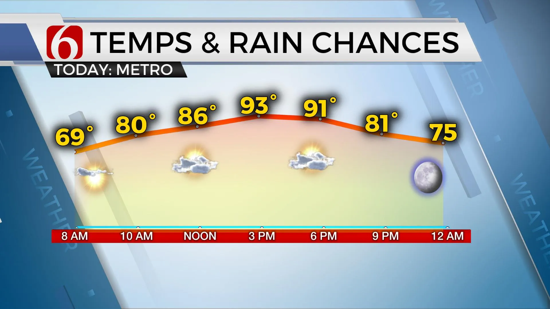
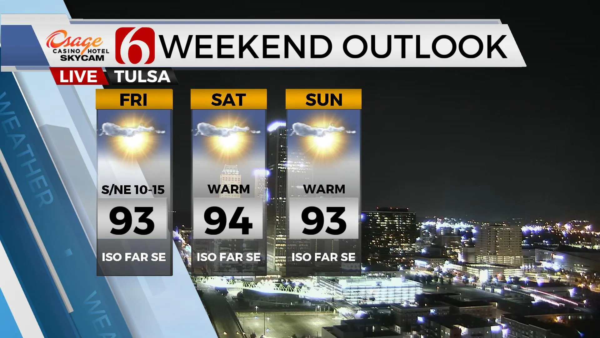
A cool morning brings a warm afternoon with highs reaching the lower 90s across most of Eastern Oklahoma. A few isolated showers will remain possible but not very likely for most of the area. A summer pattern remains this weekend before the pattern brings a taste of fall weather for a few days next week.

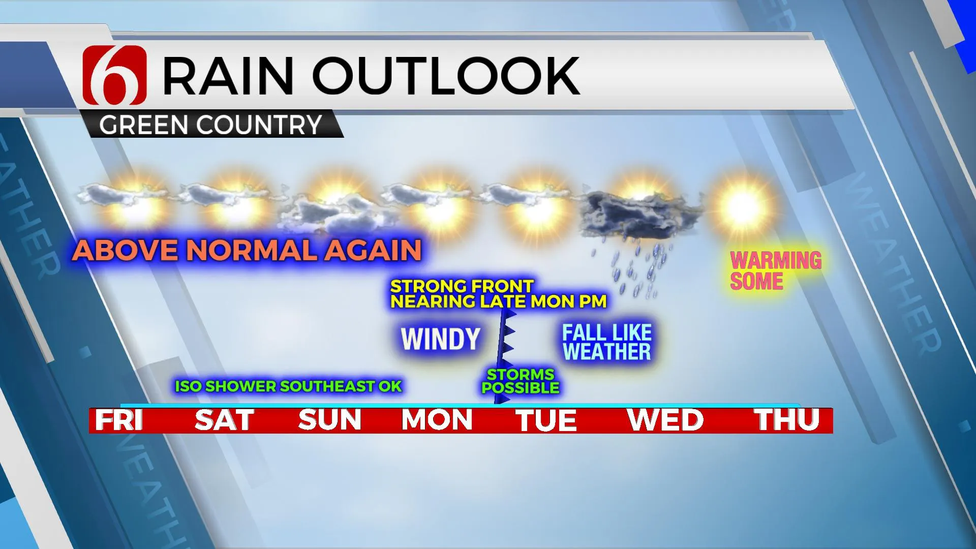
A broad trough located near the Red River this morning will drift southeast before joining the old Nicholas circulation and slowly lift northeast this weekend across the ArkLaTex into far Eastern OK and Western Arkansas. Most of the lift with this feature should be focused either to our southeast or east, but a few scattered storms will be possible today through the weekend, mostly across far southeastern Ok and western Arkansas. We’ll make some mentions for these low probabilities. The surface wind flow should bring northeast winds across part of Eastern OK later today through part of the weekend due to the proximity of this system. Meanwhile to our north, a weak front will enter southwestern or central Kansas tonight with a few storms. Most data support these storms to enter northwestern OK tonight before weakening Saturday morning. We’ll need to watch for an outflow boundary that could sneak into the area late tonight or early Saturday with a few sunrise surprise storms, but this chance seems too low to mention at this point. Temps this weekend should remain summerlike with highs in the upper 80s to lower 90s with heat index values nearing the 98 to 100 range.

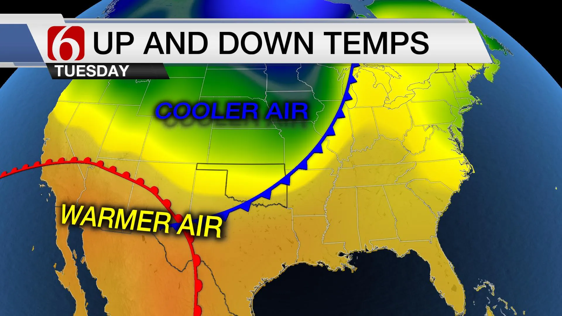
Early next week the pattern finally changes and should offer us the much-advertised cold front late Monday night or Tuesday morning across the state. The main upper-level system will eject from the Rockies Sunday and into the northern high plains Tuesday. As this occurs a strong cold front will roll out of the Rockies into northwestern OK late Monday night and exiting southeastern OK Tuesday morning. The latest data continue to be less aggressive with rain chances, but we’ll need to keep some mention for storms. We’re really drying out and need to pick up rainfall. We’re hoping to see better signals soon for storm chances.

Temps Monday should reach the mid or even upper 90s with strong south to southwest winds from 20 to 30 mph before the front moves across the area. Tuesday morning will start in the lower 60s with gusty northwest winds bringing drier and cooler air into the state. Afternoon highs will top out in the upper 70s or lower 80s with decreasing clouds by midday to evening. This brings a very nice taste of fall weather Wednesday morning with lows in the mid-50s and highs reaching the upper 70s to lower 80s. This taste of fall weather will last through Thursday.

Friday Night Football will be fine across Eastern OK for 95% of the area with game time temps in the 80s. A very low possibility remains for an isolated storm across far Eastern OK around Kick-off.
Thanks for reading the Friday morning weather discussion and blog.
Have a super great day!
Alan Crone
KOTV
If you’re into podcasts, check out my daily weather update below. Search for NewsOn6 and ‘Weather Out The Door’ on most podcast providers, including Apple, Stitcher, Tune-In and down below on Spotify.

More Like This
September 17th, 2021
February 14th, 2022
January 26th, 2022
January 25th, 2022
Top Headlines
December 14th, 2024
December 14th, 2024
December 14th, 2024
December 14th, 2024


