A Weekend Warming Trend
Another pleasant, cool morning is underway for the state as a few high clouds begin entering the western regions this morning.Friday, September 24th 2021, 5:04 am
TULSA, Oklahoma -
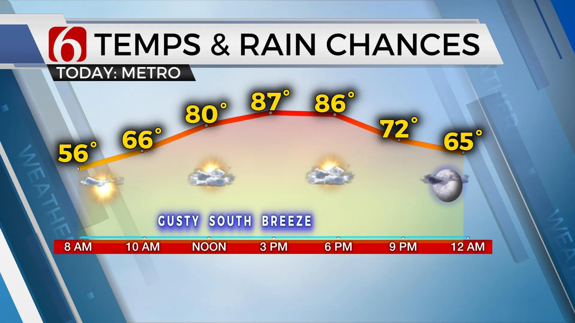
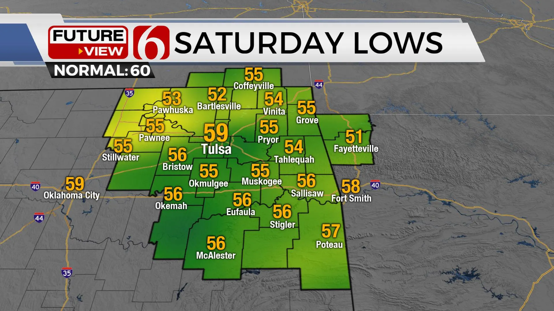
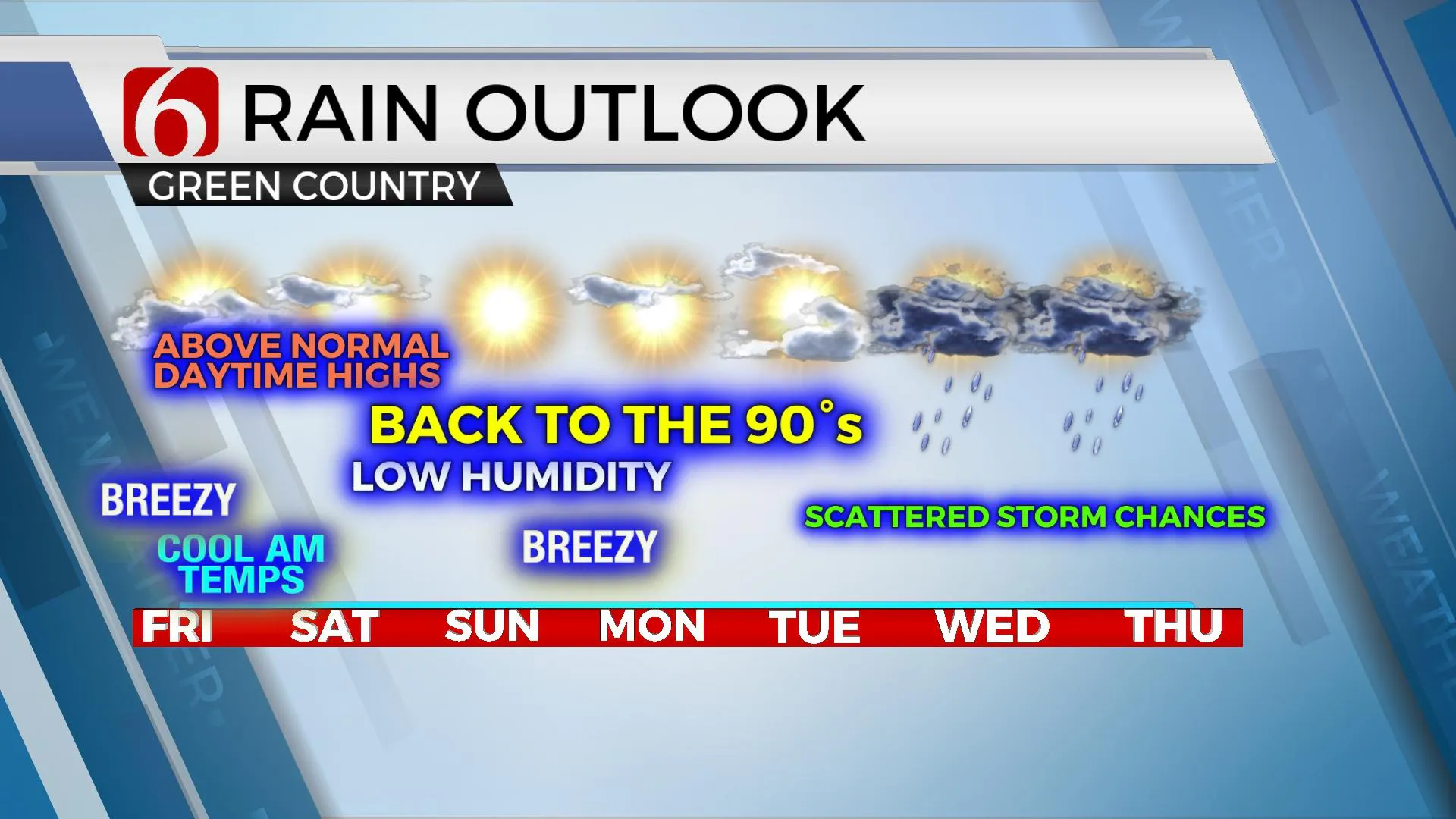
Another pleasant, cool morning is underway for the state as a few high clouds begin entering the western regions this morning. This will result in a high cloud-sun mix today with afternoon highs reaching the mid to upper 80s. Pleasant morning lows will remain this weekend, but afternoon highs are expected back into the upper 80s and 90s. The main issue this weekend will be increasing fire spread rates across the state. There will be a few items of interest, but our next rain opportunity doesn’t arrive until the middle of next week.

A stout-looking upper-level low drops into the Great Lakes later today and Saturday while bringing a weak cold front into southern Kansas later tonight. This front will briefly move into northern OK early late tonight into early Saturday morning with a few clouds and north winds for the very first part of Saturday. No other major sensible weather changes are likely to occur with this weak front. Another strong upper-level system is expected to develop and move into the pacific northwest this weekend and eject into the northern intermountain region early next week. As this occurs, a cut-off low near the desert southwest will get kicked northeast near the state by the middle of the week bring some scattered shower and storm chances to the state. There remains quite a bit of spread in the data regarding the positioning of some important weather features. For now, we’ll continue to keep only low mentions for showers and storms beginning Wednesday and continuing through the end of next week. Hopefully, we can increase these chances some during the next few days as data offers more confidence.

Temperatures will continue to climb, both morning lows and afternoon highs, with many locations reaching the upper 80s to near 90 today and eventually the mid-90s Sunday into Monday. The surface ridge of high pressure is east of the area, and southwest surface winds will increase today in the range of 15 to near 30 mph. The combination of dry conditions, gusty southwest winds and low afternoon humidity will support a rapid spread of fire conditions today and for most of the weekend, including Monday and Tuesday.

Thanks for reading the Friday morning weather discussion and blog.
Have a super great day!
Alan Crone
KOTV
If you’re into podcasts, check out my daily weather update below. Search for NewsOn6 and ‘Weather Out The Door’ on most podcast providers, including Apple, Stitcher, Tune-In and down below on Spotify.

More Like This
September 24th, 2021
February 14th, 2022
January 26th, 2022
January 25th, 2022
Top Headlines
December 12th, 2024
December 12th, 2024
December 12th, 2024


