A Pattern Change Is Underway
Scattered rain and a few storms possible on this cloudy and warm Wednesday.Wednesday, September 29th 2021, 5:38 am
TULSA, Oklahoma -
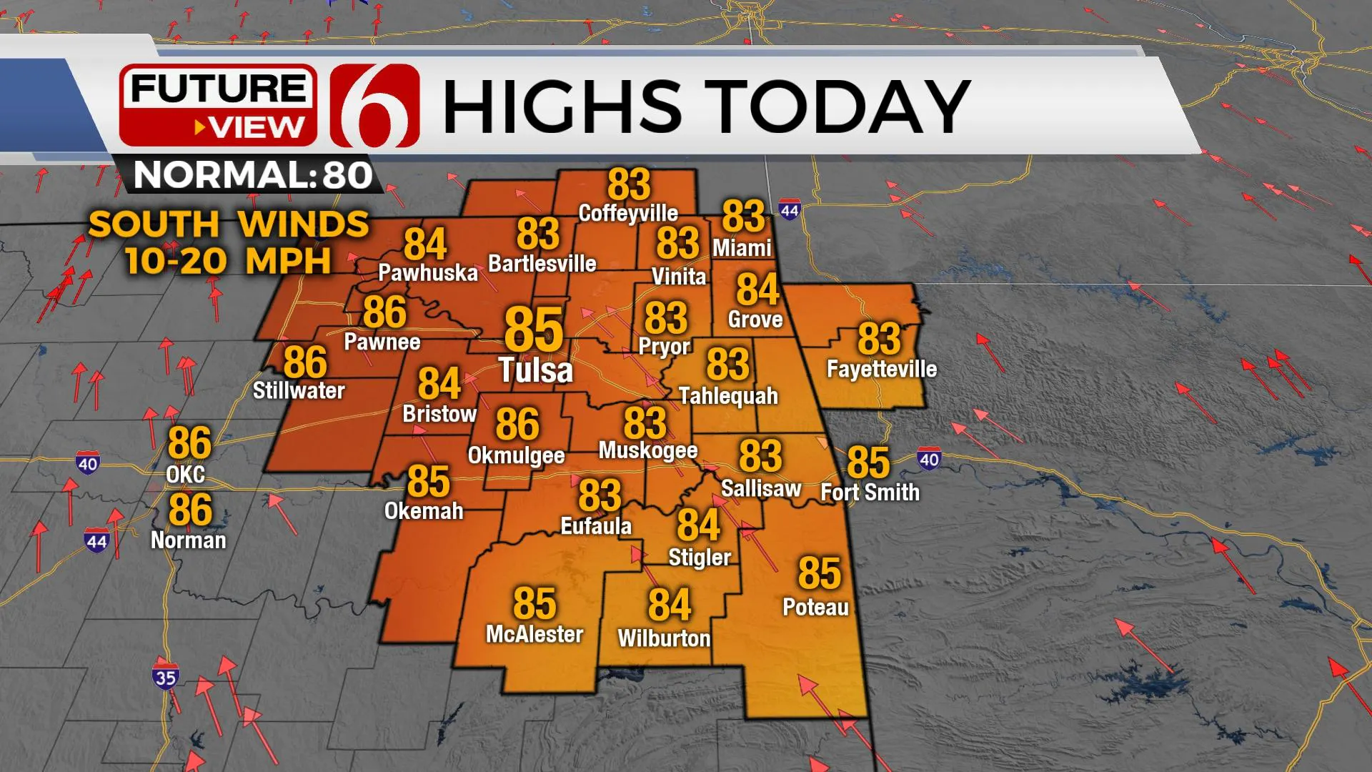
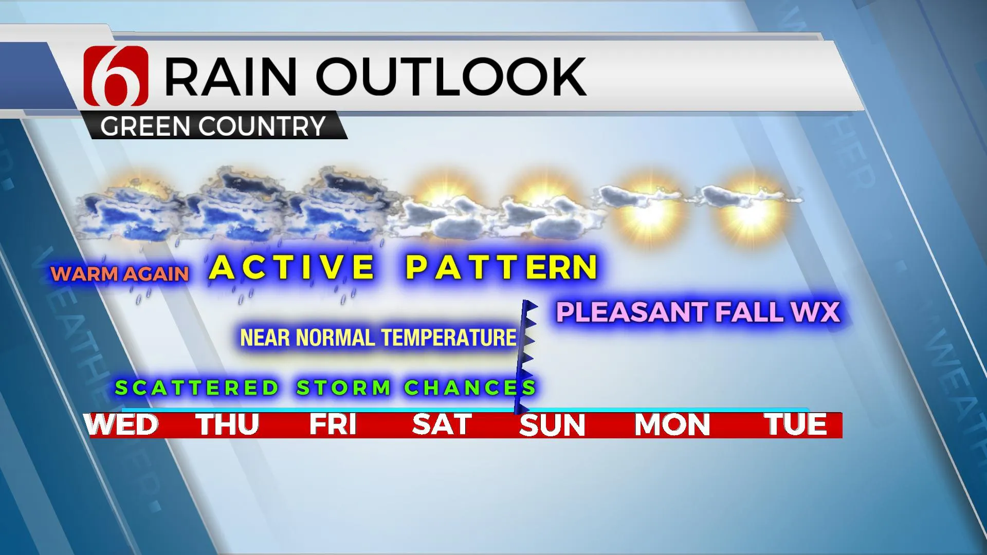
We’re tracking two systems, the first one bringing a few scattered storms across the area today, and the 2nd bringing some higher probabilities across part of northeastern OK Thursday and Friday. This 2nd system may linger across part of the area Saturday before exiting to the east as a surface cold front arrives late Saturday night into Sunday morning. This front will bring some pleasant fall weather Sunday into early next week with temperatures near normal for a few days. Highs today will reach the lower to mid-80s with mostly cloudy sky.

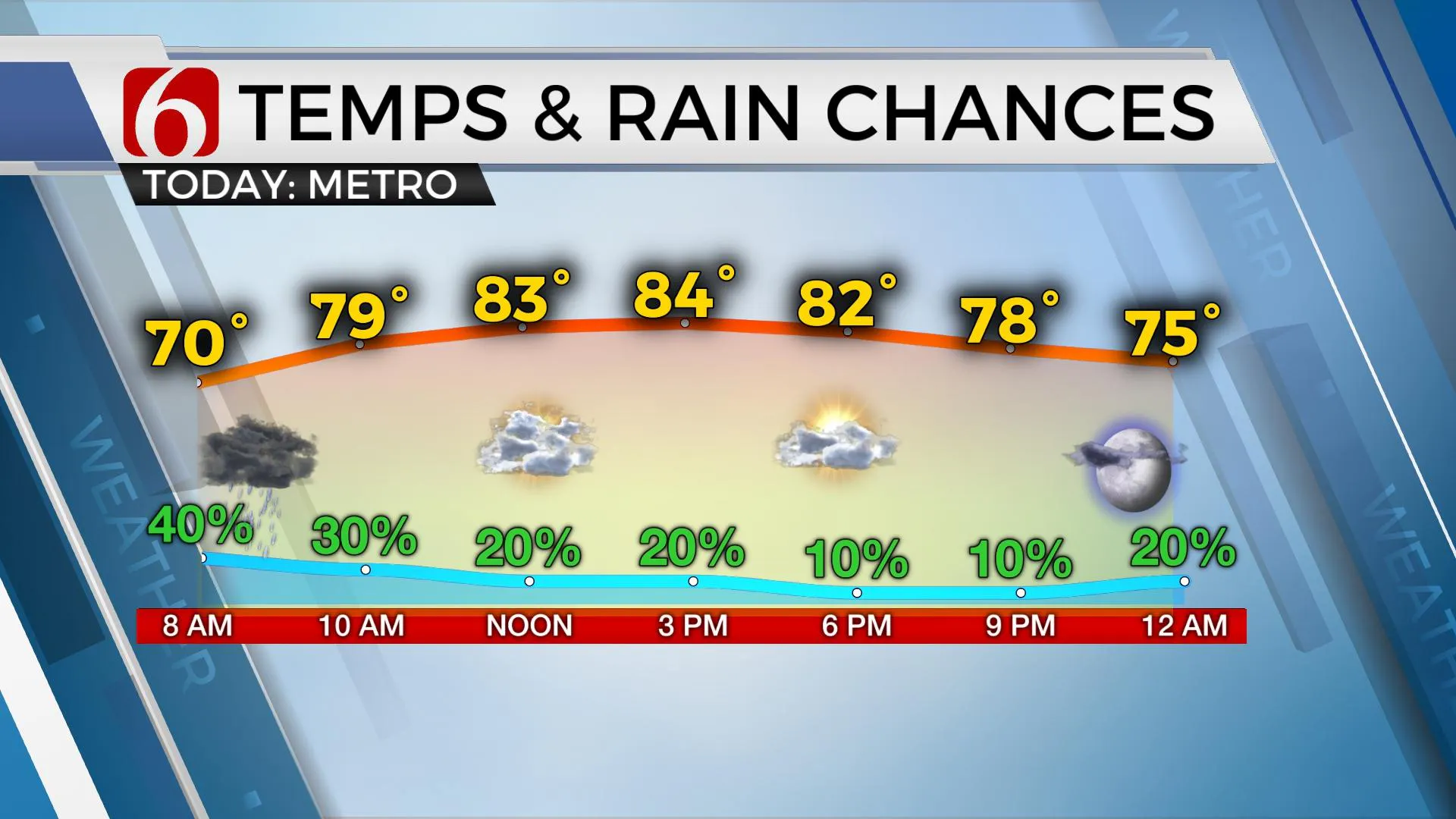
A few scattered storms will continue moving east this morning and should weaken during the next few hours. Additional scattered storms will attempt to develop later today, mostly across extreme southeastern OK and east-central OK. We’ll keep a 40% chance, including the metro for the morning hours before thinning these pops down into the afternoon. Afternoon highs will reach the mid-80s today along with a mostly cloudy sky. Southeast winds are likely remaining in the 10 to 20 mph range. We should be mostly dry tonight across the eastern third of the state while additional storms redevelop to our west and southwest.

As the current mid-level low to our west ejects northeast, it will be replaced with a new, developing trough positioned across the intermountain region of the county. Additional energy at the base of this trough will provide the lift for additional showers and storms Thursday through Friday, and possibly Saturday. A weak surface boundary is also expected to slide into part of northern OK Thursday with the possibility of a broken line of thunderstorm activity nearing eastern OK Thursday midday to afternoon. This front will stall and should become diffuse by Thursday evening into Friday as the broad trough to the west brings additional moisture up and over the state resulting in additional scattered storms Friday. This system also brings additional clouds that will lower daytime highs into the upper 70s or lower 80s Friday with south breezes around 10 to 20 mph. The upper-level trough finally begins lifting east to northeast Saturday but could still produce some scattered showers and storms for part of the day, mostly midday to early afternoon across the eastern third of the state. By Saturday evening, the front gets another shove southward and moves across the state bringing north winds and clearing sky Sunday into early next week with seasonal temps.

Thanks for reading the Wednesday morning weather discussion and blog.
Have a super great day!
Alan Crone
KOTV
If you’re into podcasts, check out my daily weather update below. Search for NewsOn6 and ‘Weather Out The Door’ on most podcast providers, including Apple, Stitcher, Tune-In and down below on Spotify.

More Like This
September 29th, 2021
February 14th, 2022
January 26th, 2022
January 25th, 2022
Top Headlines
December 15th, 2024
December 15th, 2024
December 15th, 2024
December 15th, 2024


