A Pattern Change Arriving Soon
Mostly cloudy skies and light northeast winds. A few isolated showers possible, mostly east of Tulsa.Wednesday, October 6th 2021, 4:19 am
TULSA, Oklahoma -
The cut-off low to our east will slowly advance northwest today and tonight before ejecting northeast Thursday & Friday into the Great Lakes region. Once this occurs, summer attempts a two-day comeback with temps reaching the 90s Friday and Saturday before yet another pattern change into next week. A progressive upper air pattern will bring several storms across the Rockies and into the plains next week instigating thunderstorm chances, including the threat of strong to severe storms. We typically reach a secondary max of severe weather during a portion of fall, and it appears we're moving in that direction next week.

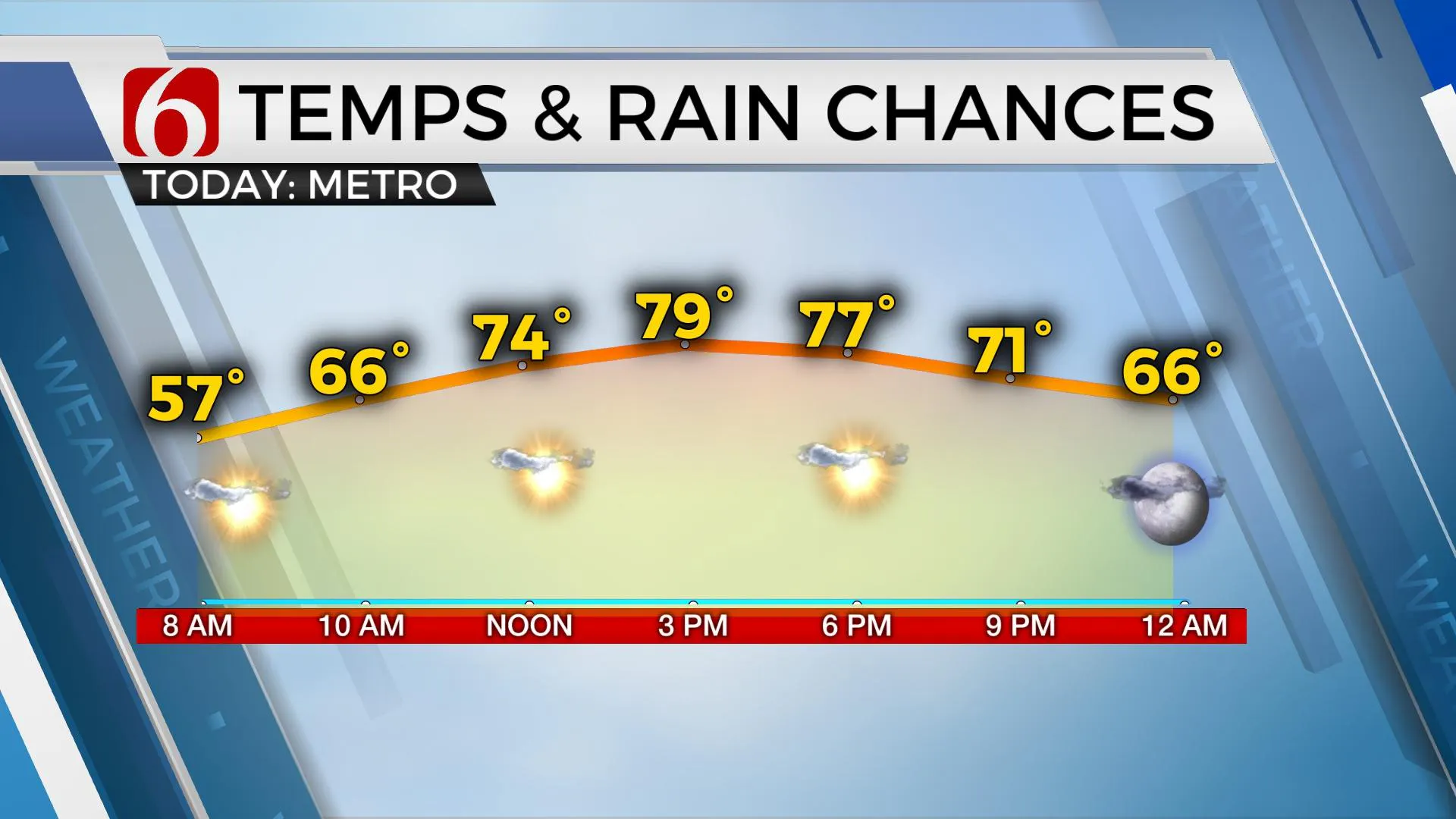
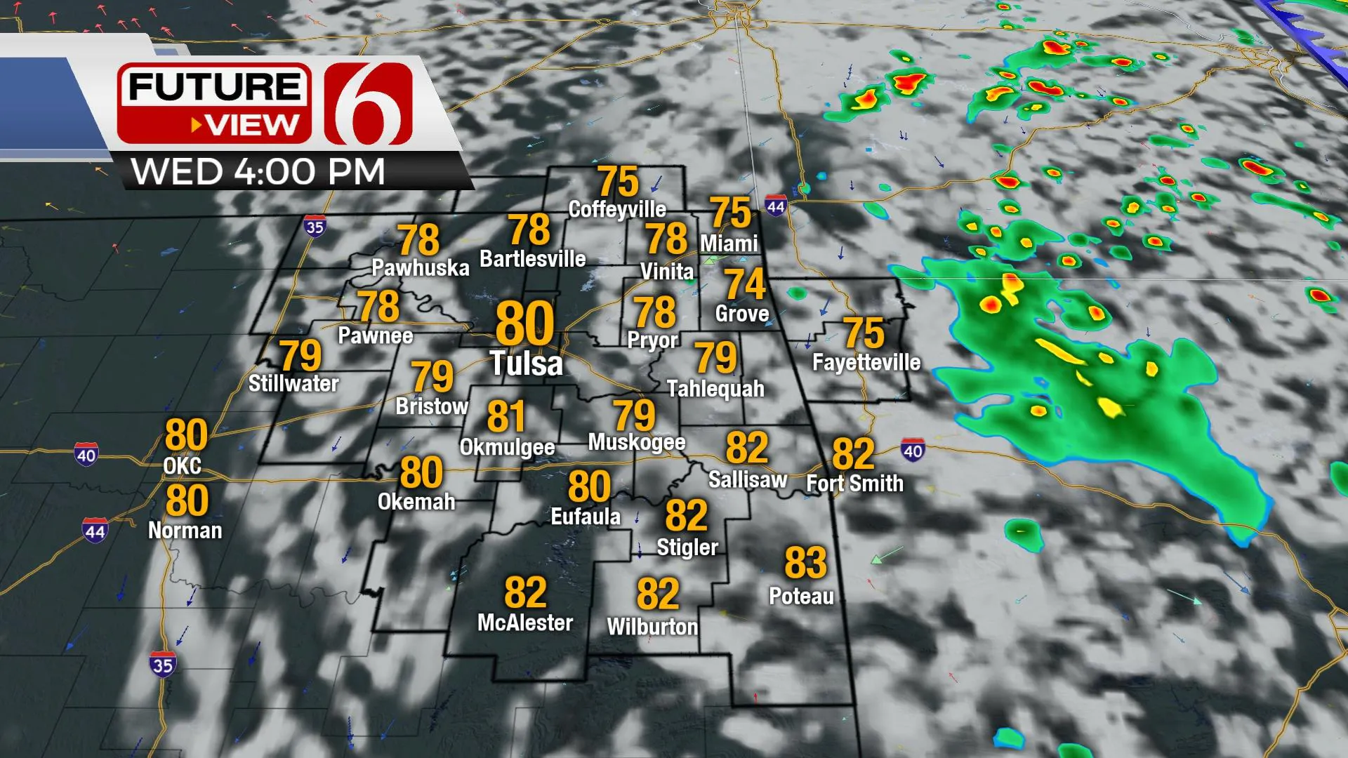
Today a few more clouds will be likely across the eastern third of the state and this will keep daytime highs in the mid to upper 70s for most of the area. The Tulsa metro will be right on the edge between 79 and 80. This may not seem significant, but we've been in the 80s or higher for afternoon highs the past 125 days. This is the 2nd longest stretch on record. If we get past today with an official 80, we're adding several more days and may possibly set a new record.

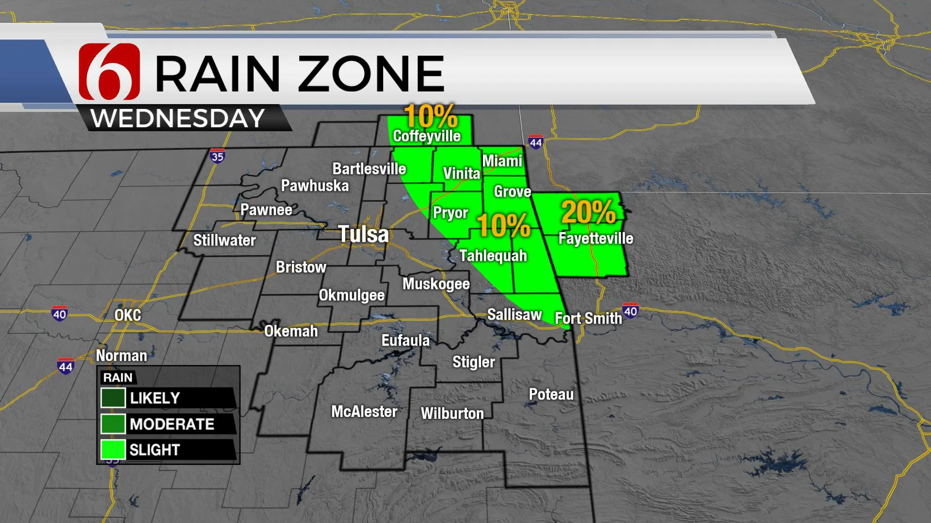
This system to our east will crank up a few storms today across central and northern Arkansas. A few of these showers or storms may migrate northwest into far northwestern Arkansas and part of northeastern OK. The chance for any activity near the metro seems very low, but we've continued to keep a chance for locations near and east of Highway 69 along the OK-AR state line region.

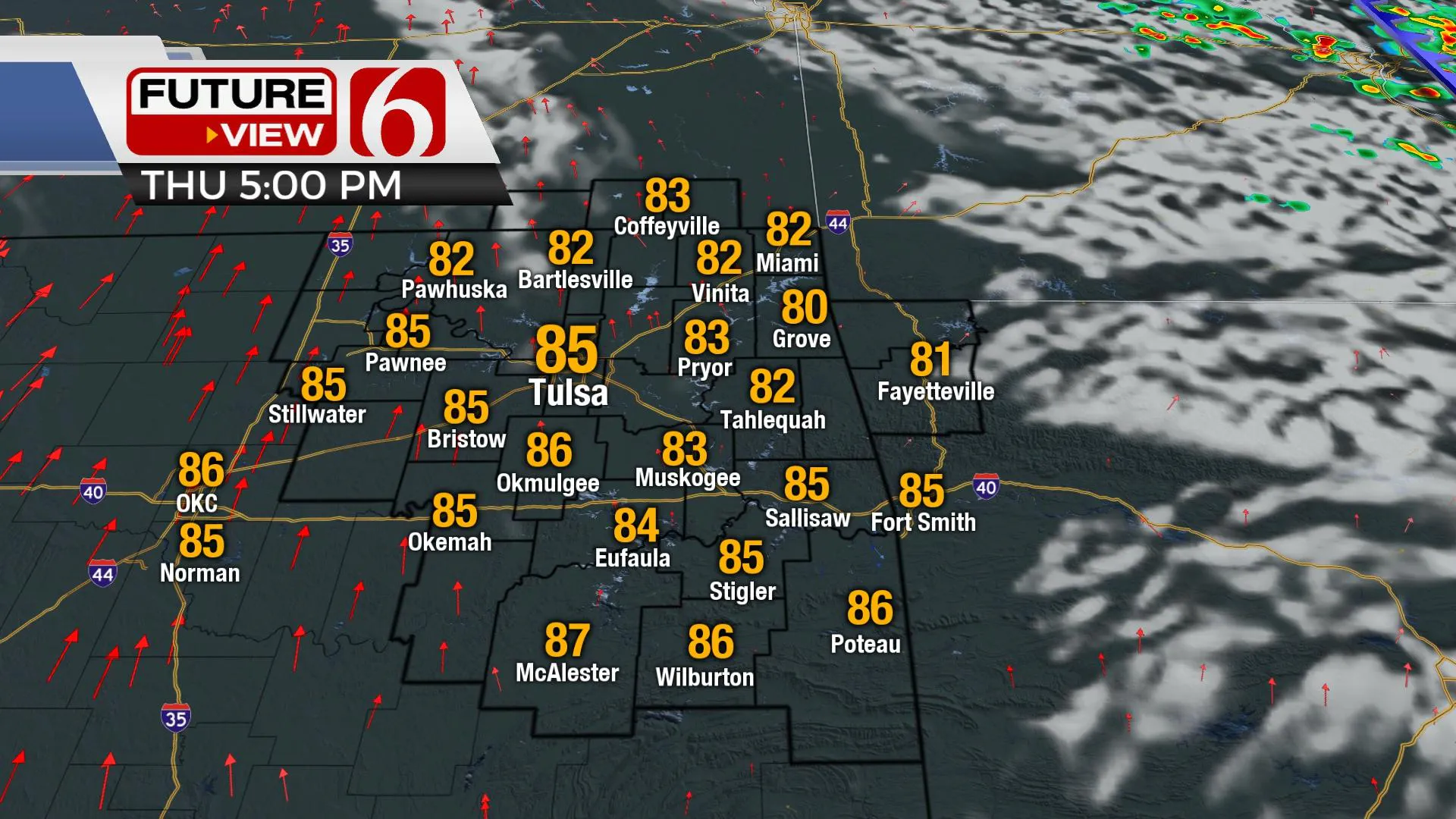
Thursday, south winds return, but morning lows will stay in the mid-50s before temps rise into the lower and mid-80s with sunshine and a few clouds. Late Thursday night into Friday morning a few showers or storms will develop across extreme southeastern Kansas and lift northwest as the first of several major upper-level troughs will develop and move across the western U.S. Friday into the weekend. A strong surface low develops in the Rockies and ejects northeast Saturday into Sunday while dragging a surface cold front into the state Sunday afternoon and evening with increasing thunderstorm chances, including the mention for strong to severe storms. Before this occurs, southwest winds Friday and Saturday will be increasing speeds from 15 to 30 mph with daytime highs reaching 90 Friday and the lower 90s Saturday afternoon. Sunday morning starts in the lower 70s along with highs in the mid to upper 80s.
The data continue offering some different scenarios regarding the trough nearing northern OK Sunday evening, but has reverted to a stronger, more closed suggestion compared to yesterday. While some questions still remain, the chance for storms will be increasing some late Sunday evening into pre-dawn Monday with this system, including the mentions for strong to severe storms. We’ll stay on the low-side for pops at this point, as the potential remains for capping issues and possibly moisture being shunted more eastward before the front arrives.

As the cold front passes Sunday night, the upper level forcing quickly lifts northeast. This more than likely leaves the front stationary for a small period Monday before rapidly lifting northward or becoming quickly diffuse as the next strong trough develops. The data regarding the upper-level system for the middle of next week continues to be supportive of a major storm system bringing snow to the Rockies and severe threats to the plains. We'll have more specifics about this system as we draw closer to the time-space domain.
Thanks for reading the Wednesday morning weather discussion and blog.
Have a super great day!
Alan Crone
KOTV
If you’re into podcasts, check out my daily weather update below. Search for NewsOn6 and ‘Weather Out The Door’ on most podcast providers, including Apple, Stitcher, Tune-In and down below on Spotify.

More Like This
October 6th, 2021
February 14th, 2022
January 26th, 2022
January 25th, 2022
Top Headlines
December 13th, 2024
December 13th, 2024
December 13th, 2024
December 13th, 2024


