Storm Chances Quickly Return
Strong storms very early in the day. Then some afternoon clearing with a gusty westerly wind.Monday, October 11th 2021, 5:26 am
TULSA, Oklahoma -
The severe weather threats will quickly subside early this morning as the main upper trough lifts northeast of the state and the surface cold front moves east and southeast through the morning hours. But the next strong upper-level system will eject into the intermountain region and the central plains Tuesday night into early Wednesday morning while bringing another round of thunderstorms, including some threats of additional severe storms, to the area. By Wednesday evening into early Thursday morning, the strong upper low will be positioned across the Dakotas but the upper airflow from the southwest to northeast will be parallel to a surface boundary stalling across southeastern OK. Additional storm chances both Thursday and part of Friday morning will remain until another longwave trough moves across the central plains bringing a strong cold front into northeastern OK Friday morning. As this occurs, our pattern should result in some beautiful fall weather for the weekend and the early part of next week. Weekend lows will drop into the 40s with afternoon highs in the upper 60s to lower 70s.

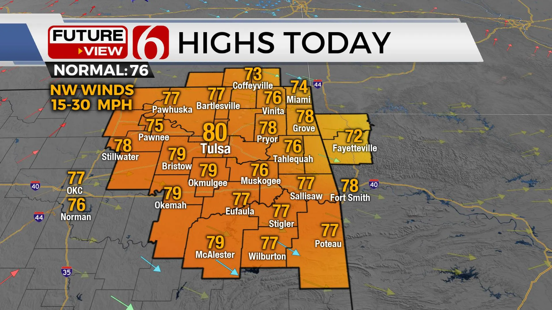
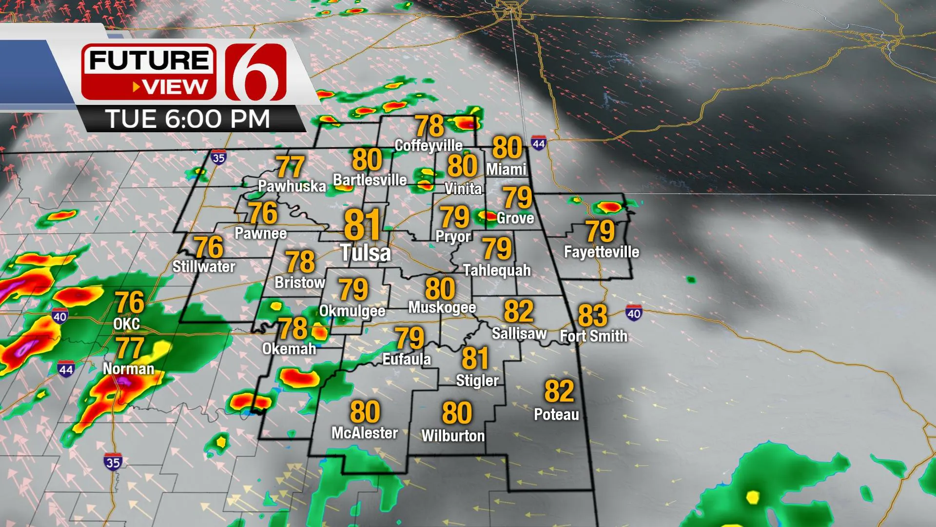
Temps this morning will start in the upper 50s and lower 60s along with gusty west to northwest winds from 15 to 30 mph before gradually diminishing through midday. Afternoon highs should reach the mid to upper 70s. South winds return late tonight into Tuesday morning with low-level moisture streaming northward into the state. A few storms may develop during the early to midday hours of Tuesday with afternoon highs reaching the low 80s. As the morning to midday progresses, additional storms will become more likely, but the higher concentration will eventually be across northwestern OK and southwestern Kansas closer to the stronger upper level forcing with the strong upper-level system. Storms will become strong to severe Tuesday evening near and west of I-35 and eventually move eastward early Wednesday morning. While the higher threats for severe storms will initially occur west of our immediate area Tuesday evening, some severe threats will migrate eastward late Tuesday evening into overnight and pre-dawn Wednesday. By Wednesday afternoon, a dry line-pacific boundary will move east with additional storms but the threats for severe storms may be limited some due to stronger dynamics remaining north. As this boundary stalls across southeastern OK Thursday, additional storms will become possible, including the threats of locally heavy rainfall and a few severe storms with highs in the 70s with south winds before the above-mentioned front sweeps into the area Friday.

Thanks for reading the Monday morning weather discussion and blog.
Have a super great day!
Alan Crone
KOTV
If you’re into podcasts, check out my daily weather update below. Search for NewsOn6 and ‘Weather Out The Door’ on most podcast providers, including Apple, Stitcher, Tune-In and down below on Spotify.

More Like This
October 11th, 2021
February 14th, 2022
January 26th, 2022
January 25th, 2022
Top Headlines
December 12th, 2024
December 12th, 2024
December 12th, 2024
December 12th, 2024


