More Storms Before Fall Returns
Scattered rain and storms, mainly in the first part of the day. Mostly cloudy, mild, and humid.Thursday, October 14th 2021, 7:13 am
TULSA, Oklahoma -
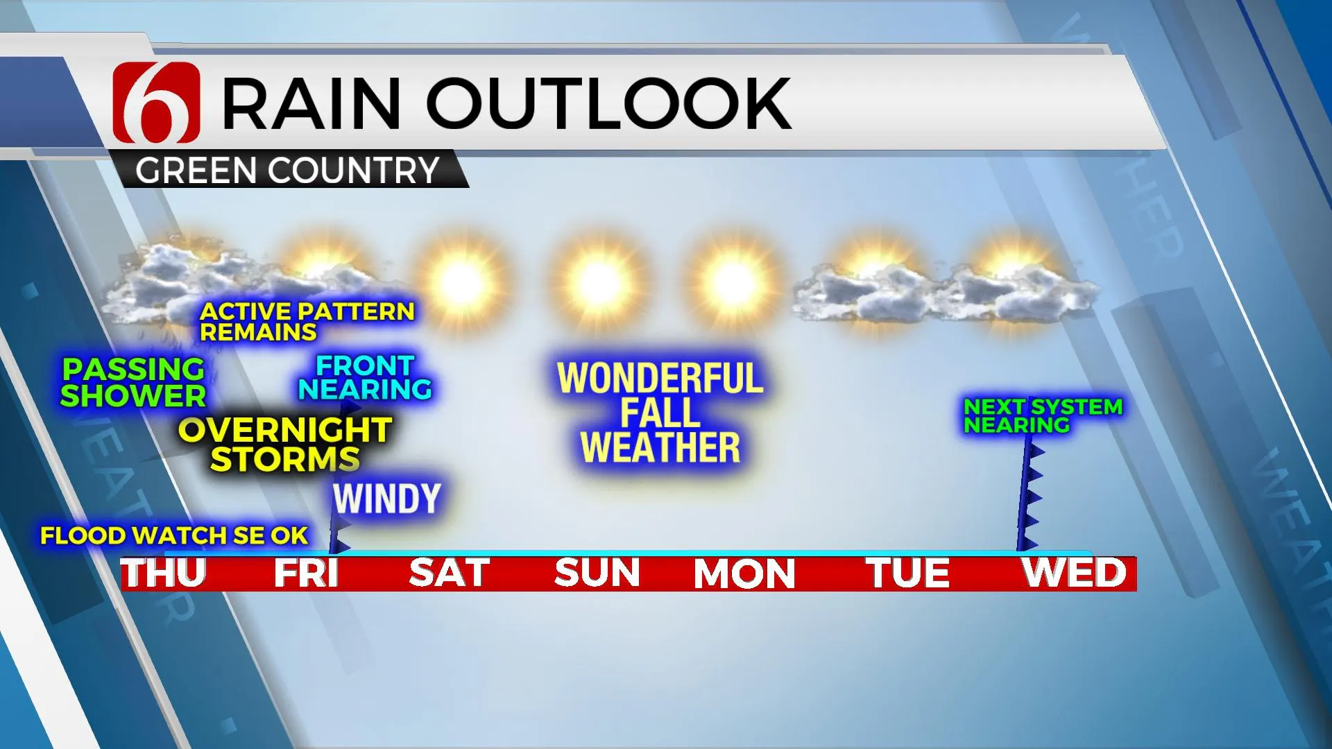
Our weather pattern remains active with a few showers still possible this morning and more storm chances overnight as a strong front arrives from the north. As the front clears the area early Friday morning, gusty northwest winds will bring another surge of fall weather. Friday morning starts in the 50s with decreasing showers and clouds followed by highs in the mid-60s. Clearing sky, light wind and dry air will bring a chilly Friday evening and Saturday morning with morning lows in the 40s. Abundant sunshine is likely this weekend with daytime highs Saturday in the upper 60s and lower 70s with Sunday's high temperatures into the mid-70s. Another system will brush the area for the middle of next week, but moisture will be lacking. We’ll currently only carry low probabilities for Tuesday and Wednesday with lows in the lower 50s and highs in the 70s.

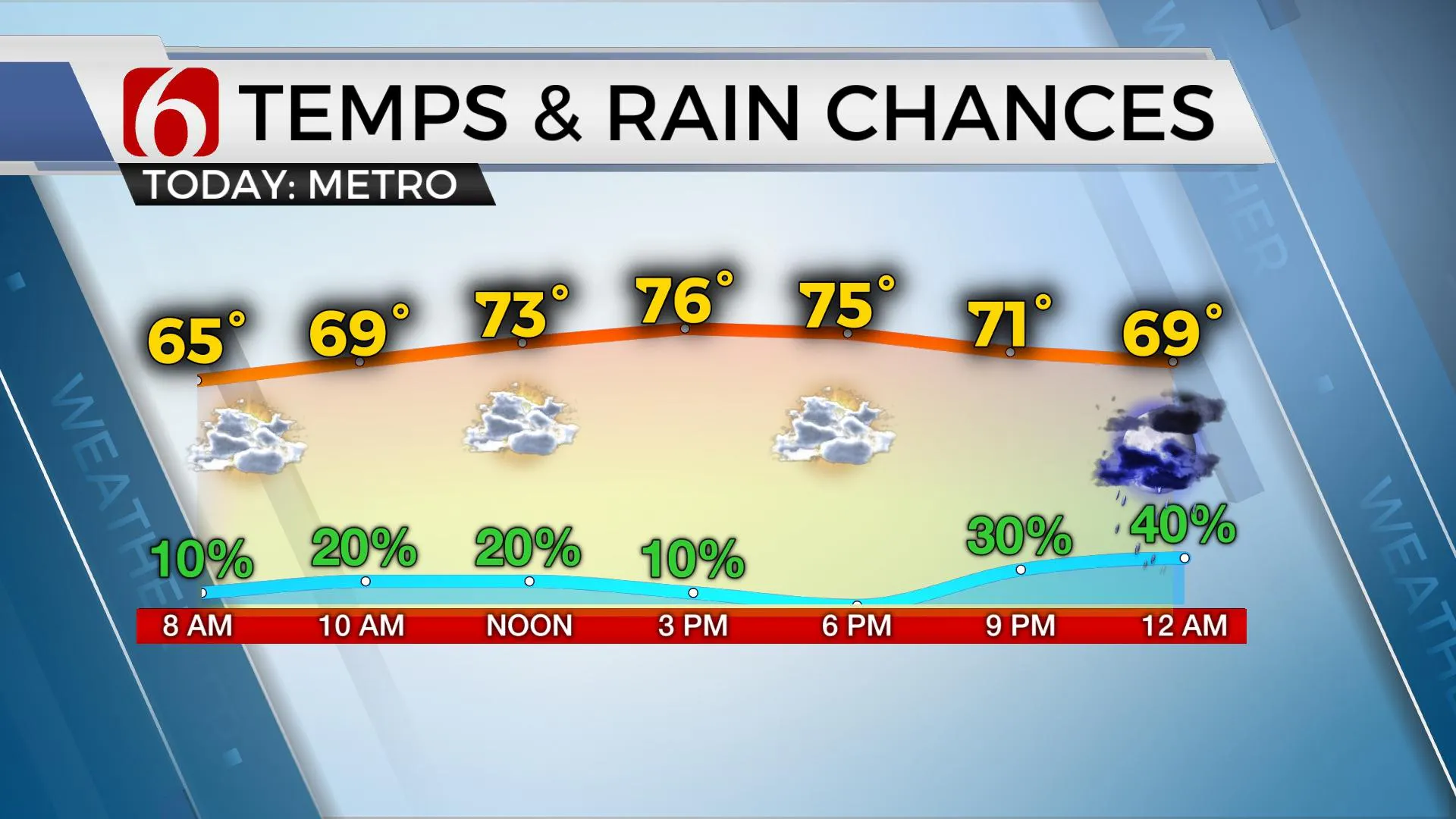
Moisture streaming from the remnant of Pacific Tropical Cyclone Pamela continues moving across part of Texas and far eastern OK this morning. A flash flood watch remains for extreme southeastern OK through the morning to midday. While the bulk of this moisture will be shunted eastward, some spotty showers may redevelop through the morning hours near and east of the metro. We’ll keep some low probabilities for this scenario, including the Tulsa metro. Highs today should reach at least the mid-70s with south winds near 10 to 15 mph.

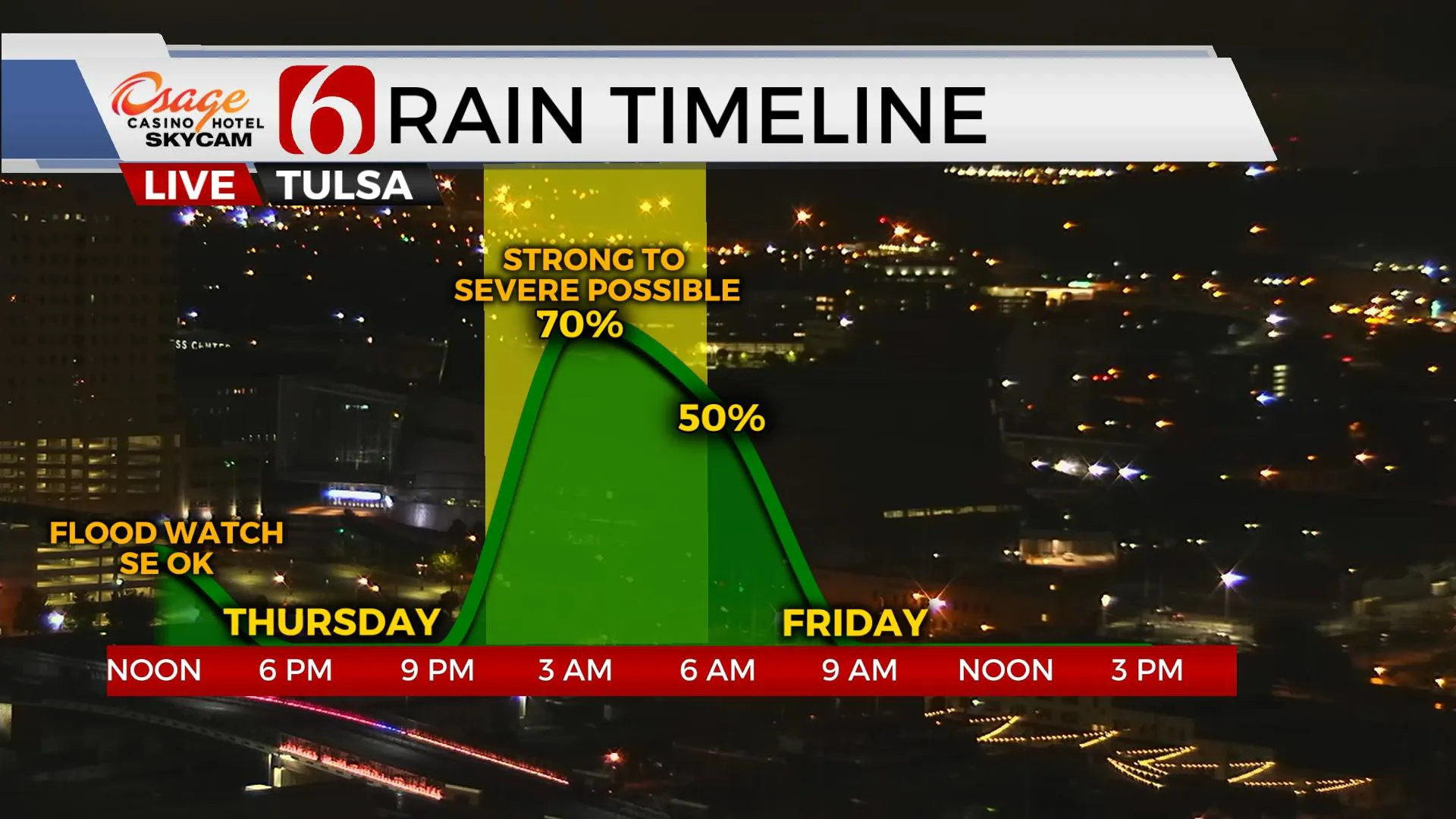
Another upper-level trough will skirt the southern and central plains states later tonight before ejecting northeast Friday morning. A surface front will begin to sharpen to our northwest and move southeast later tonight as the upper trough draws near. Low-level moisture will be surging northwest into the zone and storms will attempt to develop. The parameters for some severe thunderstorm activity will be increasing during this window from approximately 11 p.m to pre-dawn Friday before the surface front crosses the region as the upper trough moves into the Missouri Valley. Our higher chances for storms will be centered during this window, and we’ll include the mentions for some strong to severe storms. There remains some question if storms will stay elevated or could become surface-based. More than likely, elevated storms are in the mix. This means our main threats would be wind and some hail. The threats for severe storms should end around 5 a.m. to 7 a.m. Friday with the front moving quickly across the region. Gusty northwest winds will bring another taste of fall weather through the day that sticks around for a few days.

Thanks for reading the Thursday morning weather discussion and blog.
Have a super great day!
Alan Crone
KOTV
If you’re into podcasts, check out my daily weather update below. Search for NewsOn6 and ‘Weather Out The Door’ on most podcast providers, including Apple, Stitcher, Tune-In and down below on Spotify.

More Like This
October 14th, 2021
February 14th, 2022
January 26th, 2022
January 25th, 2022
Top Headlines
December 11th, 2024
December 11th, 2024
December 11th, 2024
December 11th, 2024


