Warmer Weather Arriving Soon
Mostly clear sky and light wind combined with relatively dry air has allowed temperatures to drop into the 30s across most of Eastern OK overnight and early this morning.Friday, November 5th 2021, 8:06 am
TULSA, Oklahoma -
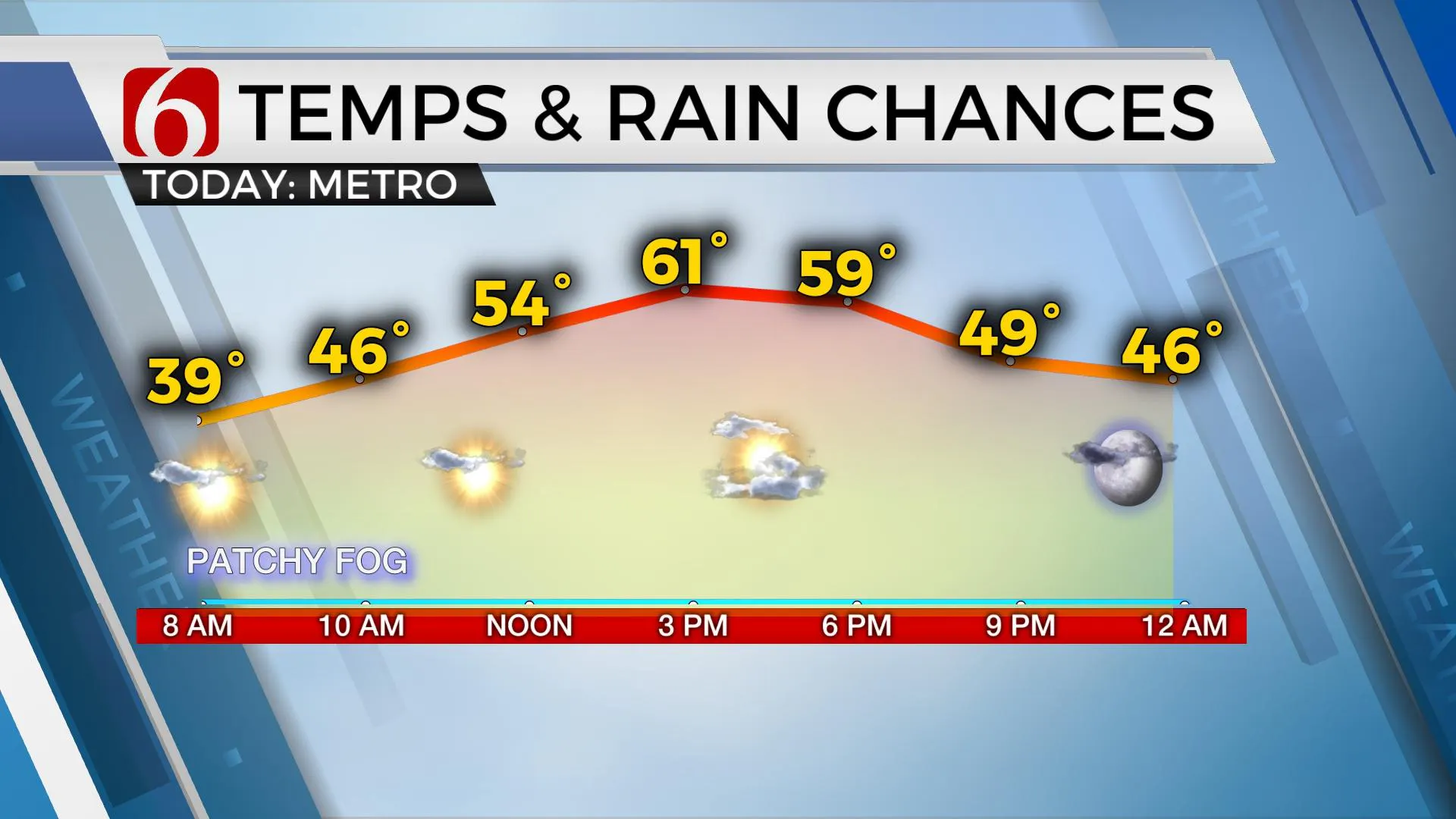
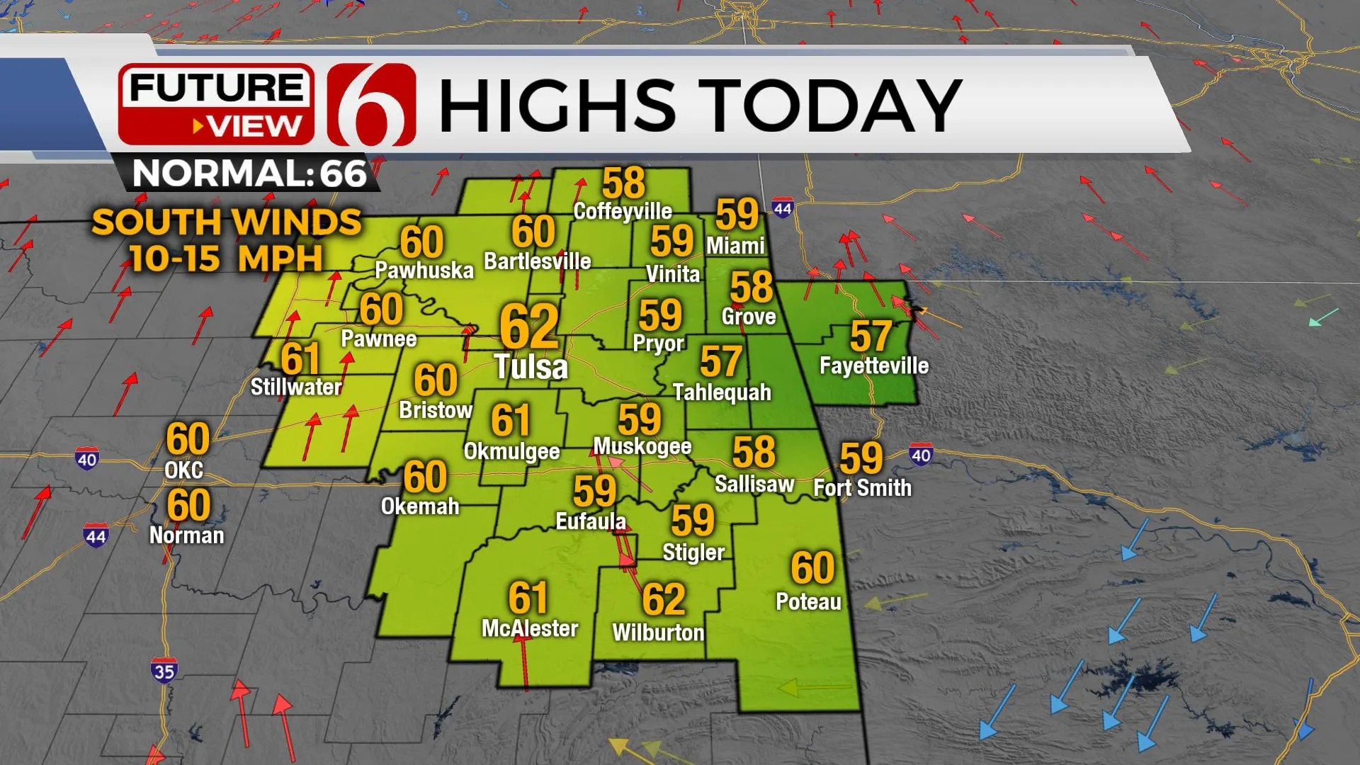
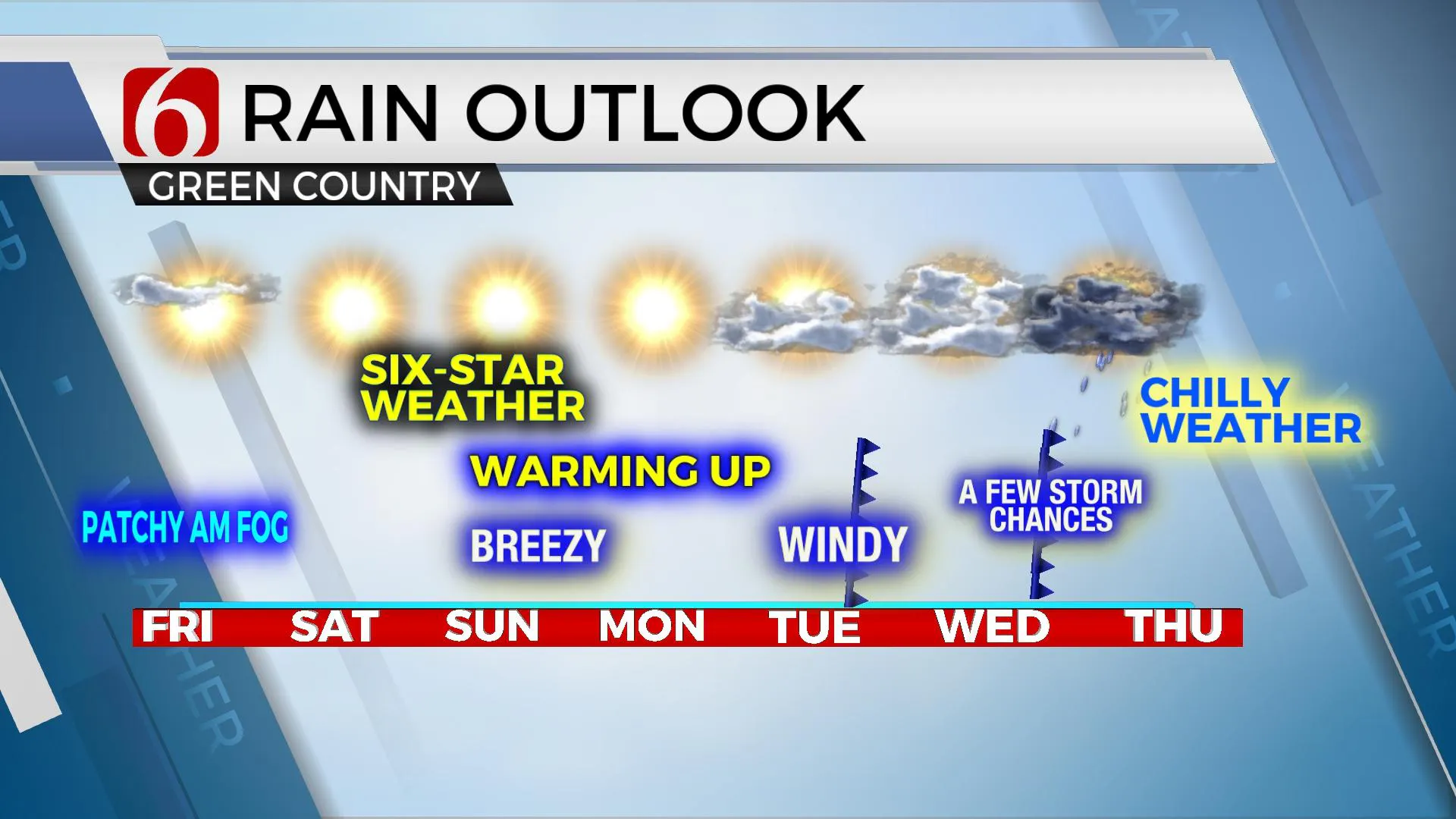
Mostly clear sky and light wind combined with relatively dry air has allowed temperatures to drop into the 30s across most of Eastern OK overnight and early this morning. Locations across far southeastern OK and extreme east-central sections may be near freezing this morning for a few hours and another freeze warning is posted for these locations. Some patchy fog is also likely again this morning in a few spots before southeast winds increasing speeds to 10 and 15 mph combined with rising temps will allow the fog to dissipate. A sunshine-cloud mix is expected with a warming trend as daytime highs reach the upper 50s and lower 60s today. This trend of increasing daytime highs will continue through early next week before our next storm system arrives Wednesday bringing another chance of showers and storms into the region. Following the front next Wednesday, much colder air is likely to arrive Friday and next weekend.

We're finally seeing the stubborn cloud deck erode today as a mid-level ridge of high pressure makes a brief appearance across part of the southern plains before moving southward early next week as the upper airflow transitions to the southwest. There will be some clouds sneaking across the sky at times, but we’re still in better shape today compared to the last few days.

Our next system brings a broad upper trough will nearby the middle of the week helping to shove the next two cold fronts into the state. The first arrives Tuesday with little impact other than a wind shift and a brief shower across extreme eastern sections. This front should stall and then retreat northward early Wednesday before a stronger front arrives Wednesday night with showers and storm chances for some locations. There will remain some differences in the data regarding the exact return of low-level moisture and positioning of the stronger flow aloft, but thunderstorm chances will be increasing with the Wednesday evening or Thursday frontal passage. The data also support a much stronger surge of colder air late next week that could bring back colder weather for next weekend.

Thanks for reading the Friday morning weather discussion and blog.
Have a super great day!
Alan Crone
KOTV
If you’re into podcasts, check out my daily weather update below. Search for NewsOn6 and ‘Weather Out The Door’ on most podcast providers, including Apple, Stitcher, Tune-In and down below on Spotify.

More Like This
November 5th, 2021
February 14th, 2022
January 26th, 2022
January 25th, 2022
Top Headlines
December 14th, 2024
December 14th, 2024
December 14th, 2024
December 14th, 2024


