Another Breezy, Warm Afternoon
A weak wave will move across the central plains today producing a few high clouds.Monday, November 8th 2021, 6:57 am
TULSA, Oklahoma -
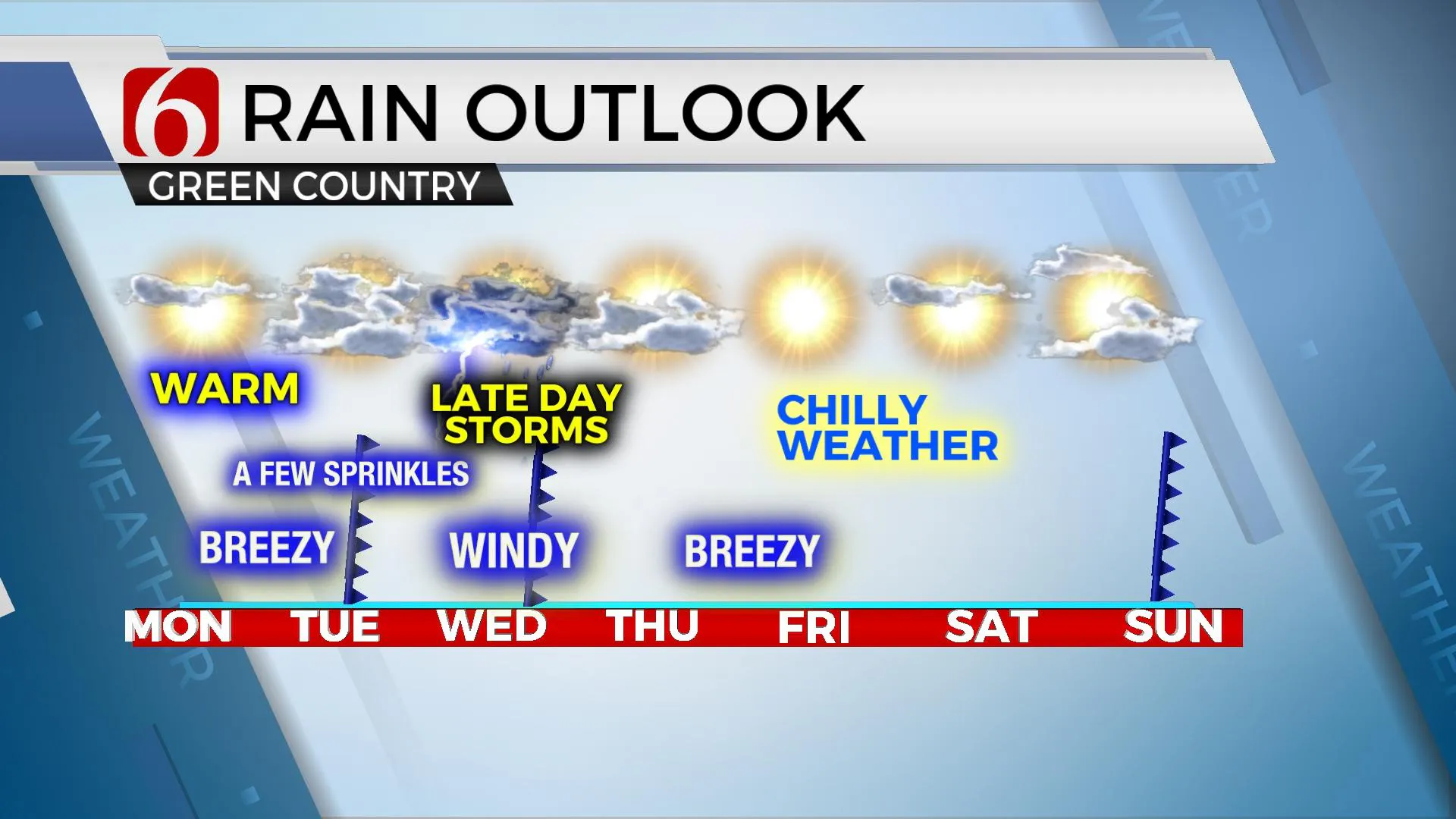
A weak wave will move across the central plains today producing a few high clouds. A second wave nears the plains Tuesday and will bring a weak cold front into at least northern OK before the wave exits east and the front stalls near or south of the metro before moving northward rapidly Tuesday evening into early Wednesday morning as the next stronger upper-level system nears the region. This will shove the front southward Wednesday afternoon and evening with thunderstorm chances developing along and behind the front. Instability is expected to remain low across the northern sections but may increase enough for a few strong storms Wednesday early evening across central to southeastern OK. The front will clear the area by pre-dawn Thursday morning taking precipitation out of the region as cooler and drier air arrives. Another surface front is expected Sunday with north winds and chilly fall-like weather entrenched across the plains.

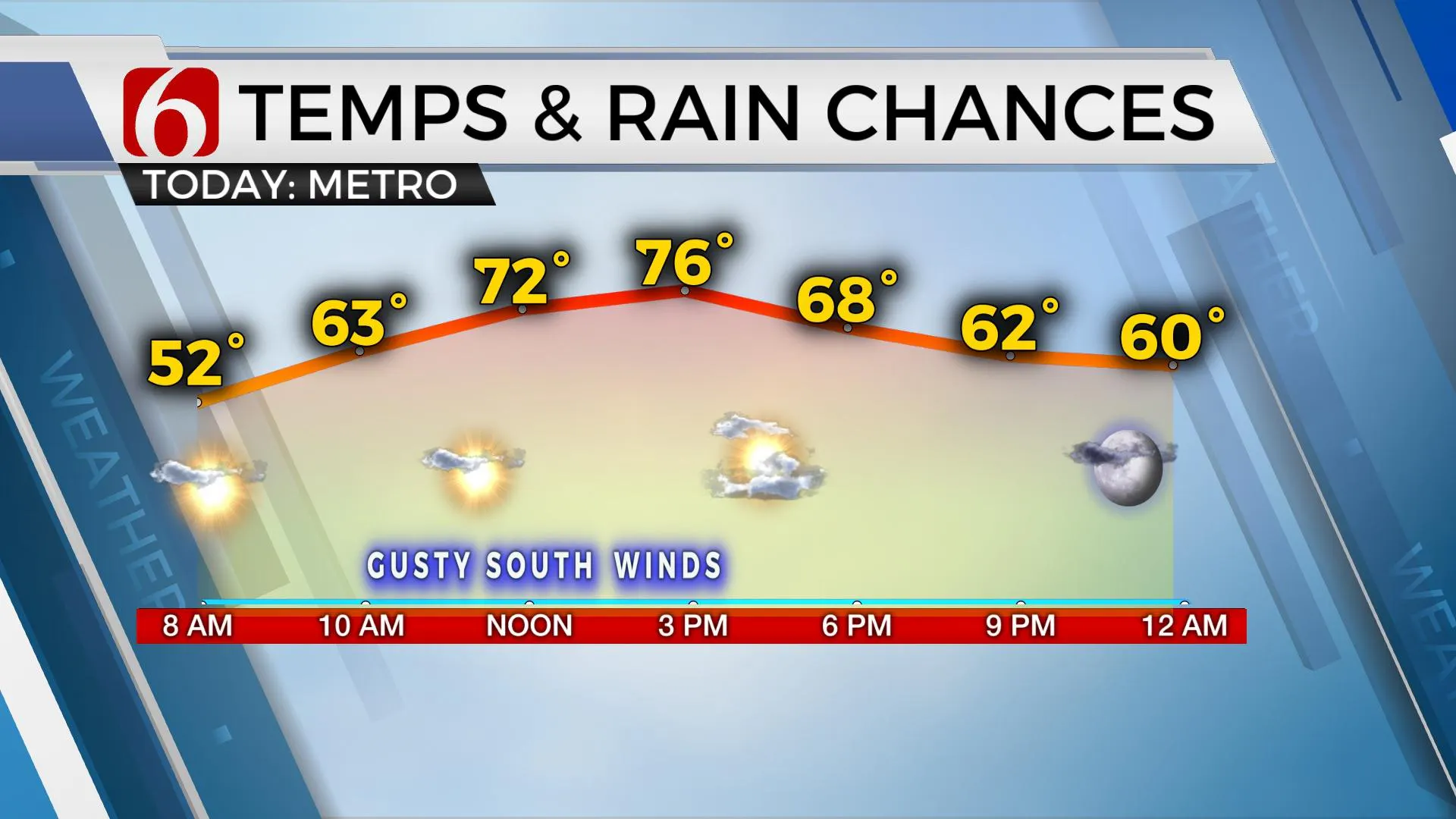
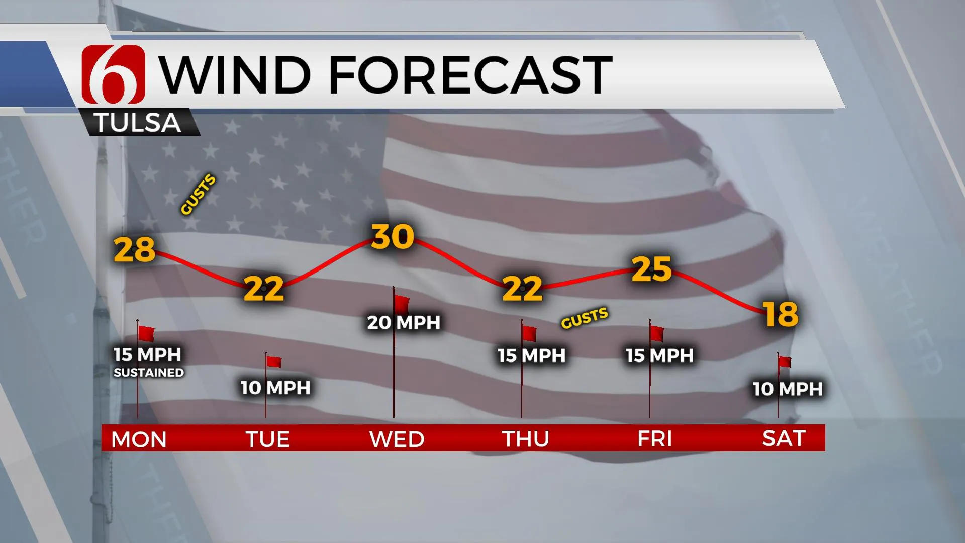
Temps this morning will start in the upper 40s to lower 50s before quickly climbing into the mid-70s with sunshine, a few clouds, and gusty south winds from 15 to 30 mph. The first front brings north winds for part of Tuesday with lows in the upper 50s and highs in the upper 60s and lower 70s. Moisture is limited but mostly cloudy conditions along with a sprinkle or two will be possible.

As the stronger front arrives Wednesday, thunderstorms will become likely by afternoon and evening. Moisture transport will bring dew points in the mid to upper 50s into central OK by midday Wednesday before the main forcing arrives by afternoon. A few of the storms will be strong to severe along and the I-35 corridor region and will move eastward Wednesday evening across Eastern OK. Wednesday morning lows will start in the upper 50s and lower 60s with daytime highs reaching the upper 60sand lower 70s. Cooler weather arrives Thursday morning as the front accelerates away from the state with highs in the 50s and 60s, with more notable cool weather arriving Friday into the weekend. Morning lows in the 30s will be followed by highs in the lower 50s Friday and Saturday and reaching the mid to upper 50s Sunday before the next surface boundary moves across the state.

Thanks for reading the Monday morning weather discussion and blog.
Have a super great day!
Alan Crone
KOTV
If you’re into podcasts, check out my daily weather update below. Search for NewsOn6 and ‘Weather Out The Door’ on most podcast providers, including Apple, Stitcher, Tune-In and down below on Spotify.

More Like This
November 8th, 2021
February 14th, 2022
January 26th, 2022
January 25th, 2022
Top Headlines
December 11th, 2024
December 11th, 2024
December 11th, 2024
December 11th, 2024


