Record Highs On Thursday
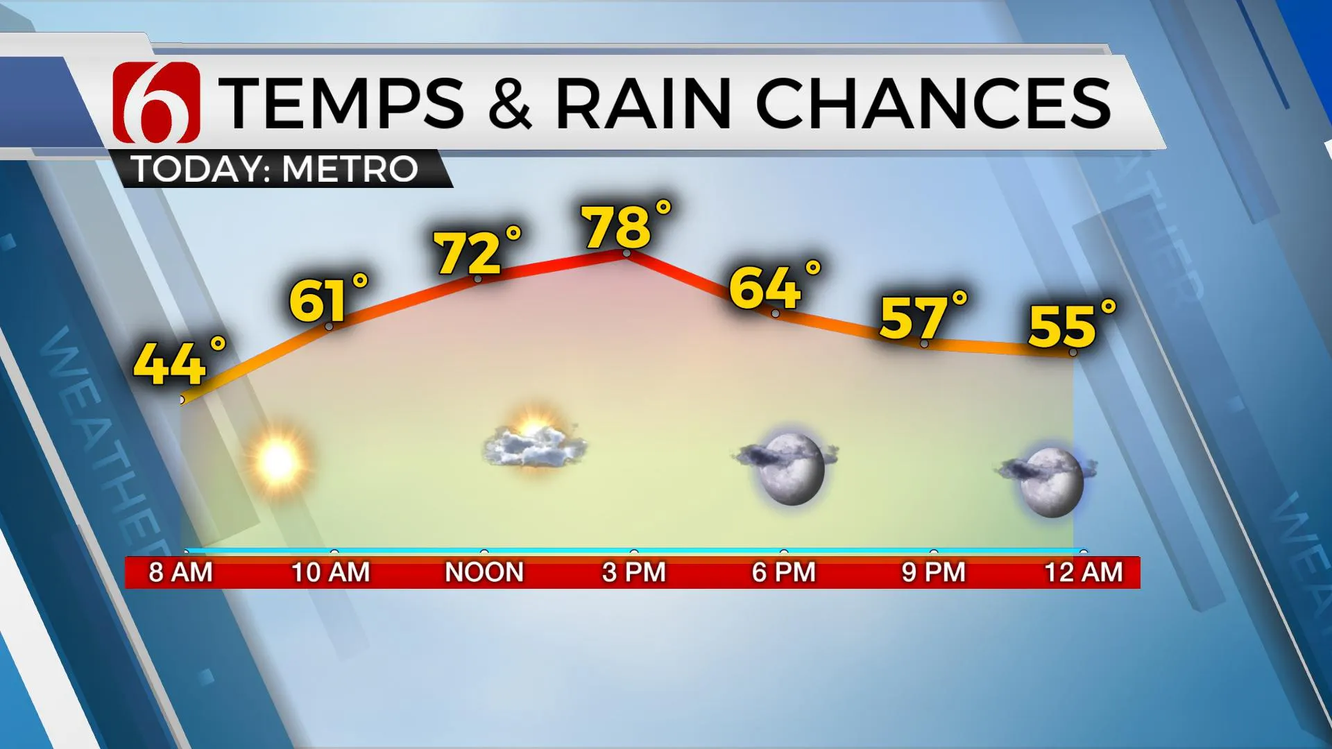
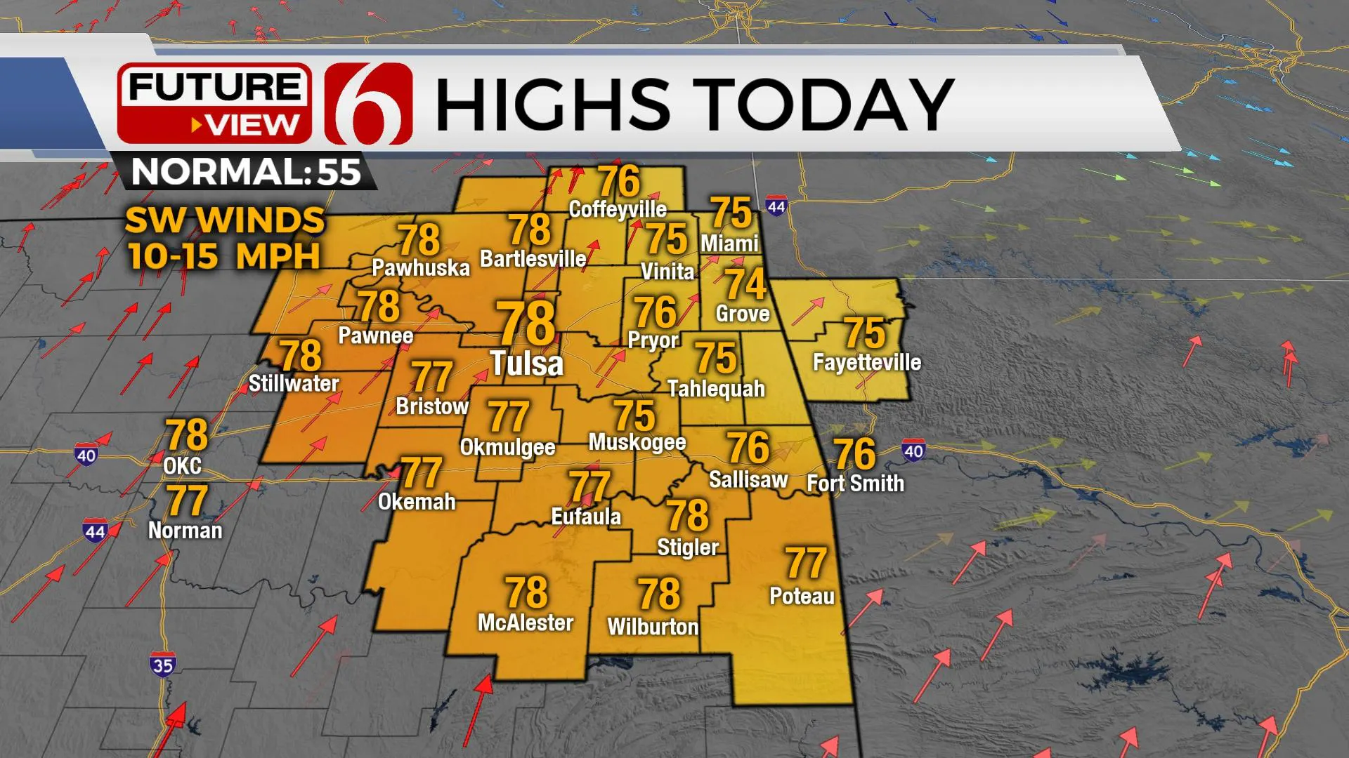
Temps will start in the 40s this morning and quickly move into the 60s midday and topping out in the mid-70s this afternoon with mostly sunny sky and southwest winds from 10 to 15 mph.Thursday, December 2nd 2021, 8:19 am
TULSA, Oklahoma -
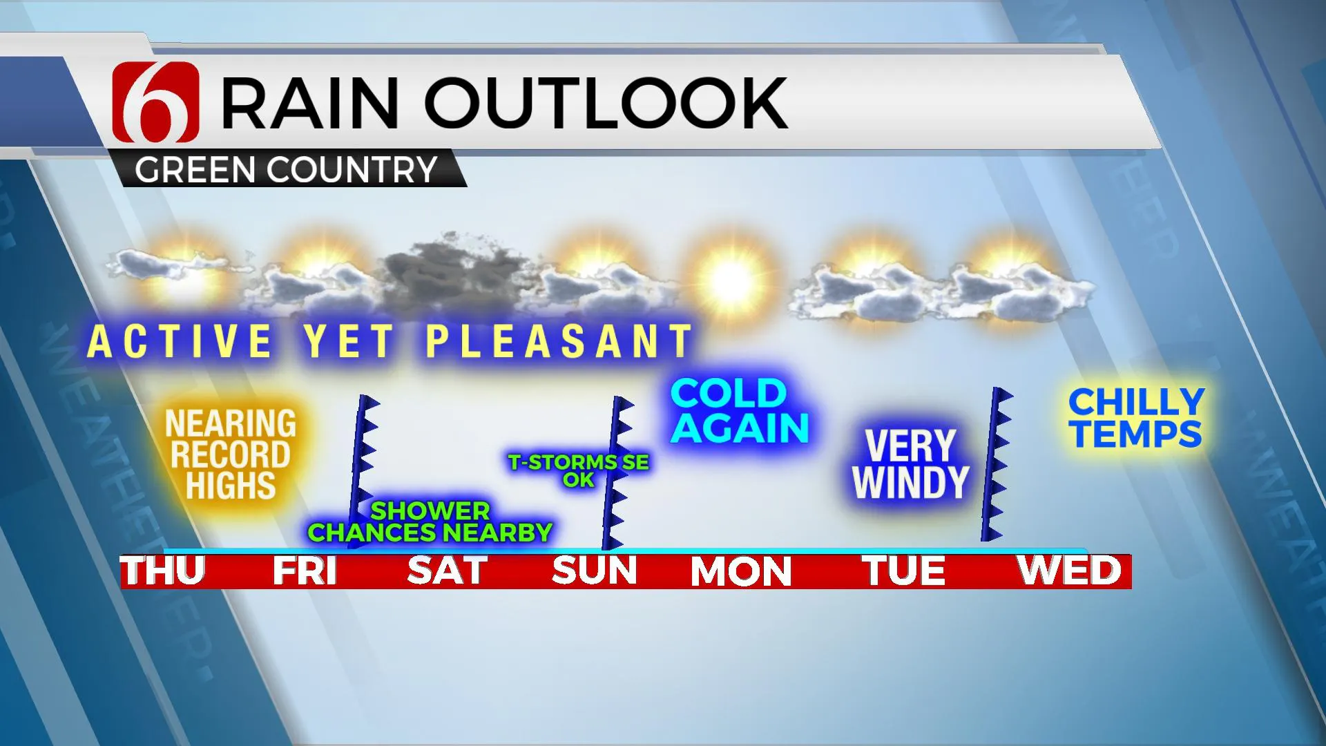
Temps will start in the 40s this morning and quickly move into the 60s midday and topping out in the mid-70s this afternoon with mostly sunny sky and southwest winds from 10 to 15 mph. Record highs will be possible today across portions of the state, including Eastern Oklahoma. Unseasonably warm weather remains Friday before a slow-moving system impacts part of the area this weekend with low chances for showers and storms. A cold front will eventually move across the state Sunday bringing chilly weather behind the boundary Sunday afternoon and evening that will continue into Monday. Gusty southwest winds quickly return Tuesday with highs reaching the mid-60s before another front slides into the region for the middle of next week another notable cool-down.

The upper air flow remains from the northwest this morning with the main branch of westerlies well north of the plains. Active weather, including much colder conditions, are noted across the northern tier of the United States into southern Canada where some snow is falling this morning. Warm temps aloft located across the Mexican Plateau will continue to invade the southern plains today with unseasonably warm weather over a very large region, including Oklahoma. These same conditions are likely Friday, but additional cloud cover may knock the temps down a few degrees in some locations. Later Friday evening, changes will slowly occur bringing limited shower chances and eventually cooler weather into the area.

As a weak southern stream impulse nears the state from the southwest, the northern stream will slowly drop southward Friday into the weekend before a trough moves through the central plains Sunday into Monday. A surface area of low pressure will develop along the Red River Valley of southwestern OK Friday and slowly progress eastward this weekend. Low-level moisture in the southerly flow will move across Texas into part of southeastern OK where dew points in the 50s are likely to reside for most of the weekend, possibly nearing the upper 50s Sunday morning. Northeast surface winds will develop across northern OK Friday night as a cold front sags southward and the broad surface low remains to our southwest. A few showers or even areas of mist or drizzle could develop north, but better chances for a few showers will remain across southeastern OK late Friday evening through Saturday morning. Temps Saturday will support a broad range with upper 50s to lower 60s north and 70s across southeastern OK. Saturday evening into Sunday morning a stronger upper impulse nears, and additional showers and storms will develop in the deeper pool of moisture, mostly located across far southeastern to east-central OK southward to north TX. The best chance for precipitation will occur across the Red River into North TX but we’ll need to keep some low mentions for southeastern-east central OK for this period. A few strong storms will be possible but mostly across Texas

Sunday midday to afternoon the cold front will zip across northeastern OK taking daytime highs in the 60s and dropping these readings quickly into the 40s with northwest winds from 10 to 25 mph. Temps will fall into the 30s overnight into early Monday morning as a surface ridge of high pressure settles over the area keeping chilly weather with Monday afternoon highs in the upper 40s to lower 50s. Strong southwest winds return Tuesday with another warm-up into the mid-60s before the next front arrives Wednesday.
Thanks for reading the Thursday morning weather discussion and blog.
Have a super great day!
Alan Crone
KOTV
If you’re into podcasts, check out my daily weather update below. Search for NewsOn6 and ‘Weather Out The Door’ on most podcast providers, including Apple, Stitcher, Tune-In and down below on Spotify.

More Like This
December 2nd, 2021
February 14th, 2022
January 26th, 2022
January 25th, 2022
Top Headlines
December 14th, 2024
December 14th, 2024
December 14th, 2024
December 14th, 2024


