Warming Weather Soon
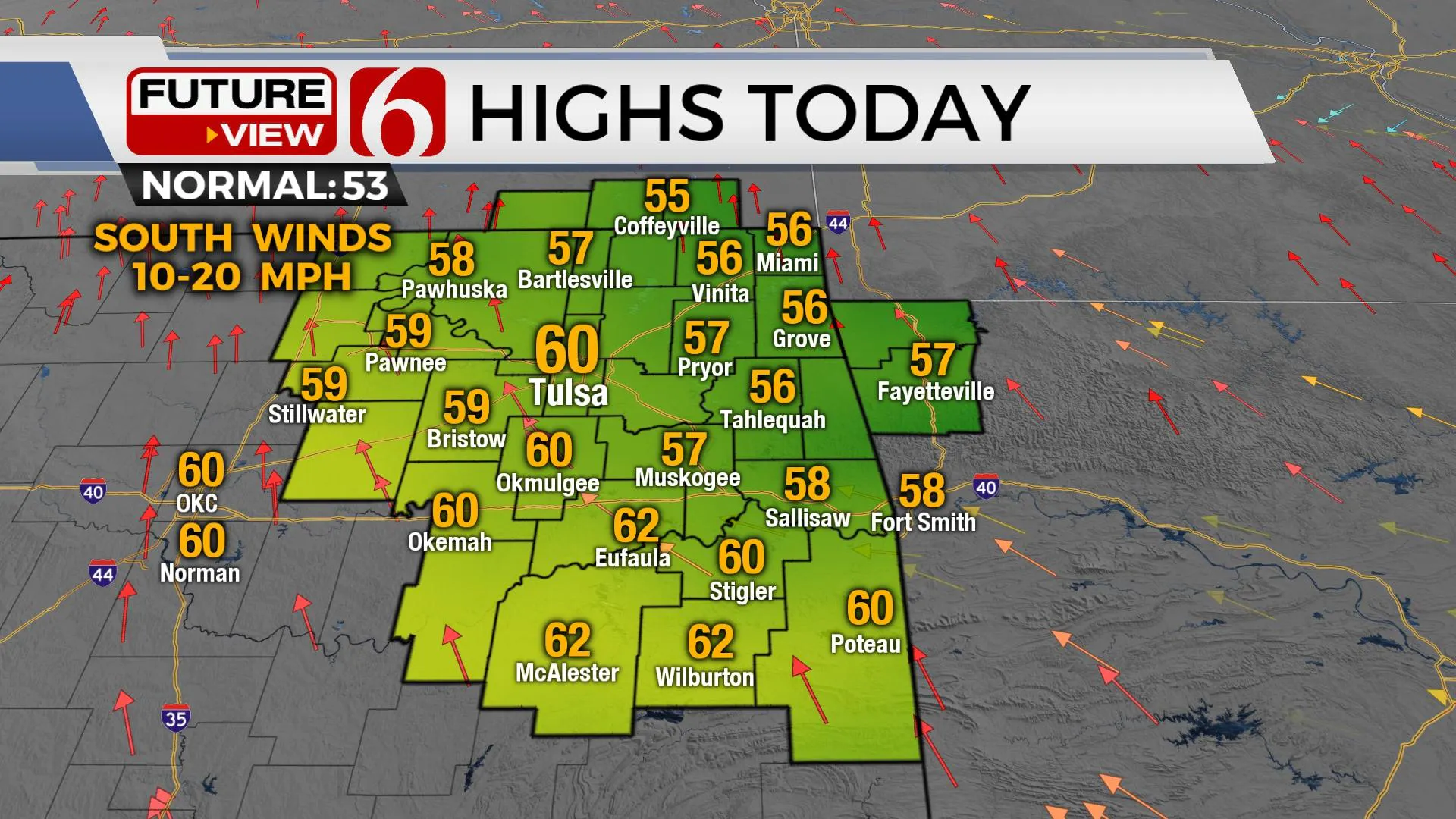
Pleasant weather arrives today with highs reaching the upper 50s and a few lower 60s as south winds gradually return ahead several short-waves that brings the next strong cold front into the state late Friday evening.Wednesday, December 8th 2021, 8:10 am
TULSA, Oklahoma -
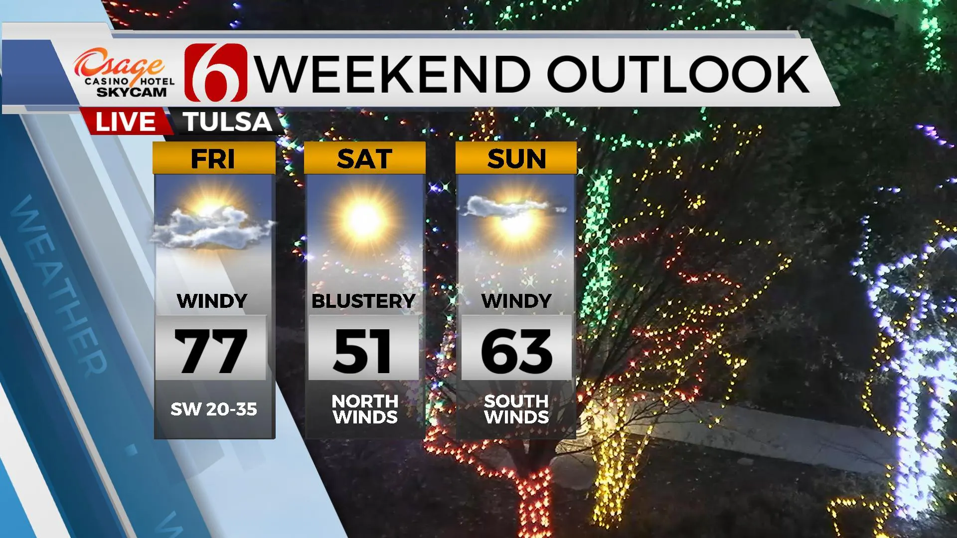
Pleasant weather arrives today with highs reaching the upper 50s and a few lower 60s as south winds gradually return ahead several short-waves that brings the next strong cold front into the state late Friday evening. The pressure gradient should tighten quickly this evening into overnight and wind speeds should respond into the 15 to 30 mph range as the first short wave emerges into the central plains. Gusty winds will remain Thursday and Friday with low-level moisture confined to the far southeastern quadrant of the state that may extend northward into far western Arkansas. As the next wave develops and interacts with the state, there will be a small window for a few showers, mostly across the far southern or eastern sections. The data is varied on the exact amount of moisture and instability, but we’ll keep a small window late Thursday evening into Friday even though most data keep activity east of the state. Gusty southwest winds are likely Friday with morning lows in the 50s and highs in the mid to upper 70s. We’ll be near record highs again Friday depending upon the exact amount of cloud cover and the timing of the front. By Friday evening, the strong cold front sweeps into the region pushing the moisture out and bringing colder weather back to the state for a brief time. Locations across the I-35 corridor westward will have increased fire danger issues Friday as strong southwest winds and drier air advects into the region.

As this system exits the area, blustery north winds and chilly weather returns with Saturday morning lows in the 30s and highs in the upper 40s and lower 50s. South winds quickly return Sunday into Monday with yet another mini-warm-up with highs in the lower to mid-60s with lower 70s Tuesday and Wednesday. A strong-looking upper trough nears the state by the end of next week and may provide thunderstorm chances Thursday or Friday. We’ve been experiencing a typical La Nina pattern for the southern plains, which means periods of warm weather interrupted by strong cold fronts and cold weather intrusions. This pattern will remain.

Thanks for reading the Wednesday morning weather discussion and blog.
Alan Crone
KOTV
If you’re into podcasts, check out my daily weather update below. Search for NewsOn6 and ‘Weather Out The Door’ on most podcast providers, including Apple, Stitcher, Tune-In and down below on Spotify.

More Like This
December 8th, 2021
February 14th, 2022
January 26th, 2022
January 25th, 2022
Top Headlines
December 11th, 2024
December 11th, 2024
December 11th, 2024
December 11th, 2024


