Widespread Fog Sticks With Green Country Thursday Morning
Foggy conditions will cause some slowdowns across the large majority of eastern Oklahoma and southeastern Kansas for the first half of our Thursday.Thursday, December 30th 2021, 9:25 am
TULSA, Oklahoma -
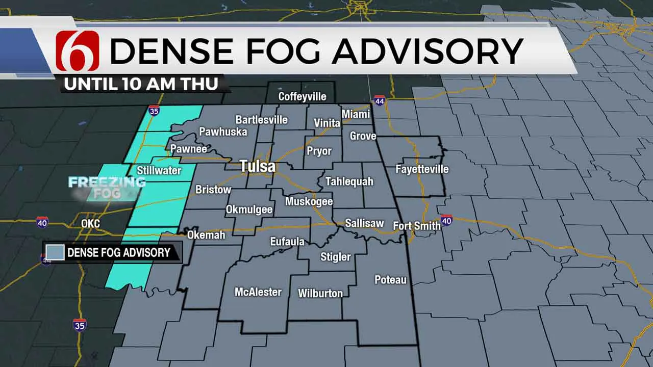
Foggy conditions will cause some slowdowns across the large majority of eastern Oklahoma and southeastern Kansas for the first half of our Thursday.
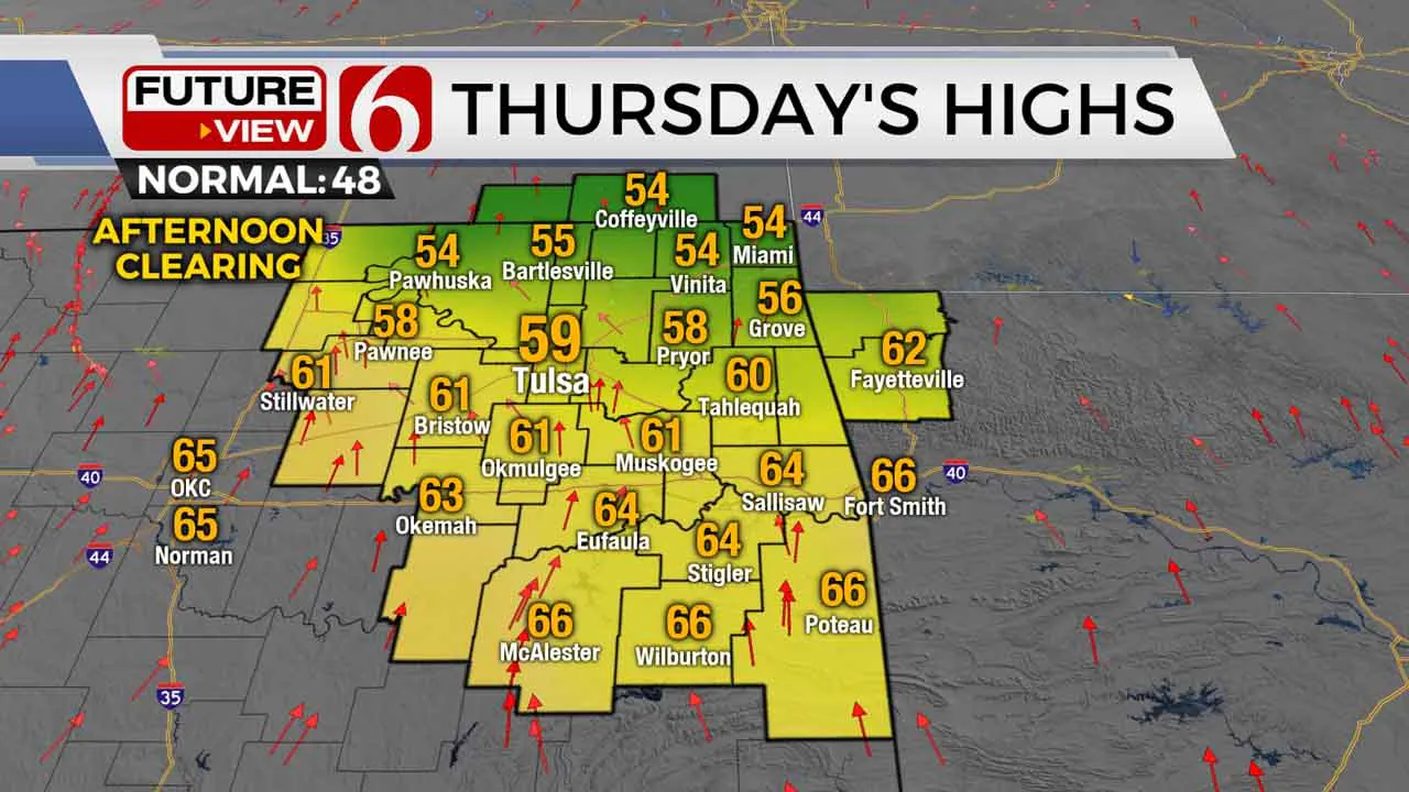
Areas of dense fog, drizzle, and low clouds will be quite stubborn through the late morning into midday, with visibility well below one mile. We’ll eventually break back out some sunshine for the afternoon hours with 50s for highs across northeastern Oklahoma and lower to mid-60s across southeastern Oklahoma.

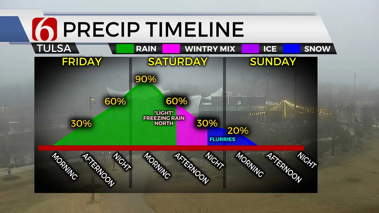
South winds start to kick back in New Year’s Eve morning, setting us up for a fairly mild last day of 2021 with highs mostly in the 60s on Friday. Scattered rain will start to develop New Year’s Eve evening, continuing off-and-on into the midnight hour as we ring in 2022. Rain and thunderstorms will become widespread early New Year’s Day morning in advance of our much-awaited Arctic cold front.

That strong cold front will surge into northeastern Oklahoma New Year’s Day morning, sending temperatures plummeting from the 50s into the 20s by New Year’s afternoon. A changeover to a light wintry mix or some light freezing rain will be possible primarily north of Tulsa behind that sharp cold front, though at the moment any icing amounts for our northern counties Saturday look to be light. An additional round of light snow flurries will also be possible Saturday night into early Sunday morning, though accumulation looks unlikely right now.

Temperatures will bottom out in the teens with wind chill values near zero early Sunday morning! It’ll be quite the shock to the system after our warm December, so get ready!
I hope you have a great Thursday, Green Country! You can follow me on Twitter @StephenNehrenz as well as my Facebook page Meteorologist Stephen Nehrenz to stay up to date with the very latest.
More Like This
December 30th, 2021
February 14th, 2022
January 26th, 2022
January 25th, 2022
Top Headlines
December 12th, 2024
December 12th, 2024
December 12th, 2024
December 12th, 2024


