Breezy, Chilly Wednesday
Temps will be below normal on Wednesday before another surge of arctic air arrives tonight bringing bitterly cold weather to Oklahoma Thursday.Wednesday, January 5th 2022, 7:25 am
TULSA, Oklahoma -
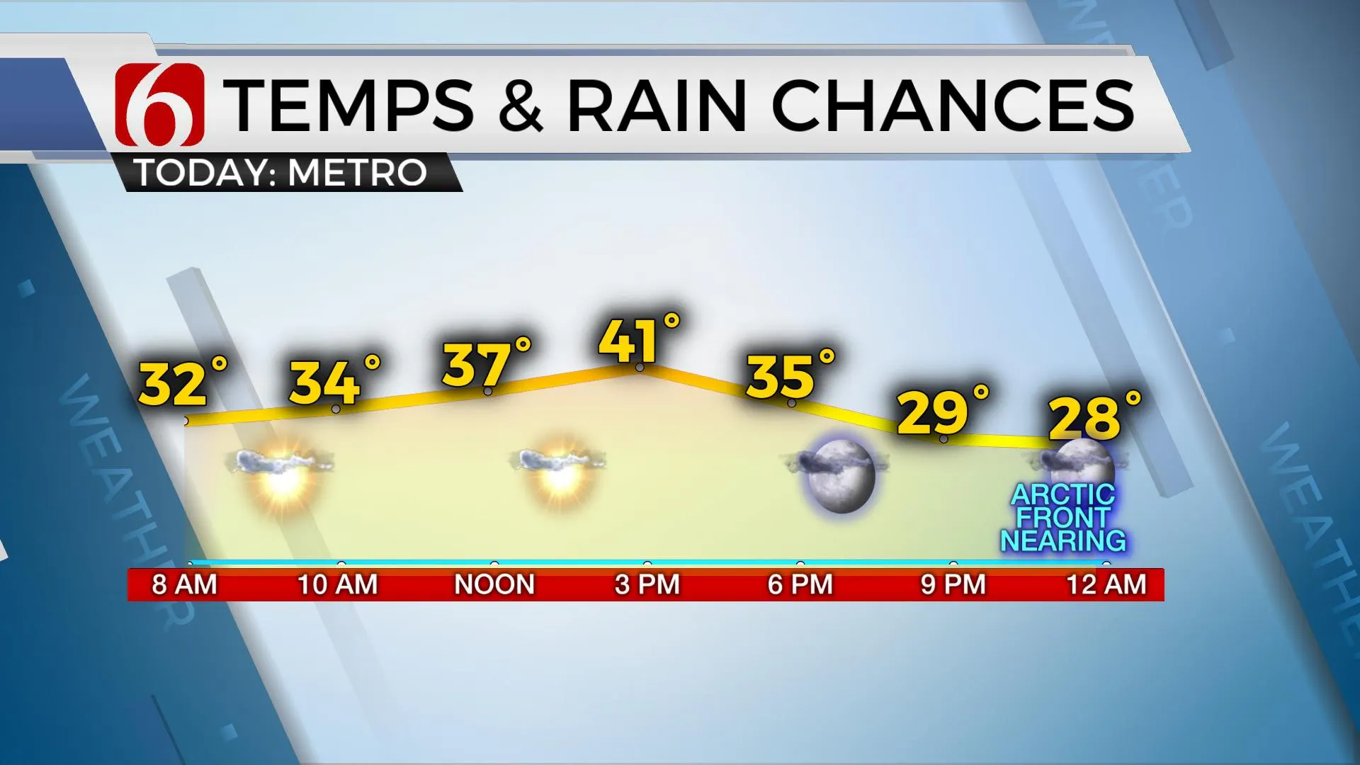
Temps will be below normal today before another surge of arctic air arrives tonight bringing bitterly cold weather to Oklahoma Thursday.

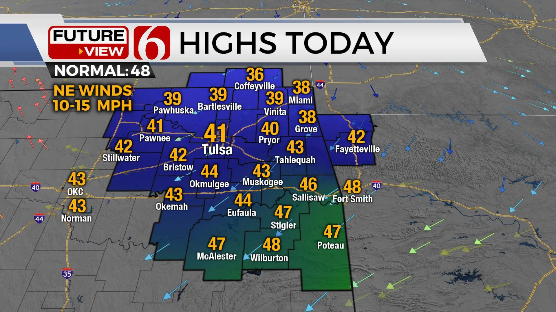
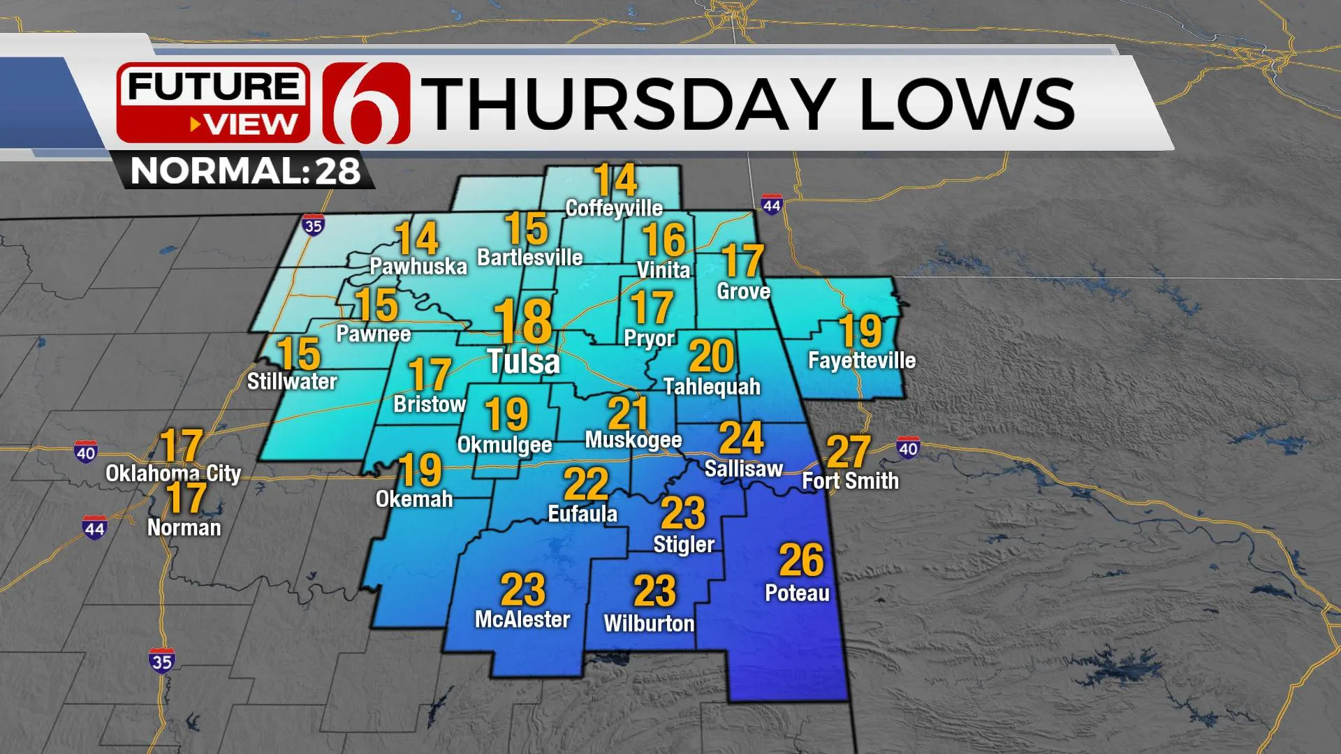
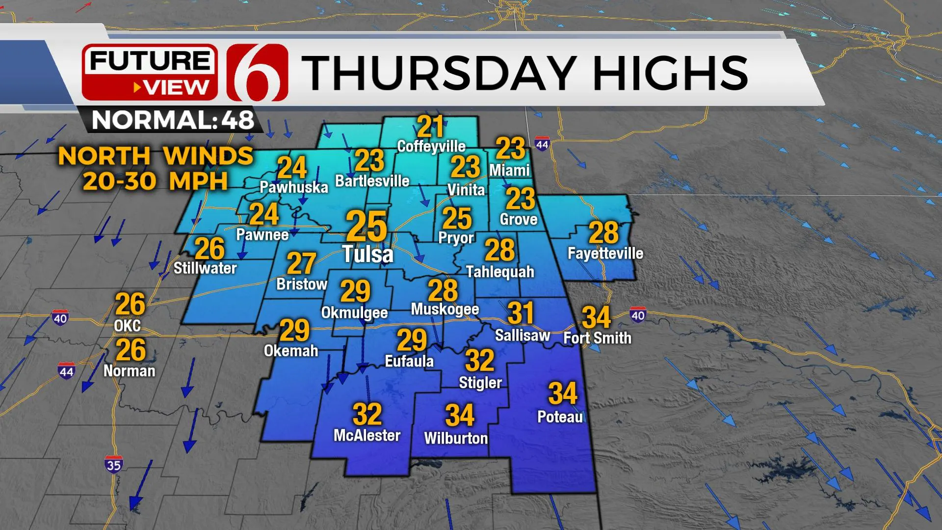
The first front moved across northern OK earlier this morning with north winds and temps falling into the 30s. Afternoon highs will stay into the lower 40s north and mid to upper 40s south along with partly sunny sky and north winds near 10 to 20 mph. A stronger arctic front arrives later tonight with temps dropping into the teens Thursday morning with north winds from 15 to 30 mph. Wind chill values near or even slightly below single digits will be possible northwest of the metro where a wind chill advisory may be needed for the morning hours. Highs Thursday afternoon will stay in the mid-20s north and near-freezing southeastern OK. A strong jet-streak moves from the Rockies into the central plains late tonight behind this front and will provide enough lift in the atmosphere to squeeze out some light snow or flurries across part of northeastern OK early Thursday morning, with higher chances in southern Kansas.

A surface ridge of high pressure will center near the region late Thursday night into Friday morning allowing the potential for radiational cooling. If the sky remains clear, temps will drop into the single digits in most valley locations across northeastern OK, with metro locations in the lower teens. The ridge moves eastward Friday morning with south winds returning by afternoon as highs reach the lower to mid-40s.

Saturday the pressure begins falling across the plains as the next upper-level impulse nears the area. South winds return from 20 to 35 mph with afternoon highs reaching the mid-50s to lower 60s before the next cold front rolls into the state late Saturday evening into Sunday morning. Low-level moisture will be pooling across far southeastern OK this weekend where a slight chance for a few showers or storms will exist both days. The front will move across northeastern OK Sunday morning with temps in the 40s dropping into the 30s by afternoon along with gusty north winds. Cold weather will remain early next week for a day or two before another warming trend arrives for the middle to end of next week. Rain chances return for the latter half of next week.

Thanks for reading the Wednesday morning weather discussion and blog.
Have a super great day!
Alan Crone
KOTV
If you’re into podcasts, check out my daily weather update below. Search for NewsOn6 and ‘Weather Out The Door’ on most podcast providers, including Apple, Stitcher, Tune-In and down below on Spotify.

More Like This
January 5th, 2022
February 14th, 2022
January 26th, 2022
January 25th, 2022
Top Headlines
December 11th, 2024
December 11th, 2024
December 11th, 2024
December 11th, 2024


