Warm Day Before The Next Arctic Front Arrives
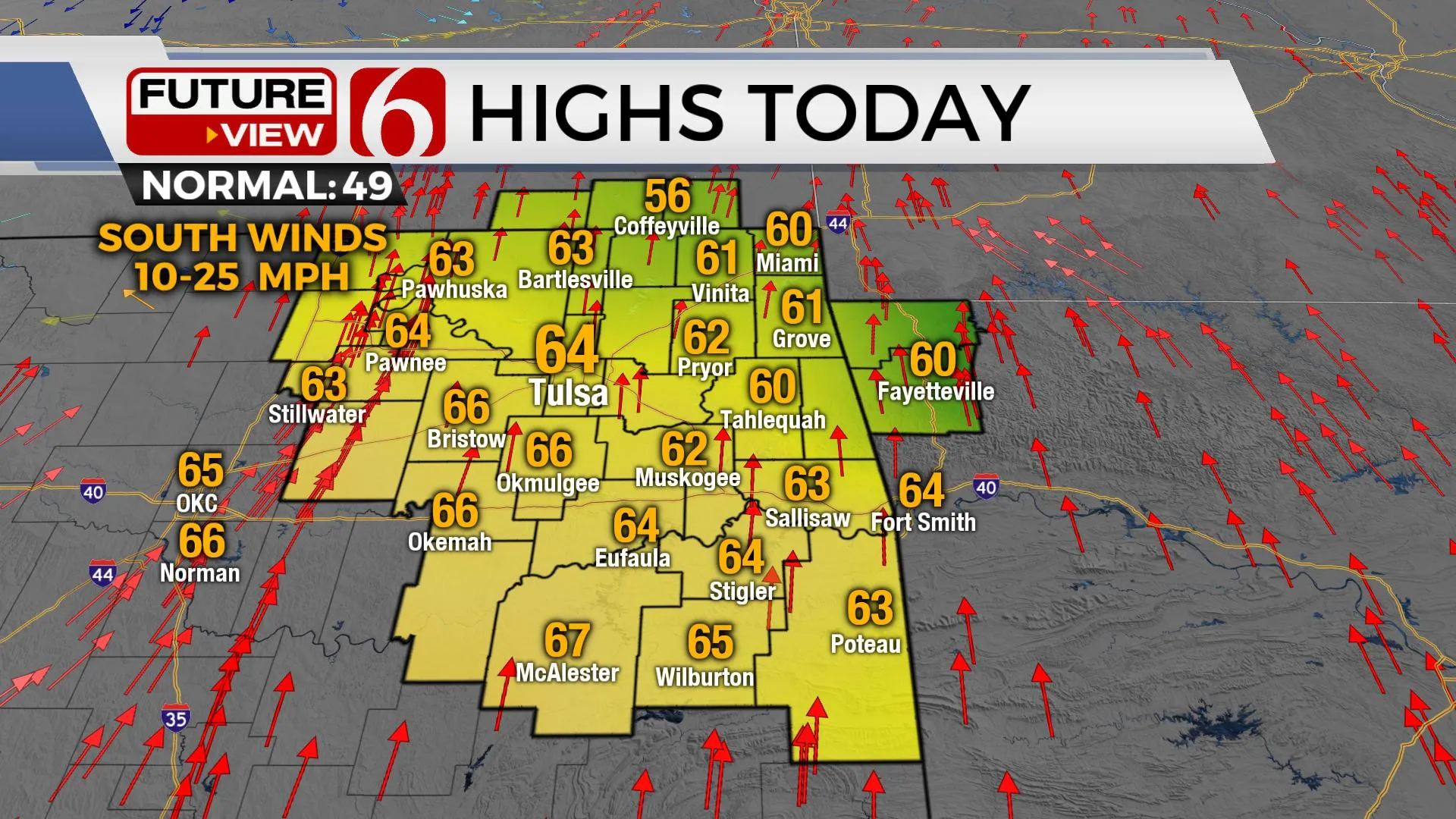
Temperatures on Tuesday afternoon will warm into the lower 60s along with some high clouds and sunshine before another strong arctic front moves into the state Wednesday morningTuesday, January 18th 2022, 5:32 am
TULSA, Oklahoma -
Temperatures warm up across Green Country on Tuesday before the next cold front moves in.
Here are the details from News On 6 Meteorologist Alan Crone:
Temperatures on Tuesday afternoon will warm into the lower 60s along with some high clouds and sunshine before another strong arctic front moves into the state Wednesday morning. South winds will remain Tuesday with a few gusts nearing 20 mph by the afternoon. Fire spread rates will be increasing across the area. Please remain aware and refrain from outdoor burning. As the colder air arrives Wednesday, temperatures drop below freezing by Wednesday afternoon through Friday afternoon before temperatures moderate some into the weekend. There will be a small mention for light precip Wednesday with the initial surge of cold air that may result in a light wintry mix across far eastern Oklahoma.

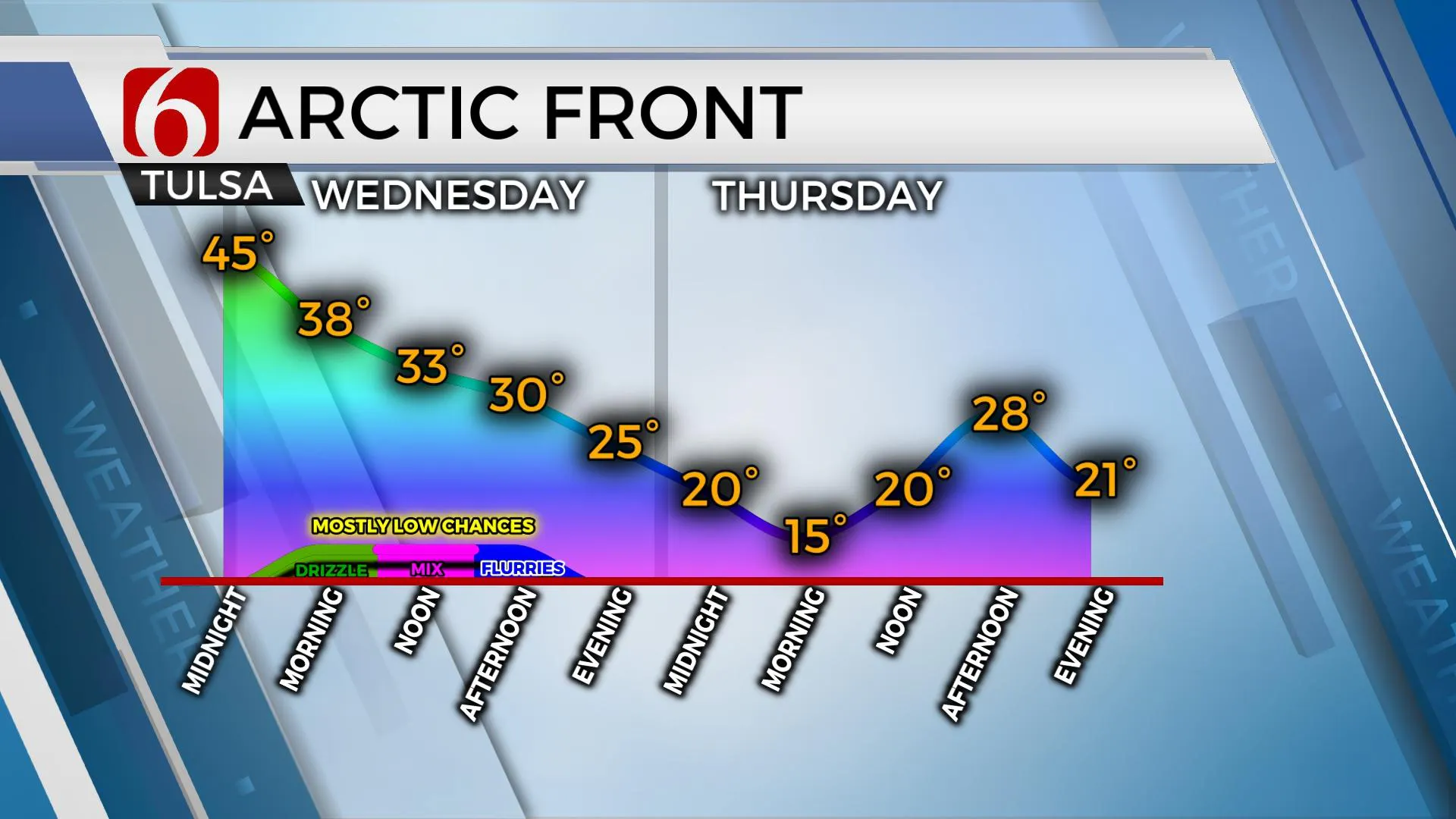
The chance for some drizzle or light showers will remain for a short period of time Wednesday morning as the cold front begins moving into the area. Temps will initially be above freezing for the morning hours but will be falling near or below freezing midday to afternoon. It is during this time that some light wintry mix will be possible across far eastern and southern OK before the moisture quickly exits the area. This is not expected to be a major issue but some locations across the far eastern and southeastern sections may encounter some light wintry mix. Locations across far NW Arkansas will be in a better position for some light snow Wednesday afternoon.

Most data support extremely dry air quickly following the frontal passage Wednesday evening that will be reinforced by very cold air Thursday and Friday. Morning lows will drop into the teens and afternoon highs Thursday remaining in the mid to upper 20s. Friday's highs should rebound into the upper 30s.

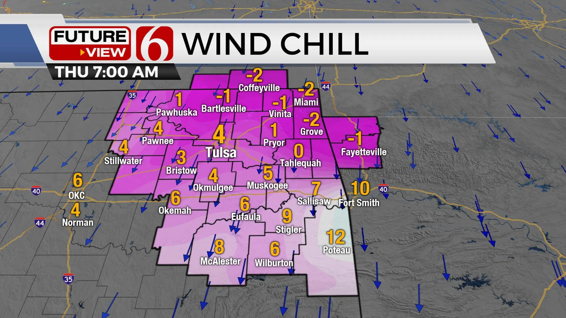
Gusty north winds from 15 to 30 mph will be likely Wednesday behind the initial front with temps falling into the upper 20s and lower 30s later in the afternoon. Wind chill values will also be dropping into the upper teens and lower 20s Wednesday afternoon. Early Thursday morning, wind speeds will be decreasing but still able to produce wind chill values in the single digits and some sub-zero readings through the morning. We'll continue with the arctic air through Friday before moderating into the 40s Saturday and lower 50s Sunday. There will be a storm system nearby this weekend, but current data support this system remaining south of our area. Another surge of arctic air is possible for the middle of next week.
Thanks for reading the Tuesday morning weather discussion and blog.
Have a super great day!
Alan Crone
KOTV
If you’re into podcasts, check out my daily weather update below. Search for NewsOn6 and ‘Weather Out The Door’ on most podcast providers, including Apple, Stitcher, Tune-In and down below on Spotify.

More Like This
January 18th, 2022
June 21st, 2023
June 19th, 2023
June 13th, 2023
Top Headlines
December 12th, 2024
December 12th, 2024
December 12th, 2024
December 12th, 2024


