Winter Weather Makes Its Way Back Into Green Country
Much colder air returns on Wednesday with strong north winds.Wednesday, January 19th 2022, 6:39 am
TULSA, Oklahoma -
Much colder air returns on Wednesday with strong north winds.
Here are the details from News On 6 Meteorologist Alan Crone:
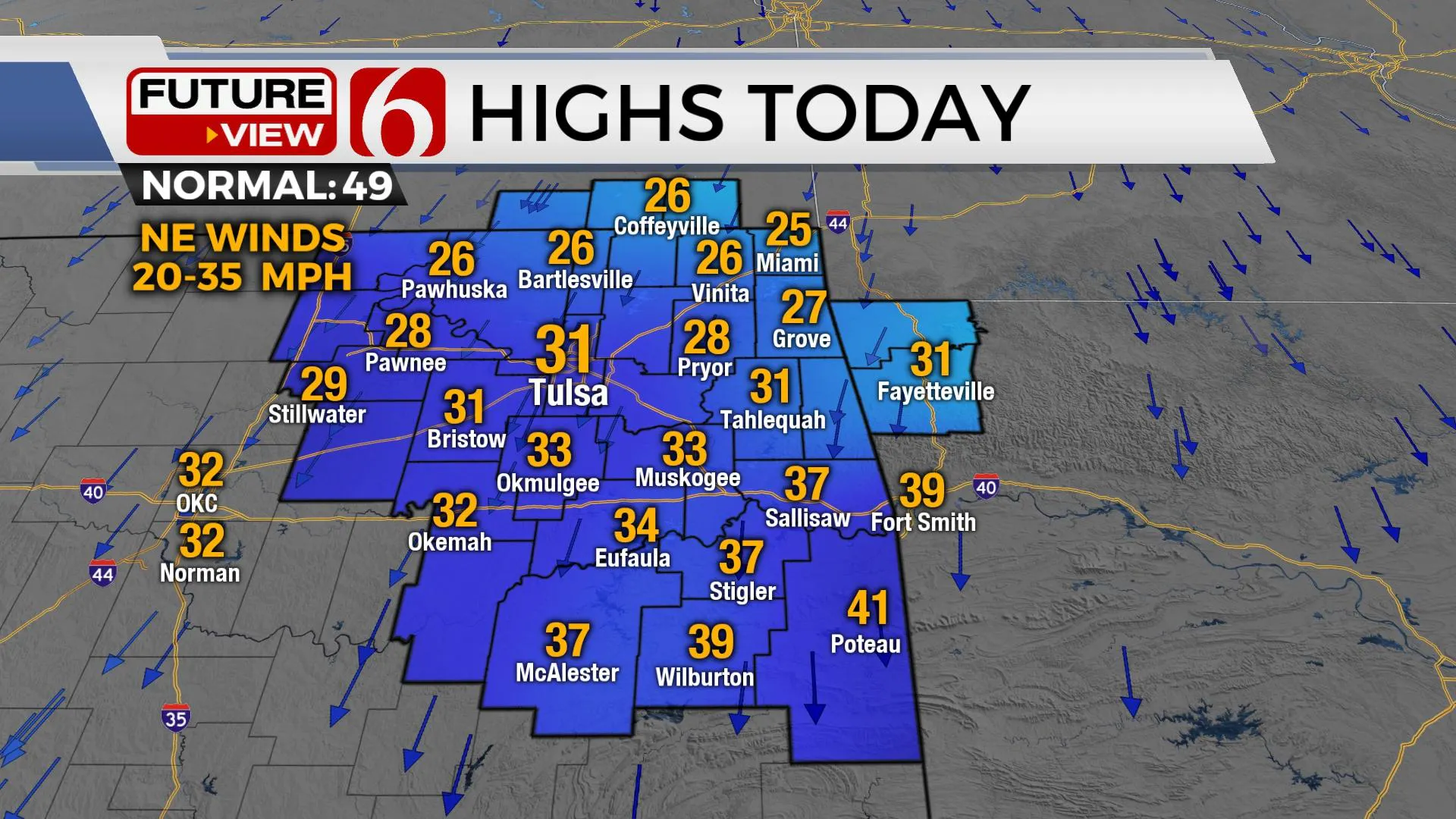
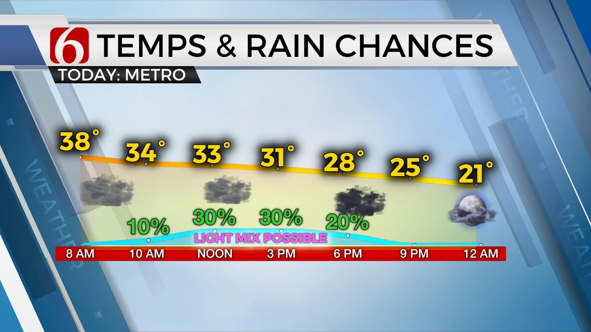
The first surge of arctic air is underway on Wednesday morning and will bring below freezing temps by midday to afternoon across most of the area. Locations north highway 412 will drop near freezing by midday. Areas along and south of I-40 will drop below freezing after the 3 p.m. hour. This temp trend is critical for any wintry precip development as light shower activity will be possible in a few locations before gradually tapering out of the area by late afternoon. As the temperature drops, we'll have a slight chance of some wintry mix developing, mostly across far east-central OK and northwestern Arkansas as a weak mid-level disturbance moves from the west to east across the state. As of Wednesday morning, a winter weather advisory will be posted for NW Arkansas. Remain aware of your local temps by midday to afternoon. If light precip develops in your area, a few slick spots could arise on elevated surfaces. The higher chances will remain south and east of the metro, but we’ll keep some mentions for midday to early afternoon. Later in the day on Wednesday, a significant second surge of cold air arrives with very dry air. This will move any light precip out of the area early evening.

Strong northeast winds from 20 to 35 mph will be possible on Wednesday as the front surges southward. Wind chill values will drop into the upper teens and lower 20s. As the second surge of cold air arrives Wednesday night, surface temps will move into the teens by Thursday morning with wind chill values in the single digits to sub-zero in a few spots. Despite the dry air, a few flurries may still fly Thursday morning near or west of the area. Thursday afternoon highs will remain in the mid to upper 20s with decreasing wind speeds but mostly to partly cloudy sky. The coldest stretch of this period arrives Friday morning with clear sky, light wind, and extremely dry air. Friday morning lows will be in the single digits in the valleys and the lower teens elsewhere before moving above freezing by Friday afternoon. A moderating air mass is likely this weekend with afternoon highs in the 40s and 50s. We’ll be near 60 Monday before another surge of arctic air arrives by the middle of next week.

Thanks for reading the Wednesday morning weather discussion and blog.
Have a super great day!
Alan Crone
KOTV
If you’re into podcasts, check out my daily weather update below. Search for NewsOn6 and ‘Weather Out The Door’ on most podcast providers, including Apple, Stitcher, Tune-In and down below on Spotify.

More Like This
January 19th, 2022
June 21st, 2023
June 19th, 2023
June 13th, 2023
Top Headlines
December 12th, 2024
December 12th, 2024
December 12th, 2024
December 12th, 2024


