Colder Weather Arrives Soon
A cold front could impact your weekend plans.Friday, February 11th 2022, 6:40 am
TULSA, Oklahoma -
A cold front could impact your weekend plans.
Here are the details from News On 6 Meteorologist Alan Crone:
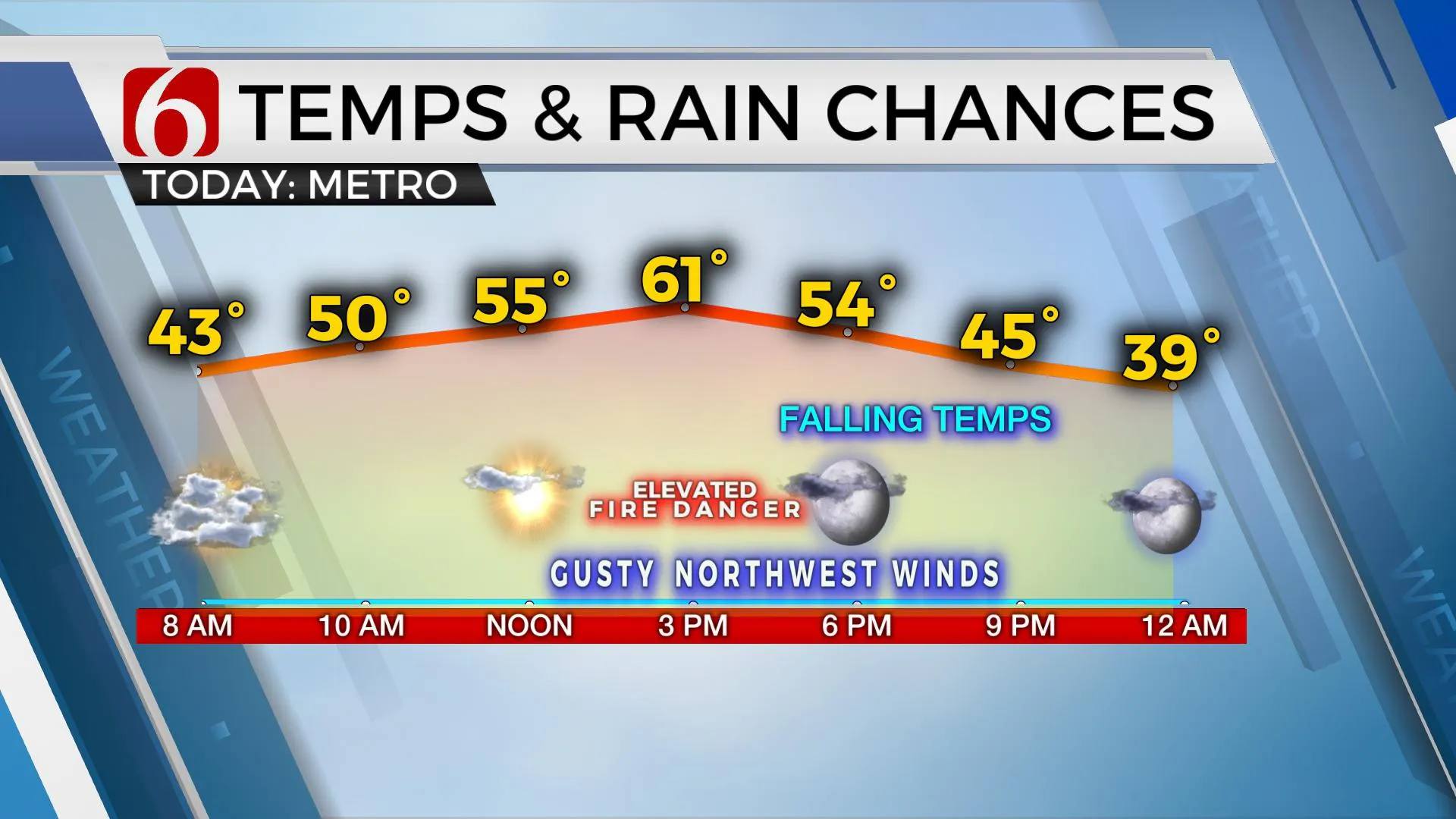
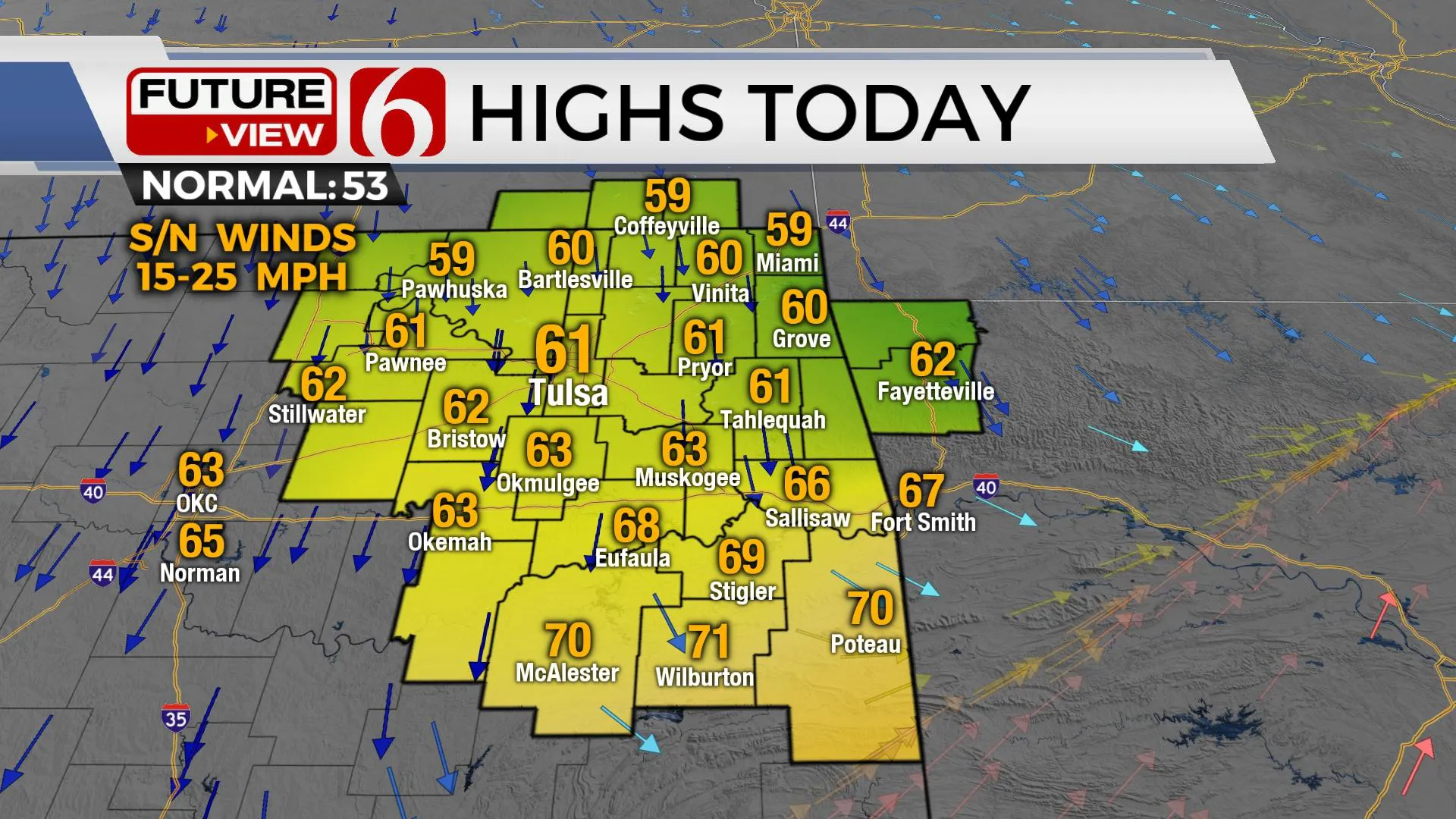
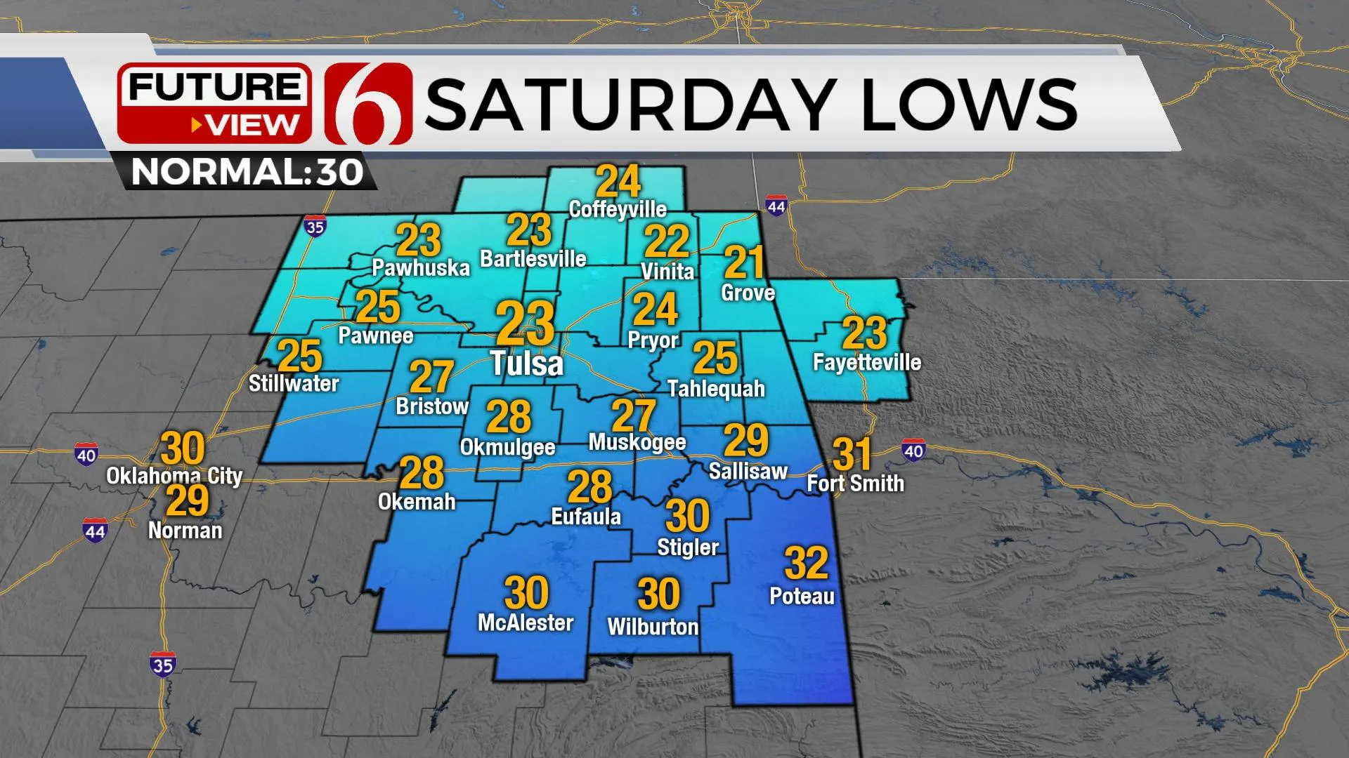
The next cold front moves across the area later Friday morning but the true cold air lags the front a few hours. Temps will begin dropping by later Friday afternoon and evening, with a more notable drop overnight into pre-dawn Saturday. Strong north winds will follow the push of colder air bringing blustery conditions Saturday. Morning lows in the 20s and lower 30s will be followed by afternoon highs in the upper 30s and lower 40s. As the front moves southward, a few small areas of showers will be possible along the Red River Valley region early Saturday morning. A second front back-doors into the area Sunday morning and should keep highs in the lower 50s before the colder air moves east as the next system nears the west coast.

South winds will quickly return early next week as a pattern change brings a stronger storm system near the state by the middle of next week.

The upper air flow, currently from the northwest will become from the southwest next week as a strong western U.S. trough develops and moves eastward. South winds will increase speeds, especially late Monday evening into Tuesday with speeds from 20 to 30 mph likely Tuesday. Fire spread rates will be highest Tuesday, but low-level moisture is expected to flow into the state mitigating some of the fire danger.

By Wednesday, a dry line is likely to develop across far western OK as the powerful upper-level system nears the state. Showers and storms will develop Wednesday evening and spread northeast across the area by Thursday morning. Strong wind speeds aloft will be more than adequate for severe storms, but surface instability may be higher south of the Red River. As the system moves quickly east Thursday morning, colder weather will arrive with north winds and falling temps. There will be some wintry weather potential with this system, but higher chances currently appear across NW OK into central Kansas. A slight shift southward could bring some of this near the metro. It’s just too early to know at this point with any confidence.
Thanks for reading the Friday morning weather discussion and blog.
Have a super great day!
Alan Crone
KOTV
If you’re into podcasts, check out my daily weather update below. Search for NewsOn6 and ‘Weather Out The Door’ on most podcast providers, including Spotify Stitcher, Tune-In and down below on Apple.

More Like This
February 11th, 2022
June 21st, 2023
June 19th, 2023
June 13th, 2023
Top Headlines
December 14th, 2024
December 14th, 2024
December 14th, 2024


