Gusty North Winds Remain Before Improving Weather
Another Chilly day is ahead before warmer temperatures return to the metro.Wednesday, March 23rd 2022, 6:23 am
TULSA, Oklahoma -
Another Chilly day is ahead before warmer temperatures return to the metro.
Here are the details from News On 6 Meteorologist Alan Crone:
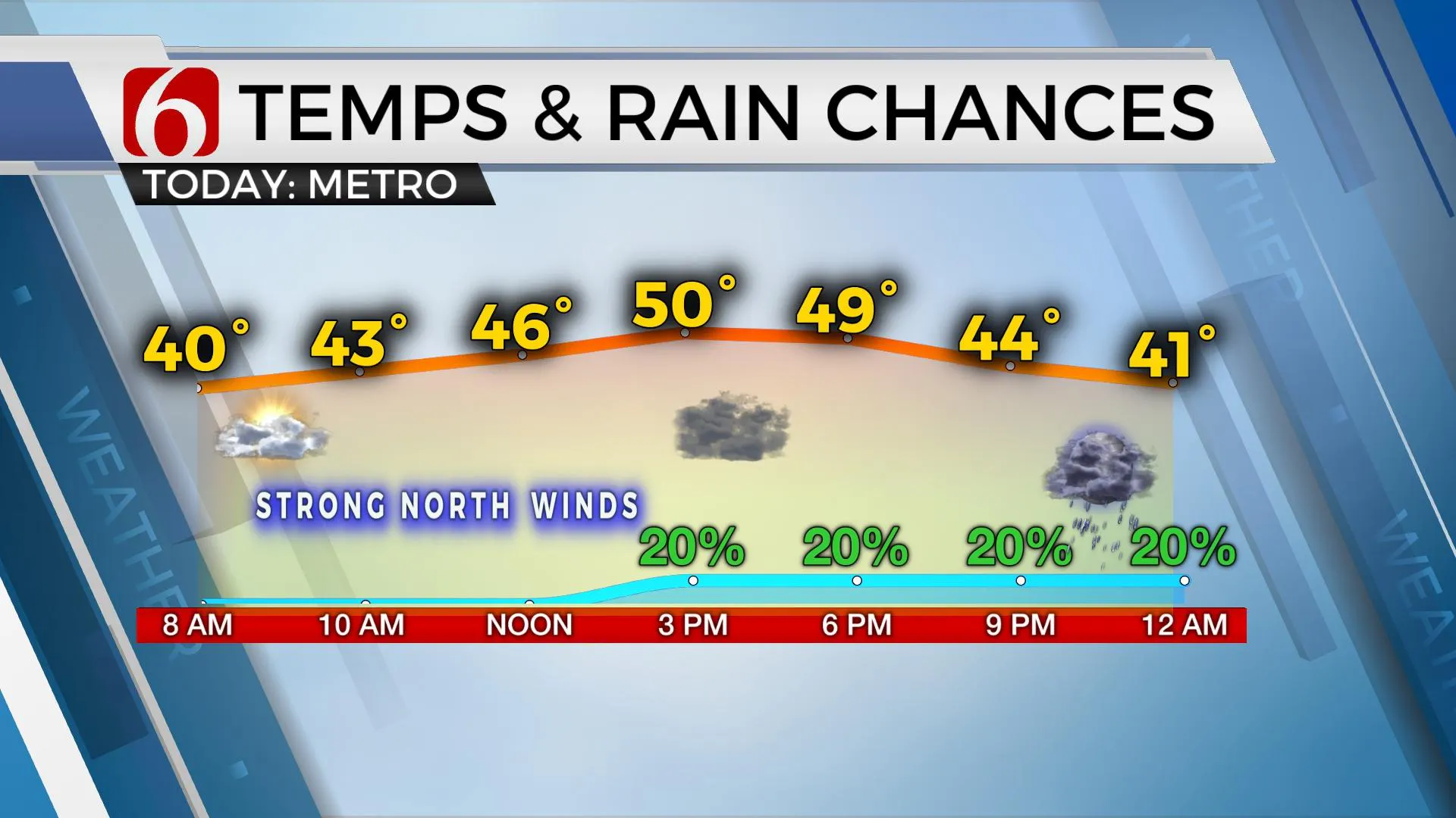
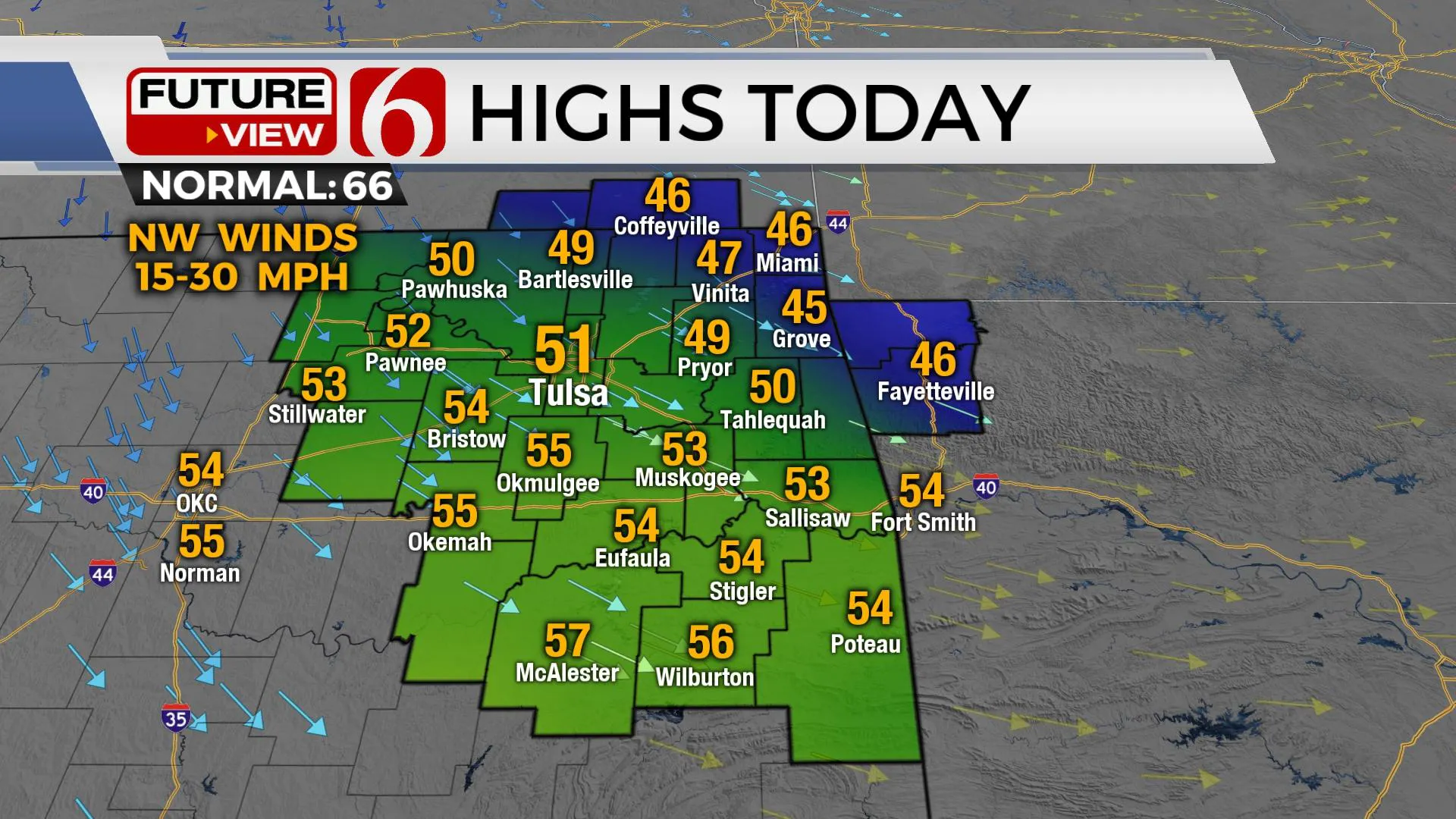
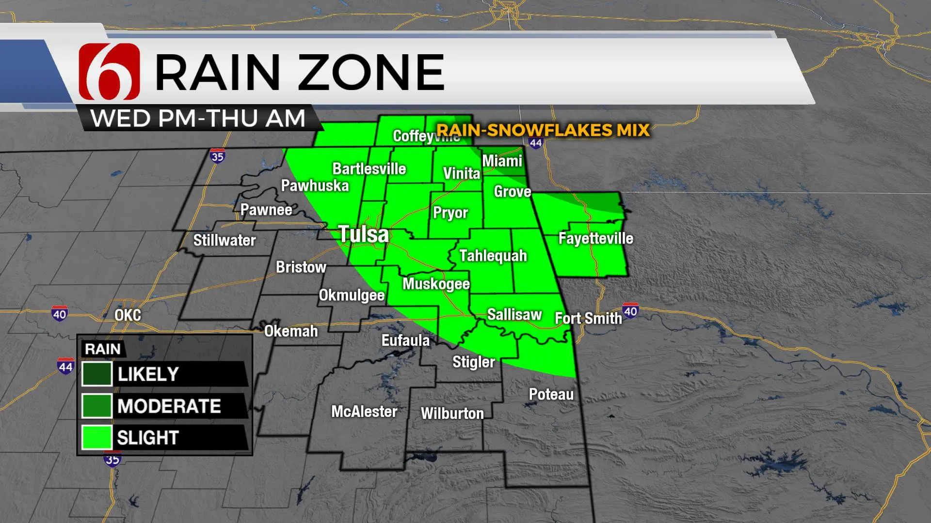
A few spotty showers or sprinkles will be possible at times on Wednesday. A few spots across southeastern Kansas may occasionally see a snowflake or two, but with no major impacts. Gusty northwest winds at 15 to 30 mph will bring blustery conditions. Locations west of the metro will have more sunshine but we’ll see another mostly cloudy day near and east of Tulsa for most of the period. Afternoon highs will reach the upper 40s and lower 50s across Northern Oklahoma with locations south of the metro reaching the lower to mid-50s. The main upper-level system will continue to move eastward, but another small disturbance aloft drops across the southern plants later Wednesday night. This brings another low chance for a small shower later Wednesday night across far northern Oklahoma and southern Kansas. A few locations across northwestern Arkansas could even see some snowflakes early Thursday morning.

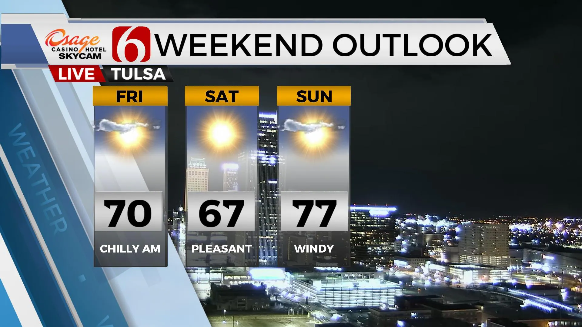
Chilly temperatures will remain on Wednesday, but we make some progress Thursday with more sunshine in the mix. Thursday morning temperatures start into the upper 30s and finish with upper 50s and lower 60s with north winds at 10 to 20 mph. Friday morning starts in the mid-30s with cooler temperatures in the valleys. Afternoon highs will reach near 70 with a weak front bringing north winds at 10 to 20 mph.

Our weekend weather looks good. Daytime highs Saturday will reach the mid to upper 60s with sunshine and only a few clouds. Gusty south winds return Sunday and Monday at 20 to 30 mph with afternoon highs Sunday in the upper 70s. Lower 80s are likely Monday with partly cloudy sky along with the gusty south winds.

Early next week another strong upper-level system is expected to develop across part of the southern plains states. Differences and model data create a slightly low confidence for Tuesday and Wednesday, but another front is expected near the area with eventually shower and storm chances returning. One set of data suggests severe weather threats will be increasing, another indicates stronger to severe parameters will again be slightly south of our area. Stay tuned!

Thanks for reading the Wednesday morning weather discussion and blog.
Have a super great day!
Alan Crone
KOTV
If you’re into podcasts, check out my daily weather update below. Search for NewsOn6 and ‘Weather Out The Door’ on most podcast providers, including Spotify, Stitcher, Tune-In and down below on Apple.

More Like This
March 23rd, 2022
June 21st, 2023
June 19th, 2023
June 13th, 2023
Top Headlines
December 14th, 2024
December 14th, 2024
December 14th, 2024
December 14th, 2024


