Pleasant Early Week Pattern Before Late Week Storm Chances
Clear skies and a cool north breeze are expected on Monday before shower chances return later this week.Monday, April 25th 2022, 6:25 am
TULSA, Oklahoma -
Clear skies and a cool north breeze are expected on Monday before shower chances return later this week.
Here are the details from News On 6 Meteorologist Alan Crone:

The system that brought active weather this weekend continues to quickly exit the area Monday morning. A surface ridge of high pressure brings pleasant conditions both Monday and Tuesday. North winds around 12 to 22 mph will be likely on Monday but we should have more of a break in the wind tomorrow. We’ll see a few clouds and sunshine today and a mostly sunny sky Tuesday. Temps will remain below seasonal averages for the next two days before the pattern brings warmer and windy weather into the area midweek and this weekend. A series of upper-level systems and a surface front will bring storm chances back to the state Thursday and continue through part of the weekend.

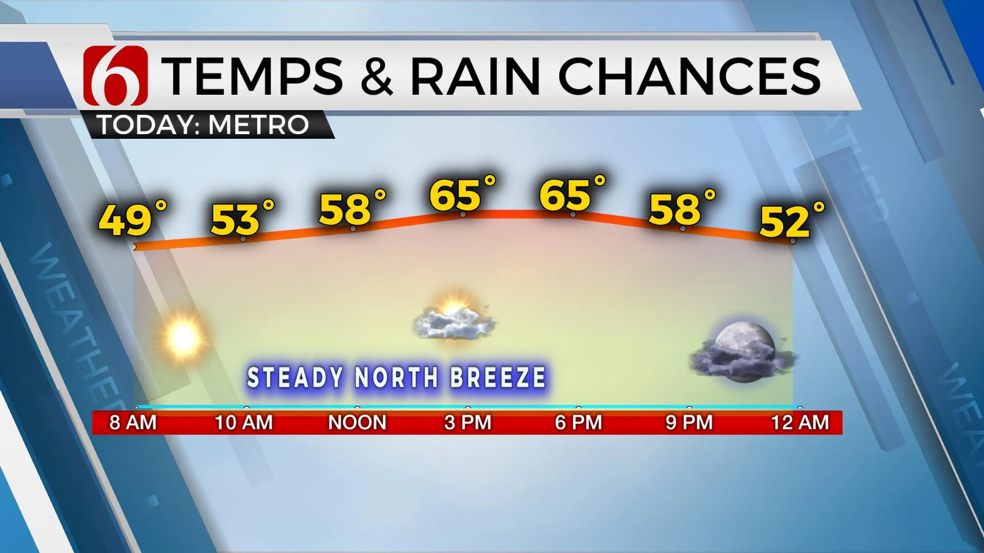
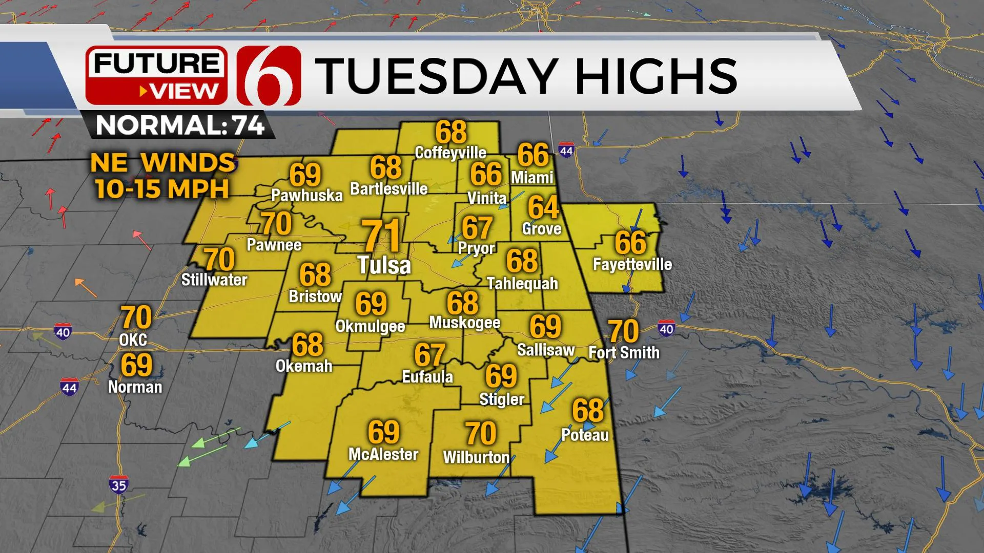
Temps on Monday will start in the mid-40s and return with afternoon highs in the mid-60s with north winds and abundant sunshine. Wind speeds are expected in the 12 to 22 mph range for most of the day with a few gusts near 25 mph. A big break from the very windy weather we've been experiencing for the past month occurs tomorrow as the surface ridge remains nearby. Tuesday morning lows in the metro will be in the lower 40s, but some valley locations may drop into the upper 30s for a small period early Tuesday. The afternoon features sunshine and highs in the upper 60s and lower 70s with north winds near 10 mph. Above seasonal average, temps return for the end of the week with afternoon highs in the mid to upper 70 Wed and Thu and into the lower 80s Friday.

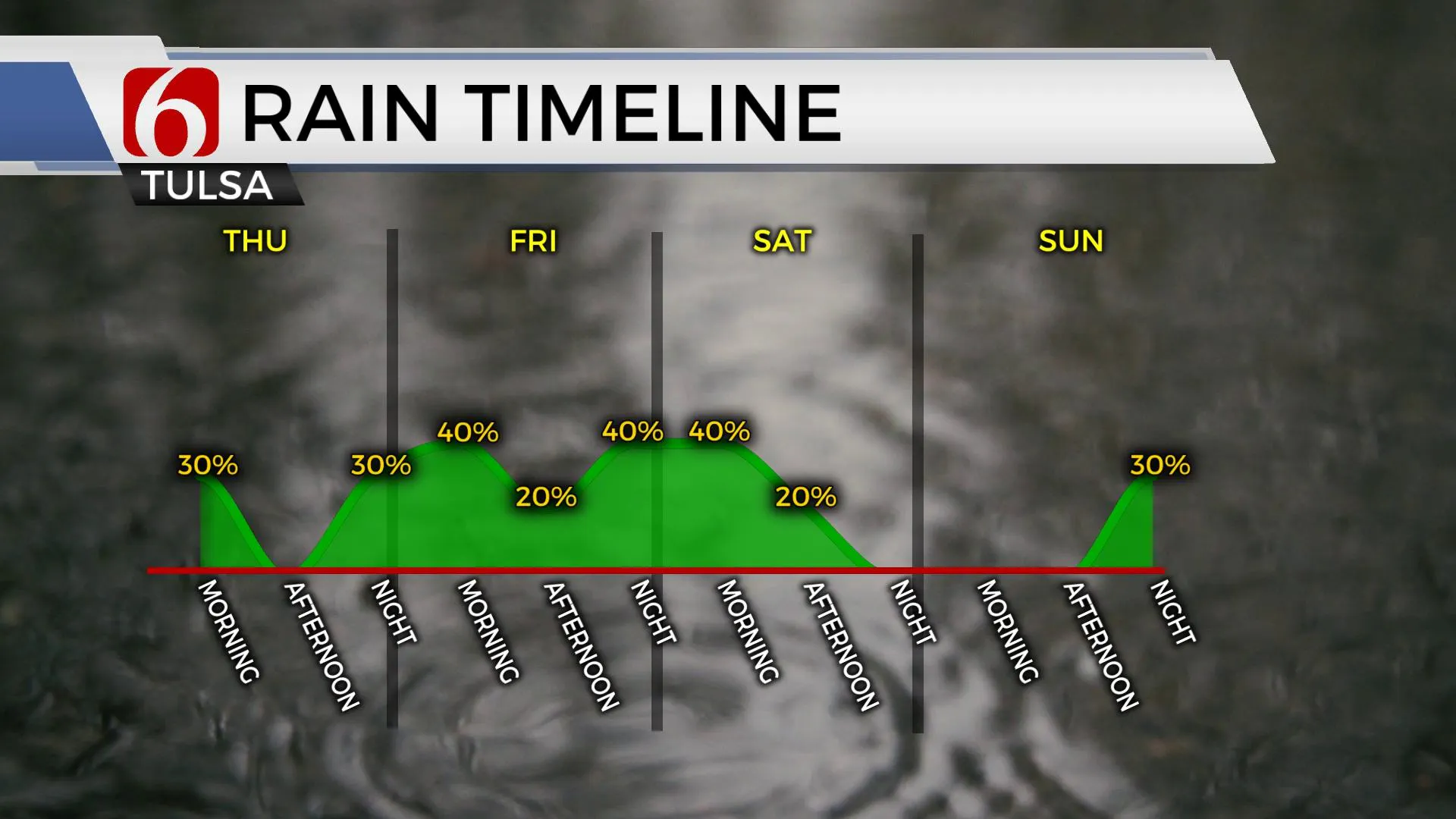
The first potential for a few storms arrives Thursday morning across northern OK. But higher chances will appear late Thursday night into Friday morning and late Friday night into Saturday morning. The upper airflow will be more conducive to severe weather threats by the end of the week. We’ll have more specifics regarding the late-week system tomorrow.
Thanks for reading the Monday morning weather discussion and blog.
Have a super great day!
Alan Crone
KOTV
If you’re into podcasts, check out my daily weather update. Search for NewsOn6 and ‘Weather Out The Door’ on most podcast providers, including Spotify, Stitcher and Tune-In, or Click Here to listen on Apple Podcasts.
More Like This
April 25th, 2022
June 21st, 2023
June 19th, 2023
June 13th, 2023
Top Headlines
December 14th, 2024
December 14th, 2024
December 14th, 2024
December 14th, 2024


