Above Normal Temperatures Remain
The heat and humidity continue underneath clear summer skies on Tuesday.Tuesday, June 14th 2022, 6:14 am
TULSA, Oklahoma -
The heat and humidity continue underneath clear summer skies on Tuesday.
Here are the details from News On 6 Meteorologist Alan Crone:

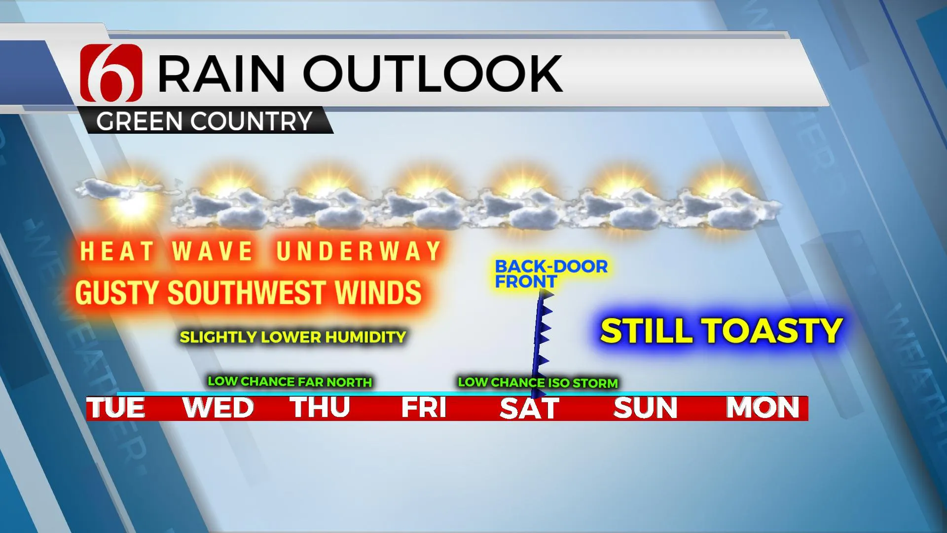
The mid-level ridge of high pressure will migrate eastward over the next few days before returning to the southern plains this weekend. As the ridge moves east, a strong trough across the pacific northwest will eject into the northern plains and southern Canada. A small disturbance will round the base of this trough and help to drive a weak surface boundary southward near the OK-KS state line region for the midweek period. A very low chance for a few scattered storms will remain possible near this region Wednesday night into Thursday morning. A weak back-door wind shift (easterly wave) will also be possible Friday into Saturday with minor changes to sensible weather. We may have one or two isolated storms Saturday, but the chance remains very low.

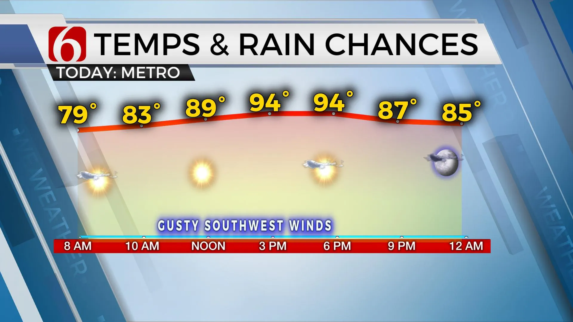
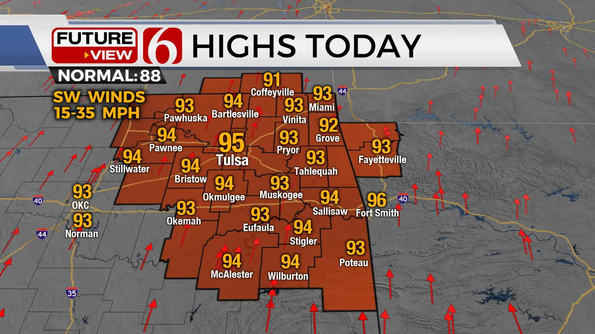
Temps will remain well above normal for the next few days, but not nearly as high as this past weekend. Low level moisture will slowly reduce and should allow for slightly lower heat index values, but these values will remain over 100 for the next few days. This will keep most of the area out of any heat advisory or excessive heat warning criteria today and Wednesday. Gusty southwest winds are likely again today and tomorrow before wind speeds relax some into the end of the week.

Thanks for reading the Tuesday morning weather discussion and blog.
Have a super great day!
Alan Crone
KOTV
If you’re into podcasts, check out my daily weather update. Search for NewsOn6 and ‘Weather Out The Door’ on most podcast providers, including Spotify, Stitcher and Tune-In, or Click Here to listen on Apple Podcasts.
More Like This
June 14th, 2022
June 21st, 2023
June 19th, 2023
June 13th, 2023
Top Headlines
December 14th, 2024
December 14th, 2024
December 14th, 2024
December 14th, 2024


