

Heat Advisories Remain With Isolated Storm Chances
Another day of hot and muggy weather is ahead as the heat wave continues.Wednesday, June 22nd 2022, 5:37 am
TULSA, Oklahoma -
Another day of hot and muggy weather is ahead as the heat wave continues.
Here are the details from News On 6 Meteorologist Alan Crone:

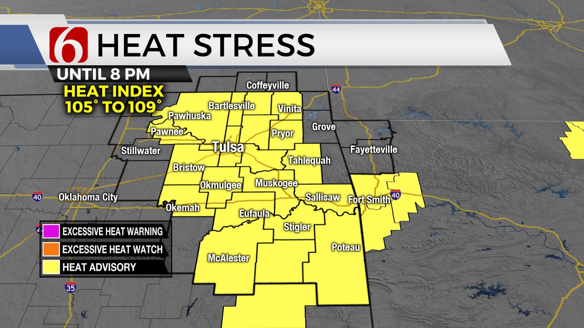
A heat advisory will be in effect on Wednesday afternoon and early evening with heat index values from 105 to 109 as temperatures range into the mid-90s with light winds. A few scattered storms will be possible into the early evening hours. The heat wave continues through the end of the week, but a cold front nears the state Sunday bringing some relief to the region.

A weak boundary will attempt to move into part of northern Oklahoma today while a disturbance moving out of the Rockies triggers a few scattered storms. These features combined with abundant low-level moisture and daytime heating will support the mention of a few storms later this afternoon into the evening hours. The coverage will be low across our part of the state, but a few more storms are likely near and west of I-35. Any storm activity early this evening may support damaging downbursts of winds with some locally heavy rainfall. The boundary is expected to slowly lift northward or even become diffuse Thursday, but a small window will remain for a few storms along the OK-Kansas state line region Thursday morning to midday. All the above will occur despite the presence of a strong mid-level ridge positioned slightly south of our immediate area today. This ridge is expected to expand Friday and Saturday bringing highs into the 99 to 102 range before a cold front brings relief from the heat Sunday into early next week.

The front is expected either late Saturday evening or early Sunday morning. Capping ahead of the front will limit storm potential but post-frontal precipitation will be possible. Higher chances Sunday morning will remain across southern Kansas. As the boundary sinks southward, additional showers or storms may develop Sunday afternoon and evening across southeastern OK. As the boundary moves southeast, eventually, drier air will arrive bringing several days of below normal temps next week.
Thanks for reading the Wednesday morning weather discussion and blog.
Have a super great day!
Alan Crone
KOTV
If you’re into podcasts, check out my daily weather update. Search for NewsOn6 and ‘Weather Out The Door’ on most podcast providers, including Spotify, Stitcher and Tune-In, or Click Here to listen on Apple Podcasts.

Get The Daily Update!
Be among the first to get breaking news, weather, and general news updates from News on 6 delivered right to your inbox!
More Like This
June 22nd, 2022

June 21st, 2023

June 19th, 2023

June 13th, 2023
Top Headlines

December 12th, 2024

December 12th, 2024

December 12th, 2024

December 12th, 2024