Gusty North Winds Bring More Fall-Like Conditions
More fall weather is expected on Wednesday.Wednesday, October 12th 2022, 8:20 am
More fall weather is expected on Wednesday.
Here are the details from News On 6 Meteorologist Alan Crone:
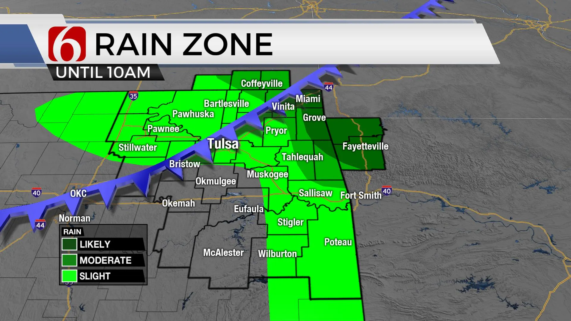
TULSA, Okla. - A cold front will rapidly advance across northeastern Oklahoma early this morning and exit early midday. The potential remains for a few scattered thunderstorms near the boundary over the next few hours, mostly across extreme northeastern Oklahoma and southern Kansas, the far eastern part of the state and extreme southeastern Oklahoma. The probability for storm activity near the metro remains low, but not zero. Stronger dynamic energy is focused slightly to the northeast, but a few stout storms will be a possibility with any activity that develops early this morning with hail and wind. Most of the region will remain dry.
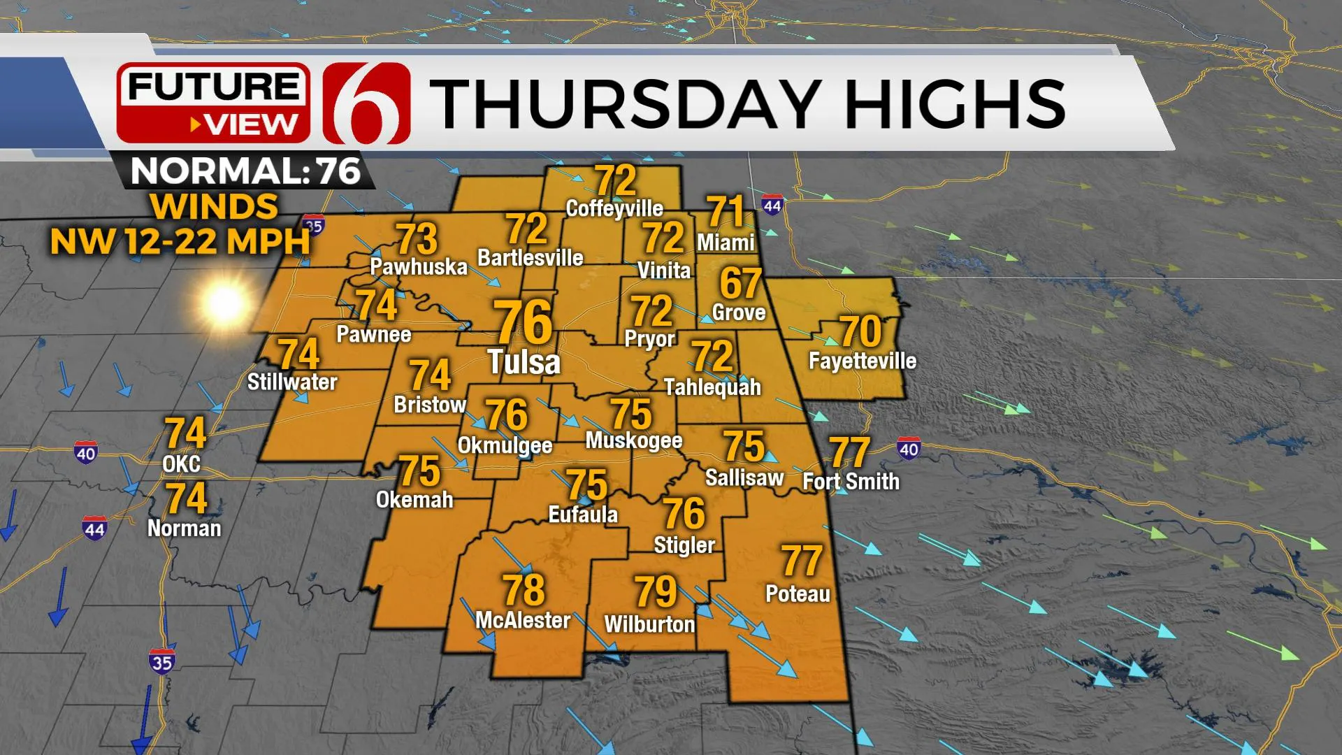
Gusty northwest winds at 15 to 30 mph will follow the frontal passage as drier low-level air moves into the region. The continuing drought and combination of low humidity and drive vegetation support another rapid fire spread both Wednesday and Thursday. Despite recent rainfall, numerous counties remain under burn bands. A second surge of cool and dry air arrives later tonight that will reinforce the gusty north winds Thursday.
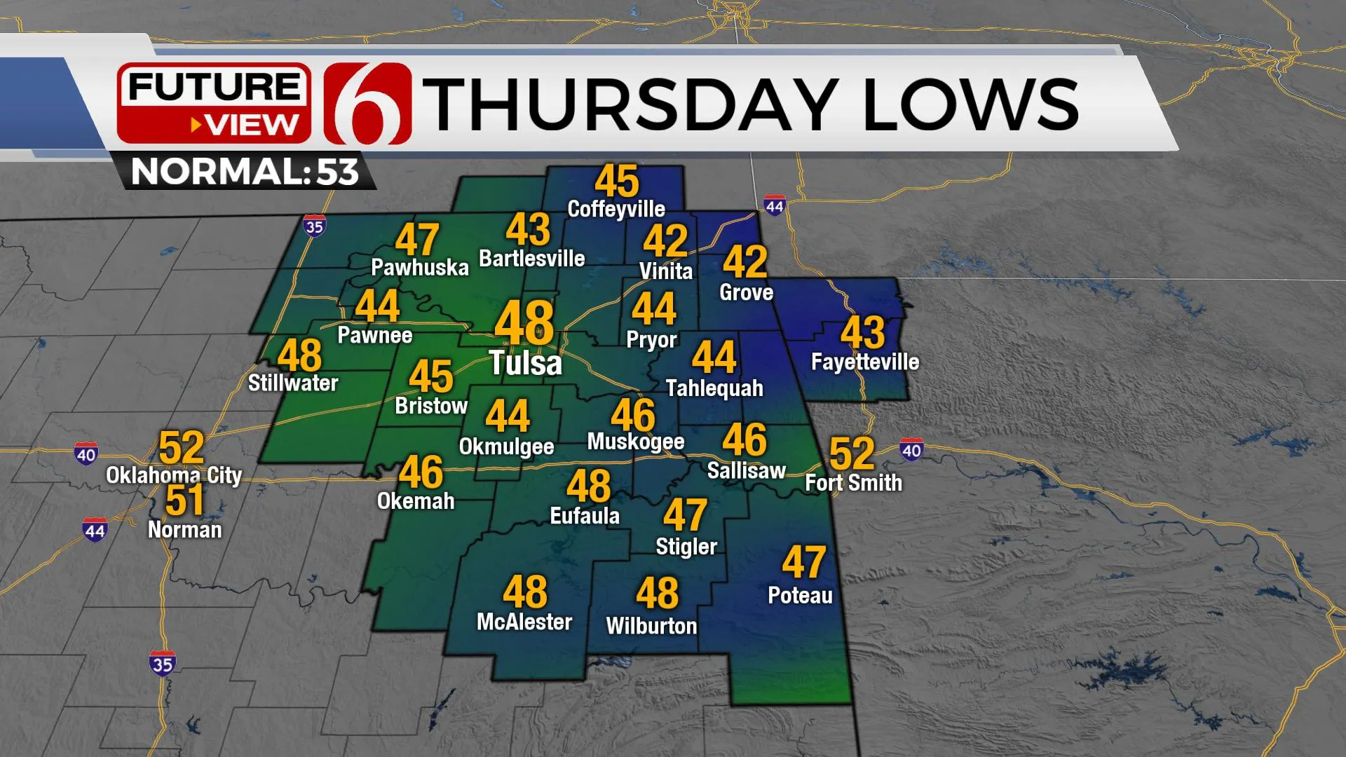
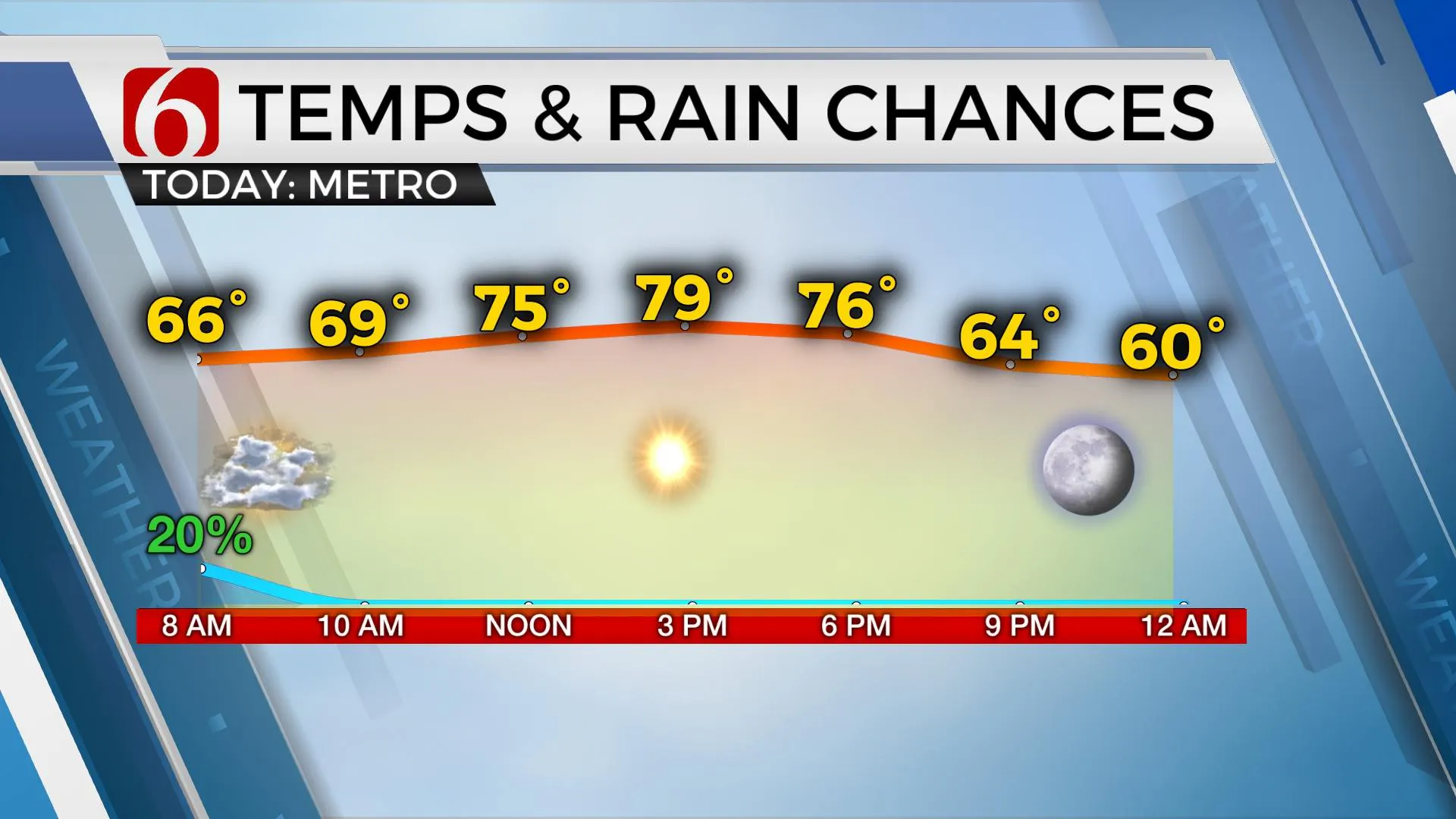
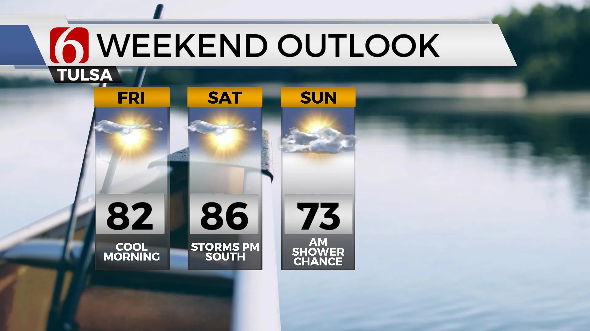
Afternoon highs today will stay in the middle to upper 70s north and lower 80s south. Thursday morning features lows in the mid to upper 40s with daytime highs in the mid-70s. Abundant sunshine is likely this afternoon, most of Thursday, and Friday. Friday morning also begins in the 40s. Daytime highs will climb into the upper 70s and lower 80s with a return of south breezes by mid-day to afternoon.
A large and deep upper-level trough will be focused upon the Great Lakes region Friday through the weekend. An area of low pressure aloft will develop in the southern stream near the Baja region and remain cut off from the upper airflow for several days into early next week. The positioning between these two features will support another frontal boundary nearing the state Saturday afternoon with a chance for some storm activity near or south of the metro. This activity may persist into Sunday morning along the Red River Valley. Cooler weather is likely early next week. I’ll have more on the cooldown on Thursday
Thanks for reading the Wednesday morning weather discussion and blog.
Have a super great Day!
Alan Crone
KOTV
More Like This
October 12th, 2022
June 21st, 2023
June 19th, 2023
June 13th, 2023
Top Headlines
December 11th, 2024
December 11th, 2024
December 11th, 2024


