A Windy And Warm Weekend Ahead
Fire danger issues will grow considerably today and continue through the weekend as strong southwest winds roll across the state.Friday, October 21st 2022, 5:35 am
TULSA, Okla. -
Fire danger issues will grow considerably today and continue through the weekend as strong southwest winds roll across the state.
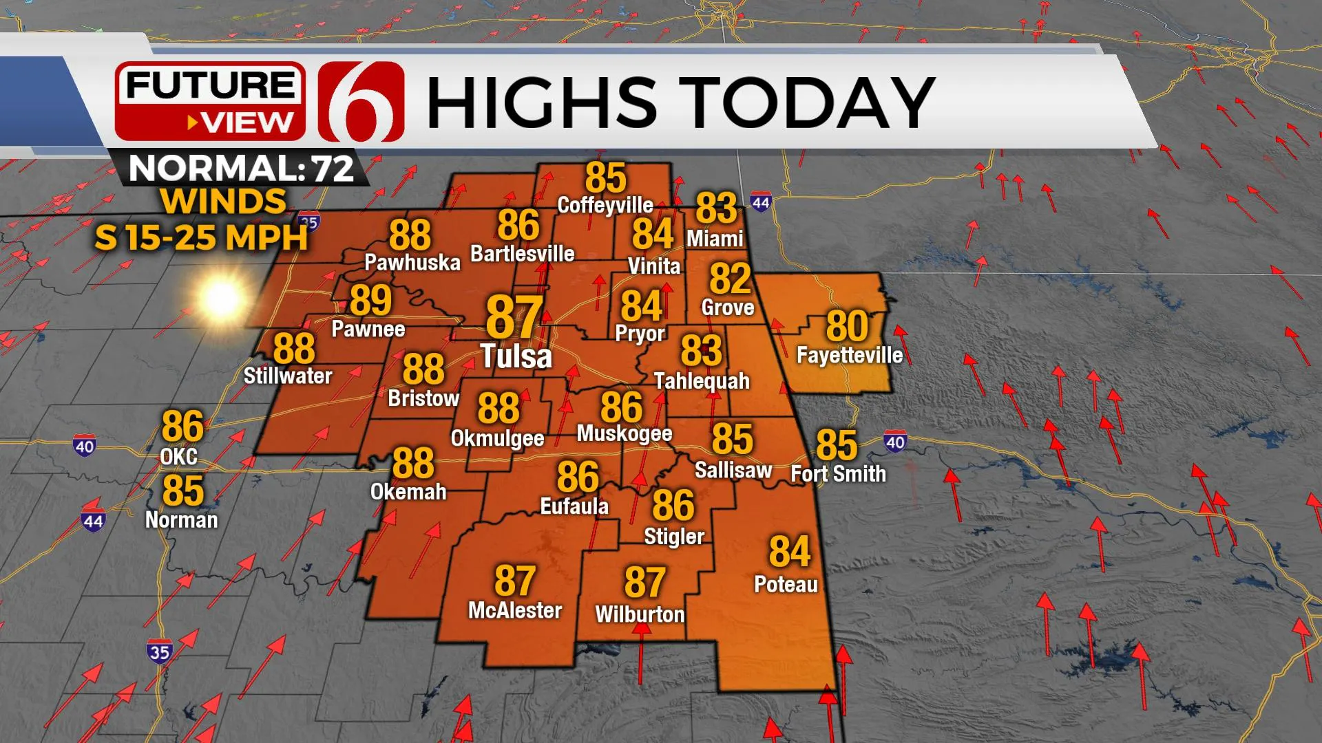
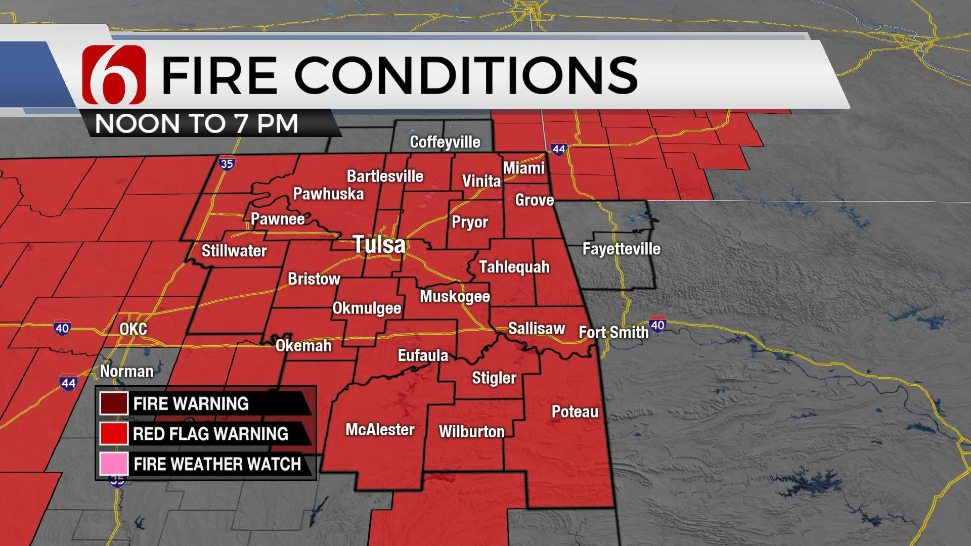
Very low relative humidity is expected this afternoon. The combination of increasing winds, drying and dormant vegetation, the worsening drought, and gusty winds have prompted a Red Flag Warning for most of the area. Any fire ignition today will spread quickly and could result in serious issues.
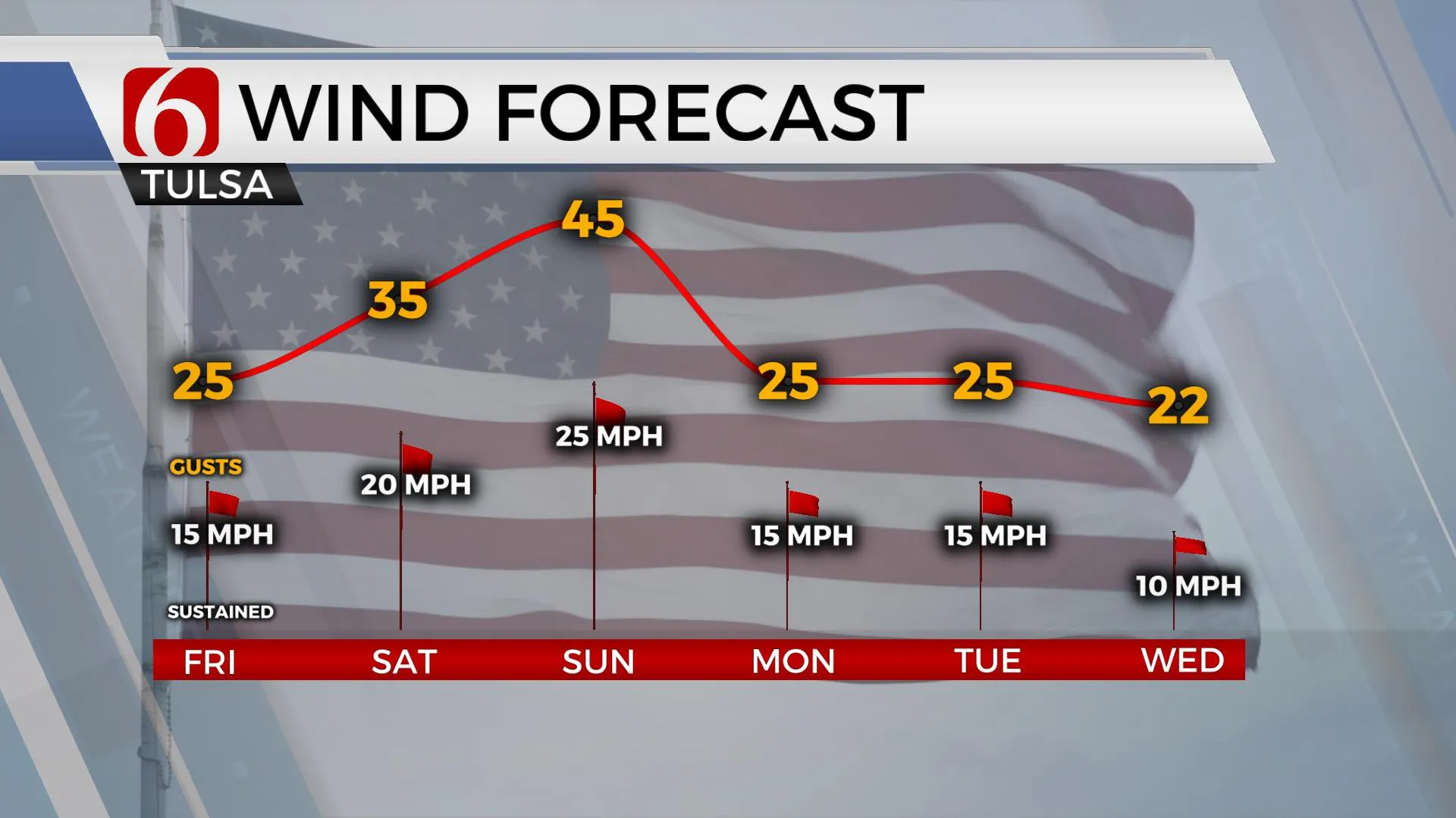
Winds will be stronger Saturday with gusts from 20 to 35 mph, with highest wind speeds Sunday from 25 to 45 mph. Low level moisture will be increasing for the 2nd half of the weekend and will mitigate some of the fire spread issues Sunday, but not much. We're entering a critically high fire danger period for the weekend.
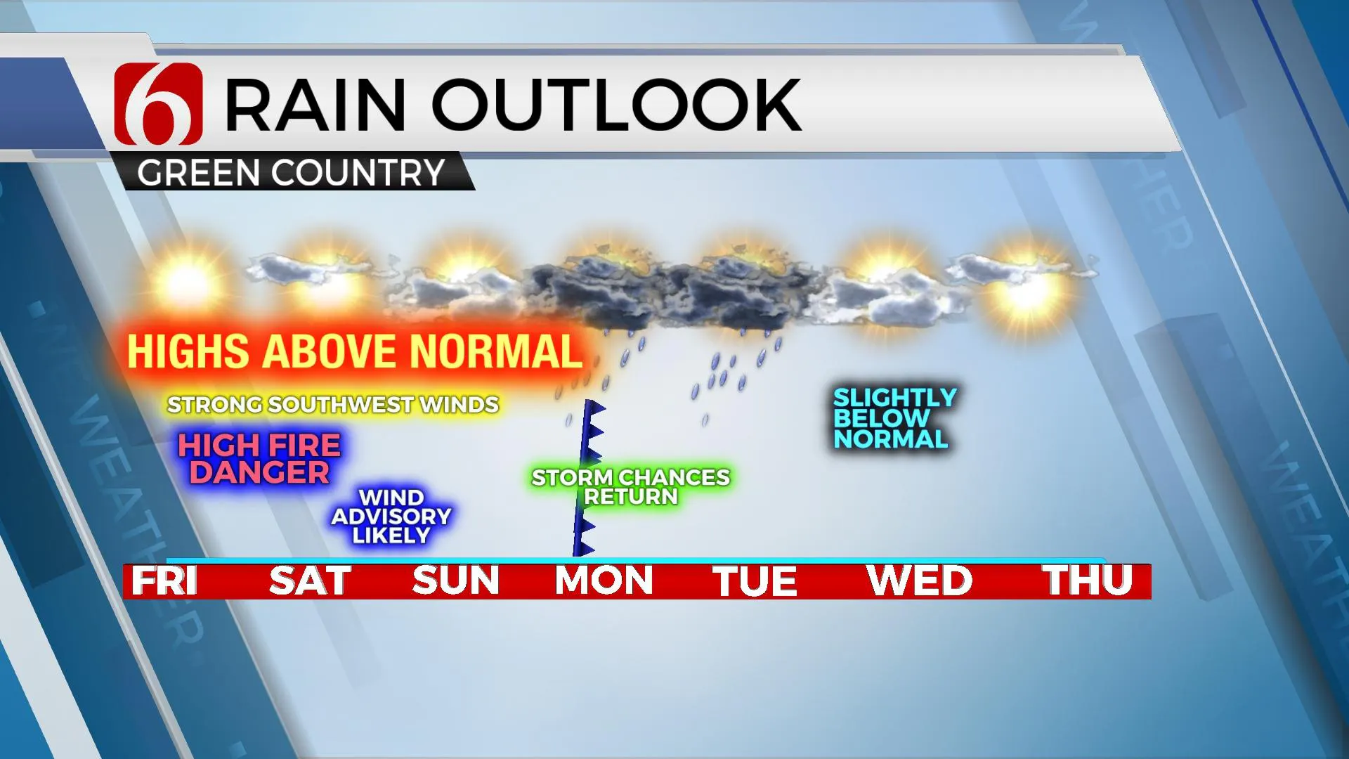
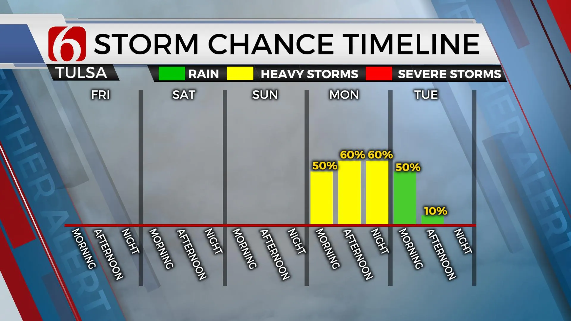
The storm system for early next week has undergone some additional and significant changes in the data. The result is a slower system, and one that should provide higher probabilities for meaningful precipitation across the area. Severe weather threats may also be increasing some due to the change in timing which will bring deeper and better moisture into the state. We'll continue with a slight chance for storms late Sunday night into Monday morning. But higher chances, nearing a likely category will arrive Monday afternoon into Tuesday as the main upper-level system approaches and moves across the state.
A surface low and cold front will also be moving across the state during these periods. This system will exit the area Tuesday evening into Wednesday with a minor cool-down Wednesday. The next system should approach the area late next week with additional storm chances.
Thanks for reading the Friday morning weather discussion and blog.
More Like This
October 21st, 2022
December 12th, 2024
December 12th, 2024
December 12th, 2024
Top Headlines
December 12th, 2024
December 12th, 2024
December 12th, 2024
December 12th, 2024


