Windy Before Late Week Storms
A warm day with some gusty winds is expected on Wednesday before more showers return to the state.Wednesday, November 2nd 2022, 8:55 am
TULSA, Okla. -
If you’re into podcasts or in a rush, check out my daily weather update. Search for NewsOn6 and ‘Weather Out The Door’ on most podcast providers, including Spotify, Stitcher and Tune-In, or Click Here to listen on Apple Podcasts.
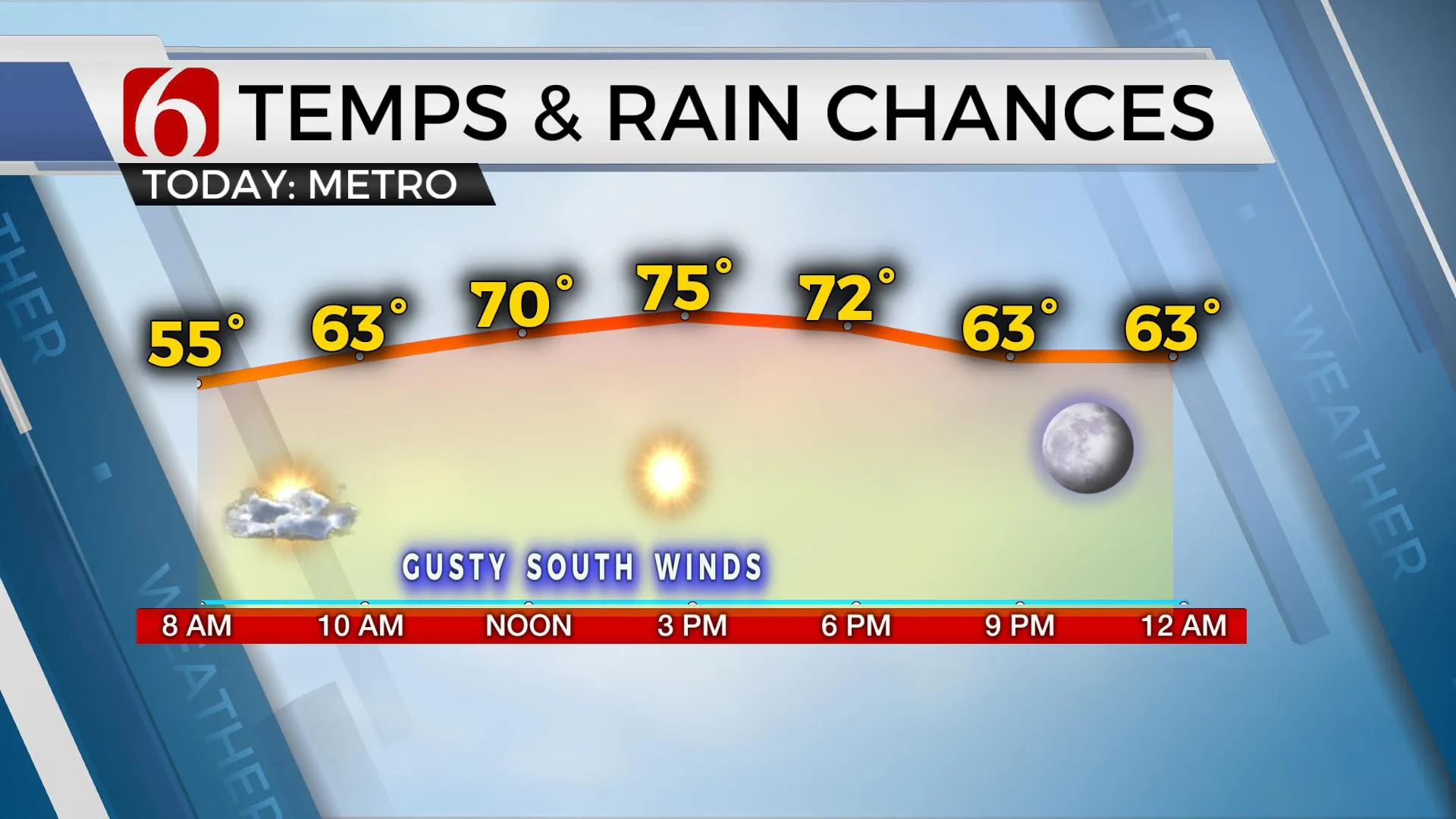
A warm day with some gusty winds is expected on Wednesday before more showers return to the state.
Here are the details from News On 6 Meteorologist Alan Crone:

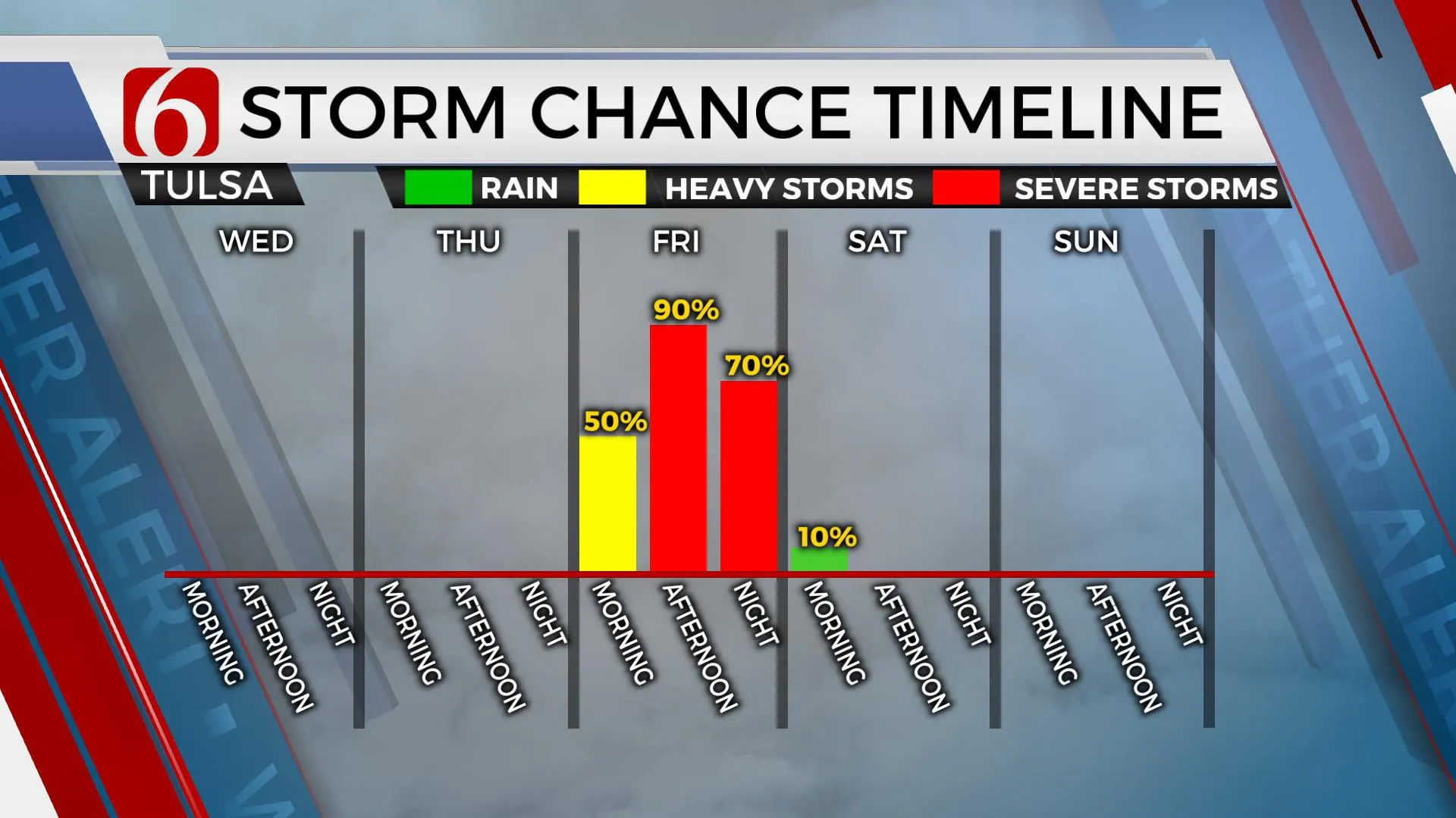
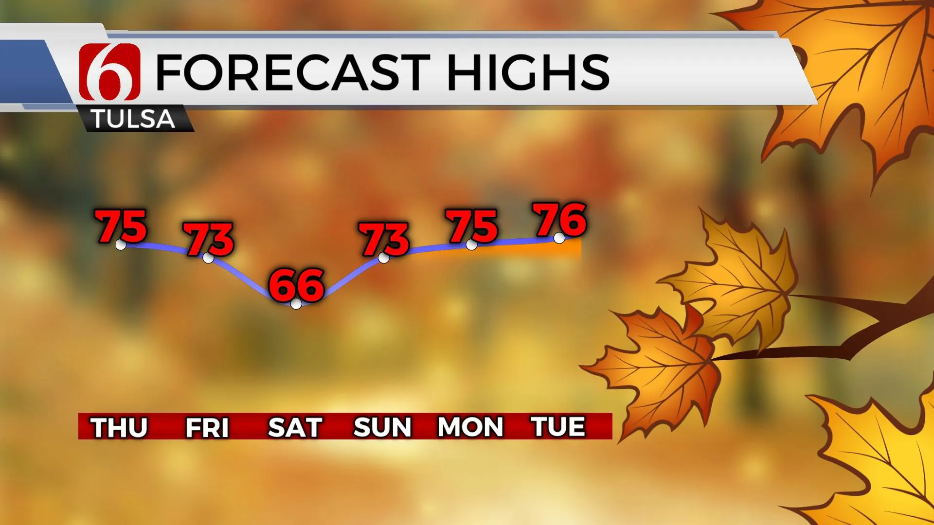
TULSA, Okla. - Gusty south winds will become more notable on Wednesday through the end of the week as our strong storm system deepens across the intermountain region. This will cause a strong pressure gradient with south winds from 15 to 30 mph Wednesday and from 20 to 35 mph Thursday and Friday. Daytime highs will max out in the mid to upper 70s for the rest of the week with additional cloud cover, more so Thursday before storm chances arrive across eastern Oklahoma. Some of the storms may be strong to severe. Heavy rainfall threats will also be possible. The system continues to be slightly more progressive in most but not all the data compared to a few days ago. This means our main window for strong to severe storms will remain mostly Friday afternoon and evening with the system quickly exiting the area pre-dawn Saturday. Due to the faster progression of the exit, we've lowered the probabilities for Saturday. The next system that was forecast for Election Day afternoon now appears slower and may not arrive until later next week.

The powerful upper-level trough will bring strong winds aloft across the area Thursday night into Friday morning and Friday evening into Saturday morning. Severe weather parameters will be possible Thursday afternoon and evening across the western half of the state, especially over northwestern OK where all modes of severe weather threats will be possible. Some of these storms will move eastward and should arrive near or just east of I-35 Friday morning to midday. Despite the early morning period, due to the strong shear values, a few severe storms will be possible. After the morning hours, we may see a relative break through midday before additional storms develop near I-35 Friday afternoon and move east by the evening. This will represent the highest likelihood for storms, including severe threats and heavy rainfall. Deeper moisture and higher surface instabilities are likely across north central Texas, but stronger shear values rolling across northeastern OK will support damaging winds and possibly a few embedded circulations along the leading edge of thunderstorms. After early Saturday morning, dry and breezy weather is likely Saturday with highs in the mid 60sd. Sunday supports a return to south winds and highs in the lower 70s.

Thanks for reading the Wednesday morning weather discussion and blog.
Have a super great day!
Alan Crone
KOTV
More Like This
November 2nd, 2022
December 12th, 2024
December 12th, 2024
December 12th, 2024
Top Headlines
December 12th, 2024
December 12th, 2024
December 12th, 2024
December 12th, 2024


