Southwest Winds Return Before A Strong Arctic Front Arrives
More chilly weather is expected to arrive in Green Country on Thursday.Thursday, November 17th 2022, 6:50 am
TULSA, Okla. -
If you’re into podcasts or in a rush, check out my daily weather update. Search for NewsOn6 and ‘Weather Out The Door’ on most podcast providers, including Spotify, Stitcher and Tune-In, or Click Here to listen on Apple Podcasts.
More chilly weather is expected to arrive in Green Country on Thursday.
Here are the details from News On 6 Meteorologist Alan Crone:

Southwest winds return on Thursday with highs in the lower to mid-50s before a strong front enters the area Thursday night, bringing much colder weather across the state Friday and part of the weekend. A few areas of flurries or light snow remain possible with no significant impacts anywhere across our immediate area of concern. No watches, warnings, or advisories will be required for this low chance of flurries or periods of light snow. Bitterly cold weather is expected Friday with a gradually improving temperature forecast early next week.

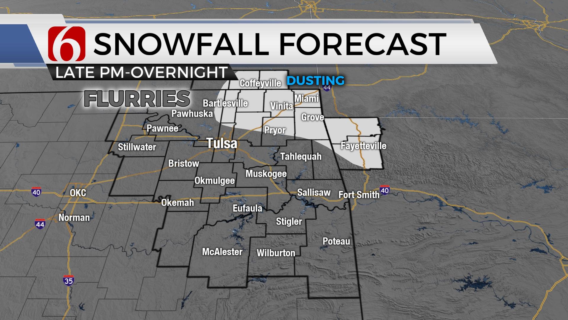
A strong arctic front arrives Thursday evening bringing frigid conditions Friday and most of Saturday. Temperatures will drop into the 30s later Thursday night with strong northwest winds from 20 to 30 mph as the front passes your area. The airmass is expected to stratify with mostly cloudy conditions behind the front. The latest data suggests an area of light snow is possible Thursday evening and overnight across far northeastern Oklahoma, southeastern Kansas and northwestern Arkansas where a dusting of snow is possible. Another mid-level wave approaches the area Friday evening. Moisture will be limited but this type of pattern and air mass can produce light snow or flurries. It's possible that a few locations may see a minor dusting of light and dry snow. While the probability of some snow will need to be included, no significant or impactful precipitation is expected. Therefore, we'll keep the chances only near 20%.

Friday morning lows will be in the upper 20s north and lower 30s south with the cloudy sky and northwest winds from 15 to 25 mph. The higher impact with this system will be the bitterly cold weather Friday.
Daytime highs Friday may stay near or slightly above freezing. Some locations may see record-high cold temperatures. As the above-mentioned disturbance (mid-level front) tracks south, clouds will clear from the north to south Saturday morning bringing very cold Saturday morning lows. The Tulsa metro will start near 23 to 25 Saturday morning while outlying areas drop into the teens. Locations near and south of I-40 will expect morning lows in the lower to mid-20s. The shallow and cold air will remain but modify Saturday afternoon with highs in the mid-40s north and upper 40s south. By Sunday, the shallow air will mix and modify more as southwest winds return and afternoon highs reach the lower 50s. We'll experience highs in the mid to upper 50s early next week before the next stronger system nears by Thanksgiving.

The data has not been consistent regarding the synoptic scale features for late next week but seems to be converging in the last few runs with a system nearing Wednesday and Thursday. Thermal profiles currently do not support wintry weather.
Thanks for reading the Thursday morning weather discussion and blog.
Have a super great day!
Alan Crone
KOTV

Get The Daily Update!
Be among the first to get breaking news, weather, and general news updates from News on 6 delivered right to your inbox!
More Like This
November 17th, 2022

June 21st, 2023

June 19th, 2023

June 13th, 2023
Top Headlines


July 26th, 2024


July 26th, 2024
