A Pattern Change Into Early Next Week
The upper air trough responsible for the recent storms and yesterday's blustery weather has exited to our east this morning.Friday, February 17th 2023, 5:50 am
TULSA, Okla. -
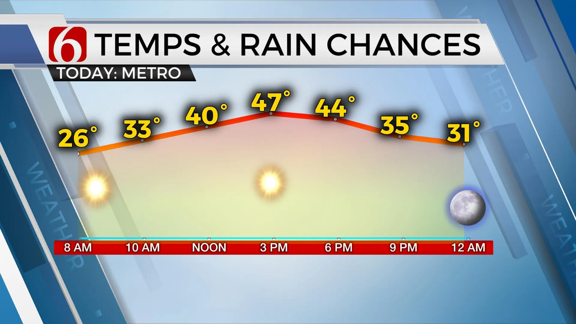
The upper air trough responsible for the recent storms and yesterday's blustery weather has exited to our east this morning. A surface ridge of high pressure to our southwest brings mostly light winds and sunshine today after very cold morning temps in the 20s reach afternoon highs in the upper 40s. The surface ridge will transit away from the area this weekend while a series of upper-level waves will influence our pattern.
The first arrives from the southwest Saturday. This brings additional clouds across the state with some sunbreaks, but the lower level of the atmosphere should remain too dry for any measurable precipitation with this disturbance. 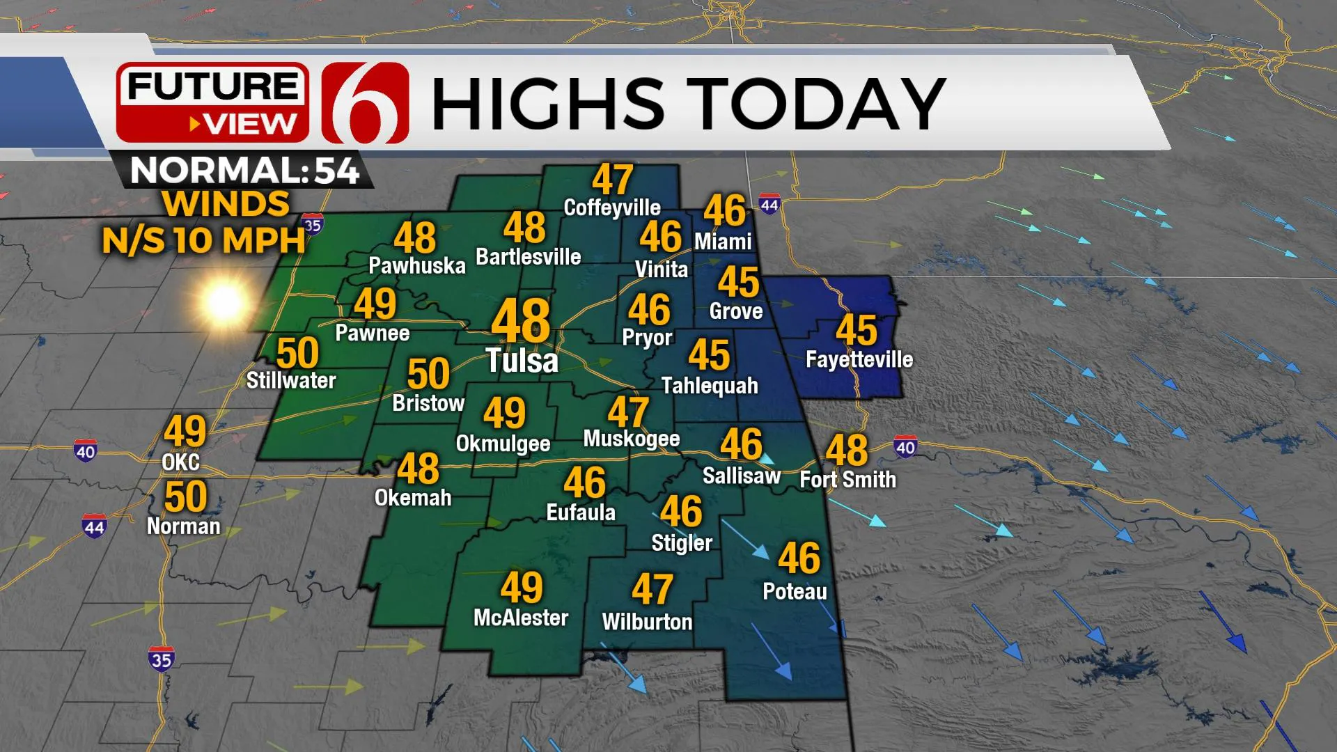
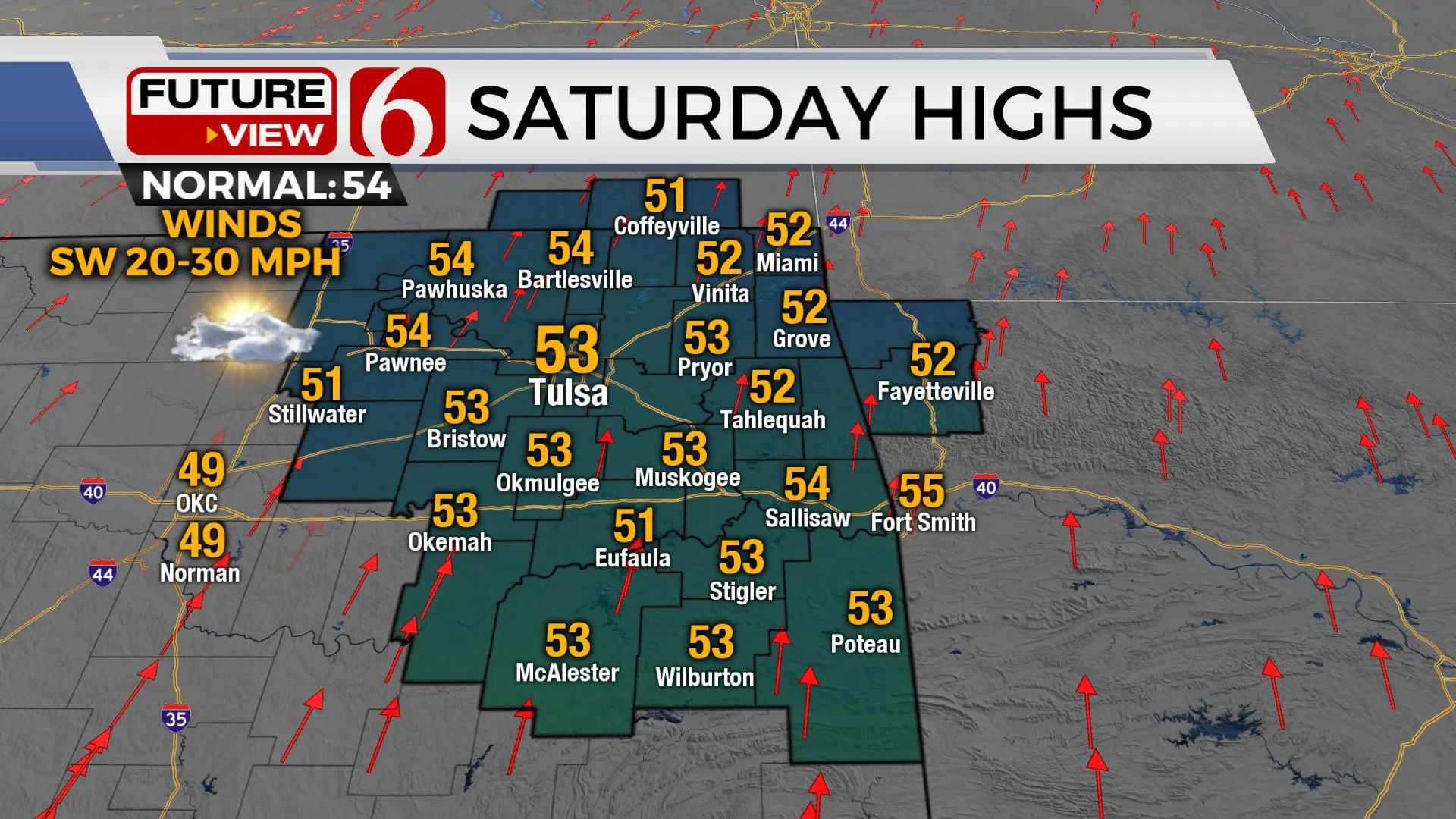
A few sprinkles may survive the trip from the cloud base to the surface Saturday but most of this will be virga. Saturday morning lows in the lower 30s will be followed by afternoon highs in the upper 40s to lower 50s.
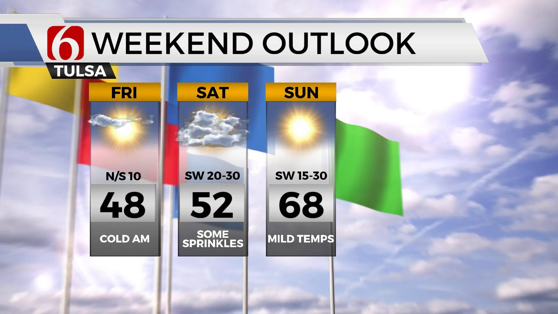
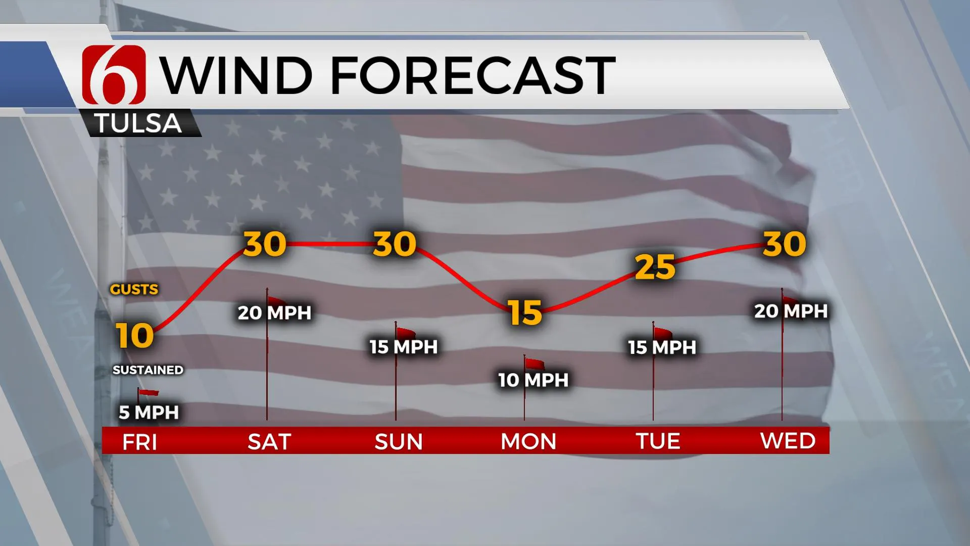
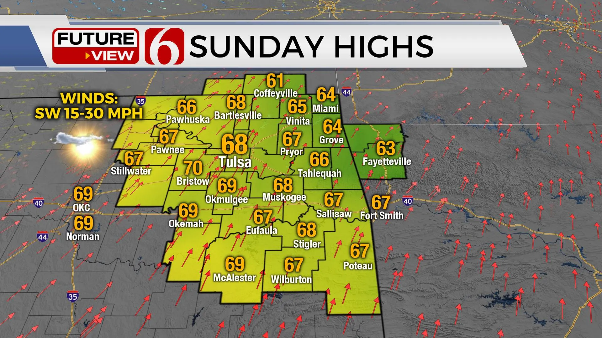
Despite the mid-level wave moving across the area Saturday, surface pressures will fall as a stronger trough develops to our northwest. This will aid in the creation of gusty southwest winds Saturday from 20 to 30 mph. These gusty winds will also remain Sunday but with more sunshine and warmer weather with afternoon highs reaching the mid to upper 60s.
Early next week a complicated and active upper air pattern evolves that eventually brings a cold front and increasing opportunities for precipitation. A moderately strong upper trough will dive southeast from Canada into the Midwest Monday in the northern stream while a quasi-cut-off low near Baja, Mexico will begin moving east in the southern stream.
A surface front may briefly nudge into northern Oklahoma Sunday evening or early Monday before moving northward as the cut-off low gets a kick east. This should keep the southern plains and most of Oklahoma breezy and above normal both Monday and Tuesday before the system brings increasing rain and thunder chances Wednesday. The surface front will again move south and should cross the state either Wednesday or early Thursday. This will initially bring cooler air, but no significant cold air mass is likely to follow initially.
Thanks for reading the Friday morning weather discussion and blog. Have a super great day!
More Like This
February 17th, 2023
December 14th, 2024
December 14th, 2024
December 14th, 2024
Top Headlines
December 14th, 2024
December 14th, 2024
December 14th, 2024
December 14th, 2024


