

Storm Chances Increasing This Weekend
Another day of warm weather is ahead.Wednesday, June 7th 2023, 5:49 am
If you’re into podcasts or in a rush, check out my daily weather update. Search for NewsOn6 and ‘Weather Out The Door’ on most podcast providers, including Spotify, Stitcher and Tune-In, or Click Here to listen on Apple Podcasts.
TULSA, Okla. - Another day of warm weather is ahead.
Here are the details from News On 6 Meteorologist Alan Crone:
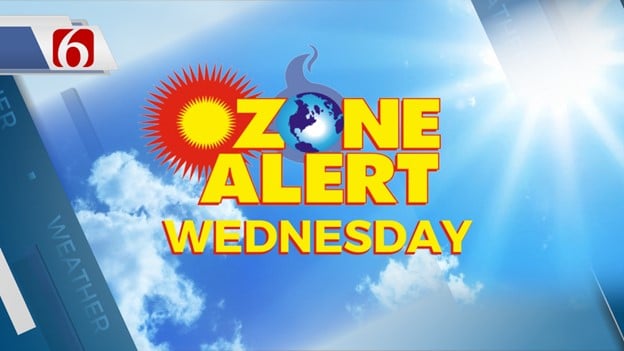
Our pattern will continue with another chance for a few pop-up thunderstorms later on Wednesday afternoon. Afternoon highs are expected in the upper 80s and lower 90s with a mostly sunny morning before a few clouds arrive in the mix through the afternoon. North winds near 5 to 12 mph will remain. Another Ozone Alert will be required for the Tulsa metro region on Wednesday. A weak front will approach from the Missouri Valley Thursday afternoon and evening but should become diffuse as it approaches northeastern Oklahoma. A few showers of storms may develop near or slightly behind this feature Thursday. Temperatures on Thursday will continue to be warm, with morning lows in the upper 60s and daytime highs in the lower 90s. The upper air pattern will be changing Friday through the weekend, resulting in higher chances for more organized thunderstorms across part but not all the region.
A mid-level ridge of high pressure currently centered across the central US will begin weakening over the next 24 hours. The broad upper air trough positioned across the Great Lakes will remain with a northerly flow developing between these two features. To our west, a broad area of low pressure remains across the desert Southwest and will begin slowly ejecting to the Northeast this weekend. This pattern will bring increasing rain and storm chances for part of the region, especially during the late night and early morning hours this weekend. Another cold front is expected to move through the Midwest and approach northern Oklahoma Sunday morning. The exact location of higher probabilities with this storm system will be refined over the next day, but thunderstorm chances will remain late Saturday night and early Sunday morning. As the front moves southward, this will bring north winds at 10 to 25 mph and a minor reduction in temperature Sunday with afternoon highs in the lower 80s. North winds should remain Monday, with morning lows in the lower 60s and daytime highs also in the lower 80s. The area of low pressure to our west this weekend brings strong upper air flow across the central and southern Plains early next week. As this feature approaches the state, showers and storms will be possible late Monday night into early Tuesday morning as South winds and low-level moisture surge across the area. The upper air flow is very strong and could spark strong and severe thunderstorms during this period. As this feature moves away from our area Tuesday night into early Wednesday, most data support a robust warming trend through the end of next week with afternoon highs reaching the lower to mid-90s.
Thanks for reading the Wednesday morning weather discussion and blog.
Have a super great day!
Alan Crone
KOTV

Get The Daily Update!
Be among the first to get breaking news, weather, and general news updates from News on 6 delivered right to your inbox!
More Like This
June 7th, 2023

December 11th, 2024

December 11th, 2024

December 11th, 2024
Top Headlines

December 11th, 2024

December 11th, 2024
December 11th, 2024
December 11th, 2024