

Freezing Drizzle Arrives Behind Bitter Cold Front
<p>Ready or not - it's here. The cold front arrived and temperatures have plummeted with biting cold expected for the rest of the day. Drizzle and freezing drizzle are possible through the early afternoon. </p>Thursday, January 11th 2018, 1:13 pm


Ready or not - it's here. The cold front arrived and temperatures have plummeted with biting cold expected for the rest of the day.
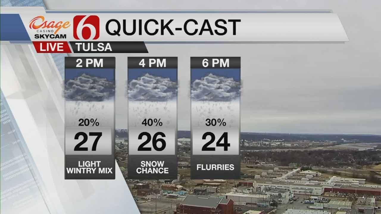
Drizzle and freezing drizzle have also arrived behind the cold front through the early afternoon. Some locations will see a change-over to possible sleet then light snow as colder air settles in.
A light band of snow is still expected to move across eastern Oklahoma late this afternoon and evening. Accumulation will be very light but it could be enough for slick spots. Elevated surfaces, bridges and overpasses should be watches especially.
Winds are gusting around 25 to 35 mph. Wind chill values will be in the teens for the metro this afternoon and single digits up to the northwest.
The City of Tulsa has applied pretreatment for pavement on hills, bridges and overpasses. They'll be monitoring the weather to see how the storm comes in with salt trucks ready if needed.
Broken Arrow Streets Department said they'll be training newer staff members on Broken Arrow's snow routes, so you may see snow plows out regardless of precipitation. It's part of their effort to monitor and respond to weather conditions.
Very cold air will stick around through the weekend.
Morning wind chills will be in the single digits. Stubborn cold air will also be around until the middle of next week before it starts to warm up.


Stacia Knight
Growing up next door to Green Country in southeast Kansas, Stacia Knight quickly became familiar with the always-changing Oklahoma weather.

Get The Daily Update!
Be among the first to get breaking news, weather, and general news updates from News on 6 delivered right to your inbox!
More Like This
January 11th, 2018

January 2nd, 2025

September 29th, 2024

September 17th, 2024
Top Headlines


March 13th, 2025

March 13th, 2025