Tracking A Cold Front Across Northern Oklahoma
<p>A front will arrive today and tonight with a chance of showers and storms for portions of the area. A few may also remain possible early this morning through midday across southern Kansas and part of northern OK. </p>Tuesday, August 22nd 2017, 4:03 am
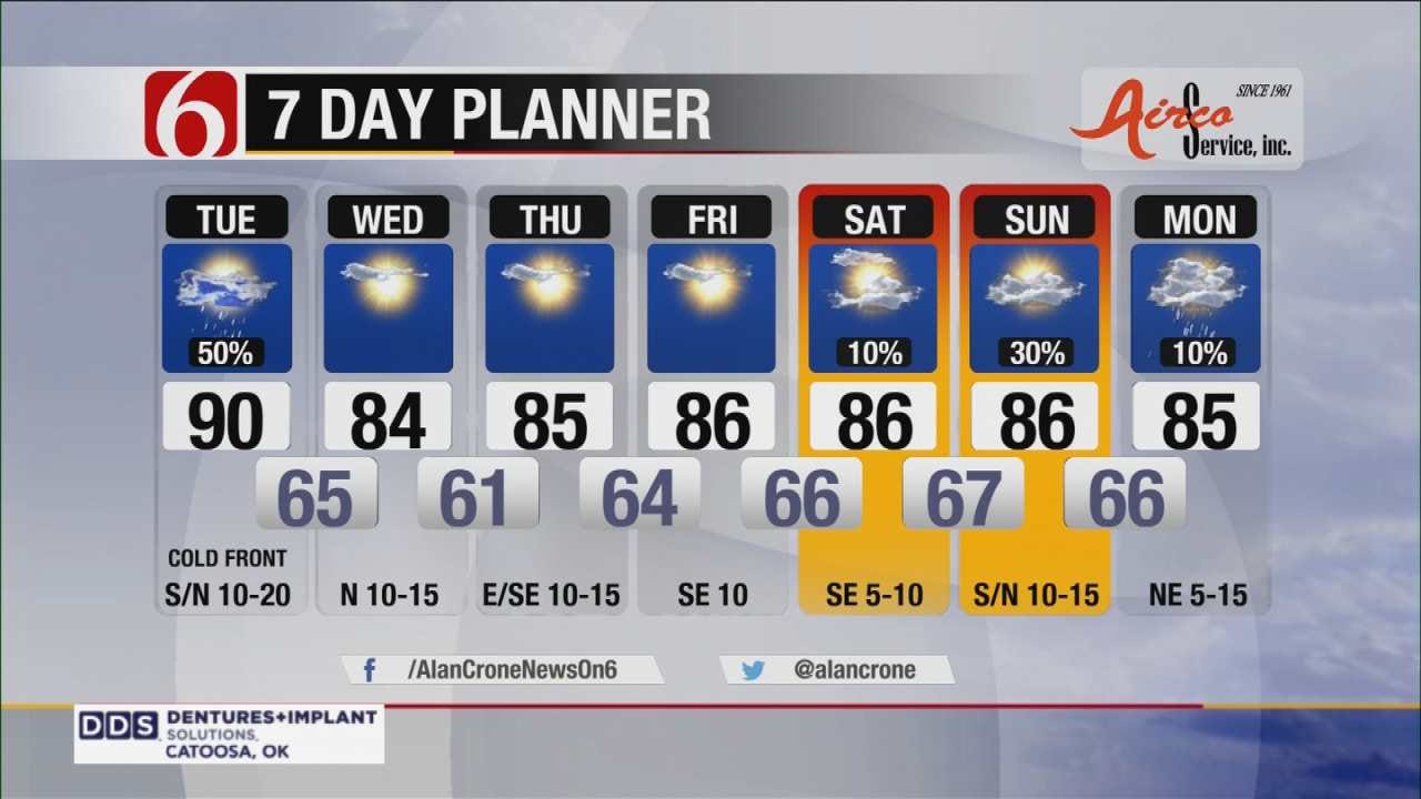
And now that the Great American Eclipse is over….we move onward! A front will arrive today and tonight with a chance of showers and storms for portions of the area.
A few may also remain possible early this morning through midday across southern Kansas and part of northern Oklahoma. Later this afternoon and early evening, a few storms may become strong to severe with damaging wind gusts the primary issue. As this front pushes southward, a noticeable reduction in temp and humidity will become likely Wednesday through the end of the week.
But, as the front nears the area Tuesday, moisture may pool directly ahead of the boundary Tuesday afternoon creating a small window of time that may allow for temp heat index values jump to near 100 for a short term along the I-44 or highway 412 corridor region.
Later Tuesday night into pre-dawn Wednesday, most of the showers and storms will be located across southeastern OK moving away from northeastern OK. This boundary may attempt to either move northward Thursday night into Friday or could reform near or north of the region this weekend.
As this process occurs additional showers and storms will be possible during the weekend, maybe as early as Friday, but more than likely we’ll keep low pops for Saturday and Sunday.
Our additional wild card will be the possible development of a tropical system that may emerge into the Gulf of Mexico during the next 36 to 48 hours and may move into southern or central Texas this weekend. It’s unclear what kind of impact this system would have on our weather at this point, but we’ll need to keep a low chance of showers and storms anyway due to the upper air flow being favorable for allowing another storm complex or two developing and then moving into our area. At this point, the higher chances will remain for Sunday into Monday but only in the 20 to 30% range at this point.
Check Weather At Your Location
Thanks for reading the Tuesday morning weather discussion and blog.
Have a super great day!
Alan Crone
KOTV
More Like This
August 22nd, 2017
September 29th, 2024
September 17th, 2024
Top Headlines
December 11th, 2024
December 11th, 2024
December 11th, 2024
December 11th, 2024


