

Dense Fog Advisory For Northeast Oklahoma
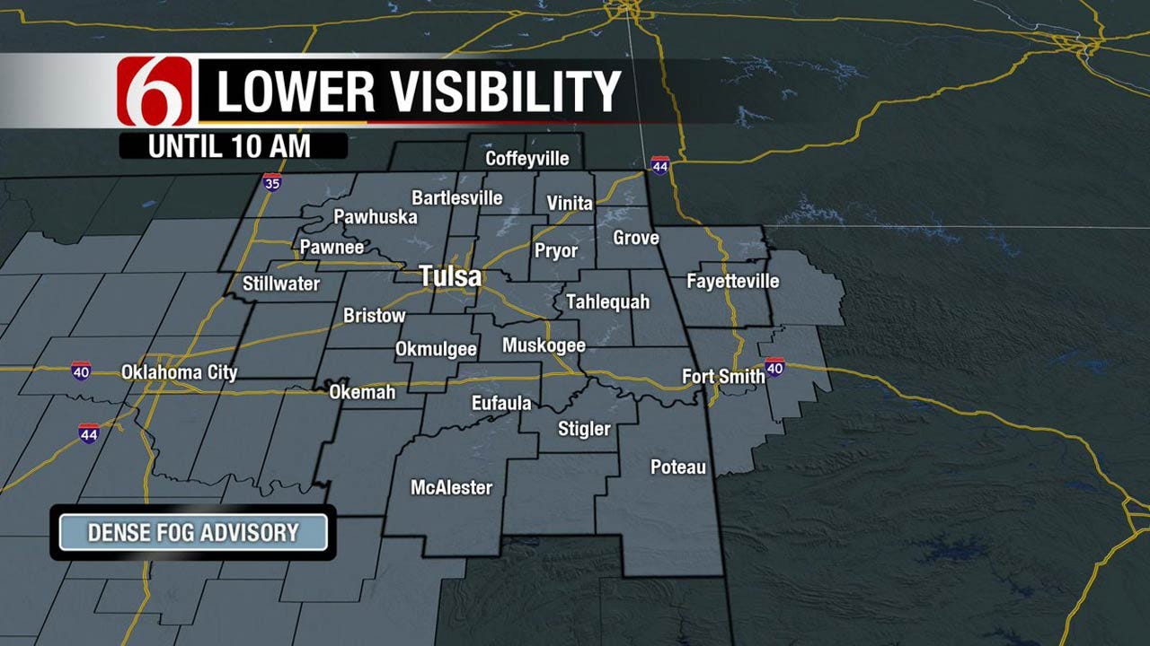
<p>Morning dense fog may be the issue for some locations for the next few hours.</p>Tuesday, April 18th 2017, 4:06 am


We have several items of interest for the next few days including a front nearing northern Oklahoma late Wednesday night into Thursday morning and a strong upper level system that will influence the state Friday into Saturday morning. A few strong to severe storms may be possible with both systems but the 2nd one will have much stronger dynamics. Several important surface features are yet to be known with confidence regarding the Friday system. High temps today should move into the lower 80's along with southeast winds around 10 to 15 mph. But this morning dense fog may be the issue for some locations for the next few hours.
The clouds have attempted to clear overnight in a few spots and this promoted the formation of dense fog in a few locations across southeastern Oklahoma. We are not experiencing the fog across the northern third of the state as I post this discussion, but we should start to see fog developing in some spots early this morning. Temps will start this morning in the upper 50's and lower 60's with partly cloudy to mostly sunny sky later today. A fast-moving wave may provide a shower or storm across southern Oklahoma later today but the odds are very low. Highs will be in the upper 70's to lower 80's.
Tomorrow a fast-moving upper level wave will eject into the central plains from the inter mountain region. This will begin developing an area of low pressure across southeastern Colorado will bring our winds out the south with 15 to 30 mph winds Wednesday afternoon. Thermal properties will support highs Wednesday afternoon in the mid to upper 80's with mostly sunny conditions for most of the day but this morning’s data is not quite as high as yesterday. I may back the high down a few degrees. Late Wednesday night a surface cold front will move across south central Kansas into northeastern Oklahoma. A narrow line of showers or storms will be possible and a few of these storms may be strong to severe late Wednesday night before weakening early Thursday morning. The position of the front Thursday should bring northeast winds and highs back down into the lower 70's for the afternoon. And if the clouds don’t clear until late, it may be even cooler. The eventual stalling location of the front Thursday may have a big role on the possibility for severe storms Friday as the main upper level system for this package moves near the state.
Stay Connected With The News On 6
The latest data support the closed-type low passing across Kansas late Friday night into Saturday morning with the front moving northward during the day Friday per the GFS and staying around the I-40 area with the EURO. Showers and storms will be likely Friday and may be strong to severe. It’s still too early to pinpoint the exact severe weather threats with this system due to the uncertainty of the positing of these important features. Saturday morning some showers or storms will be possible for the early morning hours before exiting the state to the northeast by midday. The temps behind the departing system will be cool with morning lows Saturday in the 50's followed by daytime highs in the lower 60's with north winds. Sunday morning will start in the lower 40's with highs in the mid-60's with north winds around 10 to 15 mph.
Thanks for reading the Tuesday morning weather discussion and blog.
Have a super great day!
Alan Crone

Get The Daily Update!
Be among the first to get breaking news, weather, and general news updates from News on 6 delivered right to your inbox!
More Like This
April 18th, 2017

September 29th, 2024

September 17th, 2024

Top Headlines

December 14th, 2024

December 14th, 2024

December 14th, 2024

December 14th, 2024