Rain, Strong to Severe Weather Threats Return To Green Country
The main upper level trough located off the west coast will continue to bring unsettled weather into the state for the next few days, including the potential for occasionally heavy rainfall and some severe weather threats by the middle of the week.Monday, March 16th 2020, 7:12 am
The main upper level trough located off the west coast will continue to bring unsettled weather into the state for the next few days, including the potential for occasionally heavy rainfall and some severe weather threats by the middle of the week. As this trough finally clears the southern plains later in the week, we'll get a few days of quiet yet chilly weather before another system nears by the latter half of the approaching weekend. Cool weather will remain both today and Tuesday with a noticeable warm-up Wednesday into Thursday. Any severe weather threats will also more than likely be confined to Wednesday or Thursday. No flash flood or flood watches are posted as of this morning but that may change later for par of southeastern or eastern OK.

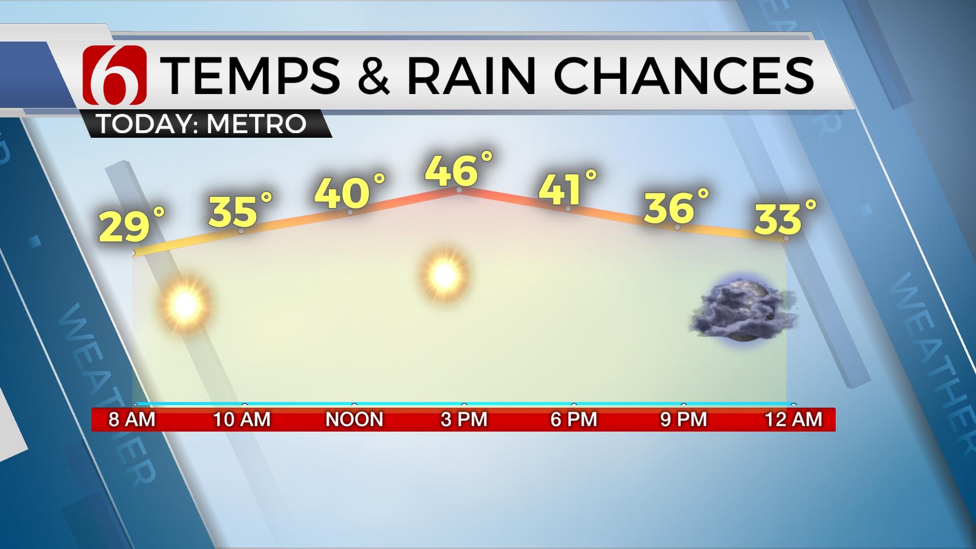
The latest in a series of upper level waves is ejecting across the southern plains this morning with additional rain and thunder across part of the state, including the eastern third of Oklahoma. Heavier rainfall with some thunder will continue to move across northeastern OK, including the Tulsa metro early this morning. This wave should quickly move out of the area after the morning hours with mostly dry conditions into the midday and afternoon with a few passing showers. Later tonight into Tuesday morning, a surface cold front to our north will quickly expand southward with a few showers or some rumbles of thunder later tonight into Tuesday morning for a few hours before also moving into southeastern OK by midday. After the early Tuesday morning period, most of the region will remain dry until the main pacific trough begins moving eastward across the desert southwest Tuesday night into Wednesday. This will quickly bring moisture northward as a moderately strong upper level jet streak moves into the state allowing for additional thunderstorm development Wednesday morning. Some elevated thunderstorms should produce hail and heavy rainfall with a small threat of a few strong to severe storms. The south winds and increasing moisture profiles will bring the threat of heavy rainfall across most of eastern OK during this period of Wednesday through Thursday. After early Wednesday morning storms, we should get a break until Thursday morning to afternoon when the main upper level system rolls across the state while bringing a surface dryline and cold front across the state along with windy weather. Storms are likely Thursday morning to midday. We'll need to mention a severe weather threat for this period, but some uncertainty will remain due to the presence of early morning storms. More than adequate shear will remain in place as the system enters central and eastern OK, but instability may be limited due to ongoing storms. The surface front will eventually clear the state by evening bringing chilly weather back to the state Friday and lasting through Saturday. Some data suggest a freeze will be possible again Saturday morning.

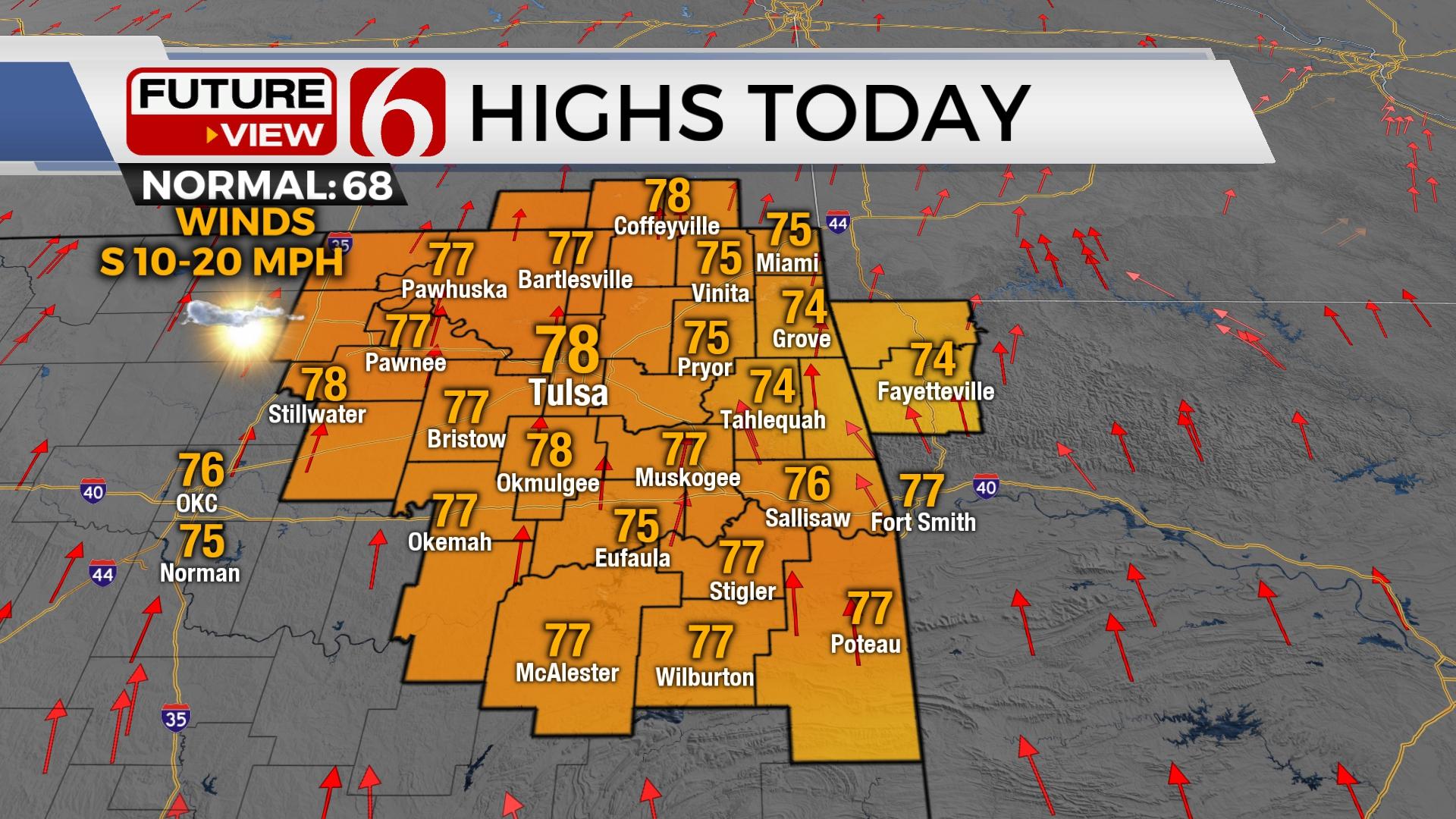
Temps will remain cool today with highs reaching the 50s. Tuesday starts in the 50s and ends with highs in the mid-60s. Wednesday and Thursday features highs in the mid-70s before we cool down again Friday into Saturday.
Thanks for reading the Monday morning weather discussion and blog.
Have a super great day!
Alan Crone
More Like This
March 16th, 2020
November 30th, 2022
November 1st, 2022
August 26th, 2022
Top Headlines
December 13th, 2024
December 13th, 2024
December 13th, 2024
December 13th, 2024


