Warm-Up Before More Wet And Cool Weather Arrives For Northeastern Oklahoma
The early morning showers and storms have just about ended, but I’ll keep a low mention for the next few hours as the boundary moves across northeastern OK.Wednesday, March 11th 2020, 7:34 am
The early morning showers and storms have just about ended, but I’ll keep a low mention for the next few hours as the boundary moves across northeastern OK. We did have a few severe storms across far east-central and far NE OK earlier this morning with nickel hail and winds near 60 mph. Again, most of the activity is already exiting the area this morning. Gusty winds will develop from the north behind this boundary as it passes your area, but wind speeds should decrease later. Temps are cool north and mild south with some rain cooled 50s across far NE OK and mid-60s across southeastern OK.

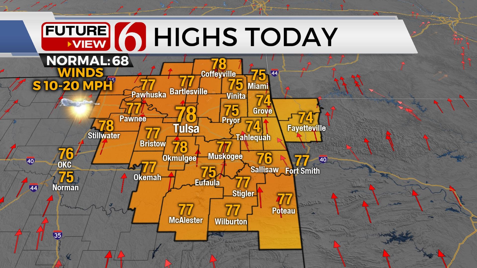
After this morning chance, temperatures will warm into the lower or mid 70s north and the upper 70s across southern OK as the front near the metro this morning moves southward and stalls near the I-40 corridor later today. This boundary will once again slowly move northward later tonight into Thursday morning and could be a focus for a few early Thursday morning storms. If these forms they would also have a slight chance of being strong to severe, but our chances will remain near or less than 20%.

By Thursday afternoon the front will move southeast again into southeastern OK where additional storms will likely develop in an atmosphere characterized with dew points in the 60s and daytime highs into the lower 80s. Storms that develop Thursday afternoon or evening across far eastern or southeastern OK could be severe. These will remain well removed from the metro. The front should remain well south of the Red River Friday as another strong upper level disturbance approaches from the west with additional rain chances by Friday midday into the evening hours and also into Saturday across northeastern OK. Most of the area will remain on the cool side of the boundary during this period tomorrow with temps Friday staying in the mid-50s. While rain and some thunder appear likely Saturday morning, the data remains inconsistent regarding the exact placement of the surface front and associated surface low. This could have a big impact on Saturday temps. The GFS and a few others would offer highs in the upper 40s and lower 50s along with northeast winds and mostly wet conditions. The EURO and a few others suggest the boundary lifting northward quite rapidly with temps nearing the upper 60s and lower 70s by the afternoon. We still have work to do for the Saturday period. I’ll use a blend with highs Saturday in the mid to upper 50s for now.
Another system may quickly drop into the flow Sunday night into early Monday morning with increasing chances for additional showers and storms early next week. The first part of next week also appears quite active with several chances of rain and thunder.
Thanks for reading the Wednesday morning weather discussion and blog.
Have a super great day!
Alan Crone
More Like This
November 30th, 2022
November 1st, 2022
August 26th, 2022
Top Headlines
December 11th, 2024
December 11th, 2024
December 11th, 2024
December 11th, 2024


