Cold And Wet Weather Returns To Northeastern Oklahoma
The pattern will remain active with additional precipitation likely, by at least Tuesday night into Wednesday if not later tonight into Tuesday morning for some locations.Monday, February 10th 2020, 7:17 am
The strong northern stream deposited a brisk cut-off low which dropped into the Baja this weekend but will rejoin the flow and move eastward over the next few days. Until then our weather pattern will remain active with shower chances for the early to midweek period.

The cold front that moved across the area yesterday is now located to our southeast this morning with most of the showers and storms well removed from our main area of concern. At least for now. The pattern will remain active with additional precipitation likely, by at least Tuesday night into Wednesday if not later tonight into Tuesday morning for some locations. The temperatures profile for most of the active periods in question will keep most of the precipitation in the liquid variety, but a few small windows for some light wintry mix will remain later tonight into Tuesday morning across extreme northern OK and Wednesday morning. These windows of opportunity will remain rather small and mostly confined to areas of extreme northern OK and southern Kansas with little impact to travel or sensible weather. At least the way it appears now. Some changes will still be possible to the wintry mix zone. As it stands now, we anticipate mostly rain for most of the area for these probabilities. As this system leaves, the colder weather will remain Thursday into Friday morning, with highs expected to remain below normal Thursday before moderating into the weekend. We'll probably go above normal again for the weekend Saturday in the mid-50 and with Sunday being the warmer day with highs in the lower 60s.

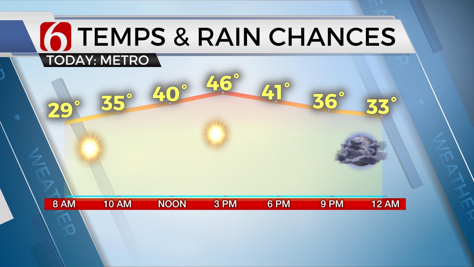
Temperatures this morning will start mostly in the 30s with highs remaining in the 40s for most of the day. A window for showers will remain later tonight. This will keep the low mention of wintry mix across far northern OK and southern Kansas also later tonight. Tuesday evening, showers will move north and impact most of the area Wednesday with chilly weather, while locations across the deep southeastern U.S will again deal with a significant swath of severe weather, including tornadoes. This Wednesday severe weather outbreak will impact places like Mississippi, Alabama and the southeast. As this system pulls away from Oklahoma Wednesday night, we'll experience a surface ridge of high-pressure Thursday before south winds return Friday into the weekend as our next system approaches to our west.

Thanks for reading the Monday morning weather discussion and blog.
Have a super great day.
Alan Crone
More Like This
February 10th, 2020
November 30th, 2022
November 1st, 2022
August 26th, 2022
Top Headlines
December 11th, 2024
December 10th, 2024
December 10th, 2024
December 10th, 2024


