Chilly Thursday Before Warmer Weather Returns To Northeastern Oklahoma
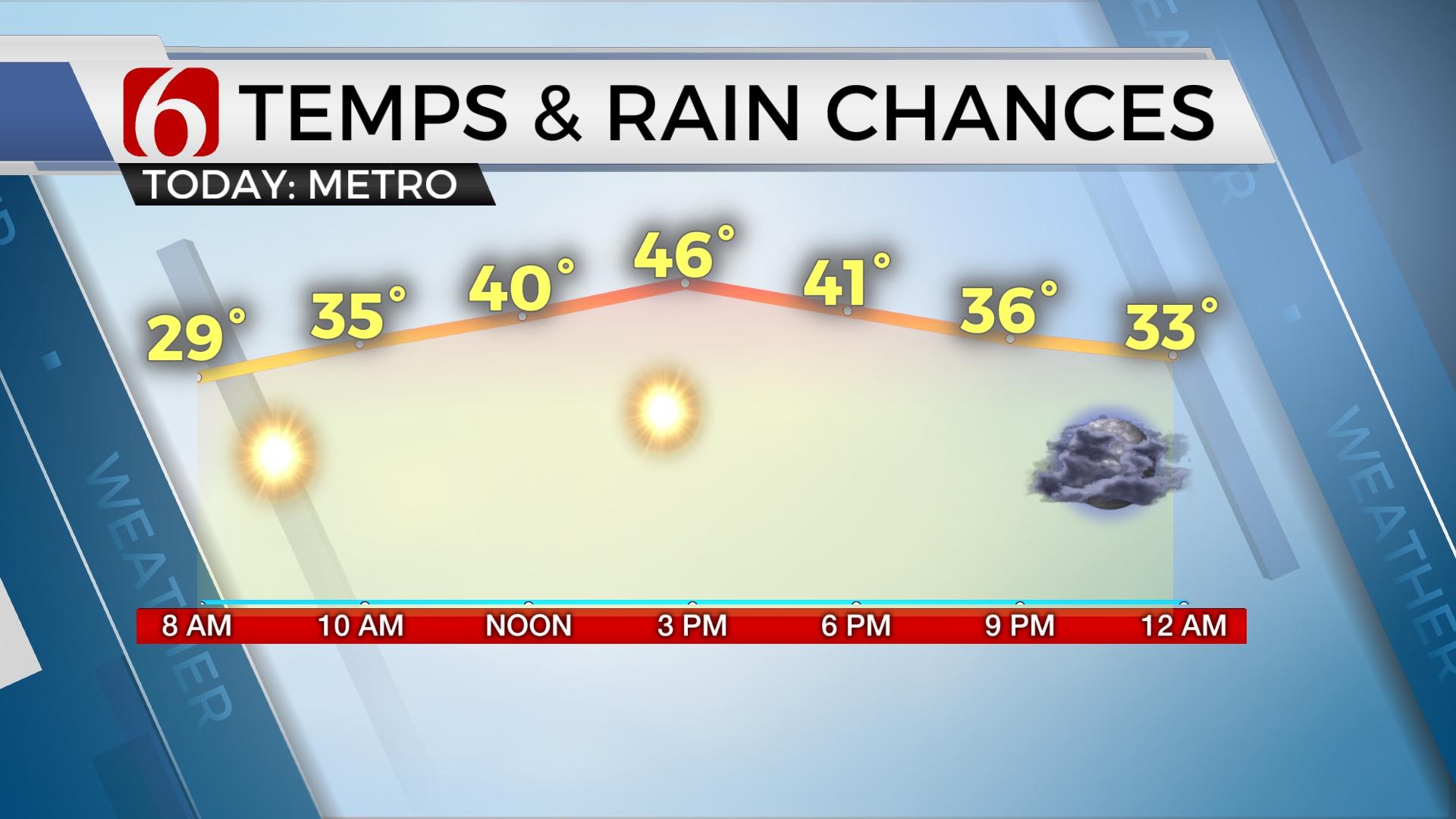
Morning clouds remain but should gradually clear from the west to east with afternoon sunshine. Highs will reach the upper 30s later today.Thursday, February 6th 2020, 5:35 am
Slick spots may remain in some locations this morning from yesterday’s snow. Use caution while traveling during the early morning commute. Morning clouds remain but should gradually clear from the west to east with afternoon sunshine. Highs will reach the upper 30s later today.

The main trough responsible for the wintry weather across part of the state has now exited the region to our east. Locations along and ahead of this feature will continue with active weather, including snow across the Midwest and northeastern U.S., and severe weather across southeastern sections of the nation. Our weather across the state will be slowly improving as clouds clear from the west to east and temperatures begin to slowly moderate. Locations over the snowpack will be colder compared to non-snow-covered regions today, but most snow will be eroding this afternoon with mostly sunny conditions. Temperatures this morning will start in the upper teens and lower 20s with afternoon highs in the mid-30s over the snow and upper 30s and lower 40s across southeastern Oklahoma where no snow fell yesterday.

The next upper level system will quickly move across the Mid-Missouri Valley Friday into Saturday morning but most moisture will be limited. I’ll mention the low chance for a few sprinkles or flurries tomorrow morning across northern OK and a few sprinkles Saturday morning, but this should have no impacts to sensible weather. Friday morning lows will be in the mid-20s with afternoon highs in the mid to upper 40s. Saturday afternoon highs will reach the upper 40s to lower 50s with north winds and decreasing clouds.
Sunday, the next upper level system will be dropping down the northern stream and may briefly become cut-off across the southwestern U.S. before kicking eastward Monday into Tuesday. As this process begins, gusty south winds will return Sunday into Monday with temperatures Sunday possibly reaching the upper 50s to lower 60s. A few showers or storms will be possible Sunday as the upper level feature begins moving east and another surface front dives southeast across the state. Our chances Sunday will begin near 40% but may increase in subsequent forecast for locations across eastern OK. The airmass behind this boundary will be cool, but not exceptionally cold, with afternoon highs Monday into the upper 40s and Tuesday into the lower 50s. Showers and storms will be possible Tuesday night into Wednesday as the main upper level trough begins moving across the state. Early indications suggest a high likelihood, including the possibility of some heavy rainfall.
Thanks for reading the Thursday morning weather discussion and blog.
Have a super great day!
Alan Crone
More Like This
February 6th, 2020
November 30th, 2022
November 1st, 2022
August 26th, 2022
Top Headlines
December 11th, 2024
December 11th, 2024
December 11th, 2024
December 11th, 2024


